No Name Tour: Day 35 – Over the Boulder

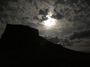
Last night the skies disappointed again. The light of the near full moon and the buildings down the hill from my motel made it feel almost like I was at a much higher latitude.

I grabbed a cup of motel coffee (mistake), a mini danish (not bad) and some snacks got the road then I headed down hill to Torrey, UT.

I spotted a coffee shop that served breakfast. Not exactly second breakfast. Certainly not elevenses. But it hit the spot.

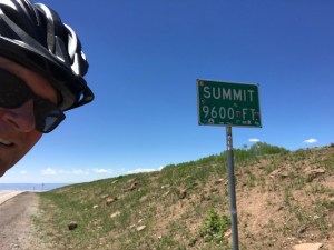
On the road the word for today was up. I had 3,000 feet of climbing to do, topping out at 9,600 feet. My bike was laden with about six liters of water so I had no delusions of pulling this off without walking.

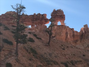
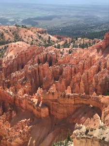
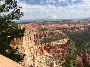
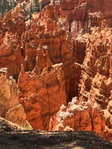
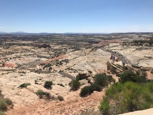
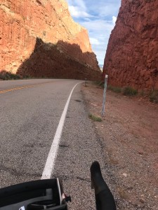
The scenery continued to be laughably awesome. I rode into the Dixie National Forest. Pines and aspens and assorted other trees began filling the landscape. As I climbed the creeks which had been muddy were running clear, no longer picking up red sandstone dust.

I struggled to find energy. About 30 minutes into the ride breakfast kicked in. (It’s actually noticeable when my body starts processing food.) I had a pleasant tailwind but I was working much too hard. After a few miles I got off the bike and walked in the hope of recharging my legs.

As I plodded along I spotted a coyote crossing the road ahead. I could hear them barking in the distance, too.

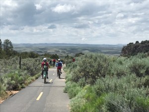
A half hour later I was back to pedaling. I had a nice tempo going and could enjoy the scenery. I passed some Forest Service campgrounds that we’re half decent. If you can’t find an official campground, you can camp anywhere you want on federal land as long as it’s not a National Park. So there are no worries about a place to lay my head down.

I pedaled most of the last eight miles but the last bit was too much and walked to the summit sign.

Then came the fast ride down. Nope. I descended a few hundred feet only to be confronted with a hill.

W.T.F.

This is like a trick calculus problem with a local optimum. Second order conditions don’t help. Nerd.

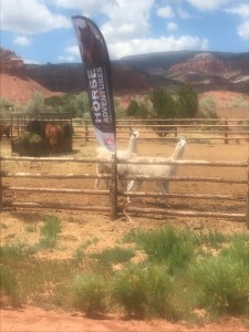
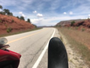
Once over the bump I had a scary, bumpy 30+ mph riot of a ride all the way back down to Boulder town. Along the way I spotted three deer crossing the road. (Please let there not be more. I’m going over 30!) Near the end of the plunge I ride past yet another farm with llamas. A couple of them bolted across the field parallel to me. Llama stampede!!

Actually they appeared to be oblivious to The Mule and me. It was some sort of domestic dispute.

I stopped at the Anasazi Museum and checked out the ruins of a community that was abandoned in the 12th century. Then I bought a burrito from Marigold’s, a food bus parked outside. I asked then to cut the burrito in two because I couldn’t possibly finish it all in one go.

Ten minutes later both halves were vanquished. Mountains make me hungry.

For most of the ride the weather was perfect: cool, dry, breezy. Near Boulder town the wind changed direction and increased in strength. When I climbed Monarch Pass a week ago I foolishly continued on, 32 miles into a headwind. The next day I quit early. So I didn’t want to repeat that mistake.

I checked out a motel across the street. It was okay but the clerk could tell I wasn’t enthusiastic. She advised me to ride into town to see what else was available. I couldn’t help myself. I checked into a resort motel with a gourmet restaurant, hot tub, robes in the room, etc.

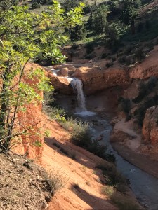
More pix and a babbling brook on Instagram.

Why not, right?

Miles today: 39.5

Tour miles: 2,025

Top speed: 39.5

Tomorrow looks like a ride through Escalante. And a descent across the hogback: 3 miles with narrow lanes, no shoulders, no guardrails, and big drops to either side of the road. Weee!

No Name Tour: Day 34 – Capitol Reef National Park

I lucked out by picking an expensive cabin last night. It was next door to a restaurant. I had pasta with grilled chicken, corn, cornbread, a salad, and two Polygamy Porters. The food was excellent. My body was so happy with me.

This morning I returned to the place for breakfast. A huge omelet, mass quantities of hash browns, toast, and coffee. Yummie.

Locked and loaded I lit out at 8:30 headed west. More rocks. A few abandoned ancient buildings made of the red sandstone that seems to be everywhere.

After 20 miles the road entered Capitol Reef National Park. It was boffo but not entirely distinguishable from what I had been riding through since Blanding.

Perhaps because it’s a National Park, traffic picked up from next to nothing in Hanksville to rental RVs in pace lines.

(I have a heightened level of awareness because the RV renters don’t have any experience driving a tank and they, and other drivers, are distracted by the scenery. Thank god for rumble strips in the middle of the road and bicycle mirrors.)

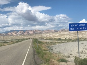
I cane across this sign and had to stop. Did the sign person think the amazing views of the previous 50 miles were not up to par? Exactly how big a dolt do you need to be to figure this out for yourself?

Midway through the park, I came to the visitors center which was a beehive of activity. Signs said “Campground Full”. Uh oh.

I topped off a water bottle, and continued westward. Uphill. Despite a tailwind, the climb was a bit of a shock to the legs and lungs.

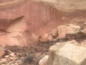
More rocks. Some petroglyphs. More RVs.

Do you see the petroglyphs of people?

Not a bad day for a ride

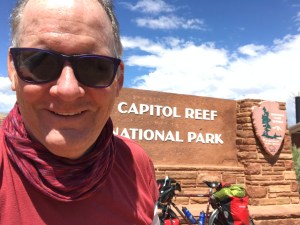
Without the sign, you’d never guess you were in a National Park. The whole area is National Park-ish or, Park-y. Of course, the sign affords the opportunity for a park sign selfie.

I spent the next ten minutes taking pictures of people in front of the sign (and feeding mosquitoes).

Five miles beyond the visitors’ center I was out of the park and in the park-ish part. Up and down and around buttes. I finally saw two resort motels. One had horses and llamas. The other had a pizza joint. Since I can’t eat a llama or a horse, I voted for the pizza joint.

Thankfully they had a vacancy.

Talking with some other motel guests, I learned the porch might provide some good sky watching tonight here outside Torrey, Utah.

Tomorrow is the 8,900 foot mountain pass. (I’m at 6,600 feet.) Then a descent to toward Escalante.

More pictures can be found on Instagram under @rootchopper.

Miles today: 45

Tour miles: 1,986.5

Top speed: 34.2

No Name Tour: Day 33 – Bonking for 51 Miles

Last night I was so tired that I could barely eat two tortillas with peanut butter for dinner. Following in my previous night’s junk food dinner this did not bode well for today.

Breakfast was two tortillas with peanut butter. This didn’t bode well either.

After taking a picture of the moon in the west, I loaded up The Mule and began to climb back out to the main road at 6:30. Two-mile climbs are a bad way to start any day.

The climb was followed by a steep descent to the Colorado River then a long slog back out of the canyon. This involved some walking as my legs were dead from yesterday’s adventure.

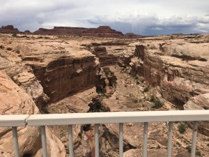
Even though the climb was a bit of a drag, the scenery was hard to beat. Glen Canyon is truly awesome. After seeing it, the next 40 miles paled in comparison.

I kept rolling along a gradual uphill following the road along a river. This was punctuated with a few climbs around mesas and buttes.

My body had nothing to offer. Pop Tarts didn’t help. Water didn’t help. A Fuji apple helped but it’s beneficial effects faded as the sugar wore off.

Ride. Stop. Drink. Calculate the miles remaining. Repeat.

When you’re this bonked you spend most of the ride looking at the ground in front of you. What a waste of spectacular geology.

I arrived in Hanksville hoping to find people dressed up as Woody from Toy Story (“Reach for the Sky!”). My luck was bad except for the very first shop, a hamburger joint named Stan’s. Double cheeseburger, fries, and a large vanilla shake.

What a gut bomb. Did it ever taste good, too.

I ended up grabbing a cabin at an RV park. It’s expensive but has a shower, TV, WiFi, and quite.

After making some phone calls (l’d been out of cell phone range for two days) I fell asleep writing yesterday’s post.

When I woke up the wind was blowing and rain was falling. This is pretty much the norm for a summer afternoon in Utah, it seems.

Total miles: 52

Tour miles: 1,941.5

Top speed: 37.1 mph

No Name Tour: Day 32 – I’ll Have a Double

The plan was to do a short day, 40 miles to Natural Bridges. This would be the first chunk of over 120 miles with only one stop for services.

Last night I ate done junk food for dinner. This morning I had a mediocre motel after a motel breakfast. Enough said.

Before heading out I had filled my 2 2-liter water bladders which made The Mule feel leaden.

About 5 miles into the ride, Yoni pulled up along side me. He had been camping in the RV park next to the motel. We chatted for a half hour before he jetted away, hoping to ride over 120 miles to Hanksville. (He did.)

I tooled along feeling pretty spunky. Down I went into a canyon. Then came the climb out only to go down into another canyon and up to a 7,000+ foot summit without walking. What a stud. When I stopped at the turn off for Natural Bridges, I realized that I had been riding a tailwind. Doh!

Rule number 1 of bike touring: never pass up a tailwind. So I didn’t. Natural Bridges has three interesting aspects: an 11 mile loop road, three amazing rock arches with a strenuous, steep hike to get to see them, and excellent stars. Given how hard I’ve been working the prospect of anything strenuous didn’t sound appealing. Also, I figured the stars would shine elsewhere.

It was a wise choice for another hour or two. Buttes out the wazoo. More chasms than you can fathom. Look at all those rocks in Fry and White Canyons. Some look like people or animals, some look like abstract sculptures. Some cliffs have caves in the sides. Others look like hoodoos. This is the Utah I was expecting.

Then the wind changed direction. 18 miles of hard work later I found myself exhausted, chatting with Maggie in the store at the Hite Recreation Area in Glen Canyon. She told me she had seen Yoni earlier in the day. And she gave me some good news about places to eat in a town on my route.

Maggie reminded me of my friend Katie B

I chugged two massive bottles of Powerade during our chat. Then rode down to my campsite.

Glen Canyon is crazy beautiful. It seems to go on forever in every direction.

I was dog tired so all I wanted to do was pitch my tent and go to sleep. For the next hour I struggled putting the tent up in a howling wind.

Of course, 20 minutes after I crawled into the tent the winds abated.

There were no stars. The incredibly bright full moon was a decent consolation prize.

I’ll post more pix on Instagram.

Miles today: 78.5

Tour miles: 1,889.5

Top speed: 34.1 mph

No Name Tour: Day 31 – A New State

The cook at the market/gas station/florist/laundromat/cafe across the street from my motel in Dove Creek makes a damned fine omelet.

After breakfast I went back to the hotel to get ready to ride. Nearly everything was packed but when I went to leave the room I couldn’t find the room key. After a long search I found it in one of my panniers. It must have tumbled in there from my bed.

My front panniers were each loaded with a 2-liter bladder full of water. I need to test them out before I need them. (One made the trip without incident; the other leaked but I think that’s because I didn’t seal it properly. Only damage done was the loss of a half roll of TP given to me by brother-in-law Greg in a box of useful things for bike tours. I’d been carrying this TP around for over 10,000 miles without ever using it, I was going for a Guinness record of unused TP transport. I’m probably out of the running now.)

Gently rolling terrain has a different meaning when your riding a bike loaded with TP and 40-odd pounds of other necessities. Even the slightest rise in the road calls for downshifting.

I endured the ups and downs and was rewarded after 8 miles with a new state! Goodbye, Colorado. You kicked my ass nine ways to Sunday but I escaped.

Barely.

The next 23 miles saw Utah turn from farmland to rocky, sagebrushy, near desert. I rode into Montecello much more tired than usual after such a short morning.

I stopped for lunch at a Montecello institution they had been doing business for 30 years. I am happy to report they make a good sub sammich and were kind enough to fill my water bottle with ice and water.

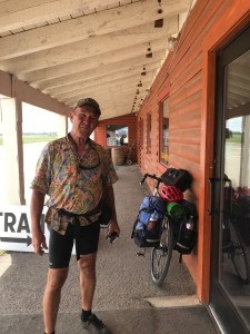
As I left the shop a bike tourist went by headed east. I yelled and he turned around. Bob is from Sacramento and has endured all kinds of bike touring hell on this trip. He’s been rescued twice: once after he got caught in a hailstorm and once when he ran out of water. Bob seemed to be in a good mood. I gave him the scoop on the miles ahead. He returned the favor. He’s dreading the Colorado mountains but he only has 2 more to go before he surrenders to sanity and grabs a train home from Grand Junction.

Bob from Sacramento

He said it was mostly downhill to a Blanding, my destination. Poor Bob’s brain is going because a few miles later I was bringing up a big hill in my granny gear.

After that, it wasn’t bad. I saw some deer (unlike Colorado they were not dead), got waved at by three women flying down a hill I was climbing, got rained on (it felt wonderful), and went down a whopper of a hill over 40 mph. There was a slight uphill before Blanding, my destination, but I was feeling my oats by then and just powered up.

Just as I pulled into Blanding, I spotted a general store where I bought a massive bottle of cold Powerade. Gone in 60 seconds.

I had reserved a room in a motel but when I went to check in I saw that they do not have WiFi in the rooms. Off I rode to a Super 8 on the edge of town. For the second night in a row, I was not allowed to bring The Mule into my room. This is the first time in four tours that The Mule has been treated so poorly.

As I was rolling it around I found that the back wheel was out of true. I flipped The Mule over to perform inept surgery with my multi tool, I spun the wheel and the wheel was true. A bicycling medical miracle. Had I been forced to operate, The Mule may not have survived.

Tomorrow is complicated. My planned destination is Natural Bridges National Monument. It has 13 tent sites given out on a first come, first served basis. And no water except at the visitors center. I probably won’t hike to see the bridges as they are quite a hike. The park has appeal for another reason: it’s so isolated it gets awesome stars.

If I get turned away it will be another 40 miles to a campground near Lake Powell. The first 40 miles features a 1,000 foot climb to a summit. The second 40 features a looong downhill with 3,500 feet of elevation loss.

Miles today: 47

Tour miles: 1,811

Top speed: 41.1 mph

No Name Tour: Day 30 – Two Rides in One

After motel breakfast I tried to leave early but was cornered by some guests who also stayed at my hotel in Montrose a few days ago.

After the chat I was off to the west on Highway 145. More terrific scenery, a generally downhill route, and a gentle tailwind. Finally!

Not photoshopped, I swear

Just before Naturita I turned onto Highway 141. It was time to payback the downhill. You’d think I could get one day without a climb but no!

So I climbed out of the valley I had ridden into and over a rather large hill into a basin, a vast valley bordered by mountains. It was quite pretty, particularly after the climb because I rode right down into the basin.

On the ride down I passed all kinds of cool rock formations. Many of the bluffs had caves. Some of the rock formations reminded me of people and animals.

This is movie cowboy country. You’re sure you’ve seen this place in a million TV shows or movies.

After about 45 miles of riding that couldn’t be beat, it was payback time. I had to ride over a range to get to my motel in Dove Creek.

Looking back from Slick Rock Hill

Ride is used loosely here. I made it a mile or two up Slick Rock Hill (Coloradans love to call enormous mountains “hills” because they have mountains that are whoppers everywhere you look.

To help things along the wind changed direction. Nothing helps push a bike up a mountain quite like a headwind.

Occasionally I got on the bike and rode to the next steep section. Then I hoofed it some more. This hill, I was told, was preferable to the hill I avoided yesterday by riding to Norwood.

Near the top I jumped back in the saddle and finished the climb. I was expecting a 20 mile descent to Dove Creek but mostly what I encountered was rollers: down for a half mile, up for a half mile. And headwinds.

After all the flooding I saw earlier in the tour it was a relief to find freshly planted fields.

I thought this was going to be an 80 mile day. I managed to go through two apples, a banana, a Clif bar, some mixed nuts, and five bottles of water. And it wasn’t nearly enough.

It was good training for Utah and Nevada which have long stretches without food or water. (Tomorrow I’ll fill my 2 2-liter bladders to make sure they don’t leak.)

Today’s miles: 74

Tour miles: 1,764

Top speed: 34.4 mph

Tomorrow will be an easy day as I enter Utah. The next day is up in the air. Natural Bridges National Monument has a first come, first served camping policy and only 13 spots. I may skip it and camp at Lake Powell.

No Name Tour: Day 29 – Off Route to Norwood

I stayed up to watch game 7 of the Stanley Cup. Not that I cared but game 7s are usually exciting. This one was meh, mostly because this is only the second hockey game I watched all year. Time management is my middle name.

After my hotel breakfast. I rode westbout of Ridgway to Dallas Divide, an 8,900 foot pass through snow covered mountains and lush meadows. I hate the climbs around here but the scenery is amazing.

I was about a half mile from the top of the climb when I realized that I was killing myself to go 3 mph. I dismounted and walked the rest. The smile is one of relief.

Thank god that’s over

The ride down the other side was not as fast as I expected. Mostly I kept my speed under 25 mph.

I pulled into a general store in Placerville. I talked to a cyclist who had just ridden from Telluride. This was the route on my maps. He reported that he couldn’t find camping in town so he settled on a $180 motel room.

That’s a bit rich for my blood. I talked to the store owner. She confirmed that road over the mountain from Telluride is a killer climb and that the road on the downslope going into Dolores Co was partially blocked by a humongous boulder.

It would be cool to see the boulder but the climb would be to 10,200 feet. She, as did the people in Ridgway, recommended that I ride off route to Norwood, Colorado.

So I headed west to Norwood. This means I will miss Dolores and Cortez, Colorado. I’m sure they are scenic but the ride down the San Miguel Canyon toward Norwood was truly spectacular. The San Miguel River was gushing with snowmelt. The hills were red rocks, all jagged and menacing looking.

The road into the canyon
I started the climb of this “hill” way down there
The canyon looking west from near the rim

After ten miles of easy riding I hit Norwood Hill. I was lead to believe that this was no big deal but it was a climb out of the canyon. After a mile or so, I was once again grinding away for 3 mph. Time to push. I passed a crew working to clear fallen rocks off the road. I kept pushing and peaking over the edge of the road. There was no guard rail just a drop of several hundred feet.

I kept pushing and the base of the canyon kept getting smaller, until finally I was over the top and could ride into Norwood with minimal effort.

Norwood has three hotels. The working class motel had no vacancies. The tony Inn didn’t either. My last hope was the Back Country Inn on the west end of town. There was not a single car in the spotless parking lot. As it turned out this was because the motel’s guests were all road crews working in the area.

I asked the owner if there was anywhere I could camp. She offered me a space in the lawn behind the motel for $20 with shower, towels, and breakfast included.

Sweet.

No it’s time to head into town for some vittles. Tomorrow I ride over the mountains 70 miles with 4,000 feet of climbing and 4,200 feet of descending. I booked a room in the motel to be sure I won’t end up in the woods feeding Clif bars to the bears.

Miles today: 42

Tour miles: 1,689

Top speed: 31.6

By this point in a bike tour I am normally getting stronger. Not this time. The mountains and the thin air are very tough.

No Name Tour: Day 28 – Listening to My Body

After three 8,000+ foot summits, my body was really tired. I slept hard again.

After motel breakfast I hit the road, heading south in the general direction of Telluride.

I knew I was riding slightly uphill, so I decided to take in the scenery and plod along at 9 mph. The temperature was comfortable and the winds were light.

The scenery just doesn’t quit

Enough hops to make mucho IPAs

I spotted a coffee shop along the road at Colons don I took a break and had a coffee and a doughnut.

A customer in the shop started chatting with me. She recommended that I not follow the Western Express route over Lizard Head pass and ride off route to the town of Norwood instead. I am always wary of taking route advice from non- cyclists; the terrain looks different from behind the wheel of s car. I thanked her and we both hit the road for Ridgway.

The terrain was slightly hillier but not granny worthy. The lack of a shoulder and the idiots driving campers made sure I was adequately stimulated.

The last three miles into town were on a concrete trail. It went along a river, through a marsh, and into town. A big improvement over the highway.

I stopped at the town bike shop and talked to Nate about the Norwood thing. He agreed that it was a better route that would also bypass Dolores, CO.

Nate of Ridgway Wrench Bike Shop

I’ll see how I feel after riding through Dallas Divide, an 8,900 foot pass before Lizard Head.

During my ride today I never felt right. My right thigh cramped a few times and I felt light headed. I think my body is tying yo tell me something.

After talking with Nate I decided to have an early lunch and see if I felt like riding on. Lunch made me feel better but I was still a little lightheaded. I checked into a motel and called it a day.

Miles today: 28

Tour miles: 1,647

No Name Your: Day 27 – Three Pieces of Eight

The Wanderlust Hostel in Gunnison worked out great. I walked to dinner at The Dive, a not at all divey open-air bar and grill.

I slept well which is attributable to me being super tired, wearing earplugs, and taking a little something to help me sleep. About a week ago I bought some chewy edibles at a weed store. I bought them as s lark to see how high I would get. I barely felt a thing out of the ordinary the first night I took one but I slept hard and woke up with zero pain in my wonky left knee or anywhere else in my body. As a pain reliever, edibles worked much better than ibuprofen.

After a humongous gut bomb at a Gunnison diner, I headed west on US 50. I left my bike in the backyard of the hostel, not knowing that it has a sprinkler system for the lawn. My helmet and gloves were the only things that got wet. Do I began the day wearing my floppy hat and the long fingered gloves I bought for descending mountain passes.

I couldn’t finish this beast

The ride from Gunnison was virtually flat and the wind was low. This allowed me to enjoy the scenery in the Currcanti National Recreation Area. The scenery is amazing here. I took a bunch of pictures, too many to fit on this post so check out my Instagram page (Search for Rootchopper, of course).

About 19 miles into the day I came across Dan Hurwitz who is riding east from San Jose. Dan was at a pull out along the road. He was using a compact luggage scale to redistribute the load in his panniers, because his bike was wobbling during descents.

We exchanged info. He gave me his card. His blog is bikerdan.wordpress.com.

Speaking of blogging cycle tourists, my friends Mark and Corey have abandoned their TransAmerica trip after riding well over 2,000 miles from Yorktown, Va. I don’t know quite why they packed it in but I’m pretty sure thin air didn’t help. They were a real treat to ride with. I was hoping to meet up with them in Oregon.

He told me the hills between Sapinero and Montrose were difficult. I was amused when he said, “It is what it is.” This should be the touring cyclist’s mantra. He reports that today and much of his tour featured a tailwind.

Oh joy.

After Sapinero about 900 feet of climbing would take me to 8,500 feet in about 5 miles. That hill was hard and the headwind was no fun but the scenery of the Blue Mesa Resevoir at least took my mind off the misery.

After a short descent, the road rose up again taking me to 8,700 feet. Okay, that was hard too. A week ago it would have done me in but my wee granny gear and wicked awesome scenery got me to the tawp.

A ten-mike descent followed. The headwind was no match for The Mule in full gallop.

Snow melt filled the creeks all day long

Near the base of the descent I pulled into a general store. They had no restrooms or WiFi for dining customers. I would have walked out but my body needed something more than another apple. The sandwich, fries, and Gatorade hit the spot. I paid without leaving a tip, which is highly unusual for me.

He died waiting to use the restroom

A sign in the store said I could find a restroom 1.8 miles to the west. And, thankfully, the pit toilet at a pull out met my rather urgent need.

Then began climb number three. Oh joy. This one was about 900 feet in five miles.

I stopped every mile to let my legs and lungs recharge. The top came and I posed from the obligatory I-climbed-this-motherfucker photo. (Should I have hyphenated motherfucker? Discuss.)

After my selfie moment, I gradually descended over 19 miles to the city of Montrose. I passed by the Black Canyon of the Gunnison National Park. From what I saw it has a lot of hills that look to be made out of adobe.

When I arrived in Montrose I discovered that I was now at 5,807 feet; this was the first time since Pueblo that I’d been this low. I also discovered that it was 89 degrees. I can’t complain. Other than the headwind it was a very good day to be on a bike.

Miles today: 64

Tour miles: 1,619

Top speed: 33.1 mph

No Name Tour: Day 26 – Conquering the Monarch

It was 39 degrees outside when I woke up. Not gonna happen. I ate breakfast of sorts on my room then hit the road at 7. Before even leaving the parking lot, I took off my long pants and my jacket. It had jumped to the 50s and I had a tailwind.

I was heading to Monarch Pass in US 50. A few days ago I utterly failed on a 9,000 foot mountain. How’ll I ever get over this 11,300 foot beast?

Don’t get too excited. The first four miles were a false flat, an almost imperceptible incline to the road. I gained 400 feet in elevation on what looked like level ground.

At Poncha Springs, the fun began: 18 miles and over 6,000 feet of climbing. I surprised myself by doing the first six miles in my middle chainring. The tailwind surely helped.

But at about 8,500 feet I started to feel the effort. I took a hit of albuterol to see if it would clear my lungs. No dice. Thin air is what it is.

With 12 miles to go I implemented my climbing plan. Stop when I get tired. Drink lots of water, eat something. Start again when my heart rate comes back to normal.

I did this five or six times. Once I stopped because a family of mountain goats were coming out into the road. I gave them lots of room.

As I climbed riders on (mostly) road bikes we’re flying down the mountain. Go ahead; make my day. The road very much reminded me of US 60 in West Virginia at Hawks Nest.

My itinerary called for me stopping 2 miles

Ride the Rockies riders descending
Hours of this

My itinerary called for me stopping 2 miles from the top and camping. When I got there I thought “Why waste a tailwind and eight hours of daylight?” I was prepared to walk the last mile, which had switchbacks that looked brutal. After a five minute break, The Mule and I managed to find a nice pedaling rhythm and went right to the top.

The parking lot of the general store was filled with hundreds of bikes and their riders. They were participating in Ride the Rockies, an annual event in these parts. They had just arrived at the top from Gunnison about 45 miles to the west.

I went into the store and bought a cup of coffee. It was about 55 degrees outside but I was shaking. The coffee helped with my body temperature but made me nauseous.

I was starting to feel the elevation big time. I got my picture taken at the pass sign then took off down the western slope of the mountain. It was a thrill ride comparable to last summer’s descent from Washington Pass.

My summit picture

There were hundreds of Ride the Rockies participants crawling up the mountain. I dropped from 11,300 feet to 8,450 feet in ten miles. All the curves were banked and the road was clear of debris. And, yes, I rode in the middle of the lane. I was passed four times on the way down.

At the base of the mountain I stopped hit lunch. A BLT, fries, and three glasses of ice water took me and hour to eat but it revived me.

I am Groot

The shop owner offered me a camping spot by the creek out back. I was tempted but decided to ride 32 miles to Gunnison.

Looking back toward Monarch
Bizarro rocks along the road to Gunnison

Stupid me. The wind had changed direction on this side of the pass. A strong headwind beat me numb the whole way. Once I got a cellphone signal, I called The Wanderlust Hostel in town. There I will stay until the morrow.

Apropos of nothing, I saw more dead deer between Sargent and Gunnison than I’ve ever seen anywhere.

Miles today: 64

Tour miles: 1,555

Top speed: 37.9 mph