Last night, I watched the election while drinking beer and eating chips and guacamole. I was feeling like a blob before the evening began; by the end of it I felt roly poly.
There was just one thing to do. I went for a long bike ride today. The weather was on board allowing me to ride in shorts. Not bad for November.
A few weeks ago I had planned to participate in the annual Boundary Stone Ride. The night before I watched an 18-inning baseball game. Need less to say, I slept in and missed the ride. But I did get the cue sheet.
What is the Boundary Stone Ride? When it was decided to establish the District of Columbia (thanks to that Hamilton chap), surveyors laid out boundary stones in a square. The square was rotated so that its corners pointed north, south, east, and west. This is because the founding fathers were incredibly anal.
Anyway, ten boundary stones were laid along all four sides of the square. 36 of them are still there, over 225 years later. Somebody nearly as anal as the founding fathers decided to ride a bike to each stone. The ride is over 60 miles long even though the square is 40 miles in circumference.
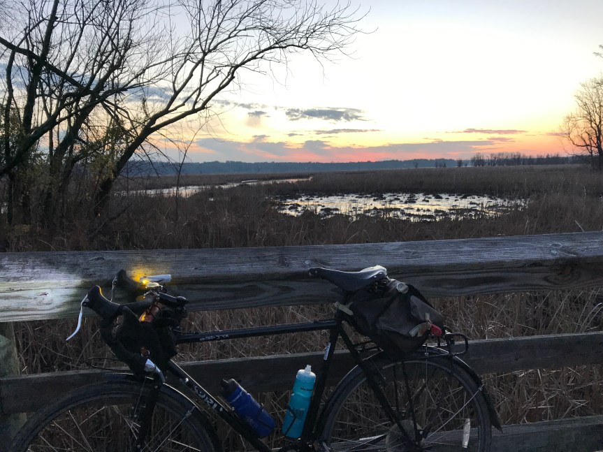
I rode to the South stone in Jones Point Park on the Mount Vernon Trail. It was overcast but the weather was just right for Little Nellie, posing here at Dyke Marsh.

The route goes clockwise mostly northwest on King Street through Alexandria. Since the stones are arrayed in straight lines the ride goes up and down hills rather than around them.
Near Seven Corners the route turns toward the northeast. I rode on streets I’d never seen before, and I have lived here since 1984. In North Arlington I went down a side street to find a stone. It was on someone’s back yard so I couldn’t see it. At least these folks were decent enough to have a gorgeous red tree in their front yard for me to gawk at.

The route took me down a scary hill to the Potomac River at Chain Bridge. Across the river I picked up the muddy C&O Canal towpath and then pushed Little Nellie up a flight of stairs to get on the Capital Crescent Trail. I very nearly fell down the stairs as my grip on the bike slipped.
Across the river I climbed up to Massachusetts Avenue and then to Western Avenue which runs along the northwest boundary of DC. From time to time I could see a stone off to my left. By this point I had missed finding about five stones so I was more concerned about the riding than the stones.
Down into and up out of Rock Creek Park brought me to scary East West Highway. It took me several tries but I finally found the North stone tucked away near the edge of a parking lot. Note the cage that surrounds the stone to protect it from evil doers.

From here the route points southeast, more or less. Eastern Avenue is the boundary road but the route meanders about. By this point I pretty much stopped looking for the stones. I was more concerned about avoiding being car chow.
In Colman Manor the route put me on the Anacostia River Trail System. After a wrong turn, I found familiar pavement and crossed the river. I stopped at Bladensburg Waterfront Park to use a blue room and refill my water bottles. I had ridden over 45 miles so far and it occurred to me that breakfast was about to wear off. Also sunset was only about 1/2 hour away.
I decided to abandon the last third of the ride and head home on the Anacostia Trail. As I rode to the 11th Street Bridge, crossed the river, and headed toward Nationals Park. Once there I followed my route to my house from summer days and nights at home. This involved dodging pedestrians and cars near the DC Wharf and nimjas on the Mount Vernon Trail. (Get some lights, people.)
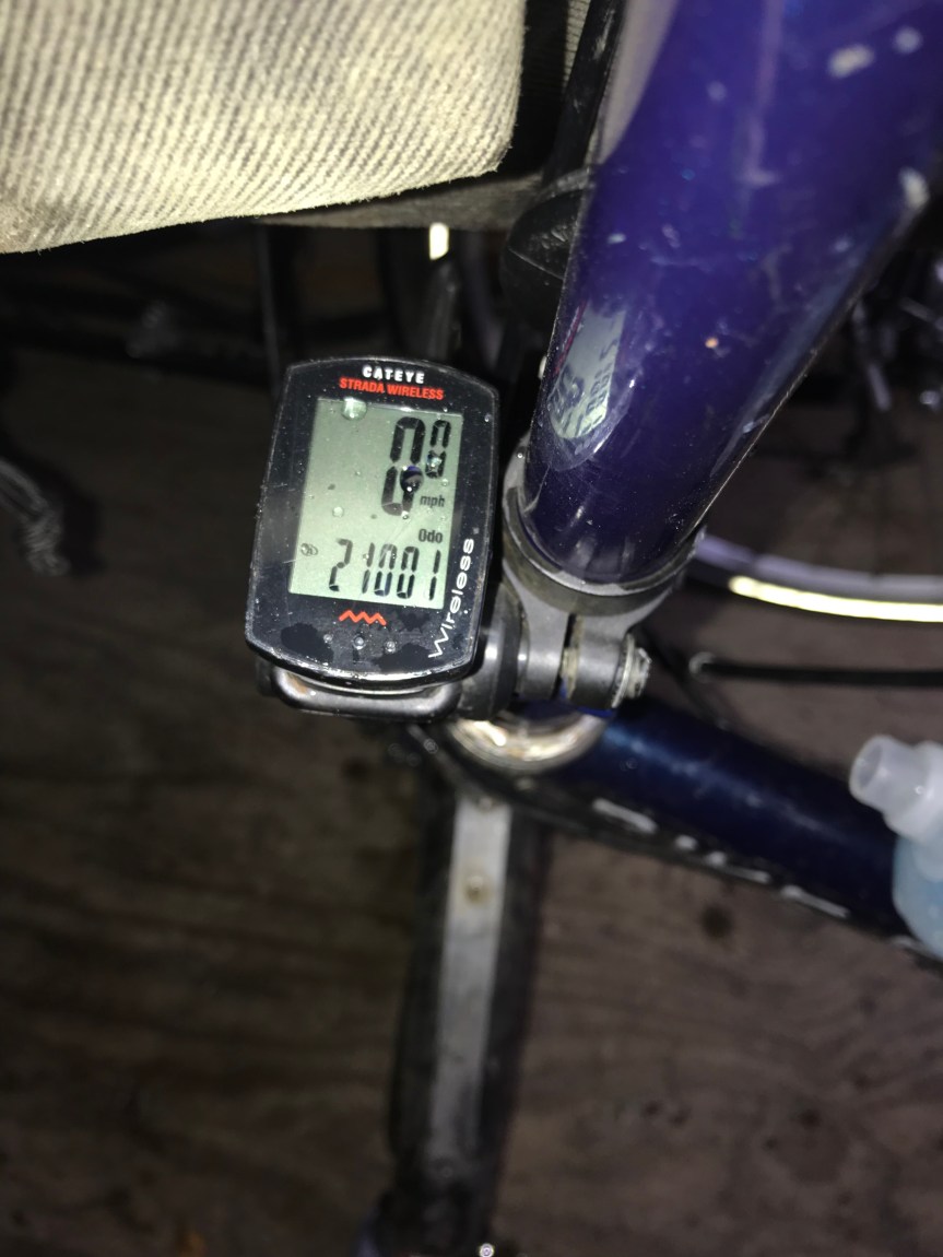
I arrived home after 70 miles.
I still feel like a blob. A sore blob.
But it was so worth it.