Last night’s dinner from 7-11 was a fine repast. A jumbo hot dog, a big bag of tater chips, a small bag of M&Ms, and a tall Arnold Palmer (sans alcohol).
I slept well using ear plugs to drown out the TVs in the hotel. Something big must have happened in the news.
The breakfast bar was no match for my hunger. Coffee, OJ, biscuits and sausage gravy, scrambled eggs, home fries, and a turkey sausage patty. Burp.
I took an apple for the road then packed slowly allowing the temperature to rise above 60 degrees.
I learned today that the Google doesn’t do country roads very well. It started me the wrong way on a two-lane, one-way road. Next it routed me onto US 29, a four-lane bicycle death trap. Later it routed me onto a gravel road. This worked out fine. A half hour later it did it again. This time the road crossed a cattle guard and ended at a farmer’s gate.
The paved alternative looked good until I arrived at an active stone quarry. A man at the quarry ungoogled me and I was soon on flat Rapidan Road, zooming south with the aid of a tailwind.
After climbing a steep hill in Orange, I stopped at a brewpub for lunch. The food was great even if the condiments were a bit pretentious.
After Orange I turned onto Virginia Highway 20 and headed 22 miles straight to my hotel. The road was rolling up and down mile after mile with each hill getting higher than the last. The traffic picked up and the drivers were impatient. The first tall building I came to was my hotel, high on a hill, of course. It’s next to a Wawa so I know where I’m eating tonight.
Hotels here are nearly double the price from last week. I blame Brandon. Still I sprung for another Holiday Inn Express because the psychological impact of staying in fleabag hotels is one of my least favorite aspects of bicycle touring.
I have booked a sofa at the Cookie Lady’s house tomorrow night. I hope also to ride the new tunnel under the Blue Ridge. I not looking forward to the brutal climbing during the day but I’m as ready as I can be.
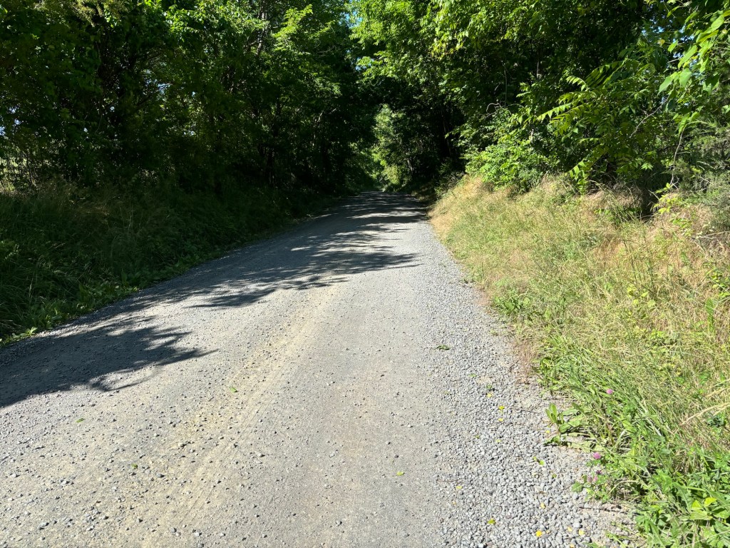
A country road through working farmland. Many of the farms near Charlottesville are mega estates.
This gravel road went through to a paved road, others did not
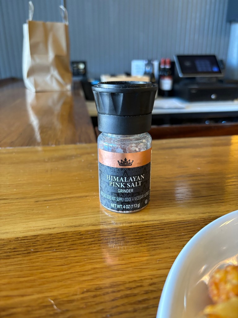
It’s kind of hard to make salt obnoxious but this bar in Orange managed the feat.
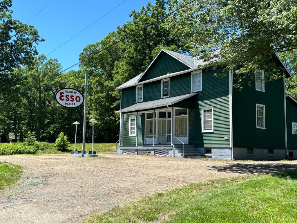
Near James Madison’s home houses are painted this interesting green color. Madison bought gas here. Or maybe not.
If you run a business out in the boonies, it’s best to specialize.
But for some insane traffic and food issues, today’s ride was about as good as it gets.
Temperatures in the low 60s. Low humidity. Tailwind.
My route to Culpepper repeated a little over 30 miles of the start of Day 1 so I changed it. Instead of using the Mount Vernon Trail, I rode flat neighborhood streets through Hybla Valley. I repeated the two-mile stretch on US 1 through Fort Belvoir. Instead of the big ups and downs of Lorton and Occoquan, I rode Old Colchester Road. It has rolling hills but is much more pleasant. It put me onto US 1 at the bridge over the Occoquan River, skipping the steep drop and climb at the town of the same name. I was now in Prince William County.
I followed the Google’s directions through Woodbridge and Dale City. I rode through heavy traffic on three-lane highways and dealt with five asshole pickup truck drivers. One even cleverly told me to “Get on the sidewalk.”
Eventually a side path appeared, lowering my anxiety level considerably. I picked up Dumfries Road, a busy cross county highway. There was a side path but I chose the 12-foot paved shoulder with rumble strips.
I turned onto Aden Road where I danced with dump trucks a week ago. After six miles I stopped at a country store. Judging from the lines, the grilled food was awesome but there was no place to sit down and eat it.
I bought a chocolate milk and a cherry pie in a box, went outside and inhaled it next to a parked plumber’s truck.
The plumber came out of the store and remarked that I must be brave or insane, considering all the dump truck traffic. Ironically, I only saw two dump trucks all day but the plumber nearly hit me as he backed his truck up. (We both had a laugh over it.)
View from the Aden Market
After another six miles I left the Day 1 route and gave myself over to my Google master.
As I continued toward Culpepper the route became a bit hillier. It was now a bit warmer and more humid. Still it was comfortable riding. I stood at two more places to get proper lunch but their grills were closed. One place sold nothing but packaged Latin food. I admit the cases of cookie-like pastries were tempting but I needed protein.
There was a lot of this today.
Near Remington the road ran parallel to a train line (the one my Amtrak train used last week). It was totally flat.
All good things come to an end. The road began to roll. At Brandy Station I stopped at a Subway for a wrap. Turkey, bacon, avocado. My tummy was happy.
The next nine miles were up and down until I came to Culpepper. The Google was drunk and sent me all over town to get to the hotel.
I had intended to stay at a Best Western but when I arrived it had been re-branded as a Days Inn. I walked around the complex looking for the registration desk. At least half the rooms were under renovation. I never found the check in desk so I went next door to the Holiday Inn Express and booked a clean, quiet room for $10 more. Well worth it.
Tomorrow’s ride to Charlottesville is about 50 miles. The weather will be a repeat of today.
I’m off to buy grub at the 7-11 next door. I ate lunch at 4 so any old food will do.
It’s been six days since illness stopped my tour. I am feeling a whole lot better, not 100 percent but close.
On Monday I did another 30-mile ride on The Mule, again unloaded. Two miles in, I rode up Rebecca Drive, a challenging hill with steep bits. No problem. My legs didn’t tie up at all. I rode 13 miles to the Pentagon at a much faster pace than I planned. I felt great. Along the way, my chest congestion started to break up. Eww. I turned for home and hit a 10 – 15 mph headwind. I’m such a sucker for a tailwind. Still, I made it home in good shape. When I got home, I started re-packing.
Yesterday, I decided to test my endurance. I rode Big Nellie, my recumbent, 30 miles in perfect weather. No hills, just cruising around Mount Vernon. After I arrived home, I mowed the lawn. I finished mowing without crashing and burning. I would have finished the trimming but the skies opened up. I felt fine afterward. Frankly I was a little surprised.
Today, I took Big Nellie out for another ride. This one was flat and easy. It only lasted 23 miles before storm clouds chased me home. It poured five minutes after I went inside. I still have some lingering sinus aches and my chest is a tad congested but I feel much, much better.
I finished packing, making some further adjustments to my load. I added a chain break tool. I subtracted my saddle wrench and my bear bag. I swapped out my big sleeping bag for my lightweight REI sleep sack and a silk liner. I doubt I’ll encounter nighttime temps under 50 degrees. This arrangement only weighs a few ounces less but it’s much smaller.
The plan is to ride back to the scene of the crime, Charlottesville. My route last week was the height and base of an right isosceles triangle, 238 miles. Instead of re-tracing that route, I’m taking the hypotenuse, a straight line from Mount Vernon to Charlottesville through Culpepper, about 125 miles. That’s 75 miles to Culpeper and 50 to Charlottesville, both are Amtrak cities so no worries about a relapse. I’ll be staying in hotels both nights. The weather forecast is perfect.
After Charlottesville, I plan a short, 35-mile day to the Cookie Lady’s house in Afton. This involves the start of the climb over the Blue Ridge. The next day will involve getting to the top of the Blue Ridge, another 30-mile day, if I stop at a campground in Love, Virginia. If I am up to it, I can descend the west side of the ridge to Vesuvius or maybe Lexington where hotels await. After that it’s down the long neck of southwestern Virginia where I’ll have amble church hostel opportunities.
Realistically, I’m taking this slow. One day at a time.
I have spent the last three days lying around the house feeling generally useless. I have had no energy. In a way, I wish my symptoms were worse so that I could feel better about abandoning the tour.
The folks at a local bike shop all came down with “the flu” which may or may not be the exact illness I have but it sure sounds like what I’ve got. The Washington Nationals had an outbreak in early May. Their catcher was so sick he lost 15 to 20 pounds. I should feel lucky.
Truth be told, I wasn’t feeling so hot when I left home last week. I attributed this to the usual pre-tour anxiety but maybe it was the first signs of the illness. This would explain why the second day climb through Fredericksburg and the ensuing 30 miles were as so much harder than in 2017.
Yesterday I drove to REI to get some replacements for tour items. One was a power pack. I bought one from Best Buy a month ago but I never could get it to work properly. It didn’t come with instructions that I could find. The new power pack was very similar in design. It had instructions. I plugged it in. Then, on a lark, I followed the same instructions for the old power pack. Voila! It worked. During this process I opened the box that the old power pack came in. There, under some packaging, were the instructions in a small booklet. Dang.
So today I needed to return the new power pack to REI. Instead of driving, I rode. I figured I needed to test my fitness to see where my body was at. The ride is generally flat, until the last half mile when some climbing is involved. I felt crummy the whole way – lead legs, coughing up gunk – and the climbing didn’t help.
The REI return process went smoothly and I headed home by a different route. Again, most of the way was flat. Still I kept having to clear my lungs. About five miles from home there is a 100-yard incline to negotiate. I zipped up it. My legs felt better. Hmmm. How odd.
View of Dyke Marsh from new bridge on the Mount Vernon Trail
About two miles later I decided to take a hill that I have used for tour training in the past. It’s maybe 150 yards long and pretty steep. Definitely granny gear worthy. I rode nearly all the way to the top in my middle chain ring, then got out of the saddle and muscled the last 50 yards over the top. Whoa.
I finished strong, 30 miles in all, and felt fine. There’s a lingering trace of congestion in my chest and sinuses but I feel better than I have in a week.
So, how do I proceed?
Well, hanging around home for the next six weeks isn’t going to happen. It’s boring. Moreover, it’s dangerous because my wife will kill me. She wants alone time too.
I have two options to resume the tour. Option 1 is to ride to the Amtrak station 6 1/2 miles from home and take the train back to Charlottesville. I’m not crazy about this idea because the loading process could damage The Mule, and I’d have to deal with the mechanical aspect of removing and installing the wheel without a stand. (I know, I’d have to do this if I get a flat. I’d rather avoid it if I can.)
Option 2 is to ride The Mule to Charlottesville by a more or less direct route: 75 miles or so to Culpepper on Day 1, 50-ish miles to Charlottesville on Day 2. (My tour route was about 230 miles).
After Charlottesville, I get back on the Trans Am, starting with 30 miles to Afton and the Cookie Lady’s house . This involves a brutal climb for the last five miles. Then, 30 or so miles up to and along the Blue Ridge to a campground in Love VA. Then it’s downhill to Lexington. Depending on how I feel, I could do Afton to Lexington in one day. Thursday the weather improves so I am thinking of leaving then.
Either way I have been thinking of ways to lighten my load: leave my master link tool (they look like pliers) and my allen keys home (a multitool will have to do). I can take two spare tubes instead of three. (I have patch kits.) I can switch my off-bike shorts and belt to a second pair of bike over-shorts. Also, I’m going to leave the maps for the Great Rivers South and Lewis and Clark routes home. I’m only taking four TransAm maps and one Route 66 map (in case I continue to Oklahoma City). All of this might come to a pound. Anything else I might use I can download from Adventure Cycling. Every ounce counts.
If I feel good tomorrow, I’ll start packing for Round 2 of the Mo Mo Tour.
I slept very well at the church hostel. Alone. I haven’t seen a rider on the TransAm and the hostel says there have been very few riders this year.
I took my time getting on the road after eating a breakfast of leftover food from yesterday. As soon as I mounted the bike I could tell that this would not be a good day. I had lead legs. I had been using my granny gear until today but this was getting ridiculous. Hills that I would have sped over last year were brutal slogs.
And, like the last three days, the weather was perfect.
I kept at it hoping that my Warmshowers hostess would come though with a place to stay 20 miles beyond Charlottesville. She never did.
Roadside wood art
I plodded along and stopped at a gas station convenience store without the gas. It was a place out of the 1940s. While washing down a homemade brownie with a Diet Pepsi, a local came by. He’s 68 and has livestock on his land. He lives off the rent from six log cabins he built with his own hands. He spends summers on a ranch near the eastern entrance to Yellowstone. He had on a weathered cowboy hat with the sides of the brim turned up like Junior Brown. He was missing a few teeth. And he could talk a blue streak.
They used to call this Ashland
After a half-hour chat I took off for Charlottesville. I often have a problem with congested lungs when I ride, but today, instead of going away, it worsened by the hour. A shot of albuterol had no effect. I was coughing up gunk all morning and feeling drowsy to boot.
As I was grannying yet another hill, some local riders in Lycra zoomed down the hill, all smiles.
Must not kill.
The hills seemed to be getting steeper with each mile. Climbing past Monticello took everything I had. The climb into Charlottesville nearly did me in.
I checked a few a few hotels and they had plenty of empty rooms. So I went downtown for sustenance. When I got off my bike I was dizzy. No bueno.
I concluded that there was no way I could continue in this condition. And even if I could, I wasn’t having any fun. If Monticello was tough, Afton Mountain and the Blue Ridge only a day away would be impossible and dangerous.
I had a burger, fries, and a beer at a bar downtown. It tasted great but my head still felt out of kilter.
Back in 2003 I abandoned a tour when my brake and shifter cables froze, the sidewall of my rear tire blew out, it was raining, and I was sick as a dog. I called my wife and she rescued me.
I did not feature laying about in a hotel for three days getting over whatever it is that is ailing me.
I rode a mile to the Amtrak station and checked about getting the train home. $46. Roll on service. In bed by 10:30.
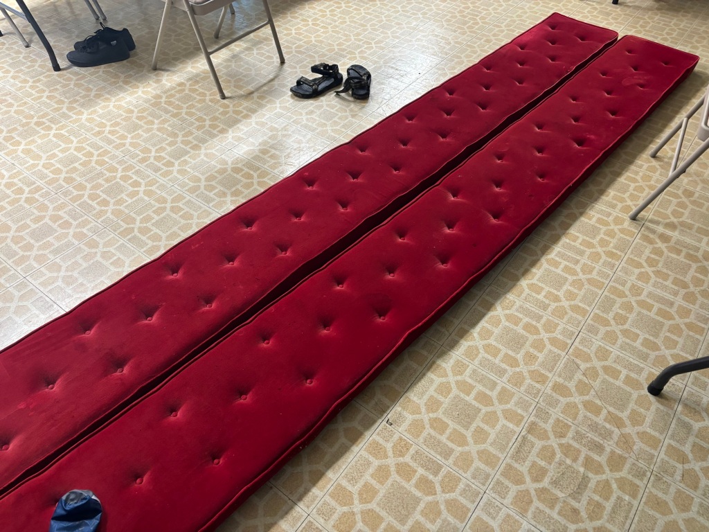
I slept on the floor at the Beaverdam United Methodist Church building. Sort of. Tina, my hostess, suggested I use pew cushions as a mattress. They worked wonderfully. I slept over eight hours.
Pew pads worked like magic
I learned that there was a gas station convenience store a quarter mile from the church. (Meaning that yesterday’s wayward, ten-mile food search was a complete waste of effort.)
Before leaving the church I put a fourth water bottle in my right front pannier increasing my bike’s weight but reducing my anxiety for the hot day ahead.
I went to the Beaverdam Kwik Stop and had a bacon and egg sandwich and chocolate milk for first breakfast. I also stocked up on more road munchies.
I lit out and rode right past the inconvenience store from yesterday. I was feeling pretty good for about ten miles. I searched in vain for the town sign for Bumpass (I am not making this up), Virginia. I imagine it gets stolen all the time so I took a selfie at the post office.
Notice how The Mule claimed the handicapped space. Bad Mule!
After Bumpass I skipped my first decent convenience store opportunity and missed a turn. After a couple of miles I realized I was off route and turned around. I could feel the heat of the day and the waning of my breakfast energy stores.
So I stopped at the convenience store for a sausage, egg, and cheese sandwich and a drink Revived, I headed north toward Lake Anna. The rolling hills of yesterday were more frequent but I wasn’t bothered by them. I passed Green Bottle Hill at 279 feet and didn’t even notice. I could tell I was getting my legs back.
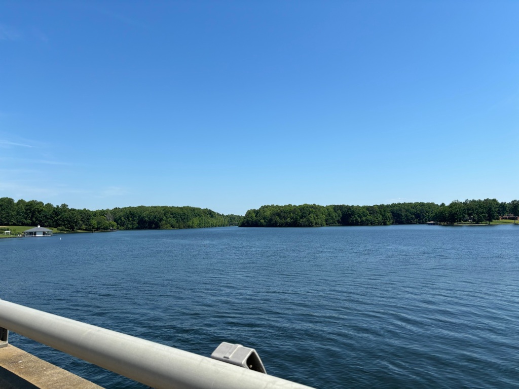
Lake Anna
I stopped at a market in Elk Creek and treated myself to more drinks and an ice cream sandwich. Nutrition is my middle name.
It was another ten miles of ups and downs to Mineral. I was tempted to call it a day and set up my tent behind the firehouse, but decided to eat lunch (oink) and think it over. A cheeseburger, fries, Diet Pepsi, a gallon of ice water, and some air conditioning revived me.
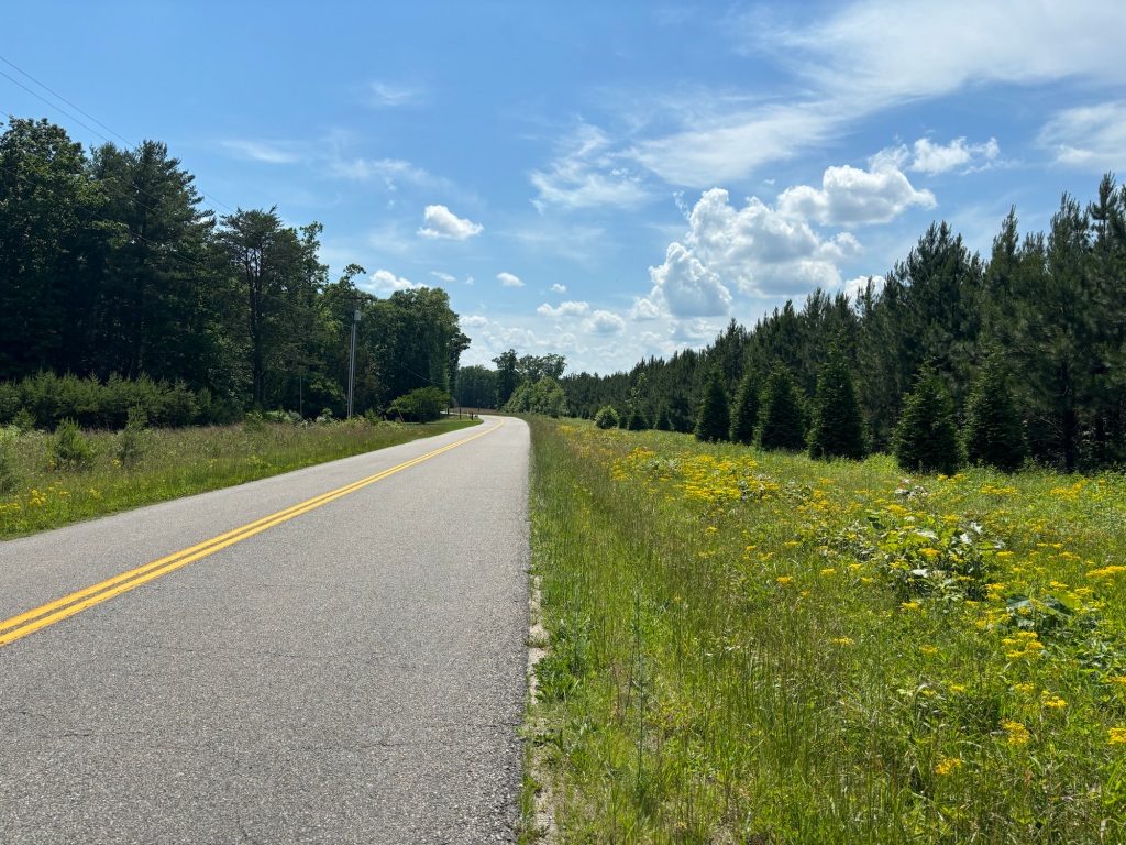
Obligatory nice country road photo
I called a church hostel in Palmyra 30 miles farther west and booked a spot on their floor. Off I rode with an unexpected increase in speed. The road dropped down to river and creek crossings after which I had to climb back up. These were the toughest climbs since Fredericksburg but I had no trouble dealing with them. I could tell that my climbing efficiency was much improved from the first two days.
This farmer was “haying” at an angle
I pulled into Palmyra and checked in at the church. Cindy showed me the ropes and drove me to a grocery to get some fried chicken, green beans , and collard greens. It’s the south, baby.
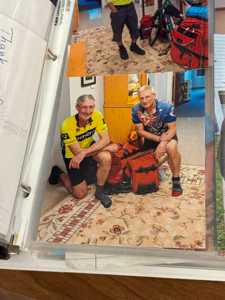
I found this picture of Corey and Mark from their 2019 TransAm ride in the Palmyra hostel
Tomorrow’s destination is unclear. Option A is to take a very short day and get a decent hotel room in Charlottesville. Option B is to ride 40-ish miles to a Warmshowers host in Crozet and camp. Option C is to ride 50 miles to the Cookie Lady’s house as originally planned. An important consideration is the fact that the climb up the Blue Ridge and along The Blue Ridge Parkway is 50-ish miles away. Lexington is the next place with hotels. I’ll see how I feel in the morning.
Today I was chased by another fierce dog. It came out from behind a pile of junk in front of a derelict house. It was snarling and bearing its teeth. The poor dachshund ran out of steam after 50 yards.
Boy was I glad I took the hotel instead of continuing to the KOA campground south of Fredericksburg. I didn’t sleep all that well and breakfast was kind of meh, but I avoided ending my day yesterday with 15 miles of punishing hills.
A dollar in the dryer and it ain’t dry yet.
After a one-mile downhill on the highway from the hotel I spun through the University of Mary Washington to begin the painful climb.
After 18 miles I passed the KOA sign and could not believe how zonked I was. So much climbing! I pressed onward stopping to inhale an apple from the hotel. A few miles later at Guinea Station I went a bit off route to see where Stonewall Jackson died. The best part was there was a water fountain and a bathroom. Not for him. For me. Hell, he was missing an arm when he croaked.
Stonewall died here.
Back on route I slogged along unable to find any rhythm to my pedaling. Every hill seemed like Alpe D’Huez, despite the fact that my 2017 account of this section of the route remarked on how flat it was.
I was chased by my first dogs today. Two corgis made a valiant effort. I hope they weren’t angered by my laughter. Later one of two roadside turkeys squawked its head off as I passed.
The white turkey in front really gave me the business.
Forty miles in I was totally discouraged and ready to bail to a hotel and maybe to cancel the whole tour. I sat on a bench at a churchyard playing and ate three bagel thins with peanut butter.
When I hit the road I could feel my energy level rising by the mile. I hadn’t been eating enough all morning and I experienced a classic bonk. My blood sugar had tanked.
I stopped at a nursery to get for some tap water. I noticed there were empty plastic water bottles strewn about the greenhouse. The staff told me the water they used on the plants was not potable. A Latina staffer kindly gave me a cold bottle out of a cooler. Her two-year-old was surprised when I said “Hola” and “Buenos Dias”. He was obsessing over dinosaurs and being totally cute. He followed me out to see me ride off. If he said, “Vaya con Dios” I didn’t hear him.
Back on the road I reached the turn off to the TransAmerica Trail, US Bike Route 76. I had been calling a Methodist church in Beaverdam just off the TransAm to see if they would accommodate me in their hostel (a community room with a kitchen and bath). They didn’t return my calls.
Turn right. No guts, no glory.
There are very few choices of places to stay and this was the best option. Mineral puts up bike tourists behind its fire house but it was 25 miles farther away, making for an 80+ mile day.
I was being passed by logging trucks for the last ten miles and I found out why. A tree farm was harvesting its wood, taking away my much needed shade in the process.
(Hard to complain though; the weather was splendid all day.)
Finally I emailed the church and continued past the turnoff for Beaverdam to get something to eat three miles further on.
I missed a turn and ended up adding four miles to my day. During my wandering my phone pinged with an email telling me the church would gladly accommodate me.
I returned to the trail and headed west, away from the church to buy some dinner at a convenience store with a grill. The grill was closed and the store carried nothing but junk food.
I bought some Doritos and washed them down with chocolate milk and Gatorade. Upon leaving the store the wife of the minister pulled up and told me the church hostel door was unlocked and that she’d meet me there.
I back tracked to the turn off for the church passing an enormous Baptist church. God is good for business, I guess.
At the more modest Methodist church Tina, the preachers wife and her son John, showed me the ropes and dug a can of Chef Boy-R-Dee ravioli out of a box on the kitchen counter.
After they left, I showered and nuked the ravioli. It was nasty but I ate every speck of it.
Tomorrow I continue west to Palmyra and amother camping opportunity. If I’m feeling my oats I may press on to the edge of Charlottesville and get a hotel room. My destination for Thursday will be the fabled Cookie Lady’s house in Aston. More on what that means in a later post.
Miles today: 75.5, of which about ten were utterly unnecessary because of a dud convenience store and a missed turn.
I expected today’s ride to be a repeat of the first day on my 2017 post-retirement ride to Key West. Mostly it wasn’t.
As I was about to start my son FaceTimed us from Thailand where he’s a scuba diving instructor. The good news is business is great. The bad news is that warming sea temperatures are causing coral bleaching near Thailand. It was a pleasant surprise talking with him.
After the chat, I hugged the daughter and kissed the wife and rolled down the front lawn, heading south via the last mile of the Mount Vernon Trail. The three-mile downhill to US 1 was worth the slog up to Mount Vernon.
The Adventure Cycling Atlantic Coast route that I am following goes around Fort Belvoir on Telegraph Road. This involves an incredibly difficult climb in traffic. No thanks. I used the side path on US 1 that goes straight through the base. There are hills but they are much more gradual.
These signs for US Bike Route 1 helped me navigate.
After Fort Belvoir came the slog up the hills of Lorton and past the rehabilitated buildings of the federal prison that used to be there.
Next up was down, down out of Fairfax County into the quaint town of Occaquan. There’s a nifty little bike-ped bridge across the Occaquan River as part of the route.
Alas, after crossing the river came the hellacious climb away from the river. I knew it was coming but that didn’t make it any easier.
Once at the top, I was rewarded with eight miles of truly ugly, car-centric suburbia in Prince William County. The world would be a better place if the military used this area for artillery practice.
I was really looking forward to escaping the sprawl but it has become much more extensive since 2017. I finally turned onto the two-lane country roads that circumvent the Quantico base. Rather than get relief I was treated to an endless parade of dump trucks and other commercial traffic intermixed with clowns in pickups and sports cars.
The shoulder was unpaved and all of two feet wide so I just kept trucking with dump trucks lined up behind me. Occasionally I pulled over to let them pass.
To take a break I stopped or lunch at a Subway. I really didn’t feel like eating but when I got back on the Mule I could tell that my blood sugar had been low before the meal.
More dump trucks. I felt like I was in Oregon on the west side of the Cascades. It’s incredibly stressful riding even though the dump truck drivers were very considerate of my presence.
At one point a the driver of a flat bed truck passed me with smoke coming out of his exhaust only to nearly hit an on-coming dump truck before swerving back into my lane. It was fortunate that the dump truck driver slammed on his breaks or there would have been truck goulash.
Once I made it past Quantico I had ridden 61 miles. The weather had been perfect so far but the sun came out and temperatures started climbing. I had planned to ride to a campground past Fredericksburg but my body wanted nothing to do with an 84-mile day.
I expected to stop at an ice cream shop from 2017 but it was no longer in business. Waaa! I rode into Fredericksburg which has a beautiful historic district. I used the Google to find a Best Western hotel, one I knew was used by bicycle tourists. It was only a couple of miles away but it was on Virginia Highway 3, a bicycling death trap. And up a huge hill. And past interchanges with US 1 and I-95, or so I thought.
I was focused on not getting killed (the theme of the day) as I approached I-95. I saw a Dunks sign and thought of Connecticut. What I didn’t see was the Best Western sign above the Dunks sign. So I rode a mile farther than necessary and traversed the I-95 interchange twice.
Ugh.
The hotel is fine. A welcome splurge on a very stressful day. I plan to lay waste to the hot breakfast in the morning. For dinner, I walked next door to Mama’s Chicken and ate a massive calorie bom. (The mac and cheese is fantastic.)
I am happy to report that my body held up well. The range of motion in my neck isn’t 100 percent but I managed fine. My back is no worse for the wear.
Tomorrow’s I’ll ride to Ashland and pick up the TransAmerica Bicycle Trail. Westward ho!
Miles today: 76
Sorry about the lack of pictures but dump trucks aren’t picturesque.
Well, for a start, the tour has a name. Since I’m riding to Missouri that’s one Mo. it’ll be my third time in Missouri so that’s mo’ Mo. I’m going beyond Missouri that’s mo’ riding. Since I’m dealing with the Appalachian and Ozark Mountains, we have mo’ mountains. If successful I’ll be adding three mo’ states (Kentucky, Arkansas, and Oklahoma) to my 50 states hunt.
The plan is to ride south to Ashland Virginia where I will pick up the Transamerica Trail. I’ll head west on the TransAm all the way to western part of Missouri thereby completing my personal TransAm. (I did the other two thirds of the Trail in 2019 and 2022.) After that the plan is to ride south to northwest Arkansas and then west to Tulsa, Oklahoma (and maybe Oklahoma City). How I’m getting back is anybody’s guess.
Saturday
For the first time in a week, I managed eight hours of sleep. Gabapentin is my jam.
The weather was lousy outside. Rain. Humid. Dank. Perfect.
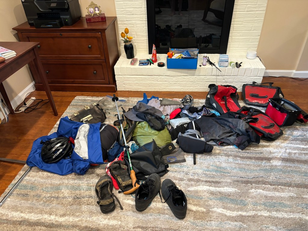
I spent the afternoon, amassing the stuff I need for the tour. I started by emptying my saddlebag. It must weight 10 or 15 pounds! Spare tube, tire levers, patch kits, and pump were transferred to the “tour” pile. The bag became the “home” pile.
Next I grabbed a bunch of white kitchen garbage bags and some zip lock bags. I use the former as a liner for my allegedly water proof panniers. The latter contain small items organized by use.
My right rear pannier was first to load. Sleeping bag, sleeping pad, pillow, camp towel, camp washcloth, rope, clothes pins, and maps and medications I won’t need for the first ten days. I’m also packing a wire mesh bag for my food for camping in the mountains.
The left rear pannier contains clothing (for off bike and on), swim trunks, rain gear, a floppy hat, toiletries and daily medications, and sandals. Rain gear is in a separate bag. An empty bag is reserved for dirty clothing. I’ll also add a small bag with electronic stuff like cables, plugs, and batteries tomorrow. My back-up prescription glasses go in the bottom.
The front panniers are smaller. The front right pannier contains anything I need for bike maintenance. Tire changing stuff goes in one zip lock. Spare tubes in another. Tools (allen keys), a wrench, a master link tool, go in yet another. Small items like valve stems, my fiber fix spokes (a cord that can substitute for a broken spoke), and such go in a third. I also stashed a couple of cables in a small insert built into the pannier.
The front left pannier contains stuff I will need easy access to. Mostly this is food, my lock, sunscreen, butt cream, a back up water bottle when needed. (I decided to leave my water bladder at home.) I also included one small bottle of pickle juice and and another of electrolyte tablets.
The handlebar bag will hold my phone and headphones, wallet, dog defenses (whistle, horn, and mace), a pen, my map(s) of the day, prescription sunglasses, a power pack, a headlight, some pickle juice, electrolyte tablets, and snacks.
Finally, I will have a dry bag containing my tent, stakes, ground cloth, and collapsible cane.
BeforeAfter
Now you see why it took four hours to organize all this stuff. It will weigh a lot; it always does. In my experience the weight isn’t much of a problem – I’ll be going about 10 miles per hour – except for the hills. My biggest concern is how my body will hold up. I’ve done a number of 50-mile rides in recent weeks but my back and neck issues are utterly unpredictable. Lord knows, how they will hold up to tent camping. Even when in good shape, I have struggled to sleep well outdoors. Advil, Advil PM, and Gabapentin will help in that regard.
Sunday
Today I loaded The Mule with all the bags and went for a one-mile test ride. I tweaked a few things as a result and all seems fine. My last task is to go for a ride to a bike store for done butt cream packets.
The Mule with everything except toiletries, meds, cables, and batteries.
It being a nice day I decided to ride Big Nellie. On the way to Old Town we rode across the now officially opened Dyke Marsh Bridge.
It’s wide. It’s new. It’s about time!
Day one promises to be very long, 70 to 85 miles depending on where I stay tomorrow night in or near Fredericksburg Virginia.