Any Road Tour: Day 18 – Ups and Downs

I awoke to thunder. It was pouring outside. The weatherman said that the rain would end by 9 so I waited it out.

When I hit the road it was cool and breezy. The wind from the east was a tailwind for most of the day.

I rode through downtown Dyersville. It reminded me of downtown Bloomington Indiana in Breaking Away. I felt like telling a cop that I was a little disturbed by the developments in the Middle East, but I let the moment pass.

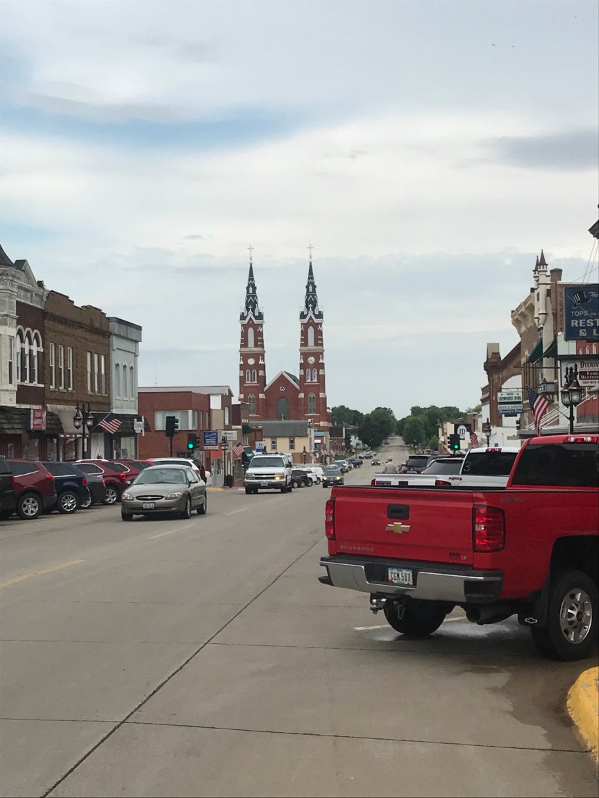
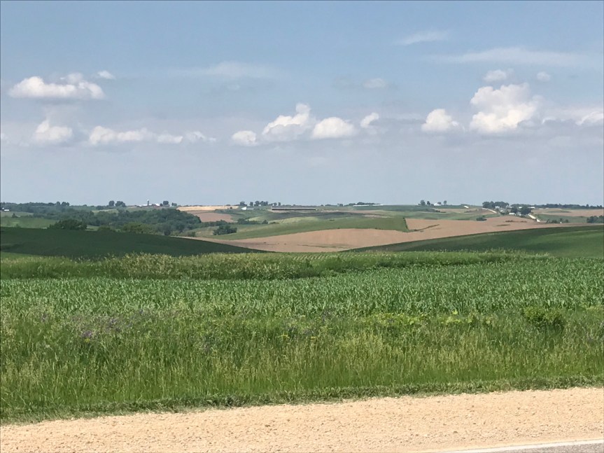
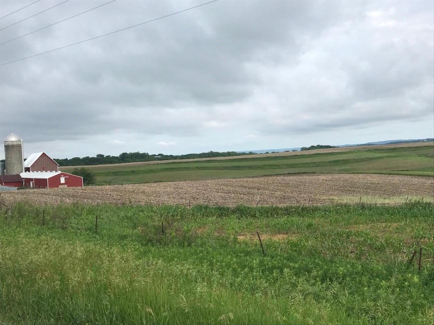
The riding began with a five mile tailwind. This allowed my legs to ease into the day. The tall grass on the side of the road looked like it had been through a tough time.

I rode north under overcast skies. To the north dark clouds loomed.

I did a four mile winding descent into Elkport that was quite thrilling. Sometimes even a Mule can fly.

Then came the climb. I was warned that this ride would get hillier as I headed north. Roger that.

Then it started to rain. I was already a bit chilled and the rain added to my shivers. I stopped and put on my rain jacket. Within minutes it was pouring. And there was thunder.

Pedal, pedal.

I checked my surroundings for shelter in the event of lightning. Barn. Porch. Garage.

The climbing kept me warm but I was starting to worry about my visibility. On a descent I pulled over to put on my blinking light belt. I was quite cold so I zipped up the pockets and pit zips on my jacket. Stopping The Mule took much much too long. Rim brakes are pretty useless when they are trying to stop 270+ pounds going 30 miles per hour in the rain.

I had a long downhill to Elkader. No guts, no glory.

Whoosh!

I made it to the bottom in one piece then started another long climb, perhaps the biggest one since Ohio.

About halfway up the beast, I spotted a burger joint with a covered patio. Food and shelter! When I stopped I realized that I was shaking from cold and tired and grumpy. The Google told me there were plenty of options for motels and such nearby. Hmmm.

The weatherman said the storm would pass over in about an hour. So I decided to enjoy some fish and chips. Hot food was just what I needed. My focus on rain-related matters had blocked out the fact that I was extremely hungry.

Snarf!

Then I spotted the sign for ice cream. “You want nutrition, eat a carrot.”

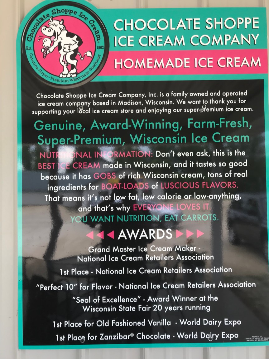
I ordered a double dip cone and inhaled that bad boy in minutes.

The counter staff advised me that there were plenty of hotels in Prairie du Chien Wisconsin about 30 miles away and just a couple of miles off my route.

The rain stopped and I decided to ride on to Monona, the day’s planned destination with free camping in the town park. 15 miles of hillage ensued.

The town park was lovely but the soggy ground and porta potties turned me off. After a coffee break at a gas station convenience store, I decided to ride 15 more miles to Prairie du Chien.

They were remarkably level miles with more Iowa farm views.

I passed through the town of Watson.

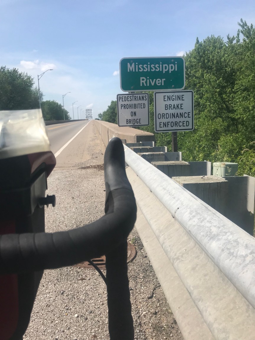
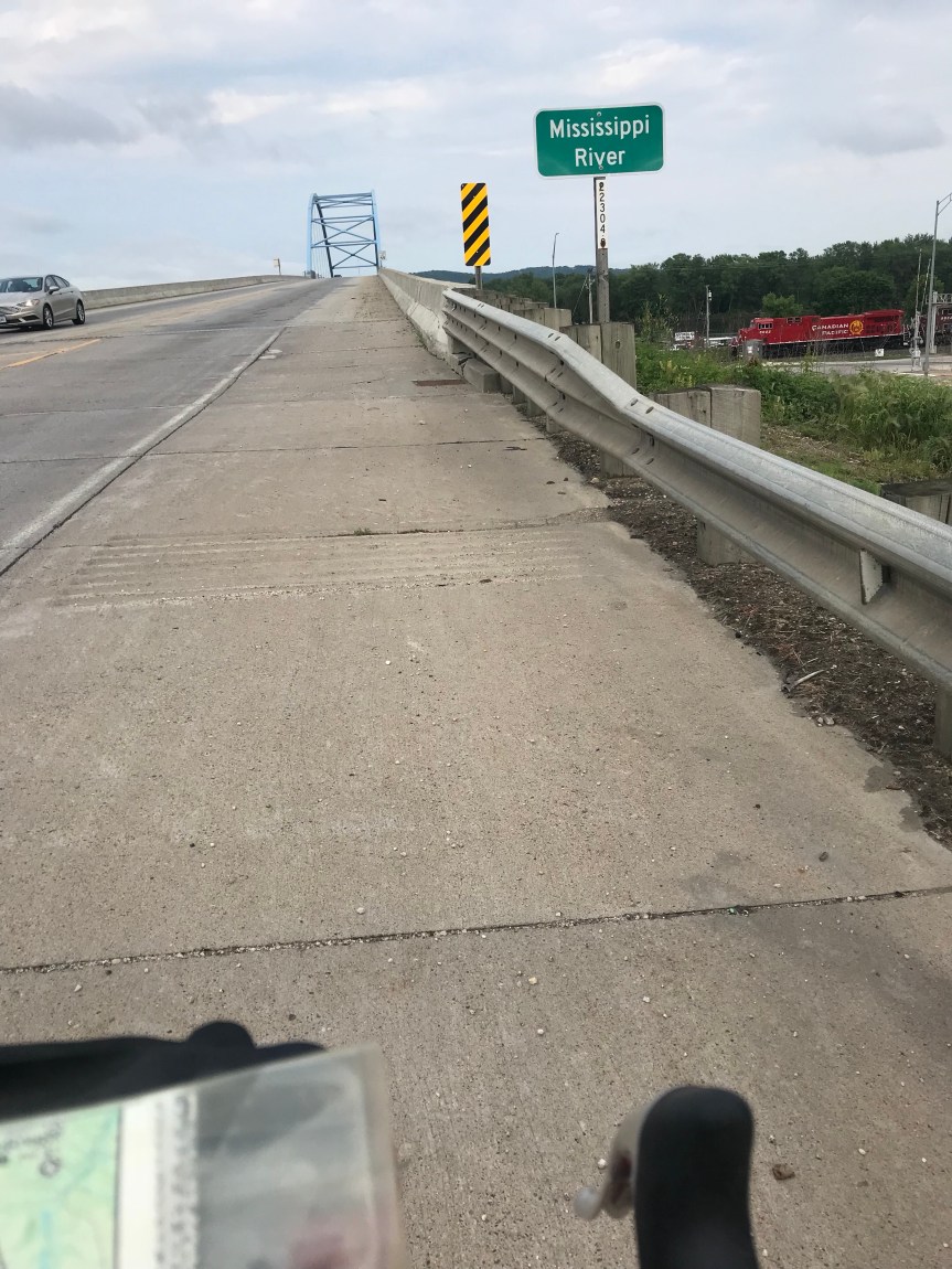
A few miles later I flew down a curving hill to the Mississippi River. It was a thrilling ride. I just took the lane and went for it.

As I entered the town of Marquette, I feathered my brakes to bring The Mule in compliance with the town speed limit.

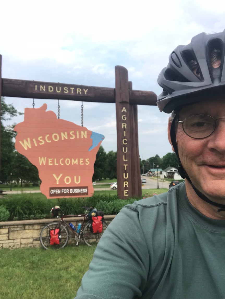
I crossed the river to Wisconsin and did the state line sign picture thing.

And The Mule and I paid our respects to Father Marquette who “discovered” the Mississippi.

After a three mile search for lodging, I ended up at a Super 8 (again) south of town. After cleaning up, I went next door to the family restaurant and had the soup and salad bar. All of it.

I discovered that my waterproof Ortlieb panniers leaked quite a bit. The desk clerk at the hotel gave me a roll of plastic bags to wrap my things in. The worst victim of the water infiltration was my ancient copy of Tom Wolfe’s The Electric Kool Aid Acid Test.

As I write this it is thundering again. Tomorrow’s route continues on the Iowa side of the river. About six very hilly miles away is Effigy Mounds National Monument. I’d like to check it out but the prospect of rain is putting me off. I understand that the terrain in Iowa to the north is super hilly. Lucky for me, the river road on the Wisconsin side is level. I shall take the path of least resistance.

Total miles: 77

Trip miles: 1,344.

Any Road Tour: Day 17 – Two for one

When I drew up the itinerary for this tour, I planned short mileage days for Iowa. The reason for this was that all my friends who hAve ridden RAGBRAI, the massive cross-Iowa bike ride, have told me that Iowa’s hills are horribly difficult.

It turns out they are probably right if you are trying to ride them with 10,000+ other people. When you are riding alone, they’re not bad at all. The tend to be long, sometimes longer than a mile, but not particularly steep. Compared to what I rode up during the first week of this tour they are easy.

The farms in Iowa follow the contours of the land. Instead of Indiana farm’s straight rows, Iowa farms are all curves and contrasts. For most of the day I admired them. The last 20 miles not so much.

It was supposed to be a 48 mile day of grueling hills but, as I already said, the hills were no big deal. I arrived at my planned destination, a cute town called Oxford Junction, at 12:30. I could camp in the town park for free or continue on to Cascade, 25 miles to the north. I decided to skip the all you can eat offerings at the town restaurant/bar and forge ahead.

In the town of Wyoming I stopped to consider riding beyond Cascade to Dyersville. I decided to delay the decision until I arrived at Cascade.

Off I went down a suspiciously winding highway. My map said this should be a straight road. Hmmm…

I was going the wrong way. Four miles. Uphill. Into a headwind. Doh!

At least the return trip was fun.

I stopped in Wyoming and had some comfort food: a blueberry fritter. Damn did it taste good.

On to Cascade. It was a slog to be sure. I tried to put those extra eight miles out of my mind. Just put my head down and pedaled.

I arrived in Cascade feeling pretty good. I sat on a bench outside a gas station considering my options. Camp for free in the lovely city park in Cascade or ride on 23 miles to Dyersville, my itinerary’s destination for tomorrow. I’d already ridden 81 miles.

A mechanic came out of the garage and started talking with me. He told me the 23-mile route was designed to take me past the Field of Dreams ballpark in a cornfield. I didn’t think much of the movie so when he told me that taking the highway to Dyersville was only 15 miles with only a few hills after about 10 miles.

When you get route advice from a non-cyclist you really should take it with several grains of salt.

I went for it. The first 10 miles were scenic and level. Just what I needed. The rest of the shortcut matched the mechanics description to a t.

Which is not to say I was enjoying the last few hills or the relentless expansion joints in the pavement that were beating my body up. When I saw the Dyersville water tower I knew I was home free.

Down a long hill into town. Rather than camp in the park I grabbed a motel room, after making sure it’s TV system carried tonight’s Stanley Cup game. Go Caps!!

Today’s mileage: 96 (thanks to those 8 bonus miles)

Trip miles: 1,267.

Tomorrow I’ll take it a bit easier.

Any Road Tour: Day 16 – Tailwinds to the Mississippi

Drinking a half gallon of caffeinated soda at 9 p.m. might not be the best formula for sleep but I did it anyway. After yesterday’s beatdown from hills and headwinds I could not get enough to eat. I had PB&J sandwiches, a Snickers bar, two chocolate chip cookies, and fast food. And my pants are falling off. No lie.

I had two breakfasts because, well, no food be said “Stop!” I think I am going to get banned from some hotel chains.

I decided to stay on the due west Adventure Cycling Northern Tier Route because the Google instructions for riding into Iowa on a northwestern diagonal were much too complicated.

On the road around 8 I instantly felt regret. It was cool and there was a strong wind from the east. Perfect tailwinds for a fast bike ride. Why didn’t I get on the road sooner?

Leaving Kenawee I was cruising at 15 to 20 miles per hour. Hills? What hills?

The level prairie had given way to rolling hills. The main crops were corn and soybeans as before but they were planted in curves that matched the topography.

I didn’t take any pictures because I was too busy taking advantage of the fantastic conditions. I stopped for lunch st a 7-11 in Sherrard. I was half way to Iowa at 11:30,l. When I came back outside, the wind had changed direction. It was now a crosswind out of the south. It gradually shifted to the southwest creating something close to a headwind.

Still I was grateful for 38 miles of assistance.

I stopped a couple more times just to break up the grind.

Then I saw this sign. Not again. It was ambiguous.

I ignored it and never encountered the promised outage. At about the point where the outage was supposed to be, I caught a mile long curvy downhill on smooth pavement.

Zoom!

After a few more miles I stopped to orient myself. Next to me were acres of crops clearly in a flood plain.

My head was immediately surrounded by annoying flying insects. I won’t be camping near here was my immediate thought

Soon I was on a busy highway making use of my mirror just like in South Carolina last fall.

Then I saw this sign.

At the top of the bridge I stopped to check out the Big Muddy.

On the far side of the bridge in the city of Muscatine, I put a notch in my handlebars for the 8th state on my trip, Iowa.

A search with The Google turned up several hotels. After stopping for a celebratory ice cream cone, I pedaled onward looking for shelter.

Traffic was heavy and the highway unwelcoming, so I turned down a grassy hill into the parking lot of a Super 8.

Mission accomplished.

Today’s 78.5 miles were far easier than yesterday’s 62.5.

Tour total: 1,171.