Any Road Tour: Day 14 – Turbines and Chipseal

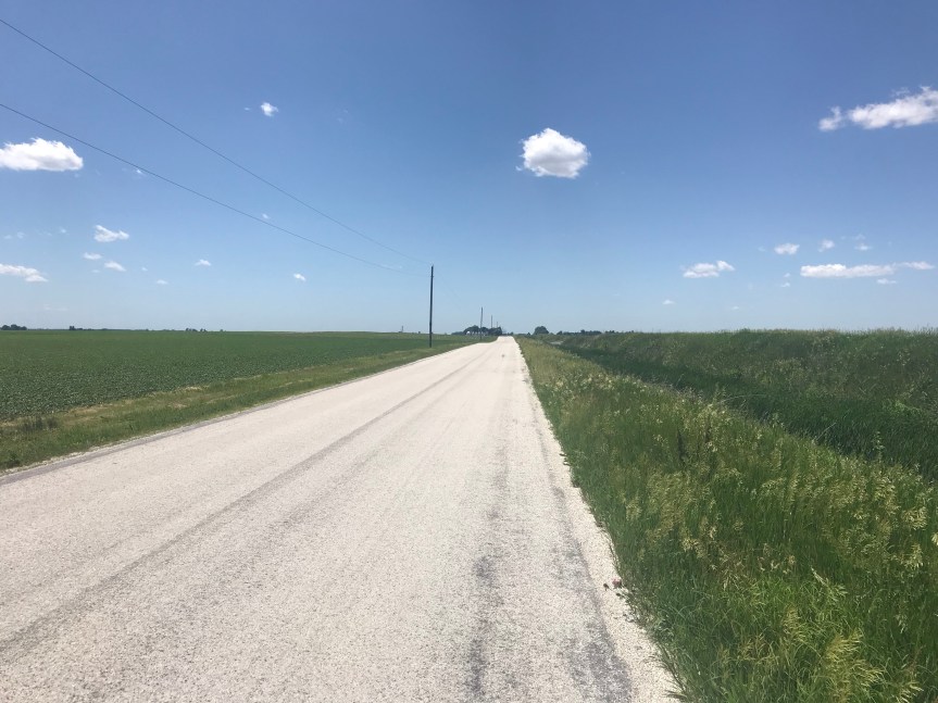
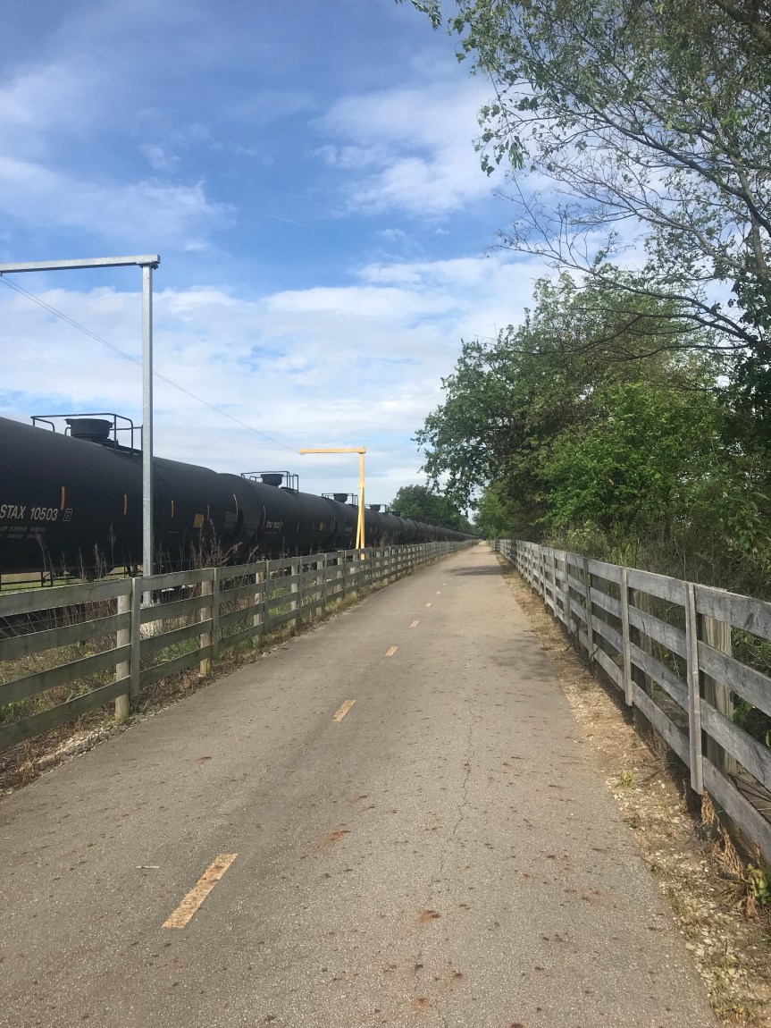
After a fine hotel breakfast or two at the Super 8 in Watseka (a surprisingly nice place, BTW) I asked the Google for directions to get me back on my route. The Google did an outstanding job directing me down perfect country roads with plenty of trees to shade me from the headwinds.

The headwinds today were about half as strong as yesterday and easily manageable. When I started riding it was 55 degrees. It warmed up to the high 70s with moderate humidity. Until mid afternoon there was literally not a cloud on the sky. Dang it was nice out.

The Google route was windy (as in not straight) but after days of riding a grid it was a welcome relief.

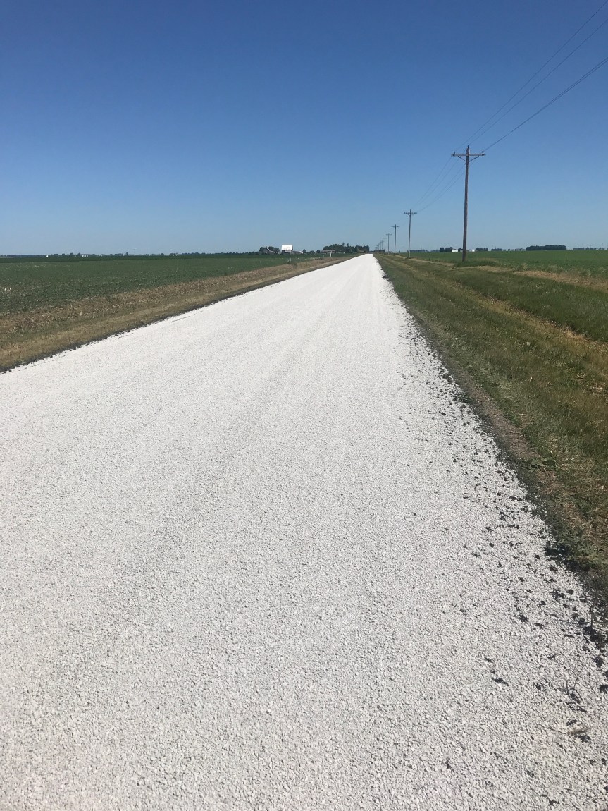
Many of the county roads are paved with chip seal. The road is coated with sticky tar and then gravel is put in top. I road a few miles on roads that had been recently renewed. It slowed me down but didn’t approach the level of unpleasantness that other bike tourists had warned me about.

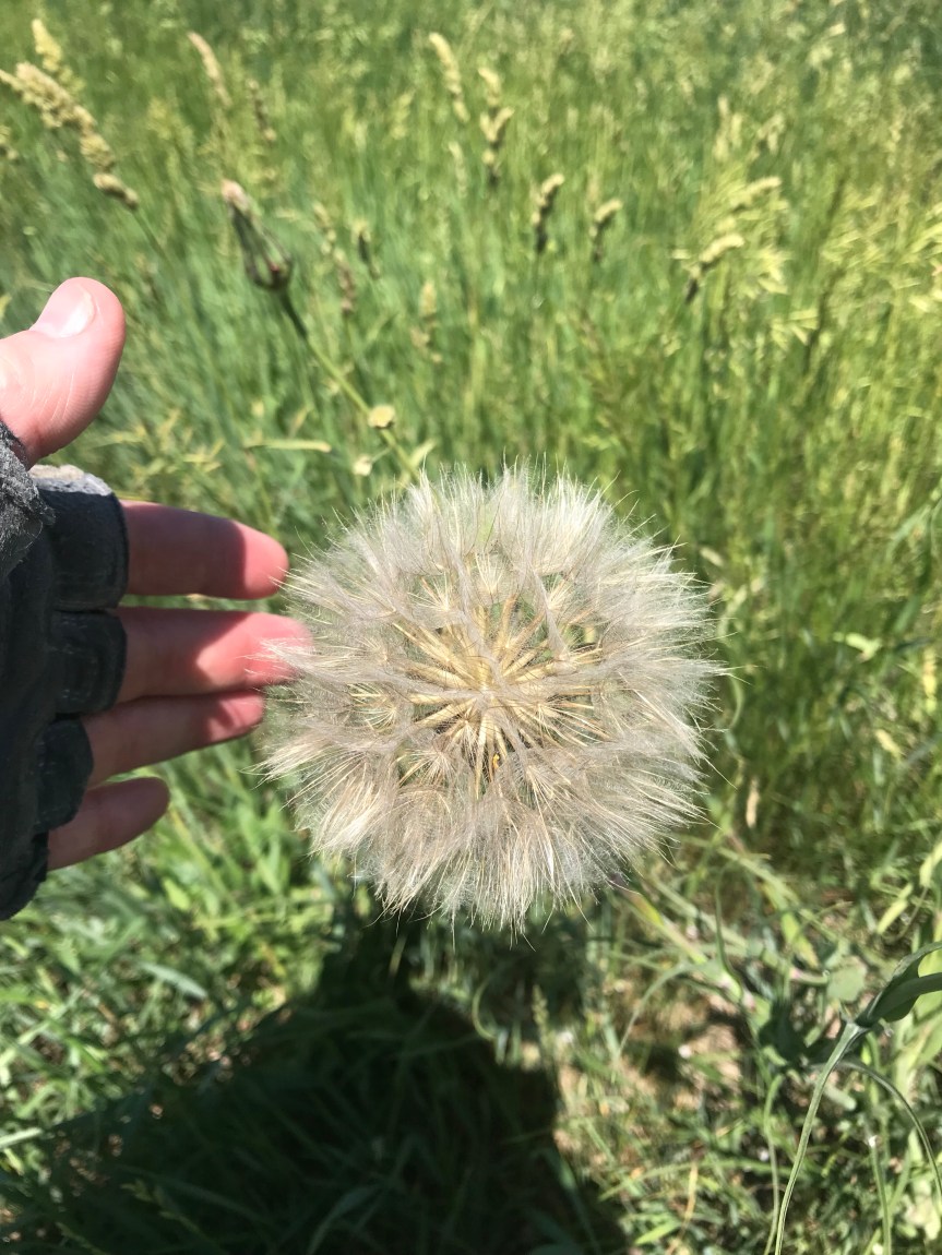
The dandelions on the side of the road are enormous. I didn’t see any yellow just these big fluff balls.

Another item of note is the bird life. I spotted what looked like an osprey chowing down on some prey in a field near the road. Seeing me he took off and landed on a telephone pole about a quarter mile from his meal. After I passed he flew back to it.

And there is a small bird that looks to me like a sandpiper. It’s about the size of a cardinal. It gray-ish feathers on its wings and tail with a brown patch just above the tail. They only fly a few feet off the ground. After flying for 30 yards they land and run for a few feet before taking off again. They are entertaining to watch and I must have seen 100 of them today.I road past several wind farms today. It’s amazing what happens when you plant a turbine seed in a corn field. 
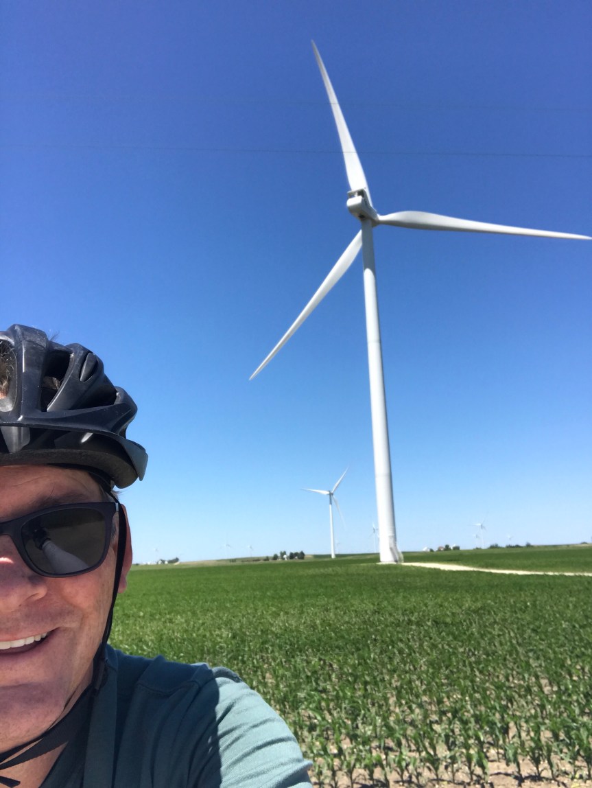
I once saw a turbine blade on display near the Energy Department. The thing looked to be as long as a football field. (How they drove into DC with it is beyond me.) Anyway, seeing these things from a distance is truly impressive but up close they are hypnotic. I nearly ran off the road I was so captivated by them.Another thing I noticed today is that the pool table is starting to have some gentle up slopes. I probably climbed 200 or 300 feet today, 30 feet here, 20 feet there. In Kempton I stopped for lunch at Tom’s. There is a mural that runs the length of the building. It’s a bit like to cover of Sgt. Pepper’s. I parked The Mule to the left of Dorothy from the Wizard of Oz. Is she signing something?
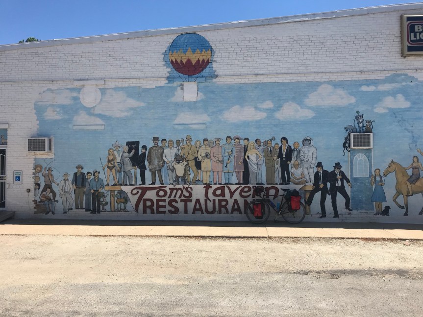
In Odell I crossed Route 66. There is now a bicycle route that follows the route from Chicago to Los Angeles. As I was taking a picture of the sign a woman jumped out of her car to get a picture of her own. My plan had me stopping at Cornell Illinois but there were no campgrounds or hotels there. There was plenty of daylight left and I was feeling fine after 67 miles so I continued on to the City of Wenona. They let bike tourists camp in the city park. It’s a very nice set up and the shower was the best. My thanks to the Wenona police officer who directed me to the park (and checked up on me later) and to Sheila who showed me around and gave me the secret code to the shower room.On days like this I have a hard time getting off the bike. I rode 92 miles. My total for the first two weeks of the tour is 1,030 miles.

Any Road Tour: Day 13 – Headwinds and camping fail

I was awoken by geese and the sound of gurgling river water. A breeze was making the trees sing along. Not a bad way to start the day.

About a mile from camp I rode by the buffalo farm (in Buffalo Indiana no less). The buffalo were grazing but too far from the road to take a decent picture. (Brittany, I swear I am not making this up.)

I stopped at the corner store for coffee and a cookie. The coffee was weak and the cookie was stale.

I hit the road to learn that the breeze was a headwind. And it stayed a headwind all day. Of course as the day wore one it turned into a 20 mile per hour beast with gusts well above that. The wind made it impossible to ride above 10 miles per hour. And the gusts moved The Mule all over the road. Both my legs and my arms were getting a serious workout.

The winds were much worse when I was riding past open farmland. The corn was to early to offer me any sort of wings break. )I wonder how it grows straight up and down with all this wind). Each farm had a stand of trees to block the wind so I’d get a few seconds of rest before the next blast. (Several times during the day I stopped. The wind actually blew The Mule and me back a step when I tried to start again.)

Other then the wind it was an absolutely beautiful day.

I crossed into Illinois after noon. There was no welcome sign. They must have known I was coming.

Most of my riding was done with my head down to try to cheat the wind. I’d look up and see corn or soy or hay, realize I was still in a nightmare headwind, then put my head back down.

Weeks ago I planned this to be an easy 58 mile day to take advantage of the free camping in the park of the town of Iroquois. The park is beautiful but camping is no longer allowed.

My choices were ride another 20+ miles into the headwind for free camping in another town en route or ride 6 miles off route to Watseka and grab a hotel room. Watseka won without a fight. I simply could not handle another 20 miles of this headwind.

At a lunch stop I learned that there is a cross country cyclist ahead of me. I wonder if I’ll catch him.

Watseka is within eyesight of a massive wind farm. Those turbines were getting quite a workout today.

I spotted this house today, in Watseka. A painted lady with a wrap around porch and a tower. Perfect.

Finally Watseka has what all badass midwestern towns have, a humongous grain elevator.

The desk clerk at the hotel is from New Delhi. She was a nurse back home but her credentials did not transfer to the U. S. I told her about my blood clots and she knew all about DVTs and pulmonary embolisms.

So today I rode 67.5 miles, about 10 miles farther than planned. They were honest miles. Good miles.

This morning, tomorrow’s forecast was for similar winds but it has been revised to winds that will not crush your soul.

938 miles in the bag. I try not to think about how much farther I have to go.

Any Road Tour: Day 12 – Tailwinds at last

The Red Roof Inn breakfast lived down to my expectations. Three rounds of Cherrios, mini muffin, and coffee fueled my first 36 miles. I grabbed two plastic wrapped apples for the road.

After spending 10 minutes wandering around I consulted The Google for directions and was soon back on the rail trail. I fell into my riding trance and was spinning along pushed by a tailwind when I nearly hit a bollard. It was hinged at the base and laying flat. I just managed to avoid hitting the hinge. It would have been a disaster. My front wheel wouldn’t have survived and I would have been a hurting unit.

Pay attention moron!

I came to the town of Converse and wondered how it was pronounced. Incidentally Peru is pronounced PeeRoo not PayRoo.

After 25 miles I passed three campgrounds in a row. Life’s not fair.

I met a cycle tourist going the opposite way. He was riding the length of the Wabash River. He told me of a good breakfast place in Peru. “They’ll fix you up.” And they did.

Outside of Peru I stopped at the International Circus Hall of Fame. It was sadly downtrodden and deserted but for a caretaker. He let me wander about then told me stories of seeing the circus as s kid, probably in the 50s. After the show they’d take the 2 elephants down to the river to play. He said the campers didn’t much care for that.

Back on the rail trail to Deedsville. I tried to contact my in laws who live 60 miles northwest of here but my calls rolled to voicemail. So I turned west, for the first time on the Northern Tier Route that I will follow all the way to Montana.

The wind was at my back and I had perfect, straight country roads to ride. There were gentle hills that allowed for easy hill hopping, speeding down hill and practically gliding up the next.

I was down to my last Apple and diverted about six miles to Royal Center where I picked up some fine vittles for camp.

Following the map, and not the detailed instructions on the back, I ended up at what looked like a camp. It was instead a former camp that had been converted to a retirement place by two brothers. One brother rolled up in a golf cart and told me the camp I was looking for was on the far side of the river about six miles away. Ugh.

He was shirtless and filled his golf cart with his mass. His left shoulder had a tattoo like the one Mike Tyson has. And his belly was immense, but hard as a giant’s bowling ball. I tried to imagine how much beer went into its construction.

He told me to stay for free but I had already told the campground I was coming so I declined.

Just before the turn off to camp I passed a store that was stocked with everything I needed had I not already ridden six miles out of my way to buy it.

On the last mile to the camp I passed a buffalo farm. I kid you not. Which reminds me that I saw numerous vultures today. Hmmmm.

I set up my tent on the banks of the Tippecanoe River. Other campers told me that a tree near my tent held two baby raccoons. They had been abandoned. Unfortunately they didn’t come out to chat.

There was good eating for dinner.

93 miles

870.5 so far

Any Road Tour: Day 11 – Cruising the Cardinal Greenway

Last night’s repast was McDonalds and a raid in the gas station convenience store. I disgust myself.

I did get done laundry done at the Econolodge. Once again the breakfast bar featured stale Cheerios. I was not amused.

I waited until almost 8 o’clock because it was raining. Thus I lost an hour of riding in comfortable weather.

It turns out I stopped about 4 miles east of Richmond Indiana. As I rode into town I realized that being in town was nothing to get excited about. Richmond looks pretty worn out.

In town I picked up the Cardinal Greenway rail trail. It was s smooth ride but for the tree debris from a storm that passed through last night while I was unconscious.

I passed numerous small trees that had been toppled. Fortunately they didn’t block the entire width of the trail. Then my luck ran out.

I had to take all the stuff off my bag and portage over the tree. It only took a few minutes but I was sorry I didn’t pack my chain saw.

A few miles later I came to another tree across the trail. A cyclist coming from the other direction and I pulled the tree off the trail. Hulk smash.

At a crossroads I heard the clippety clop of horses hoofs. A black Amish buggy made a right turn in front of me. As it passed I could see a little boy in the back.

On I rolled only to encounter a DC bound bike tourist on s Rans Nimbus recumbent. We chatted for ten or fifteen minutes. He said he was going to send his camping gear home, because it was slowing him on the hills and he wasn’t using it.

He said I would get plenty of use out of my camping gear once I turned onto the Northern Tier route that goes all the way to Seattle. I warned him about the hills he’d be facing in eastern Ohio and recommended deviating from the route I took. He warned me of a trail closure in Muncie Indiana about 20 miles away.

He doesn’t have a cell phone with him. It took him a half hour to figure out a way around the closure. (I just walked my bike through the closure which was about 100 yards of trail construction.) I use my cellphone constantly on my tours. It saves me all kinds of time, but it also means I don’t interact with local people that much.

The trail took me straight into Muncie there I stopped to eat lunch at a Mexican place. It was next store to a bike store where I stopped to pump up my tires and buy more chamois cream.

My only physical complaint for the last several days has been chafing and nerve pain down there. I am using lots of chamois cream for the former but the latter seems only to respond to getting off the saddle now and then.

The riding had been very easy. The only difficulty being the seemingly constant headwinds, hit muggy afternoons, and thunderstorms.

The trail continued north from Muncie without obstructions. In Gaston I shifted to country roads for 16 miles. It was a nice change of pace but the road surface was bumpy and, without protection from trailside trees, windier.

And there were farms. Beaucoup acreage planted with corn and soybeans.

I had been toying with the idea of riding another 30 miles to camp near Peru (pronounced pay roo) but my sensitive butt and dark storm clouds did not concur. As it was I got caught in the rain. Luckily the tree canopy over the trail was so dense that I barely got wet. Thunder and the report of a lightning strike nearby sent me looking for shelter. Three miles later I tied up The Mule at a Red Roof Inn. It looked drab on the outside but the room is quite nice. The Asian family that runs the place are very personable. They even offered to help carry The Mule up to my second-floor room. (I took care of it myself.)

So with tummy full of pizza I end my 11th day of pedaling west. Although it sounds like a lot, today’s 81.5 miles was not all that hard.

Tour total: 777.5

Any Road Tour: Day 10 -Failure to camp (again)

Xenia Ohio is famous for being obliterated by tornados about 45 years ago. I was in no rush to stock around for any repeat performances.

Dinner was the all you can eat salad and soup bar at the local restaurant next door. I feel bad for these people. I should announce something Hulk-like like: “You wouldn’t like me when I’m hungry.”

I watched the hockey game last night and managed to stay up for the entire contest. Yay Caps!

This morning I intended to repeat my hooverization of the morning free hotel breakfast but it was sadly subpar food. Stale Cheerios can really mess with your whole meal. However, I persisted. Oink.

I was soon back on the rail trail heading for my planned destination, Richmond Indiana. Today’s tail trail featured my first snapping turtle of the trip.

There was also this attractive building on the trail.

In Dayton I left the trail to check out the Wright Brothers Museum. I watched a film and thought about how great things come from obscure places like Dayton and Liverpool and a garage in Palo Alto. They were complete self-taught nerds who risked everything to solve a series of massive physics problem. Most of the buildings they occupied are long gone but you can get a sense of their little corner of the world at the turn of the 20th century from some of what remains.

Here’s a statue of Wilber on the sight of his last workshop. Note that even the greatest people in history end up with bird poop on their heads.

Next to the Museum was the site of the Wright Brothers bicycle shop. The bikes on display look remarkably similar to modern bikes.

I’ve been seeing goslings all along the way but today I saw my first babies. So cute, but camera shy.

I managed to tear the transparent plastic on my map case so I stopped at a post office to fix it with some packing tape. The window clerk also told me where the local eateries were. I stopped in Bob’s next to the trail for the buffet.

About 90 percent on the patrons were way older than me. Everything moved so slowly. I had soup and salad and dessert for $10 because that’s what every meal costs on this trip for some reason. Riding a bike this far makes me crave veggies.

I’ve been meaning to include some corn in this blog so today I’ll get that out of the way.

After Brookville my route took me in roads. There are very few cars to deal with so it’s nearly as peaceful but without any shade. I also had to contend with strong headwinds as the day wore on. I suppose it’s good practice for North Dakota, but ten miles of frustration was plenty. It wasn’t all bad. This covered bridge was pretty cool.

As I neared the Ohio-Indiana state line I thought my readers would like to know the score. It’s Columbus 88, Indianapolis 82.

Not long after taking this picture the sky started to darken. Ominous black clouds loomed. I saw that my maps were taking me on a meandering route to Richmond. I called an audible and turned around. The headwind became a tailwind as I made my way to a highway that went straight into Richmond. Zoom!

It started to rain. The sky was black. I kept slogging along, scanning the roadside for an emergency shelter. Porches, barns, extended waves.

I looked up and saw signs for hotels and restaurants and made a beeline for them. I had intended to camp but this storm was scary looking. I checked into a motel as the skies opened.

Any Road Tour mileage today: 62.5

Total tour mileage: 696.

The headwind made it a tough day but I’m still on schedule.

Any Road Tour: Day 9 – Rail riding on the pool table

The hostel upgraded me to a private room last night. This is either because I am a nice guy or I smelled too bad to be put in a group room.

I walked to dinner, choosing a Mexican place about a mile away. I had an avocado burrito. It made my tummy happy.

Before sleeping I did a bunch of exercises to loosen up my back. My leg muscles were really tight so they got some stretching love too.

I fell asleep on top of the bed never actually getting under the covers, yet another sign that I am pushing my body a little too hard.

I was proud of myself for remembering that today is Wednesday. So I wore my WABA socks with pride.

After breakfast in the hostel, I headed out town the Olentangy Trail. This took me past Ohio State University and it’s enormous football stadium.

I made several wrong turns because the wayfaring signs need some work. I passed another bicycle tourist who was trying to find his way to Cincinnati. I said I had no idea. I later learned that my route was probably what he was looking for.

The Olentangy Trail led me to the Camp Chase Trail which led me to the Roberts Pass Trail which led me to the Prairie Grass Trail. Basically 90 percent of my riding was car free – except for the pick up truck that nearly t-boned me at a crossing. (My bad. I was trancing.)

The breeze was pushing me a bit but as the day went on it became a cross wind. Fortunately most of the nearly 30 miles of the Prairie Grass Trail was lined with vegetation that provided me with some protection.

After noon, the heat, humidity, wind, and clouds began to increase. I decided that pushing beyond Xenia OH might be tempting fate so I checked into a hotel.

It did in fact rain about 30 minutes later so I probably made the right call.

Indiana tomorrow.

Today’s mileage: 63

Tour mileage: 633

Any Road Tour: Day 8 – Hello Columbus, you sure are hot

After a sumptuous dinner at the Steak and Shake next door to the hotel, I turned on the hockey game. I made it through two periods. When I awoke the TV was on and the hockey game was long over. I guess I was a little tired.

I hoovered the hotel breakfast bar then hit the road. The first six miles had a few hills but nothing like the last few days. I also had a light tailwind and for a few hours tolerable heat and humidity.

What was especially nice was to crank it up to 15 miles per hour for a few stretches.

Fourteen somewhat rural miles later I turned in the Panhandle Trail. It was my second Panhandle Trail if the trip. Is this s Midwest thing?

I stopped to chat with two day riders, retirees out for their morning constitutional. Then I ride down the shady trail trying not to hit every tree root bump.

A few miles later I came upon the world’s largest (and maybe only) basket building.

Proof of aliens among us. (It was the headquarters of the Longenburger Basket Company before they bit the financial dust.

The trail took me to Newark, a county seat with one of Ohio’s impressive county courthouses.

I stopped for mocha java and a sandwich just like the randos!

Right after Newark I picked up the TJ Evans Trail. This trail had quite a few locals on it. It was shaded but I could tell it was heating up because the Holstein cows were clustering in the shade.

They reminded me of WABA’s Laura Miller.

Because she has a cycling jersey with this pattern in it.

Much of my day was spent on U.S. Bicycle Route 50. This is a signed route just like U.S. 50 but only greener.

As a native Albanian I had low expectations for the town of New Albany. Dang if it wasn’t nice. Tastefully posh with lush lawns and not-gigantic houses.

The route took me in a round about way to Hoover Dam. It was okay as dams go but rather smaller than its big sibling out west.

Westerville was comfortably upscale and Worthington less so.

I was starving so I stopped at a Dairy Queen conveniently located on my route. There I made a reservation for a hostel in Columbus, about 8 miles away.

To get there I rode the Olentangy Trail, quite a nice bit of urban infrastructure, except for the noisy highway next to it.

Back on city streets I closed in on the hostel but was sucked in by the air conditioning powered tractor beam of a McDonalds. All you can drink for $1 totally works for me. (Yeah, I had a burger with fries too.)

As I dismounted The Mule at the hostel it felt like the ground was swaying. The heat and humidity had really cooked my brain. Good thing I quit when I did.

I had to disassemble TheMule’s load to get into the hostel. I am awaiting the arrival of the owner. I can’t wait to get cleaned up so I can pass out from exhaustion.

Today’s miles: 76.5

Total tour miles: 570.5

Any Road Tour: Day 7 – I bought my bike anchor at REI

After pigging our at the hotel’s breakfast, I hit the road late, around 8:15. I still had a bit more of a hill to climb. This was good because it warmed me up for the 4,000 hills to come. Eastern Ohio is a topographical roller coaster. The hills are shorter than yesterday which allows for a bit of hill hopping, riding hell for leather down one hill to zoom up the next one. This works a whole lot better when your bike isn’t a tank though.

My bike is a tank naked but add four panniers and camping gear and you’ve got one weighty beast. This being day 7 you might be wondering why is he carrying the tent, a heavy 2-person tent I might add, and all that camping stuff.

Because I’m an idiot, that’s why.

The truth is I want the option of camping when indoor accommodations are not easy to come by. I think the tent will become more useful in the weeks ahead. When the terrain is level. Life’s not fair then you die.

I was thinking a lot about death today as the temperature rose into the low 90s (Celsius). There were so many hills that I had to find a way to keep from completely blowing up on them. I started to pre-breath like a free diver to get as much oxygen into my system and to expand my lungs. Also, once I dropped into my granny gear, I’d just put my head down and focus on the road just s few feet beyond my front wheel. This kept me from being mentally defeated by seeing the top of the climb way…up…there.

So I didn’t take too many pictures.

There were many descents at over 30 miles per hour. The Mule can rumble!

After Barnesville I missed a turn and had a nice hilly, mile-long tour of the countryside.

This made me paranoid about missing more turns so I stopped often to get my bearings. And ice cream. And water. My hematologist warmed me not to get dehydrated. So I made sure to carry extra water. At a gas station I had lunch: PB&J, chips, a big cookie, and a Diet Pepsi that was so big I had difficulty holding the cup. I am not making this up. Ohioans must have amazing bladders.

The Mule had so much water I thought of renaming him The Camel, The Mule was not amused.

At 1 or 1:30 I came to my planned stopping point at a campground near Senecaville.

It was too early to quit and I’d only ridden 50 miles so I decided to continue on for another 30 miles to Zanesville.

Did I mention it was hilly? Did I mention it was hot? Did I forget to mention that there was absolutely no shade on the god damned road?

Fug me.

The elevation profile on my maps seemed inaccurate. I should have notice that the scale had been compressed from yesterday. I stared at the elevation profile. Just 5 more hills to go!

I was on a road that had tar on the surface. The tar was liquefying in the heat. Every so often my back wheel would slide in the stuff. And the road also featured curious patches of gravel. Gravel on a descent can ruin your whole day.

Then the terrain stopped matching the profile. I came to a highway. Oops. I had missed another turn someplace.

Fortunately the highway was US 40, the National Toad that goes right through Zanesville. Highway 40 had very little traffic, a wide shoulder, and smooth pavement. There were hills but they were gradual.

After seeing a recently painted Mail Pouch tobacco sign, I rode down the hill into downtown Zanesville. Let’s just say Petula Clark would never sing about this downtown.

I searched the local hotels until I found a decent one near food, a burger and milk shake establishment.

Heaven. I’m in heaven.,.

The detours pushed my mileage to 84 for the day, easing the tour total to 494. Not bad for a week’s work.

Any Road Tour: Day 6 – Of Lungs and Loving Kindness

Last night I spent the evening reminiscing with my old friends Earl and Anne. We worked together while going to college so we’ve known each other over 40 years. Somehow Anne looks 35. They must have wayback machine in their basement.

After acquiring chamois cream and a belt for me, we ate dinner at a Mexican place called Mad Mex in Shadyside. I had my first beers in over 5 months. And the waitress looked like Brandi Carlile (even before the beers).

Earl took us on a magical mystery tour of his hometown. Pittsburgh was once thick with ultra rich industrialists and financiers. The remnants of their wealth are all over the place. After a few decades of rebooting to a health care and tech economy the joint is jumping once again.

After they dropped me off I stayed up for a while talking with people at the hostel. I slept well and woke up to more coffee chatter with Paul, one of the owners. The Southside Traveler’s Rest turned out to be a terrific find. Paul and his wife Mary Beth are anxious to build their bike tourist clientele. I think once word gets out they’ll be wondering where to put all the grungy bike people.

I lingered linger than usual and hit the road about 8. I started following the Adventure Cycling New York to Chicago route. A brief ride near the river turned into a serious climb away from the city. As I ascended I was passed by club riders out for their weekend spin. I figured if they’re riding it, it can’t be that bad. It wasn’t. I never was wanting for a breath. After some rolling miles on the roads I picked up the Panhandle Trail. The first 7 miles were unpaved and bumpy, but in Washington County PA it became paved which helped with the gradual uphill.

After a crest the trail began a gentle downhill slope. It felt pretty darn good. I stopped at a trailside cafe in Burgettstown. The owner said that if I wanted a proper breakfast I should go to Walden’s restaurant next store. It was hard to walk away from the awesome blueberry muffins on display but I needed calories big time.

At Walden’s I ordered a kind of hash that they included home fries, mushrooms, ham, bacon, sausage, and veggies with sausage gravy on top. Sooo perfect. All of it washed down with several cups of coffee. As I was eating a woman sat down and asked me where I was biking from and to. When I told her she said “Your meal is free.” Walden’s has a policy of feeding long distance bike tourists on the House. I had stumbled upon some amazing trail angels.

She handed me a guest book and asked me to write a note about the trip, which I did. I thanked her and the owners who were sitting across the room. In the rest room I saw this notice on the wall.

I’ll bet they get plenty of donations from bike tourists (and their blog readers).

The trail took me downhill for about 8 miles then, after getting briefly disoriented, I got the roads to climb over the mother of all hills. The climb was about 500 feet in a mile. It took everything I had to get over that beast, but I am happy to report that my lungs held up fine.

The downhill was great fun. So much fun that I missed a turn and had to back track a bit to finished the descent to the bank of the Ohio River.

After riding WV 2, a bit so busy highway, for a few miles I stopped for lunch at a scuzzy Dairy Queen. I switched over to the Yanked Trail (despite it being against my religion) and the Wheeling Heritage Trail, both of which were and improvement over the highway. Views of the Ohio kept my spirits up. This is s dam with a lift lock for boats.

Once in Wheeling I took the lay of the land. Wheeling is one beat down place. The only hotel downtown has a reputation as less than wonderful (one bike tourist disliked it so much he left and back tracked 8 miles over a mountain).

I was feeling fine after about 70 miles so I decided to go off route and climb US 40, the National Road, to a hotel in St Clairsville Ohio. I had done this climb on Big Nellie during my 2005 tour to Indiana. It was brutal then and it lived up to my memory of it.

Did I mention the temperature had risen to 86 degrees? Big fun.

I put my head down and did the deed. It wasn’t as hard as the climb to the river but you could have put a fork in me at the top because I was DONE.

The first hotel I came to was a Comfort Inn. Yeah babee.

I am a few miles off route and about 10 further west than I planned. The worst of the climbing is behind me.

Total miles for the day: 77.5

Total mikes got the tour: 410

Oh, and about a mile into the ride the odometer on The Mule hit 46,000 miles. Dang.

Any Road Tour: Day 5 – GAP-ing to the Burg

I slept poorly in the Adirondack shelter in Connelsville. (Still haven’t used my tent!) I neglected to fully inflate my sleeping pad, a mistake I won’t repeat. I awoke with the sun and resisted the urge to start riding. I lingered over a fine breakfast of two slices of left over pizza then I hit the trail.

The trail is still pretty dreamy north of Connelsville. I set a goal for the town of West Newton for proper second breakfast. I was running on fumes when I began a search for food. I found an eatery, the only one open for breakfast, across the river in town. I ate an appalling amount of food and drank at least six cups of coffee.

Stuffed and buzzed is how you do a bike tour, my friends.

Pedal, pedal.

There have been purple wildflowers along the trail. Anyone know what they are?

The trail passes through several small towns like this.

One of them had an ice cream place. Two scoops please!

Pedal, pedal.

I stopped to address a comfort issue with some chamois cream. It helped. It also afforded me the opportunity to take a picture of one of the scores of little waterfalls along the trail.

About 20 miles from Pittsburgh the trail loses its rural vibe altogether and acquires pavement. My speed increased noticeably. In McKeesport I missed a turn but a dead end at a bus depot set me right.

There are actual hills in this section of the trail. How dare they?

And there are bridges over the river and train tracks.

The trail was busy with weekenders some of whom failed to appreciate the fact that a loaded touring bike doesn’t maneuver or stop particularly well. Despite being pretty tired, I made it to the hostel without uttering a single f bomb.

Today was an easy day of sorts: 60 miles. All told I’ve ridden 332 miles. Tomorrow I plan to ride to beautiful Wheeling West Virginia. Probably in the rain.

Onward.