The day began with coffee and granola in the hostel cafe. Afterward Corey packed up all his cares and woes and took off for a nostalgia tour of Portland (he has a daughter who attended Reed College) and then head to the Amtrak station. We confirmed last night that his bike tools will remove his pedals, essential for boxing his bike.
This morning I rode a half mile to West End Bikes and turned over The Mule for shipping. West End shipped The Mule home in 2018 and it arrived intact.
Corey and I shared a room last night with a bike tourist who just did a loop ride in western and central Oregon. He’s now headed north. He wasn’t exactly chatty but that’s okay.
I’m killing time here at the hostel. My flight leaves tomorrow afternoon which should give me plenty of time to chill. (I hate to bring this up but it’s actually kind of cold here.)
As far as bicycling goes, the tour is now officially over. Thanks to everyone who read these blog posts. Your encouragement of my insane little adventure is most appreciated.
In the coming weeks I will convert these blog posts into a proper journal on Cycleblaze.com when I get the time.
I’ll also post a few more entries reflecting on the tour.
Our hotel was enormous. Its long hallways reminded me of The Shining.
The hotel cannot find enough staff to operate properly. Breakfast was a disappointment. At this stage a couple of bowls of Raisin Bran and some coffee gets the job done.
After a tour of industrial Longview we rode back across the Lewis and Clark Bridge to US 30 in Oregon. The bridge is downright scary. It’s noisy and shaky and has shoulders filled with debris.
We were glad to be off of it except for the fact that US 30 to Portland is nearly as nasty. The shoulders were adequate and the debris was less but the trucks made for a deafening bike ride.
We rode. All business. Get her done. No need for excess hemoglobin because there were no hills to speak of.
After about 50 miles we left the highway to ride the street grid to Union Station. Corey went inside to check out the bicycle-on-train situation. He could have put his bike n the baggie car unboxed but decided to box it for protection anyway. Amtrak will provide the box and tape. He also learned that for a reasonable price he gets to head home tomorrow, a day earlier than planned.
After scoring an Amtrak win we decided to check into the NW Portland Hostel where I stayed in 2018. It’s located a few minutes from the train station, the bike shop I’m going to use to ship my bike home, and lots of hip places for bike tourist celebrities like us.
Note also that we have N95 masks for the event that we have to share our room with a Covid vector.
Tomorrow we’ll prep for our respective journeys home.
Finally!
At the hostel: Postcards. And Stamps. Very retro.
My bike shoes died a hero. Made it all the way thanks to Gorilla Glue and duct tape
Our night as bridge trolls worked out okay for me. Corey was kept up by the clomping of feet in the room above us.
We began the day with breakfast at Pig and Pancakes, a chain apparently. We ate at one in Cannon Beach. Fortified with pancakes (good), coffee (not bad), and scrambled eggs (meh) we headed east out of Astoria on US 30 headed for Portland.
Traffic was heavy, the shoulder was debris-filled, and the air was filled with mist. The road rolled up and down with the occasional somewhat serious climb. No matter. Our blood is still teeming with hemoglobin.
I began the day with a very sore lower back. The pain abated with every mile, and a couple tablets of Vitamin I.
Corey stopped and pointed out Mt Rainier. After about 30 miles we stopped at a gas station for snackage. A fuel truck driver gabbed with us. He said it wasn’t Rainier. He also told us the next climb would be four miles at six percent grade.
Corey and I agreed that it was a serious climb, made much worse by the incessant traffic and inadequate shoulder. We also agreed that it couldn’t have been four miles.
During a leveling off we saw two snow covered mountains in the distance. I have no idea which two it was. I think the one on the left is Mount Fuji but I could mistaken. I’m any case the one on the right was Mount Vesuvius for sure.
Fuji and Vesuvius
We had a crazy fast descent to the exit for Longview, Washington. Longview is halfway to Portland and has many motels and restaurants. According to Fuel Truck Driver there are many methheads there too.
The ride across the Columbia River was very stressful. Logging trucks go to Longview to drop their loads at the port and a paper mill. The shoulder was littered with chunks of bark. The crossing was not a lot of fun.
We stopped at Walmart where I bought a duffel bag to consolidate my panniers into for my flight home and a t-shirt to wear on the plane. (Laundry opportunities are unlikely between now and Saturday morning.)
Next we went to a bike shop for air for my rear tire and recommendations for motels and lunch. The lunch restaurant one of the bike shop guys recommended was right around the corner.
I had a cup of pig butt stew as a side dish. It was very tasty. I wish I had ordered a huge bowl of it and skipped the chicken caesar wrap.
After lunch we rode across the Cowlitz River to Kelso where we found a hotel for $120. It’s not bad at all. The lobby is rather posh.
Tomorrow it’s back across the pine bark bridge and another 50 miles to Portland, this time without the long climb. We plan to go to Union Station to get some definitive answer about whether Corey had to box his bike up for his train ride home. (In some cities you can just put your bike in the baggage car. Also, if a bike box is needed we’ll have to find out if Amtrak supplies them.)
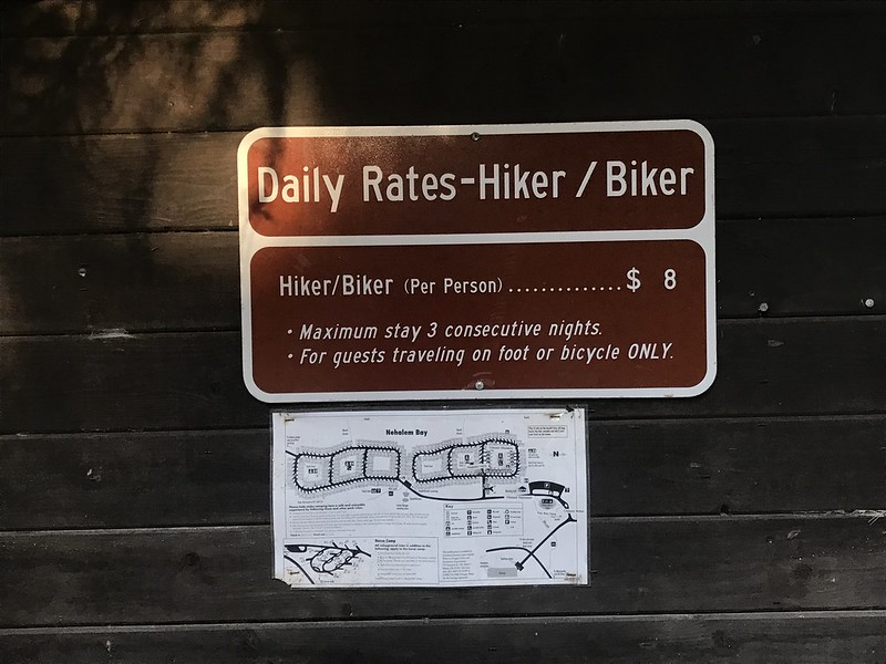
Nehalem State Park was the best campground we stayed at during our trip. We camped in a huge stand of pine trees. The pine needles and sand made for a perfect natural mattress. The bathrooms were clean and the showers refreshing. The windy evening gave way to cool breezes at night. The roar of the ocean off in the distance lulled us to sleep.
We broke camp after breakfast. Oatmeal for Corey and Mark, an apple, a banana, a Clif Bar, and three spoonfuls of PB&J without bread for me.
We climbed back up to 101 by backtracking then started the first of several climbs. None of them broke 1,000 feet but they certainly gave us a workout. The first climb out of Nehalem to Oswald State Park topped out at about 625 feet. Quite a way to start the day. We next descended into a tunnel. We all wore blinkie lights in anticipation of darkness but the tunnel was extremely well lit. No worries about not being seen.
We had light winds for most of the day, a blue sky with puffy clouds, and temperatures in the 60s.
It was yet another day of superb scenery. Ocean views out the wazoo.
The traffic was a bit of a drag but we diverted into Cannon Beach and stopped for proper breakfast after 20 miles or so. After climbing back to 101 we descended into Seaside where we rode along the boardwalk next to the beach.
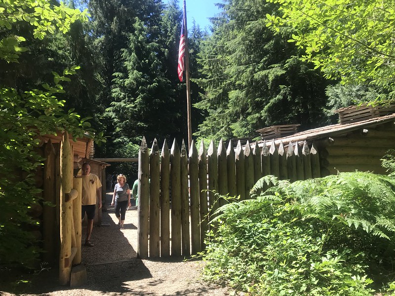
After Seaside we left 101 for Lewis and Clark Road, the back road into Astoria. The road was windy and hilly, cutting through countryside and away from the ocean. After much exertion we stopped at Fort Clatsop, where we checked out a replica of the fort used by Lewis & Clark during the winter after reaching the Pacific Ocean.
We’ve been bumping into Lewis and Clark for hundreds of miles. Too bad they didn’t have bicycles and paved roads.
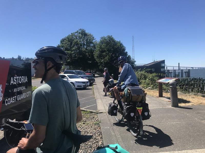
After our tour of the fort we rode over the Lewis and Clark River then over Youngs River into Astoria. I was gritting my teeth on the steel deck of the second bridge when the genius driver of a passing pick up yelled at me to “use the sidewalk.” So helpful.
Astoria forms a rounded point at the mouth of the Columbia River. We rode around the point then, mostly, along a bike trail along the riverfront.
Because of pedestrian traffic and sketchy trail design (the trail goes along some trolley tracks) I fell behind Corey and Mark and missed their big finish. Actually there wasn’t a big finish because there is no sign indicating the end of the trail. (The same is true at the eastern end I’m of the TransAmerica Bicycle Trail in Yorktown, Virginia.)
Mark’s wife Tracy was there to greet us with a phone for picture taking and a rental car with a trunk full of drinks and snacks.
While we were talking about our travels, Billy and Greg, whom we had met a few days ago, pulled up to finish their TransAm.
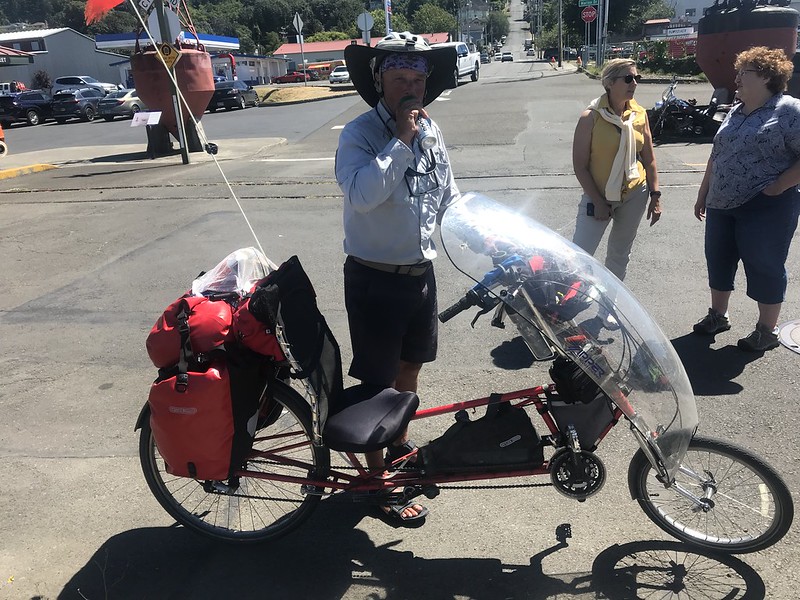
As we were about to leave, three riders appeared, heading south. Really south. They were bound for Ushuaia, the southernmost city in Argentina!
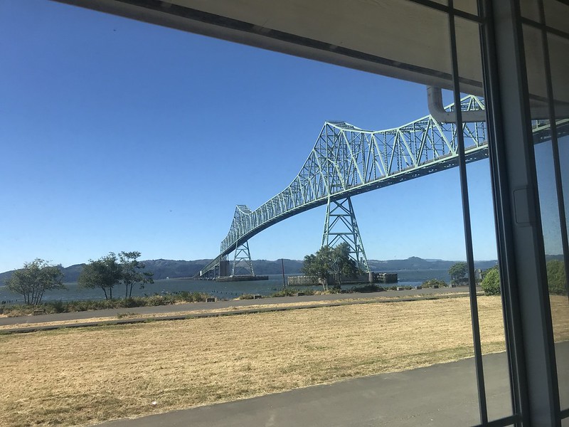
Mark and Tracy went one way and Corey and I another. Corey and I are sharing a room in a Motel 6 underneath the scary bridge across the Columbia River to Washington State. We feel like a couple of trolls.
Tomorrow we head toward Portland, most likely a two-day trip. Corey is taking a train to Chicago on Sunday. I’m flying home on Saturday.
Miles today: 50.5 Tour miles: 3,336
Best Hiker/Biker Site Ever
Looking down at Neahkahnie Beach
Arcadia Beach
Replica of Fort Clatsop
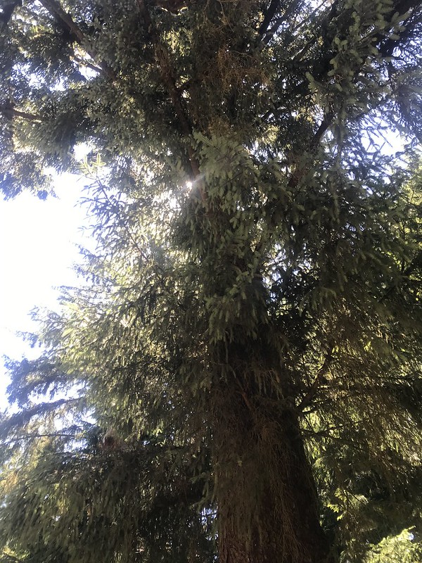
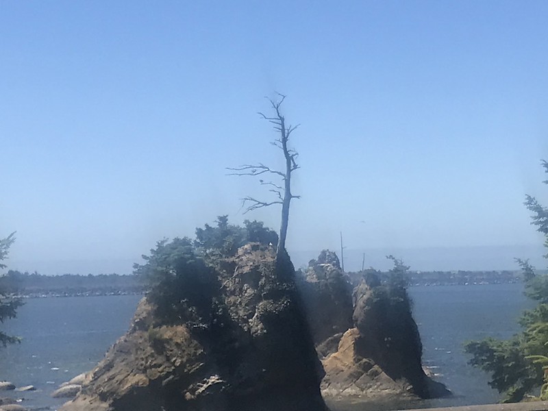
Looking up into a cool tree with a foggy lens
Me, Corey, and Mark at the finish of the TransAm
Greg and his Tour Easy after his first bike tour, across the country!
Headed for Tierra del Fuego
The view from our hotel window. People bike over that!
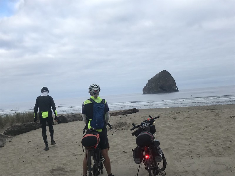
After a moment of profound reflection (Dang, that’s a big rock) at Chief Kiwanda Rock we set out on our mission to edge frustratingly closer to the end of the TransAm Bike Trail in Astoria, about 95 miles to our north.
We climbed straight up about 800 feet, the down, then up a few hundred more, then down. Unlike a week ago we are now dealing with hundreds rather than thousands so, except for the steepness, the climbing is no big deal, and we get the bonus of views of the Pacific coast from time to time
Along the way we met two southbound riders who warned us of a nasty 15 percent grade downward in which the road was covered in gravel. They had stout tires and rode up the bloody beast but we decided to divert from the main routes and check out the Three Capes Scenic Route. It was plenty scenic and, of course, hilly AF. We endured the roller coaster for about a third of the loop before Mark pointed out that a landslide had knocked out 1 1/2 miles of the route. It was scheduled for repair by 2030.
That was a tad more time than we were willing to wait so we doubled back, re-climbing most of the hills then turned inland to get back on the main TransAm route.
This wee shortcut involved a monster hill that went straight up. A boy on an e-bike sped by me as I ground my knees to dust. Curse you, you little twerp!
A second climb took us to the main road which we used to bypass the gravel hill of doom and ride straight into Tillamook, a cheesy place if ever there was one. A field just outside of town was filled with enormous black and white cows. I presume that milk from these animals is used to make chocolate chip ice cream. I could be wrong.
After lunch of chili and a taco in a bar in Tillamook, we started north but now that hill with the electronic kid had given me a screaming lower back ache.
Oddly once I was in the bike my back felt fine. Our route now coincided with US 101, the Pacific Coast Highway. I don’t mind hills and I can tolerate traffic but the combination of the two makes for unpleasant riding
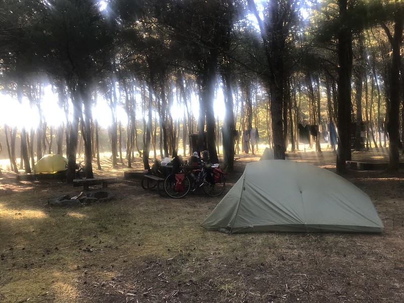
After 27 more miles we arrived at Manzanita where all the motels were booked. We decided to camp one last time at a state park with hiker/biker sites. We lucked out again. Our tents are nestled among a stand of pine trees. Soft ground and cool ocean breezes should make for a good night’s sleep.
After yesterday’s mega ride we needed a breather. We rode 22 miles up the Willamette Valley, planning to stay in a town park in Independence about two miles off route.
We arrived in Monmouth after a little over 20 miles and began searching for second breakfast. (Predictably the Corvallis Super 8 lobby breakfast was meager. Raisin Bran and coffee.) Along the way we rode under cloudy skies past farms and orchards, and one very large vineyard.
We stopped at a brew pub that served breakfast. The food was pretty good. In truth it’s hard to screw up scrambled eggs and biscuits and gravy. After eating we checked out the park online and saw the reviews were off putting. Vagrants. A scuzzy bathroom. No thanks.
Across the parking lot from the pub was a motel. We found the rate and the room acceptable and checked in.
Tomorrow we head for the coast, then two days to the end of the TransAmerica Trail in Astoria before riding to Portland for transport home.
Our tent site in the woods next to the river made for sound sleeping. As we were cooking breakfast (I was “cooking” PB&J sandwiches) we could hear helicopters flying over the forest. We never found out what was going on but I suspect they had something to do with logging operations in the burn zone on this side of the mountain.
We headed west down Hwy 126 descending gradually below 1,000 feet of elevation. For me this was my first time in such thick air in over seven weeks.
We kept a brisk pace with Corey joking that we were going to ride a century (100 miles) today.
Our ride was hardly peaceful with all the logging and dump trucks zooming past.
We stopped for second breakfast at a cafe in Vida. The food was quite tasty. About 15 miles later we finally got off 126 and away from the infernal trucks.
Back roads took us around Eugene to the north. We stopped for lunch in the town of Coberg. We jointly inhaled a large pizza then Corey and Mark tried to find a place for us to sleep. Everything nearby was booked so they looked further afield,
We eventually settled on a Super 8 in Corvallis, over 30 miles on route to the north. Corey led the way using his GPS which disagreed with my paper map and Mark’s GPS.
We kept pedaling and getting more tired and grumpy with each passing mile. Corey’s route took us on low traffic farm roads through Hazelnut orchards, and fields of hay and clover.
At one point we saw hay devils, dust devils made out of dried, cut hay.
We rode the grid of roads until we popped out onto busy Peoria Road, the direct route from Coberg to Corvallis. About 12 miles later we arrived at our motel exhausted.
We went out to dinner at a brew pub down the street. The food and beer were very good. To be honest, we’d have eaten anything after riding 95.5 miles.
A note about Super 8 motels. I’ve stayed at many of these motels over then years on my bike tours. I could count on them being a reasonably priced, consistently well run motel. Not anymore. The Super 8 in Florence CO was overpriced and offered coffee and granola bars for “continental breakfast”. The Super 8 in Corvallis had an empty pool for starters. Our room is missing a light bulb from a ceiling fixture and has a dysfunctional bathroom faucet. On top of that our room had not been properly cleaned. All for the low, low price of $280 per night.
Tomorrow we plan on an easy, short ride to Independence.
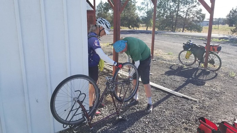
Last night in the hotel Corey noticed that the middle of the tread on my rear tire was worn out. We all knew that this would compromise its protection against flats. Little did we know….
We headed out for our big day, our last mountain pass. We rode Hwy 126 west toward Sisters. About three miles into our journey I ran over a remnant from a retread truck tire, something we’d seen scores of times on our trip. Weeks ago I happened to notice a tiny wire from a retread sticking out of the middle of the tread on my front tire. I pulled the wire out. The thick tread had done its job and prevented a puncture. This time, with the worn tread on my rear tire, I wasn’t so lucky. I hit the remnant hard, it got hung up in my rear fender, and the rest was misery.
It was my first flat on the road in over 12,000 miles of touring. (Not counting the one at the start of my trip was caused by an old patch that failed.) The tires I use are Schwalbe Marathon Plus tires. You have to try mighty hard to get a flat with these tires and, alas, I succeeded.
In the process of changing the tire I managed to put a knot in my chain. Mark used a tool to break the chain and we set both the tire and the chain right.
How many 60-something bike tourists does it take to change a flat tire.
We rode to Sisters. I stopped at a bike shop where I bought a a new tire and tube. This tire was a Schwalbe Marathon which is not as bullet proof as the Plus version but it has lower rolling resistance.
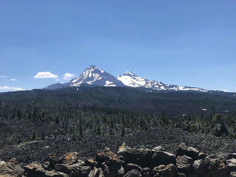
On the road to Sisters, the famous Three Sisters mountain peaks provide a stunning scene
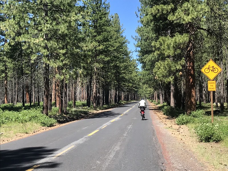
With tire replaced, we set off on our big climb to McKenzie Pass. The road was restricted to vehicles no longer than 35 feet. This meant all the commercial traffic was routed to nearby Santiam Pass. The road to McKenzie was smooth and nearly car-free.
The road started relatively flat through a ponderosa pine forest. Many of the trunks bore signs of burns.
It was nearly a bike path through a tunnel of pine trees
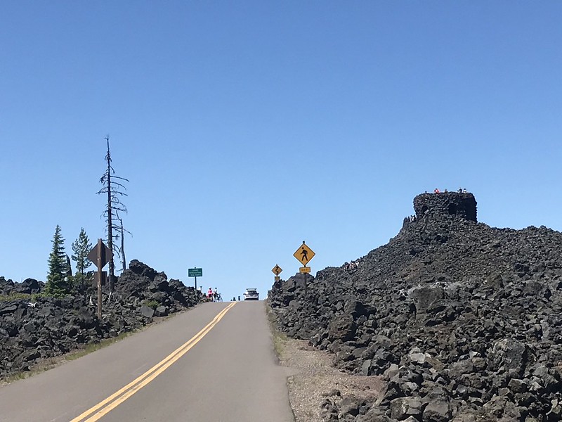
The forest transitioned to a burn zone as we started the climb in earnest. The higher we went the more the scant undergrowth was replaced by black volcanic rock. Soon the rocks dominated the landscape with a burned out tree trunk now and then. The last volcanic activity occurred over 7,000 years ago. The burnt trees have the illusion that lava flowed here in recent years.
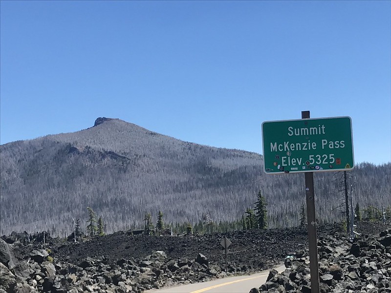
Up we climbed, a never ending crawl. We didn’t care. This was the last one. We didn’t mind that the top was at 5,325 feet. By this point we didn’t notice the thinning air. We are gods of hemoglobin.
We came to a turn out called Windy Point. We looked out over a moonscape with snow covered peaks, including Mounts Washington, Jefferson and Hood in the distance. What a creepy site. The black boulders were once lava. Hmm… This place could blow at any minute!!!!!!
The scene at Windy Point
Another perspective at Windy Point
The next mile or so was level to gently rising. We could feel the cool breeze that foretold of the approaching summit. I stopped when the summit observation tower, built using these same volcanic boulders, was in view.
Nearing the summit
Not the moon
Another view from the summit
Last one
After playing at the summit for nearly an hour we began our descent. Or so we thought. After a brief downslope the road went up again. Whaaa? Another downslope was followed by another short climb. The mountain was taunting us. The next downslope was the real thing. Over 20 miles of twisty descending. Switchbacks and other curves with advised speed between 15 and 35 mph. Man, was I glad I replaced that tire.
The road down the west side of the pass
The road was quite narrow near the summit, perhaps only a lane and a half wide. As I came around one curve at speed I was surprised by a rock plow, a truck with a snow plow blade moving errant rocks off the roadway.
Signs announced every 1,000 feet of vertical progress. 5,000 feet. Yahooo! 4,000 feet. Wheee! 3,000 feet. Zoom!
As we descended the landscape changed from lava field to burn zone to dense coniferous forest. On this side of the mountain, fir trees dominated with thick undergrowth. You could smell the green. The air felt thick.
Burn zone
After 2,000 feet we rejoined the Santiam Pass traffic. Logging trucks and double bottom dump trucks (a dump truck pulling a second engineless dump truck) zoomed by.
We stopped in the town of McKenzie Bridge for lunch. After eating we asked about renting a cabin next door. The owner said she was booked and that we’d have trouble finding any lodging because the World Track and Field Championships were being held in Eugene, 50 miles down the road.
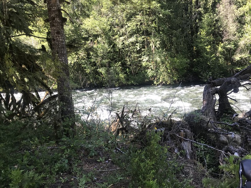
We ended up in a US Forest Service campground. Our site was about 100 feet from the McKenzie River.
We bathed in the river and rinsed out our biking clothes. After walking back to town for dinner we hit the hay in our tents, lulled to sleep by the rushing water of the river.
The day began with a huge bowl of Cheerios, the old fashioned kind not the honey nut monstrosity. I also had a massive cup of coffee and a banana.
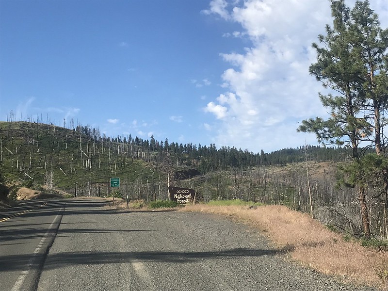
Locked and loaded we left the hostel around 6:40, heading west over Ochoco Pass. When the day begins like this, you know you’re going to have fun.
Oh what a beautiful morning
After some warm up miles we began the climb to the pass. Knowing that some types of pine trees need fire to generate seedlings, I had been expecting to see a burn area along this route and today we rode through one. This part of the forest will regenerate over the next decade or two.
Burn zone on the way to the pass
Just like the last few passes, today’s was more of an exercise in persistence. I didn’t run out of breath even as my left quadriceps muscle ached a bit from time to time.
When I reached the pass Corey was waiting in the shade. Mark was right behind me. We munched on some snacks then began the fun part. Down!
Hey, only one more to go
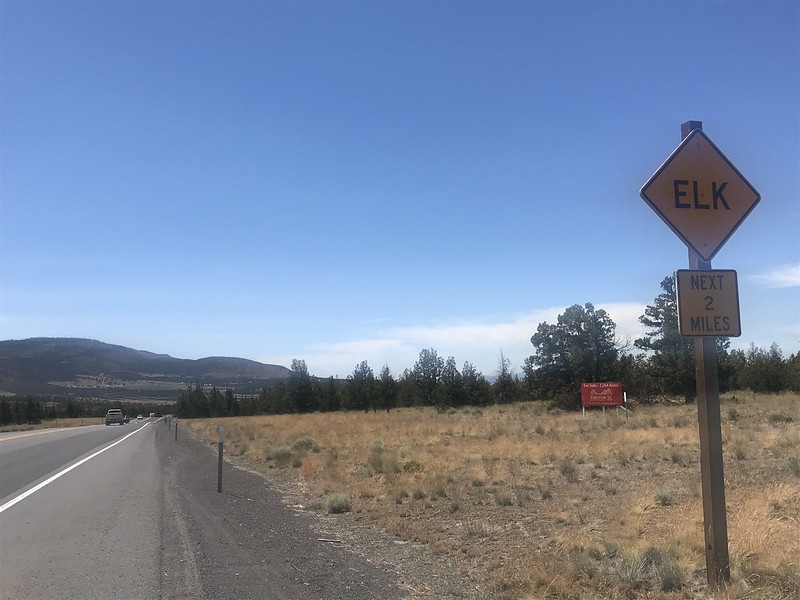
The ride down was somewhat steep but we are descent veterans so it was not at all scary. The grade lessened after a few miles but remained a slight downhill nearly all of the 30 miles to Prineville.
When descending, watch out for large ruminants
In Prineville we had lunch at a Dairy Queen. They have a $7 meal that is a very good calories per dollar deal.
I have been using an out-of-date Adventure Cycling map for planning purposes. The newer maps direct riders on a northerly path from Prineville to the town of Terrebonne. We followed the old route, state highway 126 to Redmond because Redmond is a city with many more services. It was a very busy, mostly two-lane highway. The shoulder was narrow and filled with assorted debris. It was a stressful 18 miles. I rode it as fast as I could.
In Redmond we stopped at a bike shop then spent about an hour trying to find a reasonably priced motel. The cheapest looked like a hangout for junkies and hookers. A Motel 6 only had single bed rooms. Another hotel told me over the phone that they had a two-queen-bed room available but when we pulled up on our bikes just minutes later it magically had been booked by someone else.
We ended up at a Comfort Inn. It’s quite nice and ought to be for the price. It’s my turn to sleep on the floor. I have vowed to lay waste to the continental breakfast.
One thing about living in the DC area that I have grown to dislike is the departure of so many friends.
After getting settled at the hotel, I spent the late afternoon with one of my favorite bikedc expats, Rachel Cannon. She moved to this area a year and a half ago. We spent a couple of hours nursing beers and nibbling at nachos but mostly just catching up. The visit was too short but the hugs were heartfelt. Thanks for coming by, Rachel. It was great to see you.
Rachel and me.
Tomorrow we climb McKenzie Pass, our last big climb.
It was a day of the unexpected. We left the church hostel at 6:30 to eat breakfast at the town cafe. The food was mediocre (my kingdom for some Cheerios). The owners/cooks were both wearing holsters with side arms. I know we look fearsome but we were wearing freshly laundered clothes! There were magazines on our table. The one on the top of the stack was “Open Carry”.
After breakfast we rode west on US 26. A mile out of town we came to a full stop at a construction zone. A section of the road ahead was being chipsealed. We had heard about this and were dreading it. It turned out to be a great break for us.
Half the road was closed to traffic with each side being let through at 20 minute intervals. We followed the last car and had four miles of road to ourselves. The side of the road we were on was untreated. Beyond the construction zone, we still had the road to ourselves thanks to the intervals at the start of the zone.
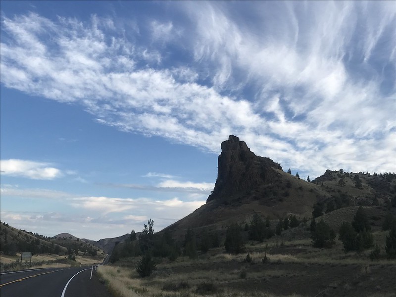
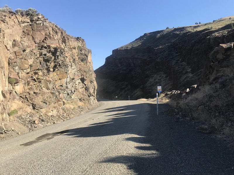
The road next passed through Picture Gorge in John Day Fossil Beds National Monument. This part of the road is narrow and twisty with no shoulders, normally a real headache for cyclists. Without traffic it was like the best bike path ever. We could stop and take pictures of the gorge to our hearts’ content. And we did.
We skipped going off route to the fossil beds because we wanted to get off the road before temperatures hit the forecasted 104.
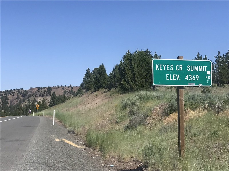
We began a gradual climb out of the gorge toward Keys Creek Summit. As in days past, our effort told us we were climbing but our eyes said we were not. The views were splendid regardless of our delusions. The summit came without extraordinary effort. Are we getting stronger or are the climbs getting less intense? Are we overloaded with hemoglobin? Maybe it’s just the fact that we weigh less.
We’d been told the descent from the summit would be very scary. It wasn’t. We are jaded. I think I touched my brakes twice. Mostly I braked by sitting up tall.
We pulled into Mitchell. I found the hostel and backtracked to the Tiger Town Brewery for a much deserved lunch. The food, a big salad with spicy chicken, was excellent and the pint of Kolsch hit the spot.
After lunch we moved into the hostel, Spokes N Hostel. This place is terrific and the owner, Jalet Farrell, has thought of everything. Comfortable beds, a fully stocked kitchen, showers, clothes lines, seating areas, hammocks, charging stations next to each bed, and on and on. We’d been hearing about this hostel for weeks from eastbound riders and it has definitely lived up to its reputation.