Last night in the hotel Corey noticed that the middle of the tread on my rear tire was worn out. We all knew that this would compromise its protection against flats. Little did we know….
We headed out for our big day, our last mountain pass. We rode Hwy 126 west toward Sisters. About three miles into our journey I ran over a remnant from a retread truck tire, something we’d seen scores of times on our trip. Weeks ago I happened to notice a tiny wire from a retread sticking out of the middle of the tread on my front tire. I pulled the wire out. The thick tread had done its job and prevented a puncture. This time, with the worn tread on my rear tire, I wasn’t so lucky. I hit the remnant hard, it got hung up in my rear fender, and the rest was misery.
It was my first flat on the road in over 12,000 miles of touring. (Not counting the one at the start of my trip was caused by an old patch that failed.) The tires I use are Schwalbe Marathon Plus tires. You have to try mighty hard to get a flat with these tires and, alas, I succeeded.
In the process of changing the tire I managed to put a knot in my chain. Mark used a tool to break the chain and we set both the tire and the chain right.
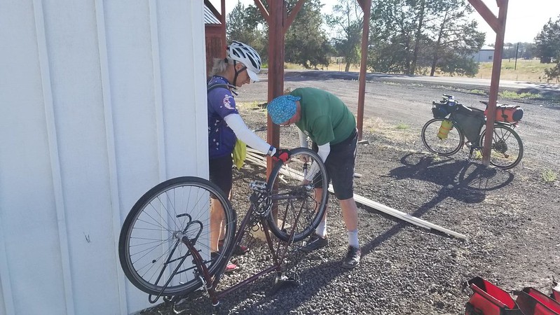
We rode to Sisters. I stopped at a bike shop where I bought a a new tire and tube. This tire was a Schwalbe Marathon which is not as bullet proof as the Plus version but it has lower rolling resistance.

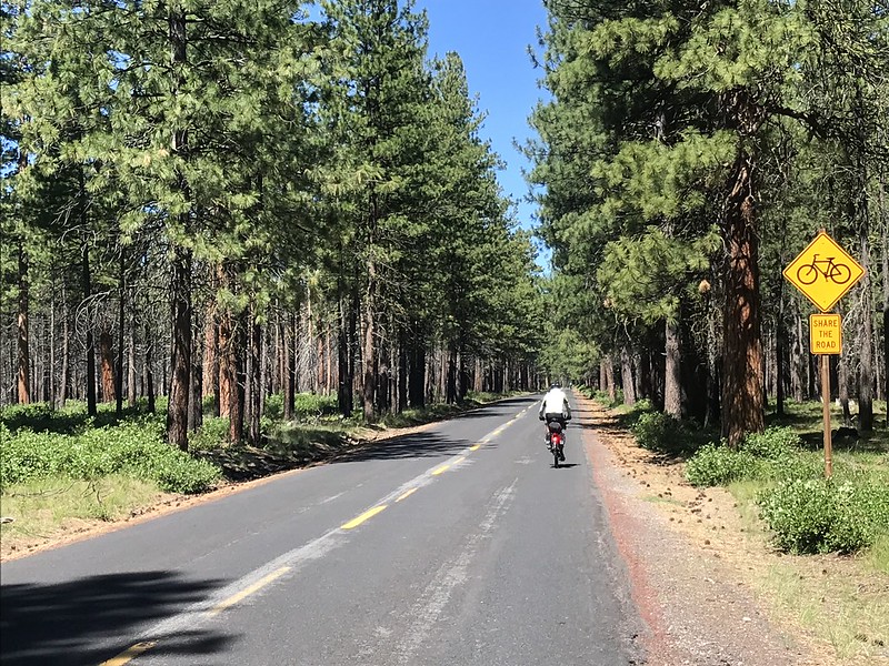
With tire replaced, we set off on our big climb to McKenzie Pass. The road was restricted to vehicles no longer than 35 feet. This meant all the commercial traffic was routed to nearby Santiam Pass. The road to McKenzie was smooth and nearly car-free.
The road started relatively flat through a ponderosa pine forest. Many of the trunks bore signs of burns.
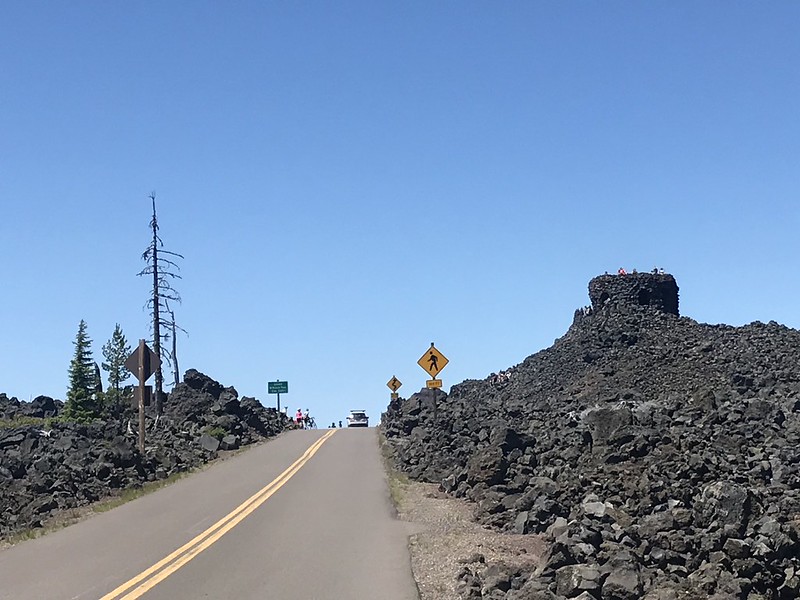
The forest transitioned to a burn zone as we started the climb in earnest. The higher we went the more the scant undergrowth was replaced by black volcanic rock. Soon the rocks dominated the landscape with a burned out tree trunk now and then. The last volcanic activity occurred over 7,000 years ago. The burnt trees have the illusion that lava flowed here in recent years.
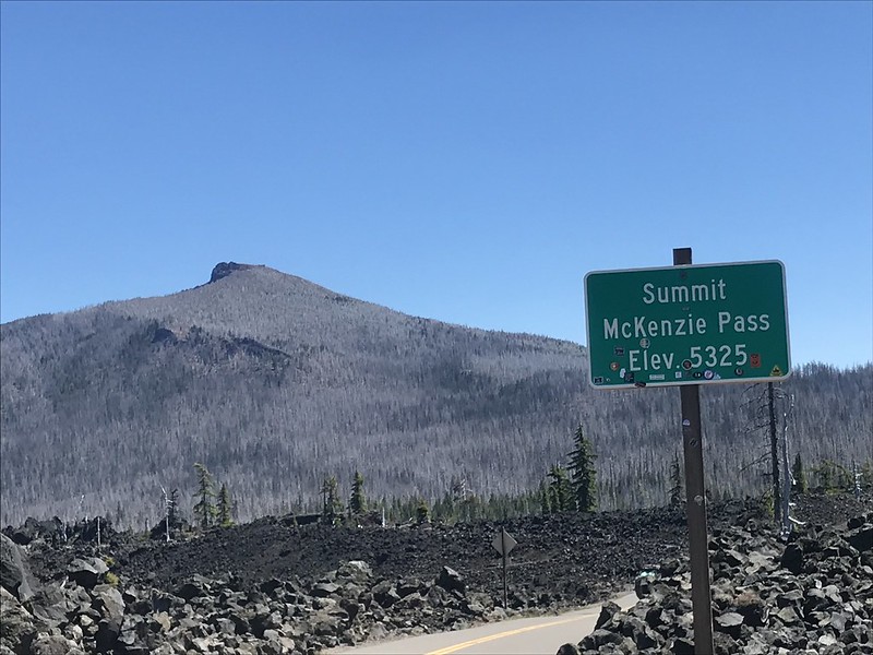
Up we climbed, a never ending crawl. We didn’t care. This was the last one. We didn’t mind that the top was at 5,325 feet. By this point we didn’t notice the thinning air. We are gods of hemoglobin.
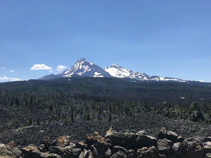
We came to a turn out called Windy Point. We looked out over a moonscape with snow covered peaks, including Mounts Washington, Jefferson and Hood in the distance. What a creepy site. The black boulders were once lava. Hmm… This place could blow at any minute!!!!!!


The next mile or so was level to gently rising. We could feel the cool breeze that foretold of the approaching summit. I stopped when the summit observation tower, built using these same volcanic boulders, was in view.

After playing at the summit for nearly an hour we began our descent. Or so we thought. After a brief downslope the road went up again. Whaaa? Another downslope was followed by another short climb. The mountain was taunting us. The next downslope was the real thing. Over 20 miles of twisty descending. Switchbacks and other curves with advised speed between 15 and 35 mph. Man, was I glad I replaced that tire.

The road was quite narrow near the summit, perhaps only a lane and a half wide. As I came around one curve at speed I was surprised by a rock plow, a truck with a snow plow blade moving errant rocks off the roadway.
Signs announced every 1,000 feet of vertical progress. 5,000 feet. Yahooo! 4,000 feet. Wheee! 3,000 feet. Zoom!
As we descended the landscape changed from lava field to burn zone to dense coniferous forest. On this side of the mountain, fir trees dominated with thick undergrowth. You could smell the green. The air felt thick.

After 2,000 feet we rejoined the Santiam Pass traffic. Logging trucks and double bottom dump trucks (a dump truck pulling a second engineless dump truck) zoomed by.
We stopped in the town of McKenzie Bridge for lunch. After eating we asked about renting a cabin next door. The owner said she was booked and that we’d have trouble finding any lodging because the World Track and Field Championships were being held in Eugene, 50 miles down the road.
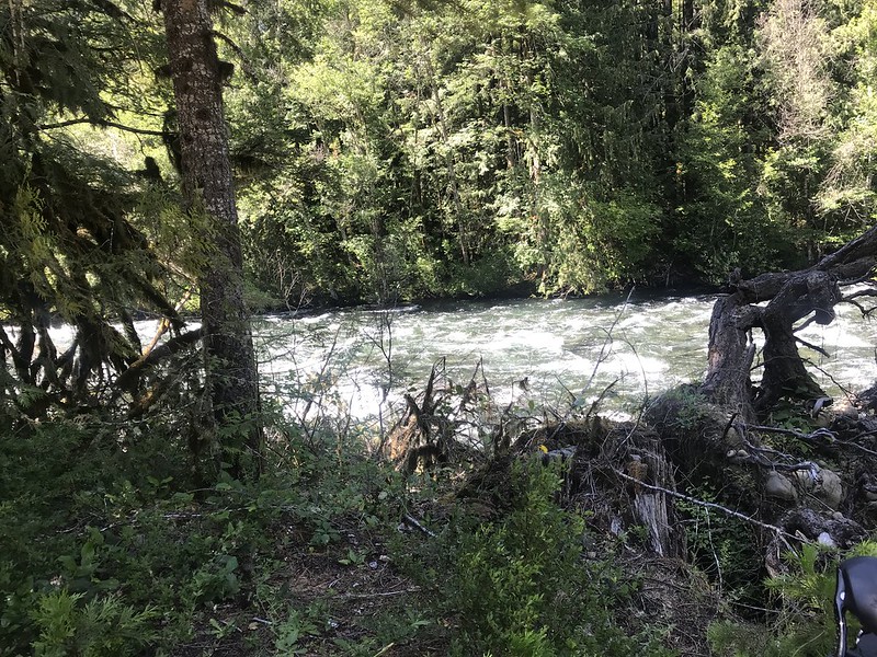
We ended up in a US Forest Service campground. Our site was about 100 feet from the McKenzie River.
We bathed in the river and rinsed out our biking clothes. After walking back to town for dinner we hit the hay in our tents, lulled to sleep by the rushing water of the river.
Miles today: 66 Tour Miles: 3,049.5