
A few weeks ago I drove to Easton, Maryland on the Eastern Shore to do a clockwise ride from Easton to Oxford to Saint Michaels to Easton, using a ferry to get from Oxford to Saint Michaels across the Tred Avon River. As luck would have it the ferry was not operating so I had to back track and take a land route.
The weather forecast for yesterday was promising so I decided to give it a second shot. This time I checked online to make sure the ferry was running. Not wanting to do things exactly the same I decided to ride the loop counterclockwise. This resulted in me riding all kinds of extra miles trying to get out of Easton.
Once on route the way to Saint Michaels was pretty straightforward. Highway 33 is a two-lane, 50-mph affair. The road lacks shade which turned out to be a bit of a problem as the day wore on. The road has huge shoulders with very little debris and the cars kept close to the speed limit.
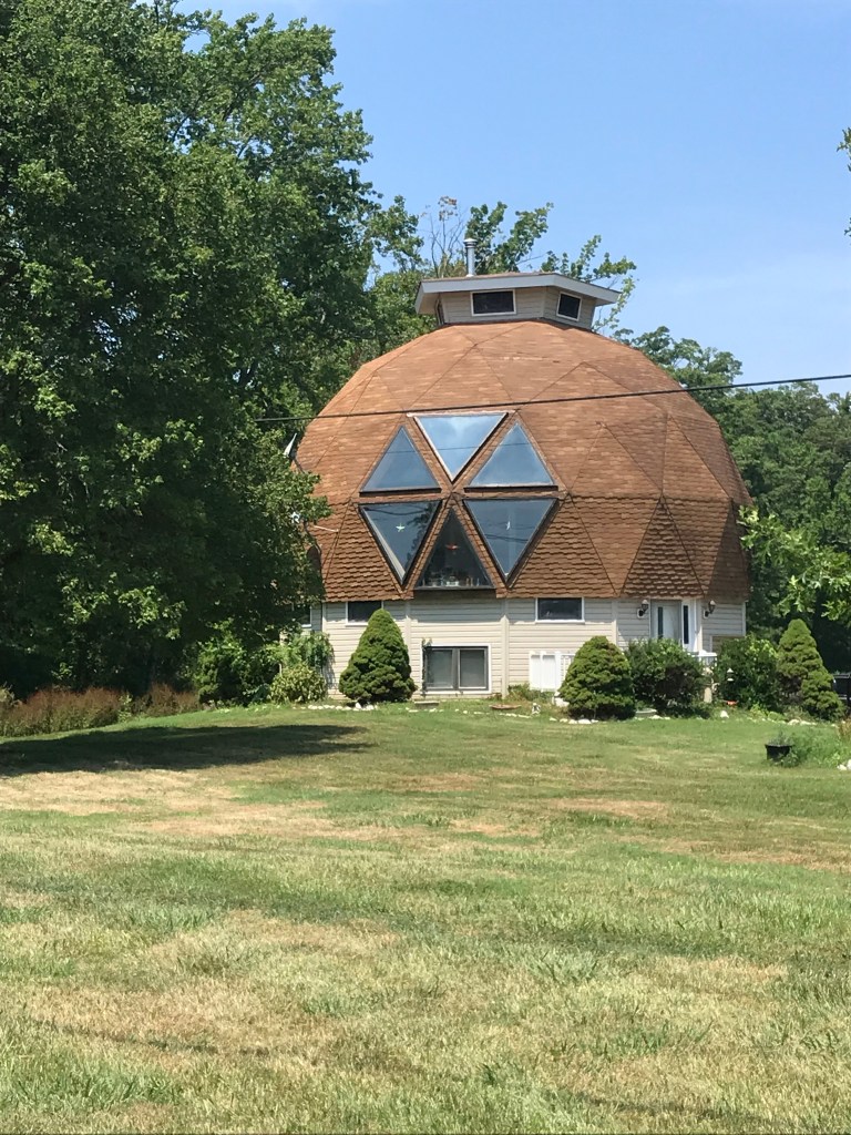
After checking out St. Michaels, a very cool town with many old residences along narrow lanes, I decided to head further along US 33 to Tilghman Island. After passing a few golf courses there wasn’t much to see. Farms and estates lined the highway. Each had a long straight, tree lined driveway to a posh house. One exception to this style of homestead was a geodesic dome house next to the road.
The only hill of any sort was the ten-foot rise on a drawbridge to get to the island itself. Not exactly Alpe D’Huez.

Once on the island I kept riding until I reached a gate blocking the road near a U. S. Navy installation. The trip from St. Michaels turned out to be 16 miles. I took a few minutes to check out the Chesapeake Bay and have a snack before heading back the way I came.

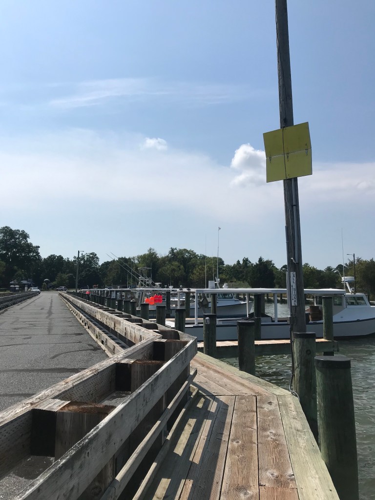
After passing back through St Michaels, I turned toward the Bellevue-Oxford Ferry. The ride to the ferry was along a sleepy, windy, mercifully shaded country road. When I arrived at the ferry pier I saw no cars in line, indicating that I had just missed the eastbound ferry. No worries, with no cars in line, bicyclists and pedestrians are supposed to pull a rope to activate a simple signal to tell the ferry that you’re waiting. The signal is a hinged board painted yellow on one side. It opens when you pull the rope. (How they see this signal in fog is beyond me.) As soon as I pulled the rope, a car pulled up. It’s a bit like lighting a cigarette to bring a bus to your stop on a cold winter day.
The ride across the river was pleasant. The breeze off the water felt great. It grew stronger as we went. I looked over my shoulder back west toward the bay and saw why. As late afternoon approached a summer storm was building over the bay. No time to dawdle.

As soon as I disembarked in Oxford, I hopped on the CrossCheck and rode as fast as I could directly toward Easton. This mean I was lopping off some of the route through farmland east of town, but the notion of being out on the road for a fierce summer storm did not float my boat.
Normally, I cruise along at 11 to 12 miles per hour. My ride from Oxford to Easton was more in the 18 to 20 mph range. As luck would have it the road I was on went directly back to where I had parked my car. After getting the bike and my gear configured, I drove a mile to a gas station convenience store. I was inside about five minutes. When I came out the skies opened with cold, hard rain.
The whole ride ended up being 65 miles, considerably longer than my previous ride here. Now that I’ve evened the score with the ferryman, I want to come back and explore some of the side roads in this area.

Good thunderstorm karma for you!
I could see it developing. Not much fireworks but really heavy rain
Wonderful photos. How do you like the geodesic dome?
Thanks. Geodesic domes are so rare that I often wonder why. I always stop to check them out.
I do also.