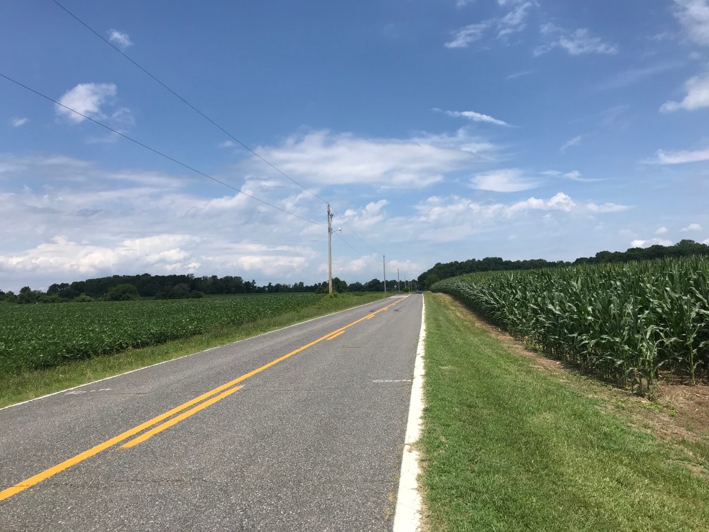
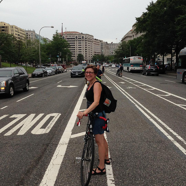
Today was my first ride over 60 miles since the last week of September. It was also my 19th day in a row of riding and 11 days in a row with over 30 miles. My weapon of choice was Big Nellie, my long wheelbase recumbent.
My travels took me about 30 miles northwest to Potomac Village, Maryland. Along the way I passed Old Town Alexandria, a decommissioned power plant, National Airport, the Jefferson and Lincoln Memorials, the Kennedy Center, the Georgetown waterfront, historic Glen Echo Park, and a series of neighborhoods that grew posher by the mile. So many gorgeous houses. So much stellar landscaping. A suburban aspirant’s wet dream.
Along the way on the Capital Crescent Trail I spotted a sure sign of spring in DC. A dozen or more cormorants were perched in leafless trees overhanging the Potomac River. They wait there to pick off bass that are swimming upstream to spawn.
For a couple of miles I rode the rolling hills past the famous golf course of Congressional Country Club. This course has hosted four grand slam events since 1964. I haven’t played golf since the Nixon administration but I know an elite course when I see one. Dang.
At Potomac Village I turned back toward the river on Falls Road. After a ten minute break to devour a peanut buttered bagel, I rode the winding, wooded downhill on MacArthur Boulevard, north out of Great Falls Park. On a recumbent this is pure street luge.
Lunch stop
I re-traced my route back to Georgetown. Along the Capital Crescent Trail I was startled by a beefy looking hawk that swooped down in front of me and cruised about 15 feet above the path until it flapped its wings and climbed up through the trees and back toward the river.
All day I was seeing vultures surfing the winds, turning long graceful arcs as they searched for carrion to feed on. Vultures are so beautiful in flight and so ugly up close. At one point I spotted an enormous vulture doing its acrobatics along the river bank near the power plant. It was being shadowed by a much smaller vulture, a young one learning the tricks of the trade.
One advantage of riding a recumbent is the heads up riding position. You see so much more than when riding a conventional bike. Near Dyke Marsh I searched the trees for the bald eagle nest near Belle View Boulevard. Before I saw the nest, I saw a huge bald eagle perched high in a tree. It was standing guard over the massive nest immediately below it in a crotch in the tree. Pity the squirrel that gets too close to that nest.
My legs were pretty well spent when I arrived at home. 61 miles in the books.
When I went in the house and walked downstairs my left knee gave me a stabbing pain and buckled. Oops.
On Sunday night I stayed up late watching a movie with my wife and daughter. The following morning I awoke after about six hours of sleep. Several cups of coffee later I was driving to Solomon’s Island in Maryland to take on oppressive humidity and rolling hills aboard my Cross Check.
The first ten miles of the ride were mostly along Route 2, a four-land highway and the only major north/south road in the area. I was still a bit groggy from my lack of sleep as I started my ride. The highway had wide paved shoulders which were occasionally guarded by rumble strips next to the right travel lane.
For the uninitiated, rumble strips are sequential cuts in the roadway that run in a line parallel to the travel lanes. These particular strips were about one foot wide. These cuts resembled a tractor track like you’d find on a dirt road. Their purpose is to alert drivers that they are leaving their lane and driving off the road. Properly designed they can be helpful to bicyclists because cars that hit the rumble strip make a distinctive, loud rumbling sound. If you’re riding and hear that sound it’s a really good time to take evasive action.
After a few miles I was getting into a nice pedaling rhythm, bombing along the shoulder at 15 miles per hour when I came to a long downhill. My speed increased quickly. I looked ahead and could see some vegetation obstructing nearly the entire width of the shoulder. This debris was probably caused by recent storms.
I rather absentmindedly started to drift to the left to go around the debris when I found my bike and me shaking violently. I had drifted right into the middle of the rumble strip. I’ve ridden some rumble strips that were no more disruptive than riding on an unpaved trail like the C&O Canal towpath. These strips, however, were composed of deep cuts in the roadway. They were so deep that the bouncing I was experiencing had slowed my speed into the mid 20s.
Even at this somewhat reduced speed, the shaking was making it impossible to control the bike. My butt kept coming off the saddle. The bike started to wobble. Instinctively I reacted by veering to the left. Freed of the rumble strip, my bike accelerated straight across the right travel lane.
I peeked at my mirror and saw nothing coming in my lane but, far behind, a vehicle was indeed approaching from the passing lane. Just as I was about to cross the dashed stripe into that lane I managed to get control of the bike and steered hard to the right, across the rumble strip, and onto the shoulder, well beyond the pile of debris.
This was the closest I’ve come to a high speed crash on a bike in years. It scared the crap out of me. I am very lucky that both travel lanes were empty when the rumble strip ejected my bike and me.
It took my several miles to calm down. In about 30 minutes the route took me across the highway onto back roads. Although these roads were quite hilly, unlike the highway, they were shaded. Temperatures had climbed into the low nineties. The high humidity made it feel like over 100 degrees.
There’s nothing quite like grinding up a series of steep hills in sweltering heat and humidity to take your mind off a homicidal rumble strips.
A few weeks ago I drove to Easton, Maryland on the Eastern Shore to do a clockwise ride from Easton to Oxford to Saint Michaels to Easton, using a ferry to get from Oxford to Saint Michaels across the Tred Avon River. As luck would have it the ferry was not operating so I had to back track and take a land route.
The weather forecast for yesterday was promising so I decided to give it a second shot. This time I checked online to make sure the ferry was running. Not wanting to do things exactly the same I decided to ride the loop counterclockwise. This resulted in me riding all kinds of extra miles trying to get out of Easton.
Once on route the way to Saint Michaels was pretty straightforward. Highway 33 is a two-lane, 50-mph affair. The road lacks shade which turned out to be a bit of a problem as the day wore on. The road has huge shoulders with very little debris and the cars kept close to the speed limit.
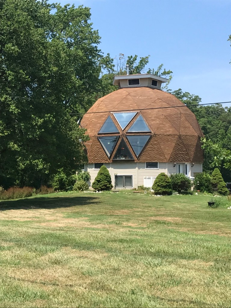
After checking out St. Michaels, a very cool town with many old residences along narrow lanes, I decided to head further along US 33 to Tilghman Island. After passing a few golf courses there wasn’t much to see. Farms and estates lined the highway. Each had a long straight, tree lined driveway to a posh house. One exception to this style of homestead was a geodesic dome house next to the road.
Geodesic home sweet home
The only hill of any sort was the ten-foot rise on a drawbridge to get to the island itself. Not exactly Alpe D’Huez.
Waiting for the drawbridge. The woman in front of me was very fast.
Once on the island I kept riding until I reached a gate blocking the road near a U. S. Navy installation. The trip from St. Michaels turned out to be 16 miles. I took a few minutes to check out the Chesapeake Bay and have a snack before heading back the way I came.
The Chesapeake Bay south of Kent Island
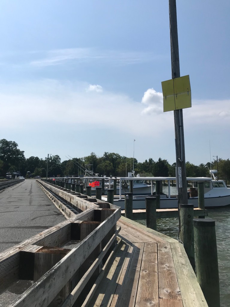
After passing back through St Michaels, I turned toward the Bellevue-Oxford Ferry. The ride to the ferry was along a sleepy, windy, mercifully shaded country road. When I arrived at the ferry pier I saw no cars in line, indicating that I had just missed the eastbound ferry. No worries, with no cars in line, bicyclists and pedestrians are supposed to pull a rope to activate a simple signal to tell the ferry that you’re waiting. The signal is a hinged board painted yellow on one side. It opens when you pull the rope. (How they see this signal in fog is beyond me.) As soon as I pulled the rope, a car pulled up. It’s a bit like lighting a cigarette to bring a bus to your stop on a cold winter day.
Call signal deployed
The ride across the river was pleasant. The breeze off the water felt great. It grew stronger as we went. I looked over my shoulder back west toward the bay and saw why. As late afternoon approached a summer storm was building over the bay. No time to dawdle.
Crossing the Tred Avon River
As soon as I disembarked in Oxford, I hopped on the CrossCheck and rode as fast as I could directly toward Easton. This mean I was lopping off some of the route through farmland east of town, but the notion of being out on the road for a fierce summer storm did not float my boat.
Normally, I cruise along at 11 to 12 miles per hour. My ride from Oxford to Easton was more in the 18 to 20 mph range. As luck would have it the road I was on went directly back to where I had parked my car. After getting the bike and my gear configured, I drove a mile to a gas station convenience store. I was inside about five minutes. When I came out the skies opened with cold, hard rain.
The whole ride ended up being 65 miles, considerably longer than my previous ride here. Now that I’ve evened the score with the ferryman, I want to come back and explore some of the side roads in this area.
One of the long rides I try to do every year is the White’s Ferry Loop. This ride links up several trails in the DC are for a 90-mile circuit. Including the 9 1/2 miles to the loop from my house brings the total mileage to 99. Typically, I add a mile somewhere along the way for the full century.
I chose to ride clockwise because the forecast called for heat and humidity. This would put me on the shaded C&O Canal towpath for the hottest part of the day.
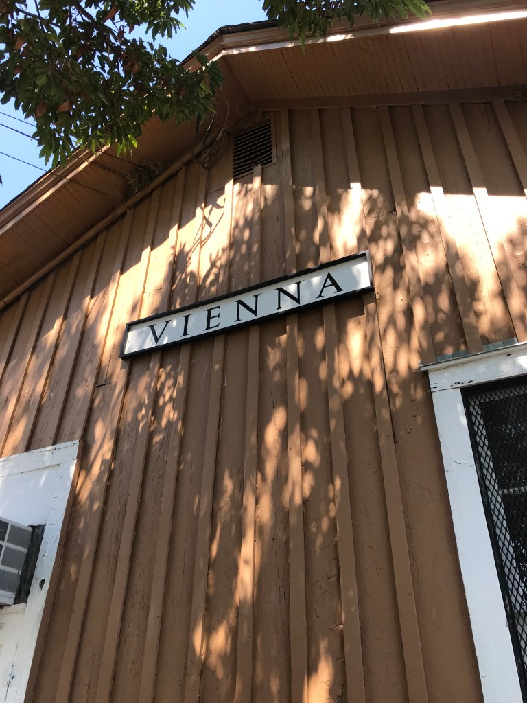
I boogied along for 23 miles taking streets and two trails (see below) before stopping at the Vienna train station building to refill a water bottle. Then I was back on the W&OD Trail all the way to Leesburg, about 47 miles from home. Whenever I could I topped off my water botlles. To be on the safe side, I carried five bottles, two on the bike and three in a pannier. I also brought snacks. Peanut butter on bread, pretzel sticks, and a couple of old chewy granola bars.
I rode on King Street through Leesburg, which had many tempting places to eat. In fact, if you stopped at every microbrewery along the way you’d pass out before the ferry.
North of Leesburg is the sketchy connection to US 15, a busy north south highway. I lucked out as there were no cars coming. The highway has a big shoulder along this part (because bicyclists were hit and killed several times in years gone by).
After a half mile , I turned onto Whites Ferry Road for another 1/2 mile of quiet country road to the ferry. If cars are coming toward you, you can take your time, because the ferry is crossing back to Maryland. I arrived at the ferry and waited in the shade for the trip back. As ferry trips go, this one is pretty calm. It only takes five minutes.
The store on the Virginia side is up an embankment. The exterior of the building has marks with dates next to them showing the high water marks for major flood events. Suffice it to say, Hurricane Agnes did a number on this river valley back in the early 70s.
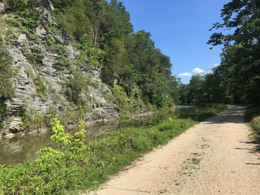
After some ice cream, Gatorade, and a port-a-potty break I headed south on the C&O Canal towpath. The double track of the past is gone, replaced with an unpaved smooth surface. For five miles, that is, until it’s back to the bumps. Riding a recumbent means you feel every bump because you cannot easily lift your butt off the seat.
Near Seneca Creek the towpath is muddy. I was slipping and sliding but I didn’t fall.
From time to time, I saw deer, squirrels, herons, and large ominous looking birds. Mostly I was just trucking along and enjoying the shade. I particular like the sections where you can see the river with all the large rocks randomly poking above the water line and the places where the canal is filled with water and bordered by ominous rock walls.
After 32 miles I switched back to pavement on the Capitol Crescent Trail. This brought welcome relief to my back. The bumpy towpath was messing with my stenosis and I was constantly dealing with achy feet and an achy butt.
The CCT leads to the nifty Water Street cycletrack which connects to a side path that runs past the Watergate and the Kennedy Center along the Potomac River. After passing the Lincoln Memorial I switched over to Ohio Drive, which is the epicenter of the Cherry Blossom Festival in the spring.
At the Jefferson Memorial, I crossed over the river on the 14th Street Bridge which connects to the Mount Vernon Trail and the 12-mile ride home.
All aboard!Waiting for the ferryImagine water well above the treetops. It happens every so oftenThe White’s Ferry Store serves food and sells snacks.Groomed towpath is a big improvementRocks in the riverCliffs, canal, towpathLittle Falls Dam northwest of DC
Here’s a cue sheet. Most people just do the loop starting and ending at Step 3.
Three Miles of suburban streets to the Mount Vernon Trail
Mount Vernon Trail north 6 1/2 miles through Old Town Alexandria to Four Mile Run Trail.
Four Mile Run Trail west 3 miles to the W&OD Trail
W&OD Trail 35 miles to South King Street in Leesburg
Right on South King to US 15 north of town, about 3 miles
US 15 to a right on Whites Ferry Road, 1/2 mile
White’s Ferry Road 1/2 mile to the ferry
Ferry across Potomac ($2)
Go 100 yards up the hill on the Virginia side
Take a right on the C&O Canal towpath and ride 32 miles to Thompson’s Boat House
Switch to paved Capital Crescent Trail and Water Street in Georgetown for 3 miles
Right onto Rock Creek and Potomac Parkway path to Ohio Drive (1 mile)
Ohio Drive to 14th Street Bridge (1/2 mile)
Cross bridge to Mount Vernon Trail (1/2 mile)
Take a right on the trail. Go 9 miles.
Re-trace suburban streets home. 3 miles.
Finally, if you do this ride, bring water and snacks. There are pumps along the towpath but these may be turned off. Also, the National Park Service treats the water with iodine. The store at White’s Ferry has limited hours so I assume it’s closed. On this day it was open.
The Washington Area Bicycling Atlas included a ride on the Eastern Shore of Maryland called the Rock Hall Ramble. I lost the book but used the Google to find a cue sheet to the ride online. And off I went.
The ride through Kent County begins in Chestertown, Maryland. Founded in the early 18th century, Chestertown is a quaint place with just over 5,000 residents on the Chester River. The town is filled with lovely eateries and old buildings, as well as Washington College, a small liberal arts college founded in the late 1700s.
The ride makes its way southwest on quiet country roads to the town of Rock Hall on the Chesapeake Bay. Here you can dine like a proper Maryland savage by ripping crabs limb from limb. Ick.
Heading south from Rock Hall, the route enters the Eastern Neck Wildlife Refuge. I saw a deer and a rather humongous vulture, as well as bunches of noisy ospreys. The road dead ended at a rather drab field so I turned around and checked out a historical marker. It was a memorial to the dead son of a colonial landowner. The son it seems died at sea captaining a ship during the Revolutionary War.
On the way back to Rock Hall I stopped at Bogles Wharf for another view of the Chester River.
Once through Rock Hall the route became rather disappointing. The road was flat but the scenery did not inspire. Basically, this is a highway to the town of Fairlee.
Then it’s back to Chestertown. The town closed High Street, the main drag, for a farmers market in the morning. It was re-opened when I arrived after my ride. As I was leaving I noticed it was closed again. Moving traffic barriers is a full time job here.
All in all the ride was not half bad. Low traffic. No hills worth mentioning. Decent views of the Chester River and the bay. A respectable place to pedal 52 miles.
A fine ship in ChestertownSoy left. Corn right. Clouds up above. Works for me.The dock of the bay in Rock HallLost at SeaMural in Rock Hall
There’s the old story about Groucho Marx. I heard it as the reason his TV show was taken off the air. The details vary in the telling. While interviewing a man/woman/couple that have been married for 10 (or more) years, they related that they have 12 (or more) children. Hearing this Groucho says to the husband, “I like my cigar but I take it out once in a while.”
It never happened. But it’s a good story.
Well, I’ve ridden my bike for 22 days in a row. I woke up today and decided that I like my cigar, but it’s time to take it out.
Instead of riding I mowed the lawn in suffocating heat and humidity. Then I did about an hour of light yard work. I wore a t-shirt, sun sleeves, and swim trunks in anticipation of a sweat fest. When I was done, I was soaking wet. My sun sleeves were so wet they slid down to my forearms.
After a snack and a rewarding nap, I am ready for another string of bike rides. I am in striking distance if getting on a pace to ride 10,000 miles this year, but I need to bang out a few longer rides. Lately it has been so hot and humid that I haven’t dared to try to ride over 50 miles.
I found a bunch of rides online in Kent County Maryland. The shortest is called the Rock Hall Ramble. It’s about 50 miles but can be easily expanded to 70 miles by riding a spur into the Chesapeake Bay. Two other rides are over 80 miles. All three start and end at Washington College in Chestertown. I’ll probably do the ramble and save the other two rides for another day. All of these rides are ideal for a recumbent but cross winds on the Bay Bridge make me weary of hanging Big Nellie off the back of my car. Getting blown into the Chesapeake can ruin your whole day.
Time to fill some water bottles and make some snacks!
The longest six months ever came to an end yesterday. Despite the pandemic, or maybe even because of it, my beat up body is finally starting to feel normal again. I am hoping that Indiana Jones was wrong when he said, “It’s not the age; it’s the mileage.” Then again, at my age, I doubt there’s much difference.
I closed out the first half of the year with a 66-mile ride on The Mule from Potomac Village to Glen Echo to Heightstown and back to Potomac Village. All in Maryland west of DC. The route was designed by the DC Randonneurs, those crazy people who ride hundreds of miles in one go. For fun. I think they need professional help.
This route is what the Randos call a Populaire. It’s a sweetener intended, I suppose, to lure riders into doing longer randonneering rides. God help them.
The ride is supposed to start in Glen Echo but I decided it would be easier to park in Potomac Village and make a figure 8 out of the route. Glen Echo is near the Potomac River so the first five miles were downhill. From there I headed back to Potomac Village and on to Heightstown, not far from Frederick. The outbound route is uphill in the form of a series of unrelenting rollers.
It was a typical DC day, hot and humid. I’d put a lot of miles in my legs recently, including 13 yesterday with a lawn mowing job thrown in for bad measure. Suffice it to say, my legs were not fresh and I could tell by the 22-mile mark. My thighs were wobbly going up the steep rollers. I normally would stand and ride over these but I resorted to granny gearing. Over and over again.
The route passed through some very scenic countryside, much of it thankfully in shade. There were many curvy country roads which makes for fun riding. At 22 miles, I ate half a bagel and hoped for a bit of a bounce from the calories. The next 14 miles were more up and down riding. Bounce or not, I was pooped by Heighstown. I stood in the shade and finished the other half of the bagel then headed back.
Lucky for me the next 12 miles over a different set of roads were mostly flat. I made a pit stop in Poolesville for some panther piss, an Arnold Palmer, a Snickers bar, and a water bottle refill.
My liquid break made the next few miles a bit sloshy. It was a good thing that these were also level riding. Finally, I arrived at River Road for the last ten miles beginning with the biggest downhill of the ride. I was flying until the road surface became a series of small moguls. This was not a lot of fun at 38 miles per hour. All I could do was relax my arms and hope I didn’t get bounced into a passing BMW.
After the bumps, I endured nine miles of huge rollers and speeding cars. The sun was frying my back. I was very happy to see the parking lot in Potomac Village.
As hard as this ride was, I once did it from my home on Big Nellie. How I rode up the steep rolling hills is beyond me. It was 113 miles. I can’t even.
I was so focused on not dying that I only took one picture. A simple field of grain at mile 50.
The ride also marked the end of June. I rode 1,102 miles in the month. For the first half of the year I’ve pedaled 4,901 miles. I think I have a decent shot at 10,000 miles for the year.
Since it was the last day of June I recommend some Finn therapy.
Here’s to a better second half. Wash your hands. Keep your distance. Wear a mask. Call your momma.
I discovered the website Bikewashington.org many, many years ago. It’s especially useful for newcomers to the DC area. Luckily, it’s list of day rides holds a few surprises even for those of us who’ve lived here a long time. And so I found myself doing the North to Gettysburg ride on what started as a splendid early summer day.
The ride starts in Thurmont, Maryland, a small town located not all that far from Camp David, the presidential getaway place. As I began my ride, I saw two Marine helicopters heading in the general direction of DC from the nearby mountains. Melania must be bored.
It was about 70 degrees F with a strong southerly breeze when I started out of town. The old downtown has a few log cabin buildings but this historical quaintness soon gave way to more modern residential houses, farm buildings, and the occasional machine shop as I left town.
The route is specifically designed to avoid the nearby mountains which contain several challenging climbs. Being an old fart with bad knees, I appreciated this aspect. As I headed north on curvy country roads, I couldn’t believe my good fortune. This area is just rural bliss and perfect bike riding. There’s enough variation in the terrain to shake things up a bit without having to go blue in the face and feel fire in the legs from exertion. I’m sure I could have done every one of the short climbs on this ride without using my granny gear, but I decided it would be best to be kind to my worn out left knee.
Yeah, I’m old.
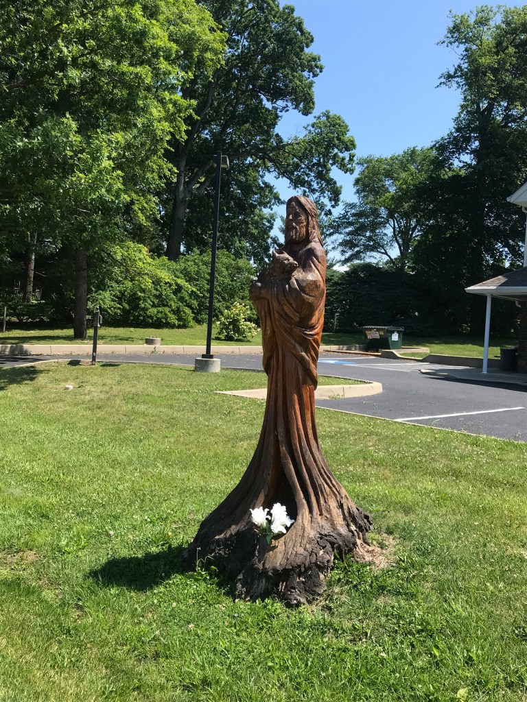
Somebody must have had time on their hands
As I approached a turn I saw a sign warning that a bridge over the Monocacy River was out of commission on Bullfrog Road. I was following a paper cue sheet and decided to follow the detour signs. After three miles I came upon Bullfrog Road. Hey, wait a minute. I consulted the Google and learned that the route never actually crossed the Monocacy on Bullfrog, rather it left Bullfrog staying entirely to the west of the river. Doh!
Well, I guess my 46-mile ride had now become a 52-miler but so what? The Mule abides.
Looking west. Miles and miles of these views. Not too shabby,
After more country roads than John Denver could a guitar neck at, I found myself crossing the Mason Dixon line, the border between Maryland and Pennsylvania. The pavement turned from black to gray but the surface remained bike-friendly. Soon I found myself turning onto a narrow lane into Gettysburg National Battlefield. The route runs along Cemetery Ridge past Little Round Top, Round Top, and the Angle. Tourists and families scrambled about the hillside imagining the Confederate army attacking up the hill into defensive fire from the Union positions. It’s remarkable that they nearly succeeded more than once.
Mason Dixon Line
The battlefield is dotted or perhaps I should say strewn with dozens of monuments to Union states and militias and military brass of the day. At the northern end of the ridge I stopped to have a snack before turning south to begin the ride back.
Snack stop in the shade of the sign. Was hoping for a free meal but it was closed.
US Business 15 bisects the flat land across which Pickett made his charge. One look at the lay of the land reaffirmed my lifelong disdain for blindly following orders. It’s a miracle his troops didn’t frag him. Instead they died by the score although some momentarily breached the Union defenses at the Angle. The South’s military headcount was vastly outnumbered by the North. That Lee would waste so many soldiers in such an obviously futile assault puts the lie to the notion that he was a superior military commander. Don’t believe me? Go to Gettysburg and see for yourself.
My route turned to the west from the battlefield and then headed south along the western side of the valley. By this time, the lovely morning weather had given way to a typically swampy mid-Atlantic summer day. The terrain seemed hillier but increase in effort may have been caused by the headwind that was wearing me down.
More hills and curves and farms and cows. Even a longhorn. I startled a yearling deer crossing the road. It turned tail into the roadside bushes. A little further on a hedgehog did a u-ey and waddled under a barn. At least the wildlife has some pep yet, I thought.
I rolled into Emmitsburg on the Maryland side of the border and, after missing a turn, found myself cruising through Mount Saint Mary’s College campus. The campus is situated along US 15, a four lane divided highway. But for this misfortune, the campus would get an enthusiastic thumbs up from me. It’s stone buildings practically intoned Catholic academia. It’s metal sided gym, really an oversized quonset hut, somehow amusingly fit in. The seminary building to the rear up a hill was the crown jewel.
Another ten miles or so to go. Up and down and around. I was running out of energy, a peanut butter bagel apparently being enough for 46 miles but not for 52.
After crossing US 15, I followed the windy (in both senses of the word) country roads to the final payoff, a covered bridge over Owens Creek. Why the heck did these things even exist? No matter, they are charming and, as long as you don’t catch a wheel in the gap in the boards, they are a treat to ride through.
Frederick County Maryland is known for its covered bridges
Back into Thurmont an annoyed driver honked his horn at me as I passed him. I pointed to the stop sign that he was about to ignore and successfully shamed him. To prove my point the route had me follow him through town. His impatience was accomplishing nothing but raising his blood pressure.
If you live in DC, I highly recommend this ride, without the unnecessary detour. I must admit that I resisted taking pictures otherwise I’d still be out there riding. It’s beautiful country.
One of the limiting factors in my bike riding during the pandemic has been the availability of restrooms. As a male I can get by for number 1 but number 2 is fraught with peril. Today I discovered that Maryland gas stations with convenience stores have opened their restrooms. Ahhh.
Today I drove nearly three hours to Princess Anne, Maryland on the Eastern Shore. It’s a lovely little town with many old brick buildings and many more rather run down frame houses. At one end of town is an old home with a boxwood garden in front. The boxwoods haven’t been trimmed in a while but it’s still a lovely sight. I am biased because the perimeter of my backyard when I was a kid was a boxwood hedge. We had seven kids and a dog. We gave those boxwoods a beating and they held their own.
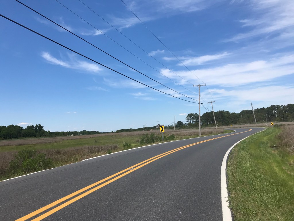
The ride I did was from Princess Anne to Deal Island on the Chesapeake Bay. It was a straight shot along highway 363. The road has rumble strips about three feet from the edge of the pavement for the first seven miles. I managed to avoid hitting them but they definitely detracted from the riding experience.
After some farms and woods, I rode through salt marsh with plenty of bird life. Red wing black birds and ospreys protested loudly as I passed them. Egrets and herons flew silently way. Turtles seem to be losing the battle with big metal things. I saw one living turtle on the road and three who had been gruesomely crushed by passing cars.
Once through the Deal Island Wildlife Management Area, the road winds through the towns of Dames Quarter and Chance before crossing over to the island and it’s historic district. A mile later the road ends at Wenona. In Winona there are stacks of crab pots and boats to charter for fishing trips on the bay. These towns look like working and middle class towns; there is little sign of the kind of moneyed living you see farther north on the Delmarva Penninsula.
Wenona was nearly deserted and rather underwhelming. I rode half way back to Princess Anne before turning off the highway to take some backroads through farmland. The land here is so flat and the weather so agreeable that the 39-miles I rode was effortless.
Here are some pix.
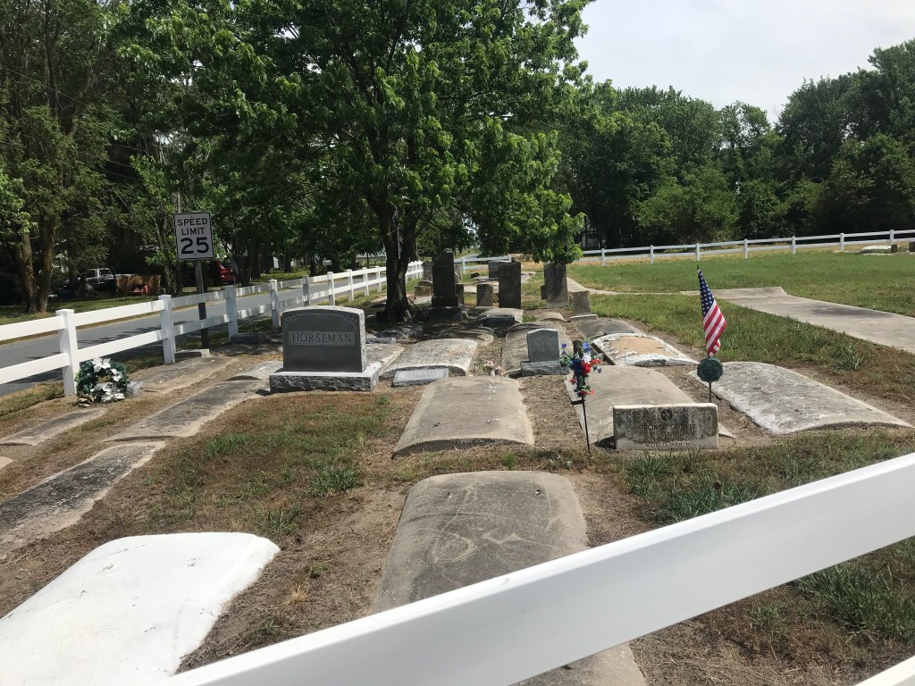
The harbor at WenonaTrolling and chumming. I think I’ll pass.The water table is so high that the graves are not buried. The highway through the salt marsh.More salt marshPoultry is big on the Eastern Shore. Back roads through some woodsSpacious skies and amber waves of grain.
Pool Noodles for the Win: Sam got us organized. We were going to occupy the Pennsylvania bike lanes to get barriers installed between 13th and 15th Street to keep cars from making illegal u-turns. Somebody got the idea of using pool noodles as props, to indicate where the barriers would go. Afterward, Dave carried them off. I think they took him to the nervous hospital later.
We all had a blast. Human bollards come in many shapes and sizes. Here’s the Katie Lee model. It’s generally impervious to u-turning cars, but can be moved aside with tickets to Packers games and Phish concerts.
Here’s Sam, the mad genius behind #biketivismdc. It’s funny what getting run over by a car does for your determination to make streets safer.
Kelly Biked to Work!: Kelly sits across from me at work. She had hip surgery which meant she couldn’t run for weeks. So she took up bike commuting. The smile means it was a success.
To her credit she really got into the bike commuting thing. Here she poses at an underpass on the Four Mile Run Trail. A few days before rising water during a downpour caused her to abandon shelter and head into the maelstrom. She survived and added a snorkel to her bike commuting gear.
Like Father Like Daughter: I went to a bunch of baseball games this year. Katie Lee and I attended a couple of games together. She is a meticulous genius at scorekeeping, an art she learned from her late father. At one game, there were two little boys in the row in front of us attending their first baseball game. They were trying to figure out how to keep score. Katie moved down and gave them a game long tutorial. It was an act of kindness that just knocked me out. Somewhere her dad is smiling.
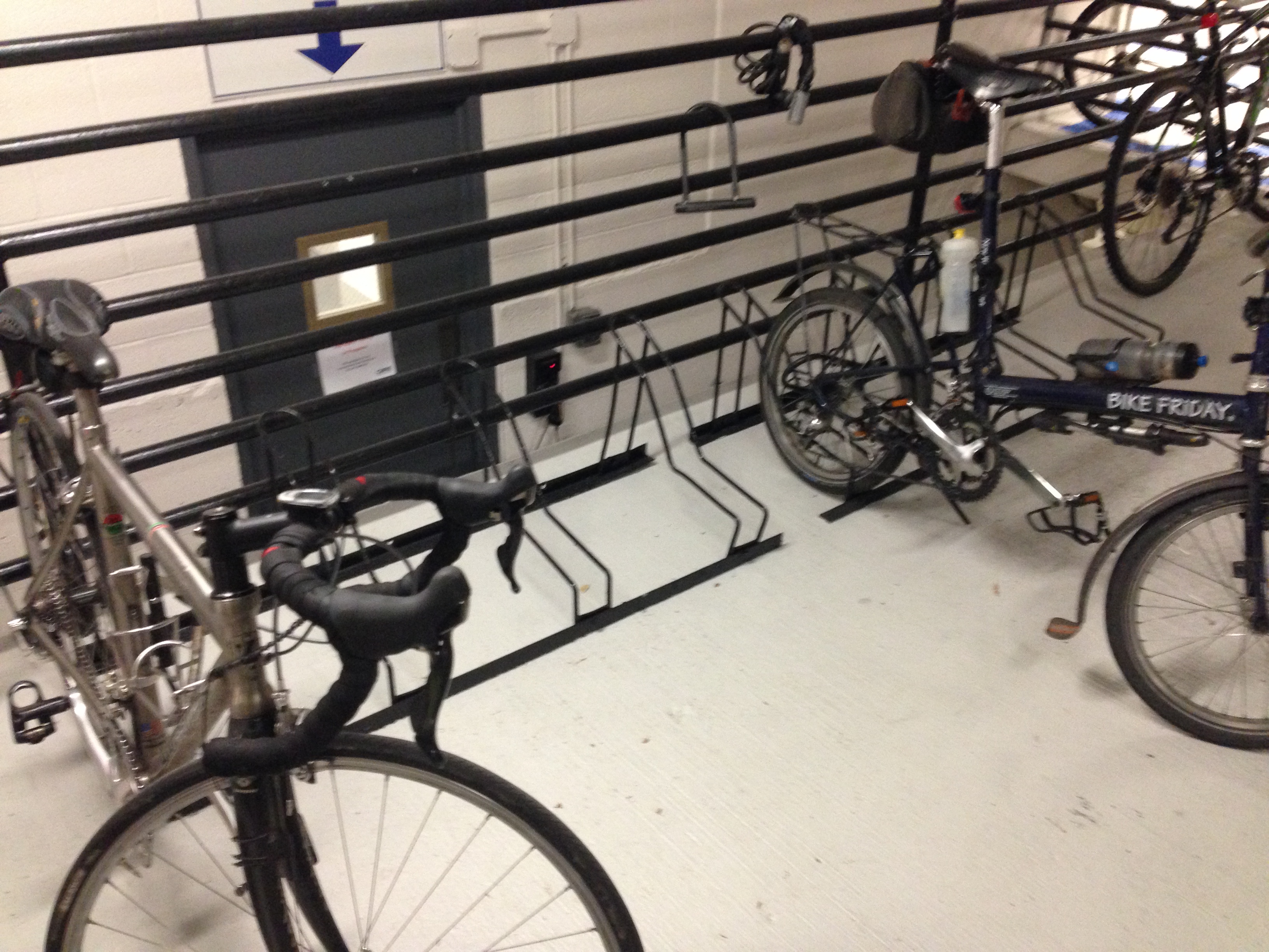
Posh Bike Parking: For some inexplicable reason, our office building started getting all environmentally conscious this fall. Without telling anyone, they replaced their absolutely crappy bike racks with a pretty awesome, secure bike room. Combined with the gym and showers one floor above, it’s a pretty darn bike friendly place to work.
Here’s the before shot.
Here’s the after.
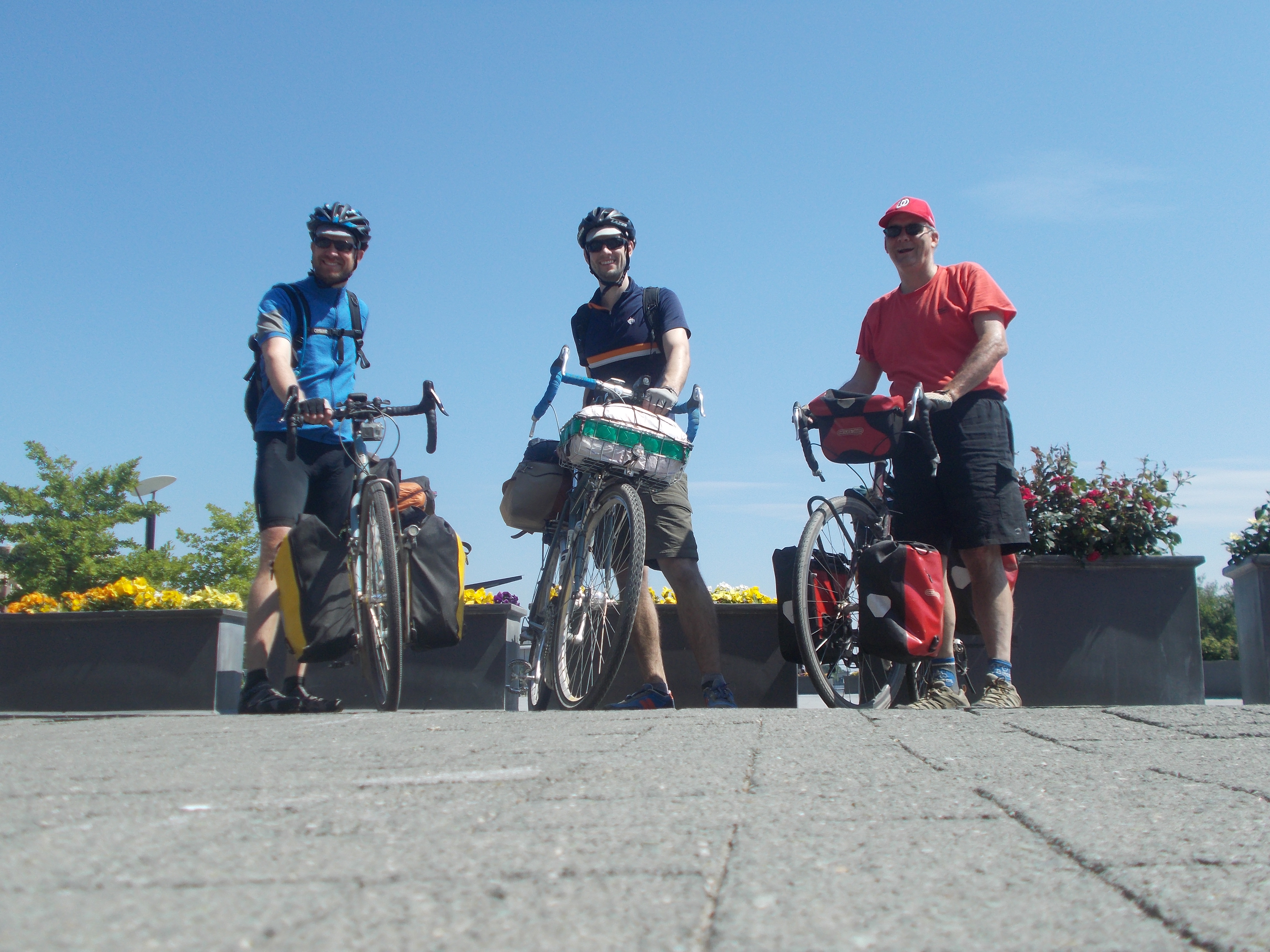
No Wrong Plan: Ryan, Kevin, and I rode from Pittsburgh to DC. It was my first bike tour in a decade. Here we pose in Georgetown’s Waterfront Park at the end of our trek. Any resemblance of me to Hoss Cartwright is entirely coincidental.
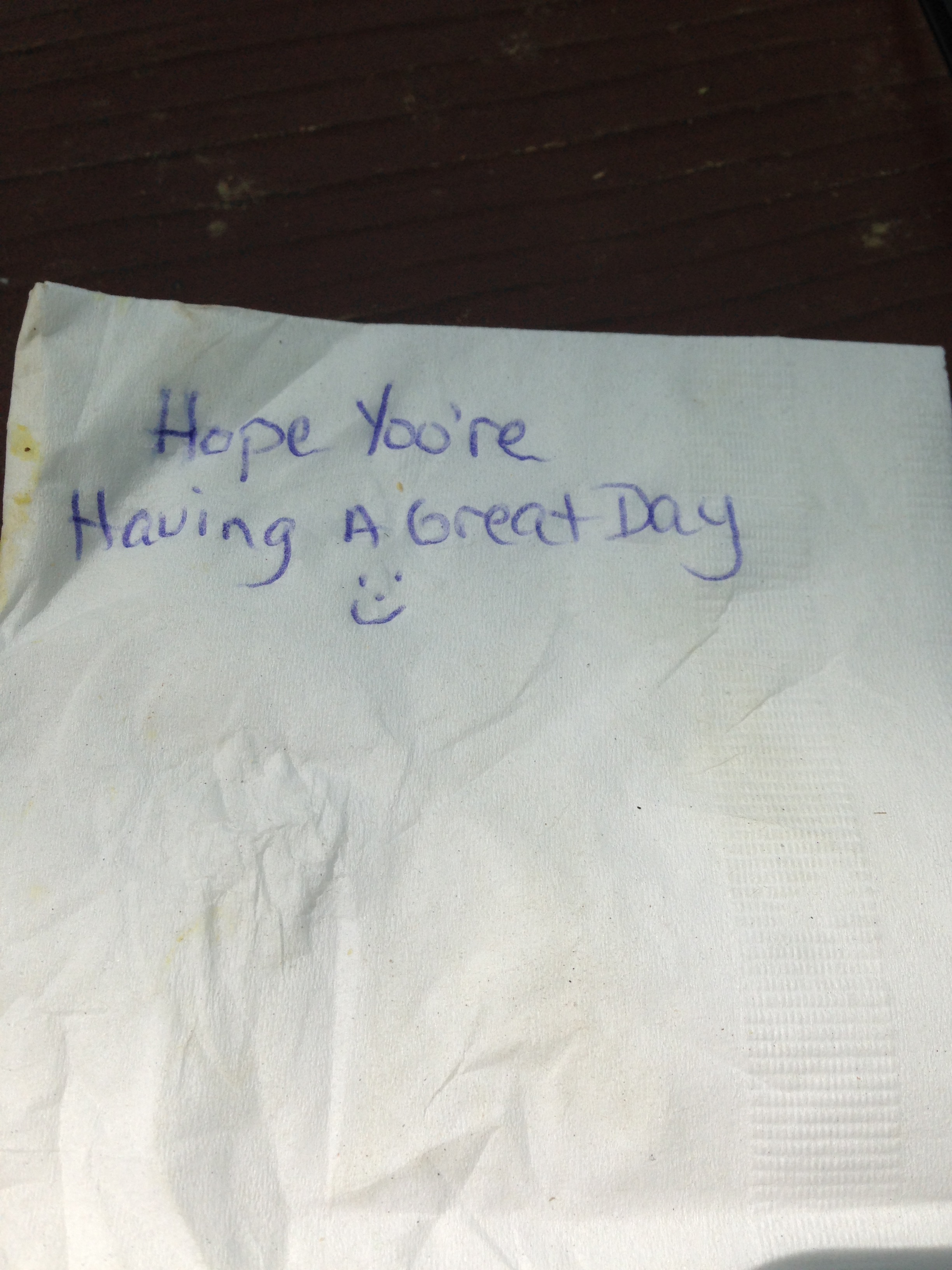
In Williamsport, Maryland, we stopped at the Desert Rose Cafe for breakfast. They made us sandwiches for lunch. Inside the bags they included napkins. Each one had a personal message. Such nice people. Such good food. Eat there. (They speak veggie and vegan too!).
Going Up: I did quite a lot of day hiking this year branching out to Shenandoah National Park for several exceptional hikes. All my hikes were solo except for this one with Ultrarunnergirl. She kicked my ass all the way up to Little Hawksbill, the highest point in the park. Then the mountain kicked my ass all the way back down.
On my 60th birthday, I hiked Old Rag. It was a tough hike and convinced me that rock scrambles are for the young and frisky. Also, the thin.
Glory Days: Mrs. RC is a very talented quilter. When I had to quit running about 25 years ago we talked about using my race t-shirts to make a quilt. Nothing came of it until she made the quilt as a surprise for my 60th birthday. What an amazing gift. Oh how I wish I could run like that again.
Around the World in 19 Days: My kids were living in Sydney, Australia and Phuket, Thailand. We decided to go visit them. While in Australia, Mrs. RC and our daughter Lily went to Uluru for dinner under the stars. Here we enjoy a drink just before sunset.
After trips to Melbourne and the north island of New Zealand, we headed for Phuket. The island is very hilly so everyone rides a motorbike like this one my son Eamonn uses.
We paid a visit to Big Buddha. He was aptly named.
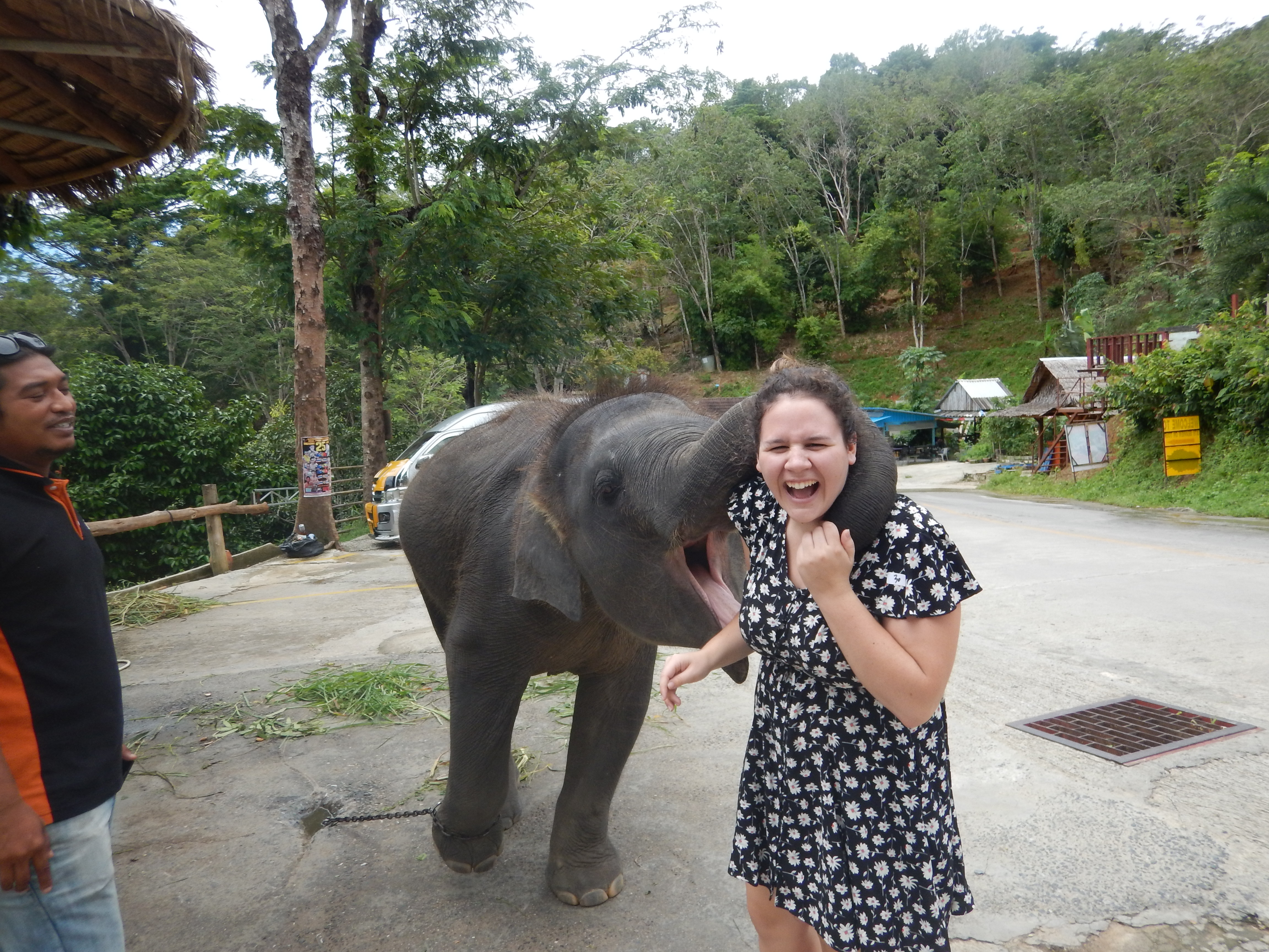
Lily made friends with a baby elephant.
Cookies and Cider: I did a bunch of event rides this year. The Cookie Ride had a good hook. Cookies at every rest stop. Here I pose with a human cookie along with Paris and Lisa.
I missed my two favorite rides of the year, the Backroads Century and the 50 States Ride, which both occurred while I was traveling. I swore off the Cider Ride last year but decided to give it a go after they moved it into November. Finishers got this cool mug. Thanks to Michelle for her event magic on behalf of WABA.
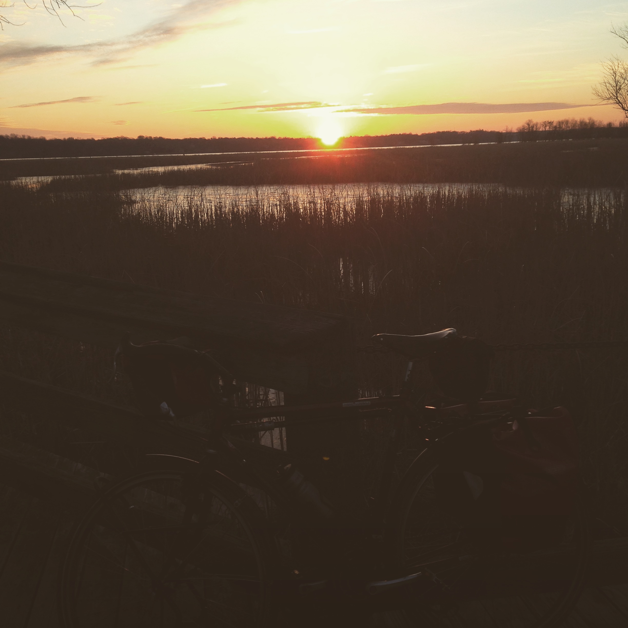
Sunrise: The year is nearly over but I am pretty sure that the new one will start something like this. Thanks for reading.