The Mo Mo Tour: Day 12 – Draper to Whytheville

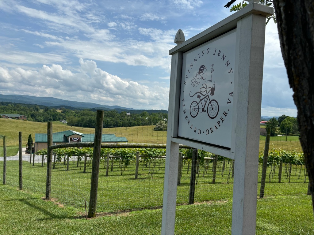
I had another good Warmshowers experience with my hosts Curtis and Jennifer in Draper. They own and operate the Spinning Jenny Vineyard. At dinner they served me some of their red wine. It was really, really good so I chugged a whole bottle.

Just kidding but not about the quality of the wine.

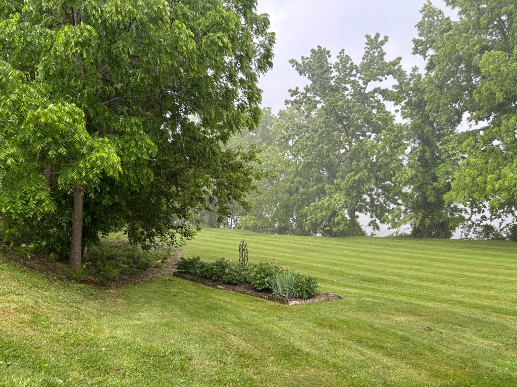
After coffee and Cheerios I hit the road. It poured yesterday after I stopped riding so my decision to do a short day was a wise one.

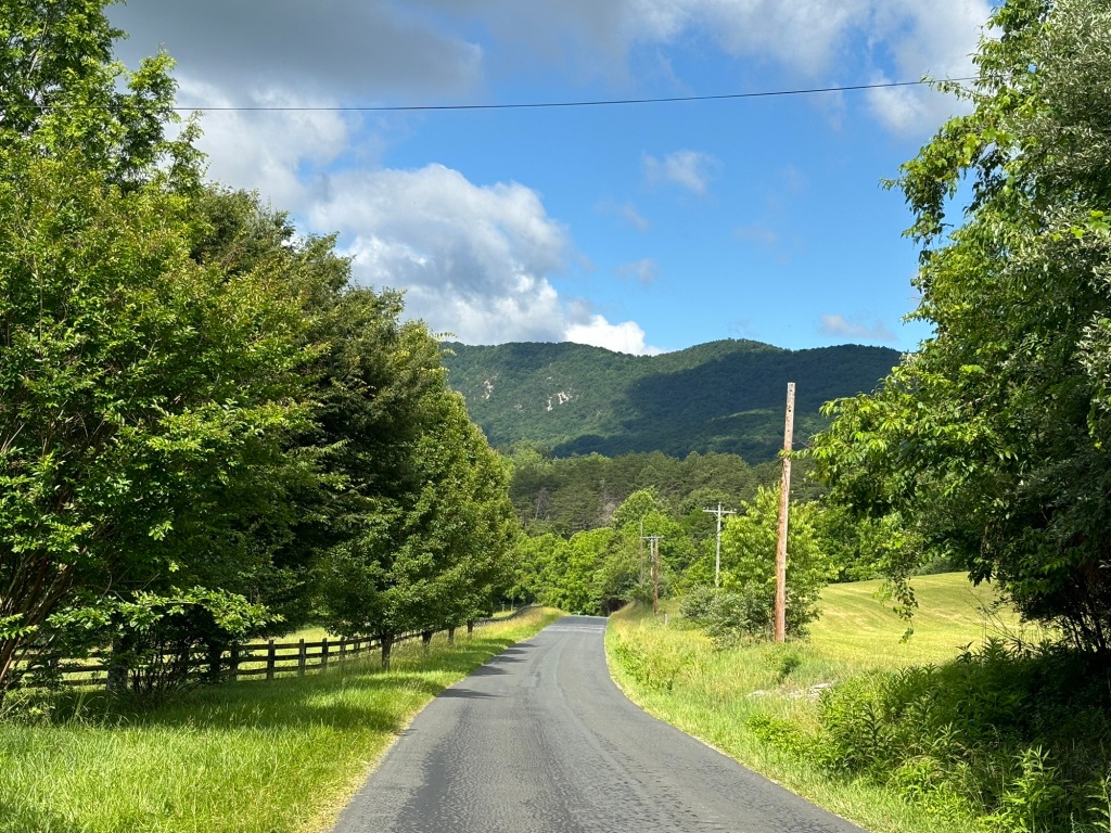
Today’s ride on rolling country roads featured a strong, constant headwind with gusts well above 20 mph.

After 5 miles I stopped and ate a banana. It had no effect on my speed or attitude. At 10 miles I stopped for second breakfast at a McDonalds. It helped a little but soon the beat down continued.

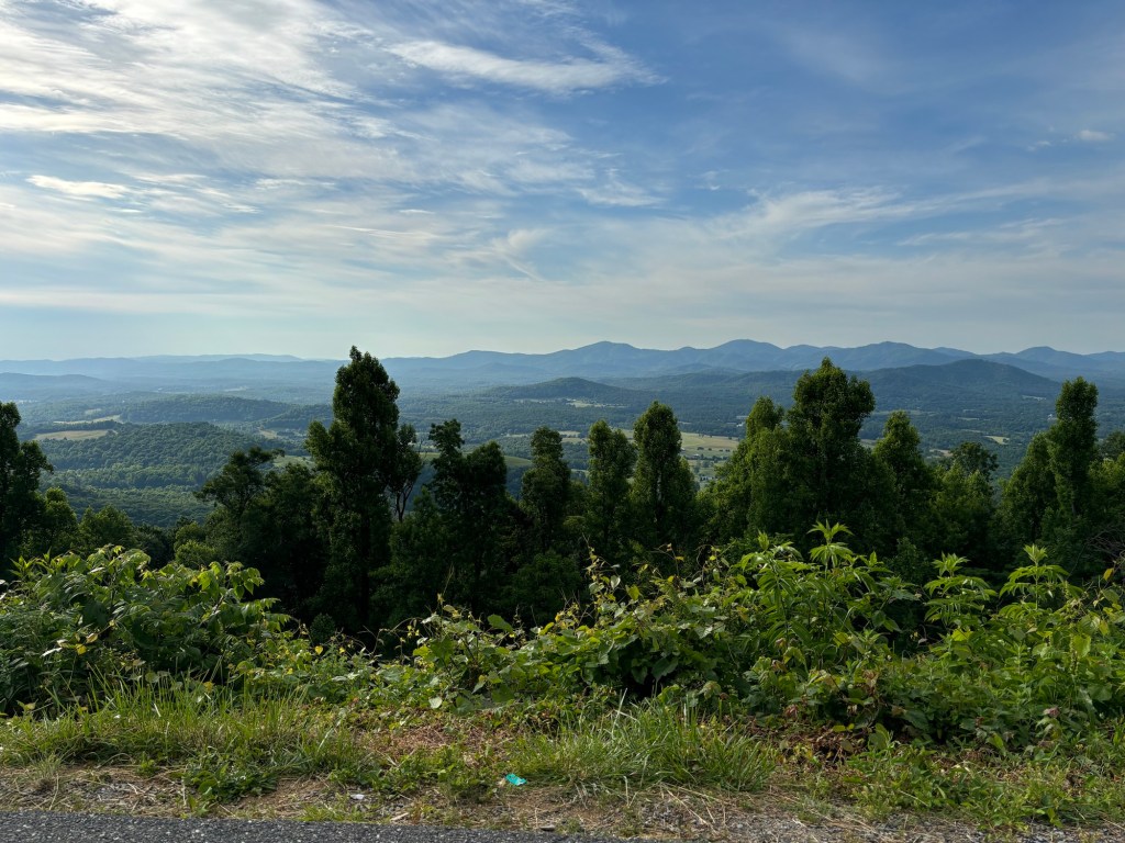
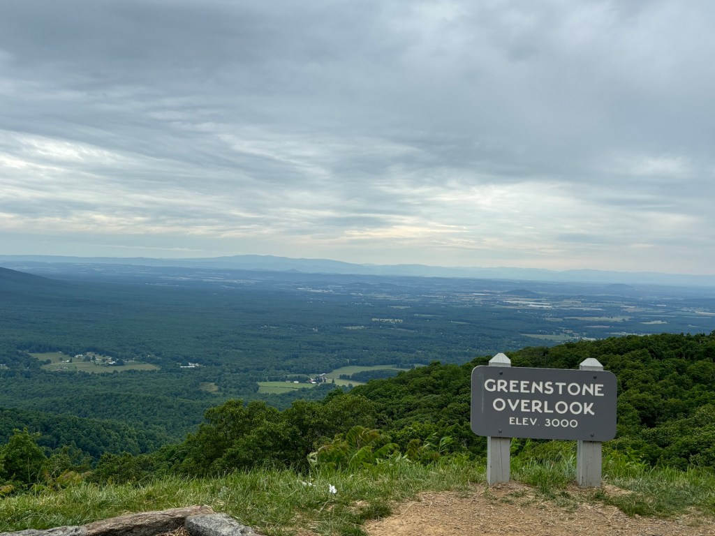
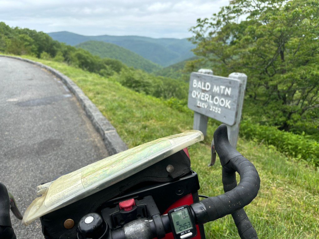
Today’s plan was to ride 50 or 60 over a mountain ridge to Troutdale. I didn’t come close. I struggled mightily on even the smallest hills.

At least the scenery was good

All the while the skies threatened to let loose with a downpour.

On prior tours, after about a week, I got stronger. This time I seem to be getting weaker. It was so discouraging that I stopped at a city park and checked to see if my brakes were dragging on the rims. Nope.

Interesting sign in downtown Whytheville

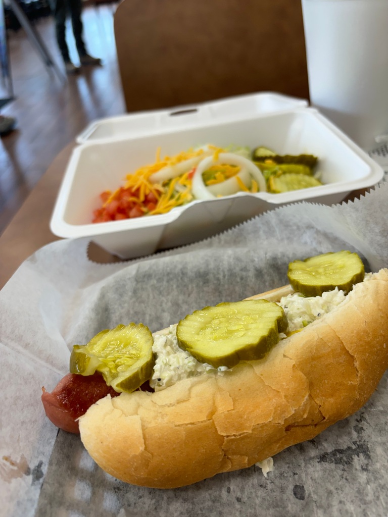
After lunch in Whytheville I knew I was done for the day. I ate hot dogs in an eatery in the first floor of an historic building; Woodrow Wilson’s wife was born on the second floor.

The last two days have been a constant struggle on even the shortest climbs. I am not having fun.

I checked out the possibility of renting a car and going home. The understaffed rental agency in town had nothing available so I rode across town and up yet another monster hill to a hotel.

I checked in and took a nap.

Tomorrow I’ll decide whether I’ll continue. The incessant climbing has worn my ass out.

Miles today: 29 (felt like 129)

Tour miles: 609.5

Update: The nap did me good. After dinner, I read a bunch of online journals about the part of the TransAm I’ve been riding. Nearly all say the hills are much steeper than the elevation profile on my maps indicate. I probably climbed 4,000 feet the last couple of days in short bursts.

They all agree that the big climb tomorrow isn’t nearly as bad as they thought.

I’m thinking of ditching a spare water bottle that I haven’t touched in 300 miles.

The Mo Mo Tour: Day 11 – Christiansburg to Draper

I slept poorly last night until I realized the AC wasn’t turned on. I awoke shivering at 7:30 a.m.

The first order of business was to lay waste to the hotel breakfast bar. Mission accomplished.

I left late because my hosts for the night, 30 mikes away, won’t be available until 4 p.m. I stopped at a hardware store to pick up some Velcro strips. I’ll use them to attach my air horn and mace canister to me or my bike. I am preparing for the dogs of eastern Kentucky.

As for the dogs of Virginia, they seem to be on vacation.

The topography of this area is a series of ridge lines running southwest to northeast. I’m in between two ridges following country roads that rise up 100 or 200 feet then go down 100 to 200 feet. None of these climbs were particularly challenging but I walked two anyway because it’s really not much slower and much easier that grinding away at 3 mph.

Before Radford I saw the word SLOW painted on the road. Properly warned I zoomed down and around a steep hill.

In Radford I stopped for lunch at a hot dog place. I ordered a large Diet Pepsi. It was more ludicrous than large. The food was fine.

The drink was so big, it didn’t fit into the picture

I crossed the New River and continued south with dark clouds coming over the ridge to my left. The temperature started to drop. Winds increased. I stopped and put on my rain jacket. Small leaves started falling and swirling across the two-lane road.

I looked up and saw a 100-foot tree swaying ominously. Limbs started falling onto the road. A few football-sized rocks were dislodged from the jagged rock face to my right.

Time to get off the road. I came around a bend and saw a dozen or so big branches in the road. As luck would have it, the was a house with a covered porched to my left. I took shelter as the storm raged. In ten minutes the show was over and I was in my way.

The view from the porch. Doesn’t look too bad, but it was.

I arrived at my Warmshowers hosts an hour early. They were here and ready to greet me.

Corey and Mark were here in 2019
I’m staying with the owners of this vineyard

I started the day at 2,000 feet and ended it at 2,200.

Dinner tonight is spaghetti and meatballs.

Tomorrow’s planned destination is a church bunkhouse in Troutdale, near the Appalachian Trail. The 60-mile ride involves quite a bit of climbing to about 3,000 feet.

Mikes today: 33.5

Tour miles: 580.5

The Mo Mo Tour: Day 10 – Troutville to Christiansburg

I didn’t sleep well last night, probably because I washed down my Subway (the closest place to the hotel) meatball sandwich with a 24 ounce beer.

I did myself proud at the breakfast bar, finishing with two apples and two bananas for the road.

I rode on a local highway to get back to the route, stopping at a Kroger on the way. I picked up some Bel Vita cookies and some flatbread (I ate my tortillas back in Lexington.)

The temperature was already in the 70s so I knew I was in for a warm day.

Back on the road I took Catawba Road west towards Gravelly Ridge. After ten miles I stopped to eat an apple and banana. The two-lane country road was busy with dump trucks. I heard a massive explosion in the distance. Soon I passed Roanoke Cement, the mining company that blows up mountains and processes the rocks (and coal, apparently).

After the mine, I encountered sawtooth terrain, one short, steep hill after another. Combined with the increasing heat, these hills were beating up my legs and my mental state. I pushed The Mule over the top of three of them, all the while thinking how will I ever do the truly big climbs head?

The road surface wasn’t helping. An especially bad part was the descent to a creek bridge full of huge potholes.

I crossed into Montgomery County and the road leveled out. Even better I hit a five-mile section of new asphalt. I stopped for a quick snack before attacking the last third of the day’s miles.

The skies behind me were darkening as a scary looking cloud formation, flat and dark, came over the ridge to my left.

I started to look for shelter as I rode. That porch looks okay. That barn will work. But I kept pedaling, now with slightly cooler temperatures and a strong tailwind. My body and mind were feeling much better.

I knew from the elevation profile in my maps that the ride climbs 500 feet in only a few miles just before the finish. I stopped in the town of Ellett to fortify myself with Gatorade and ice cream at a CSCS.

About two miles later the climb began. I’d ride until my heart and respiratory rates were maxing out. After a few minutes, I’d get back to work. The third time I did this I was weak in the legs, making restarting dangerous; I could wobble in front of a car or into the ditch next to the road.

I pushed The Mule up around a bend and there was the top at last. As it turns out, Christiansburg is at 2,000 feet of elevation.

Once into Christiansburg, I rode to nearby I-81 where my hotel is located. The front desk clerk informed me that it was 89 degrees outside.

As I’m writing this a classic summer thunderstorm erupted outside.

Tomorrow is a short mileage day to a highly recommended Warmshowers host in Draper. They won’t be ready for me until 4 p.m. so I planning on sleeping in.

Miles today: 49.5

Tour miles: 547

The road from Troutville
Best sign of the day
After the sawtooth section I saw this. I’m saved!!! Alas, it was closed
I’m in the South, y’all

The Mo Mo Tour: Day 9 – Lexington to Troutville

My Warmshowers stay was excellent. Not only did I do laundry and take a nap, but I had a fabulous dinner and breakfast cooked by Dirk and Chrissie my hosts.

I hit the road around 8:30. The first couple of miles contained an unexpected set of rollers into Lexington. I rode through the campuses of the Virginia Military Institute and Washington and Lee University.

After that the route turned into back country roads. There were streams and forests and deer and cows and calves and goats and sheep and a bunny. There were landed estates way off the road fronted by massive lawns and a row of hillbilly shacks that seemed impossible to live in (but of course they were). Most of the homes fell in between these extremes.

Off to my right were the Short Hills, a rather imposing ridge line. The route skirted them all day. I spent probably more than half the day along a stream, a rail line, I-81, or US 11, all of which run along the southern Shenandoah Valley.

Whenever the route left these features, I found myself grinding up a short, steep hill.

At 20 miles, near Natural Bridge, I stopped for a snack at a GSCS (Gas Station Convenience Store): a pint of Arnold Palmer, a bag of Cool Ranch Doritos, and a CPB ( cherry pie in a box).

I checked to see if the hostel had responded to my request for lodging. Not getting one (until just now at 6 p.m.) I booked a room in the Comfort Inn in Troutville.

My legs were pretty tired after the climbing of the last two days. The food brought them back to life for a while.

In the town of Buchanan, 33 miles into the day, I had lunch in a bar. (The town’s other two eateries are closed on Mondayso.) The bartender/cook went about her business with a cig in her lips. I only eat at the finest establishments.

I ate a fried bologna sandwich with a side of fries, washed down with nearly a half gallon of iced tea and water.

At this point, temperatures had risen into the mid-80s. The AC in the bar did as much for me as the food.

Back on the road I headed for Troutville. I came to a barrier across the road. Eastbound Greg had warned me at the Cookie Lady’s house that there was a road closure. When he encountered it, there was no warning so he convinced the road crew that they should let him pass. I wasn’t going to take a chance when I could see on Google Maps an alternate route.

Blue Mountain Road had three steep climbs. When I hit to the third one I stopped midway up to catch my breath. Two golden retrievers behind a fence came over to urge me to move on. They were harmless so we had a chat. Woof. Sit. Woof. Go home. Woof. Later.

I was 100 feet from the top so I decided to push my bike up, probably saving my knees in the process. I turned onto Lee Highway, US 11, and headed south.

There wasn’t much of a shoulder but there was even less traffic. After a few miles I reconnected with the route only to hit a steep hill just outside of Troutville. Again I rode most of the way and walked the rest. No hurries.

The ride into Troutville was a twisty 30 mph whee!

My hotel was a mile off route on Lee Highway. I checked in just before 3 and called it a day.

My wife texted me. I’ve been called for jury duty in mid-July. I figure I can finish this tour as planned by June 30, but jury duty would kill extending the tour. That may not be a bad thing. In any case I can reschedule.

For those of you wondering what the climbs I’ve been doing look like take a look at this elevation profile. The horizontal lines are increments of 1,000 feet.

The last two days were that big bump in the middle

Miles today: 50

Tour miles: 497.5

I think that’s Short Hills in the distance.
Just south of Lexington

The Mo Mo Tour: Day 8 – Afton to Lexington

We had a fun group at the Cookie Lady’s house last night. Phil, Masha, and 4-year-old Brooke arrived in the late afternoon. Daddy Phil is pulling Brooke in her trailer. Momma Masha is carrying a huge load of gear too. They were quite fun people. Australian Phil has great taste in music; he’s a Neil Finn fan.

I slept poorly but the price was right. Greg left for the east at sun up. I headed west at 7:15.

The first two miles were straight up Afton Mountain Mountain to Rockfish Gap where Skyline Drive meets the Blue Ridge Parkway.

I stopped to take a picture of The Mule at the sign pointing south for the BRP and north for Slyline.

After a mile of climbing I was tired and went to post the picture. I deleted it instead. Derp.

There were plenty of sights to photograph though. This section of the BRP had two big climbs: one to 3,000 feet another to 3,200 feet. I felt like I was out west climbing in the Rockies without the thin air. In between the two high points I descended to 2,600 feet.

Anyway I rode 27 miles on the BRP before descending on a steep and windy mountain road to Vesuvius. The road looked incredibly like the road over Deepwater Mountain between my in-laws childhood homes in West Virginia.

It was raining during the climb to 3,200 feet and the descent to Vesuvius so I put on my jacket. The cool air and raindrops were welcome relief from the hard work going up and the hot braking surfaces going down.

I did stop twice on the descent to let my rims cool down. The first time I’m sure I was close to a heat-induced blowout. These v-brakes are infinitely better than the cantilever brakes I used to have on The Mule.

The road from Vesuvius to Lexington was mostly flat but for a hill near the start and a couple of tough climbs near the end.

I’m at a Warmshowers house just east of Lexington. Dirk and Crissy have a chill golden retriever named Roxy.

Tomorrow I’m shooting for a hostel in the Appalachian Trail in Troutville.

Not half bad
Big rocks
Elev 3,000
Midway along the Parkway
Over 3,200 feet. It sure felt like it.

Miles today: 49

Tour miles: 447

The Mo Mo Tour: Day 7 – Charlottesville to Afton

Another perfect day on the road. Temps in the 60s, low humidity, sunny skies.

After laying waste to the hotel breakfast, I headed into downtown Charlottesville and re-joined the TransAm.

The route went west toward the Blue Ridge on picture postcard country roads. There were plenty of climbs as the route toyed with the eastern side of the ridge.

I was warned that there is no food at today’s destination in Afton, so I stocked up at a country store in White Hall. At noon I diverted to Crozet where i had a burger and fries. The large fries could have fed four people. I surrendered half way through the pile.

More hills and a rather dramatic uphill switchback came next. After I crossed I-64 the ride up the ridge began. It was tough. I had to stop twice to get my heart rate under control. The second time I was on a steep section so I pushed my bike 100 yards to a flat spot. A half mile later I was at the Cookie Lady’s house in Afton.

June Curry saw some bike tourists slogging Afton Mountain Road past her house on a hot summer day in 1976 and offered them water. Day after day the Bikecentennial riders came by. Eventually she caught on and started giving out cookies. She died about 12 years ago but her house is now a bike hostel of sorts. Actually it’s more like a shrine to the TransAm.

I’m here with Greg Parker, an eastbound TransAm rider. He hooked me up with a Warmshowers host for tomorrow and warned me of the vicious dogs in Eastern Kentucky.

A family of three is just arriving to fill out the rest of the rooms tonight.

The house is directly across the road from the Blue Ridge Tunnel, so I went for a three-mile hike to check it out. It’s not particularly bike friendly but it’s so cool inside that it feels like a shower on a hot day.

Tomorrow I climb up to the Blue Ridge Parkway. It’s sure to be challenging but I get a legendary descent on the far side.

Miles today: 31.5

Tour miles: 398.5

It may be hilly but it sure is beautiful
The Blue Ridge in the distance
Inside the Cookie Lady’s house
Eastern end of the Blue Ridge Tunnel