My daughter is a big fan of John Green, an author of young adult novels. He lives in Indianapolis where she went to college. Green’s most well known book is The Fault in Our Stars which was made into a pretty good movie a few years ago.
My daughter liked his books so much that I started reading them. One of his books is Paper Towns, which introduced me to the mapmaker’s concept of a paper town. A mapmaker will put a nonexistent town on his map as a marker for copywrite infringement. It makes the case against a plagiarist easy to prove. I often see this same thing in print when an obvious stray word or misspelling is used. Perhaps this is done so that scanning software used in academia can detect a cheater.
Tonight I was goofing around with Google Maps when I stumbled upon a paper restaurant. The restaurant is The Abyss and it is located outdoors behind our local elementary school. Using street view one can clearly tell that the restaurant is located where some swing sets are.
The Google Map entry even includes several customer reviews. Many of the reviewers’ names are comical (Dippy, Alden’s Got a Dumpy, for two). All but one of the reviews are 5 stars.
As you can see from the screenshot, the “restaurant” is between the school and some tennis courts. The entire surrounding area is suburban neighborhood.
Maybe someday I’ll ride over and have a paper meal.
Lord knows as someone who had ridden the 50 States Ride 13 times, I love a good gimmick. Me and my 650 states can’t hold a candle to the accomplishment of Lynn Salvo.
I first heard about Lynn from a blog reader during one of my tours. She was riding her bike across Canada. It had something to do with a peace sign.
Lynn who is six years older than me rode the Southern Tier route from San Diego to Saint Augustine in 2015. It was her first big tour. She was, by my math, 66 years old. A couple of years later she came up with a crazy idea. Why not trace out a peace sign with her bike tours. Across Canada and up and down both coasts would be the circle, with a dove’s foot down the center of the US from Canada to Wichita and then on to intersect her Southern Tier route to the south, southeast, and southwest.
The peace sign project is a labor of love. Lynn’s older brother John died when his plane crashed in Laos during the Vietnam War.
Reading about the recently completed, last leg of her peace sign down the west coast of the US blew me away. She’s 72 years old and that route sounded HARD. So many hills. So much wind. She even rode her bike on the bridge between Washington State and Astoria Oregon. When I reached Astoria in 2018, I took one look at that sucker and said “No way!” Aside from the fact that it’s a brutal climb, it’s a two-lane highway with no shoulder and the cross winds are insane.
And then there was that mountainous wildfire detour she had to take along the coast of central California. Eek.
14,500 miles over six years.
Dang.
I lifted this map from her blog. I’m pretty sure she won’t mind.
If you can get past the firewall, here is a Washington Post story about her.
My rides around the DC area involve passing three golf courses. As any duffer will tell you, balls that are abandoned in the weeds beyond the course are fair game. Finders keepers and all that. I have made a habit of picking up golf balls when I spot them on the side of the road. When I get back home, I toss the balls into a cloth bag and forget about them,
Yesterday I rode on Fort Hunt Road for the first time in a few weeks. The road surface has been milled for repaving. This makes for bad riding (especially if you manage to hit an exposed manhole cover). Not having ridden by Belle Haven Country Club, there was an unusual bounty of balls along the road. I passed on the first one I saw because it was in an intersection. Then I saw another, and another, and another….eleven in all. I felt like turning towards the golf course on the opposite side of the road and yelling, “Hold your fire!!!”
The eleven was a sort of personal record for a single ride. I normally find multiple balls in the spring when the ground is hard and the golfers are rusty. Yesterday’s haul may be evidence that the pandemic has caused a secondary pandemic of lousy golfers.
In any case, I decided to empty the bag and see how many balls I have found this year.
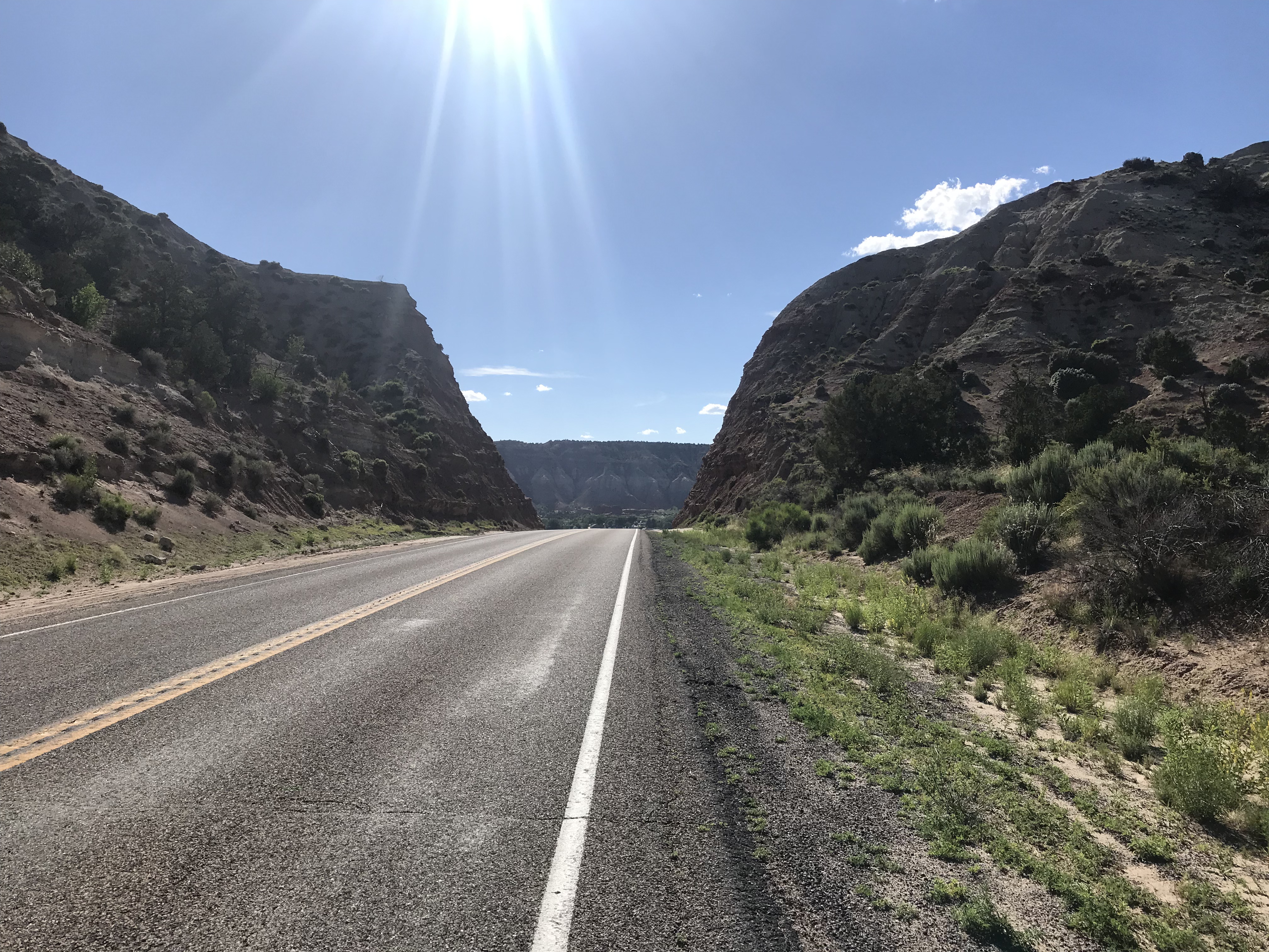
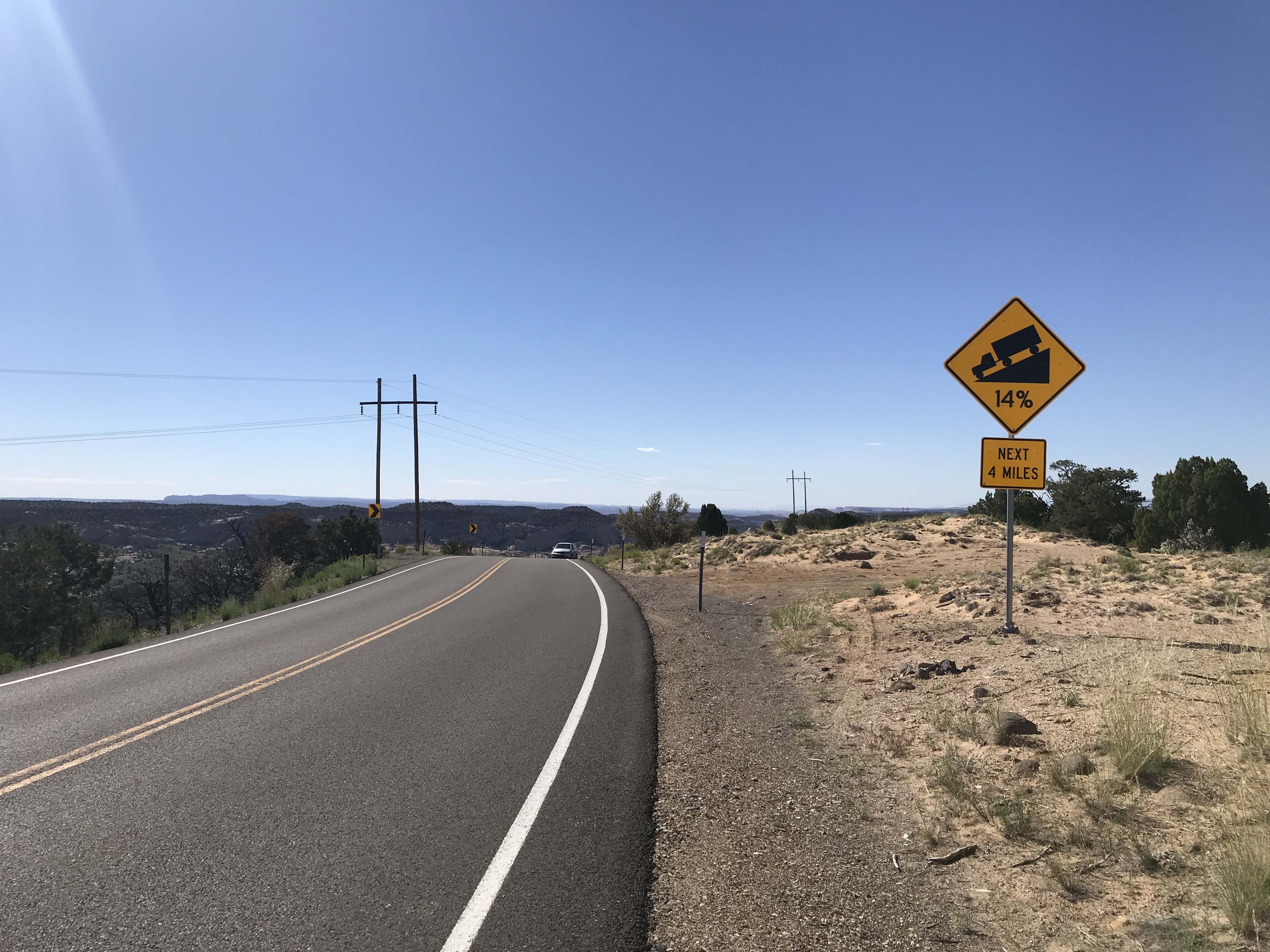
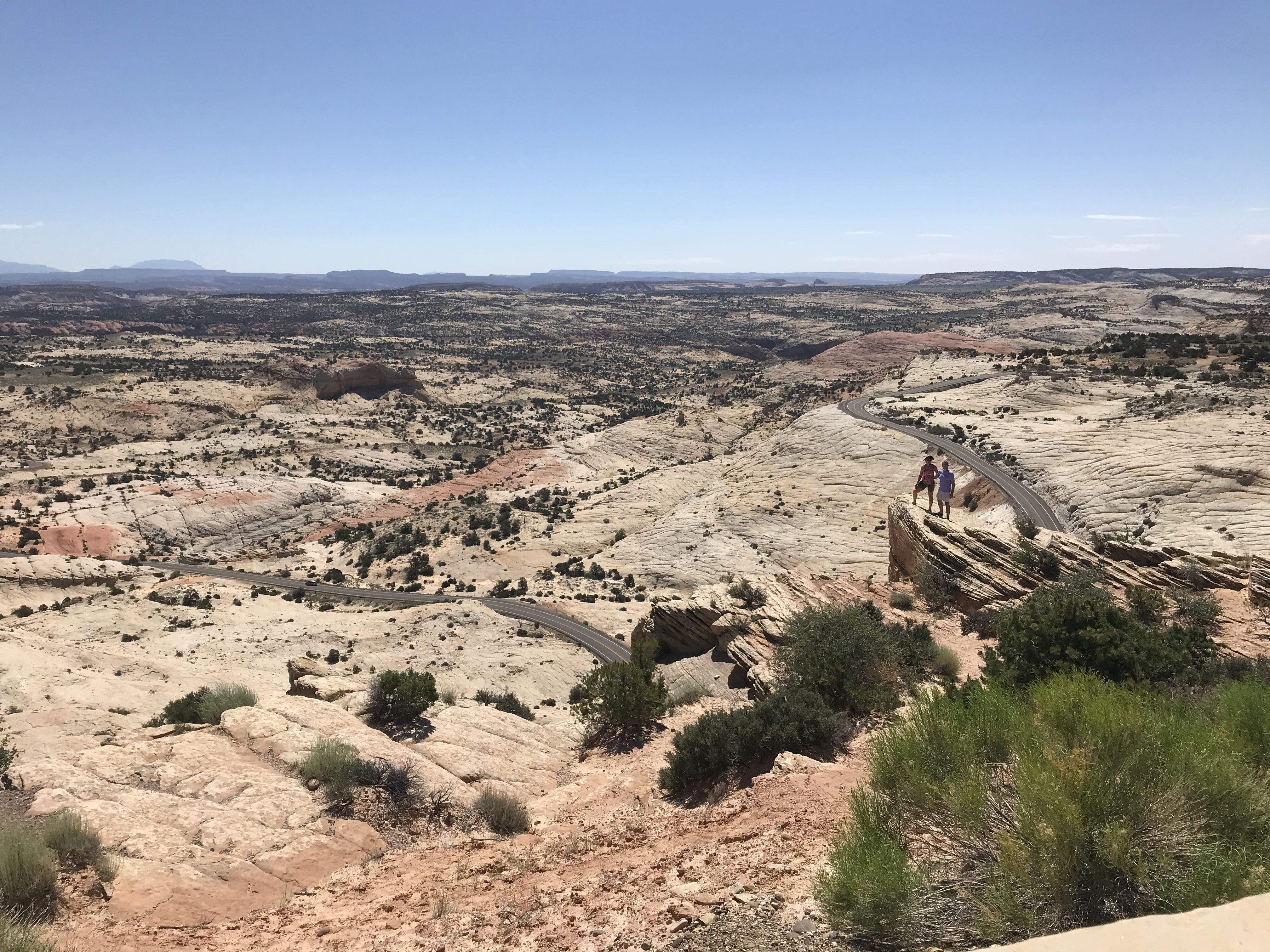
My 2019 tour took me through some breathtaking scenery in central Utah. One of the highlights was a hair raising ride through Grand Staircase – Escalante National Monument. The day before I had ridden just south of Bears Ears National Monument. The pictures I took don’t begin to do this area of Utah justice, of course. It is beautiful but harsh terrain.
I took a break in Grand Staircase at a highway overlook. I was standing at a railing taking in the sights when a van pulled up behind me. A little old lady (I’d guess she was 80, at least) carefully stepped out of the van. She looked out at the landscape with an expression of awe on her face. “This is so beautiful!” she said to me.
She was wearing a MAGA cap. She had no idea her beloved president had recently downsized the two monuments to 228,000 acres from it’s previous size of 3 million acres.
National Monuments can be created by executive order. And executive orders are modified at the will of the president in power. Thus, the size of these monuments was reduced. Today, the White House announced that the two monuments would be restored to more than 3 million acres. I don’t know if the MAGA lady is still alive, but I wonder if she has the slightest idea that any of this happened.
As for me, I am thrilled. This area of the country has a surreal beauty that just blew me away. To think that it would be open to development and artifact hunters was really depressing. We owe the preservation of these lands to our descendants.
Another month of aimlessly riding in circles is in the books. Early September brought the usual extension of summertime, but the month ended with day after day of absolutely perfect weather. It was my highest mileage month of the year, clocking in at 1,051 miles. The newly refurbished Big Nellie carried me 598.5 miles. The balance of riding, but for one mile on Little Nellie, was on The Mule.
It took me a while to regain my confidence on Big Nellie. This is normal considering the fork broke off back in June, landing me in a heap along the Mount Vernon Trail. After a while I started feeling like I was part of the bike. I even rode it to a Nats game, to Friday Coffee Club, and on some explorations all across DC. (I am extra careful riding Big Nellie in traffic. Drivers and other bicyclists don’t expect to see me when I am so low to the ground. Oddly, the opposite is true in the country; drivers stare at the weird bike and tend to steer at me. Mirrors are life savers. Caveat Bentor.)
One highlight of the month was my 13th 50 States Ride. As with my two 80-ish-mile rides on the Eastern Shore of Maryland, I did this one on The Mule. The Mule does hills better than Big Nellie. And I wasn’t really keen about driving across the Bay Bridge and its crosswinds with a huge recumbent tailfin on the car. (I needn’t have worried. I once drove back from Indiana with Big Nellie hanging off the back of my Accord.)
Another highlight of the month was the return of Friday Coffee Club at Swings House of Caffeine on G Street NW. I have to work on the getting-out-of-bed aspect though. I am no longer accustomed to waking before dawn.
I did attend three Nats games, the last one with my daughter. I’d like to say these were major league baseball games but the Nats are pretty much a AAA club with a couple of ringers (Soto and Bell). If they had a bullpen, they’d be on the verge of mediocrity. There are three more games against the Red Sox. Despite the fact that I lived in Red Sox Country for 11 years, I am not planning on going to the games.
For the year, I have ridden 7,748 miles, on pace for over 10,300 miles.
Oh, and one last thing, I had a Covid vaccine booster shot a couple of days ago. Other than a sore arm for a day, I haven’t had any side effects.
The first ride, called the Historic County Loop actually covers much of the ground of the shortest ride. Still I managed to make a wrong turn or two and stretch an 81-mile ride into 86 miles. It’s a talent.
To be honest the maps and cue sheets are old so it’s not surprising that I got lost. That’s my story and I’m sticking to it. I mean your talking about somebody who did the 50-States Ride in DC 11 times and still missed the first turn on his 12th ride.
The roads in Cecil and Kent Counties are in good shape. Higher speed roads have very wide paved shoulders. There’s a bit of truck traffic probably because these routes are close to US 301, a major divided highway running north and south. Most of the roads I was on are marked as bicycle routes so local drivers are used to seeing bikes on the road.
The Historic County Loop travels through miles of farmland and diverts now and then to the Chesapeake Bay. To be honest, I’ve seen better bay views in a dozen other places. The farms appear to my city-dweller eyes to be corn and soybeans. If you spun a Hoosier around they would swear they are right back home in Indiana. If memory serves, Indiana farms are much bigger, but these farms will do nicely for visual purposes.
I did the second ride, called the Pump House Primer, a couple of days ago. This one is a bit more interesting. Once again I encountered corn and soy but over the line in Cecil County the terrain became more rolling and the farms were a bit more diverse. One farm had a stand of hops (they grow on wooden poles). Another had some sheep. The most interesting farms were stud farms for breeding thoroughbred horses. These farms look very much like those in central Kentucky. Unfortunately, I couldn’t manage a decent picture of the horses. They are beautiful beasts.
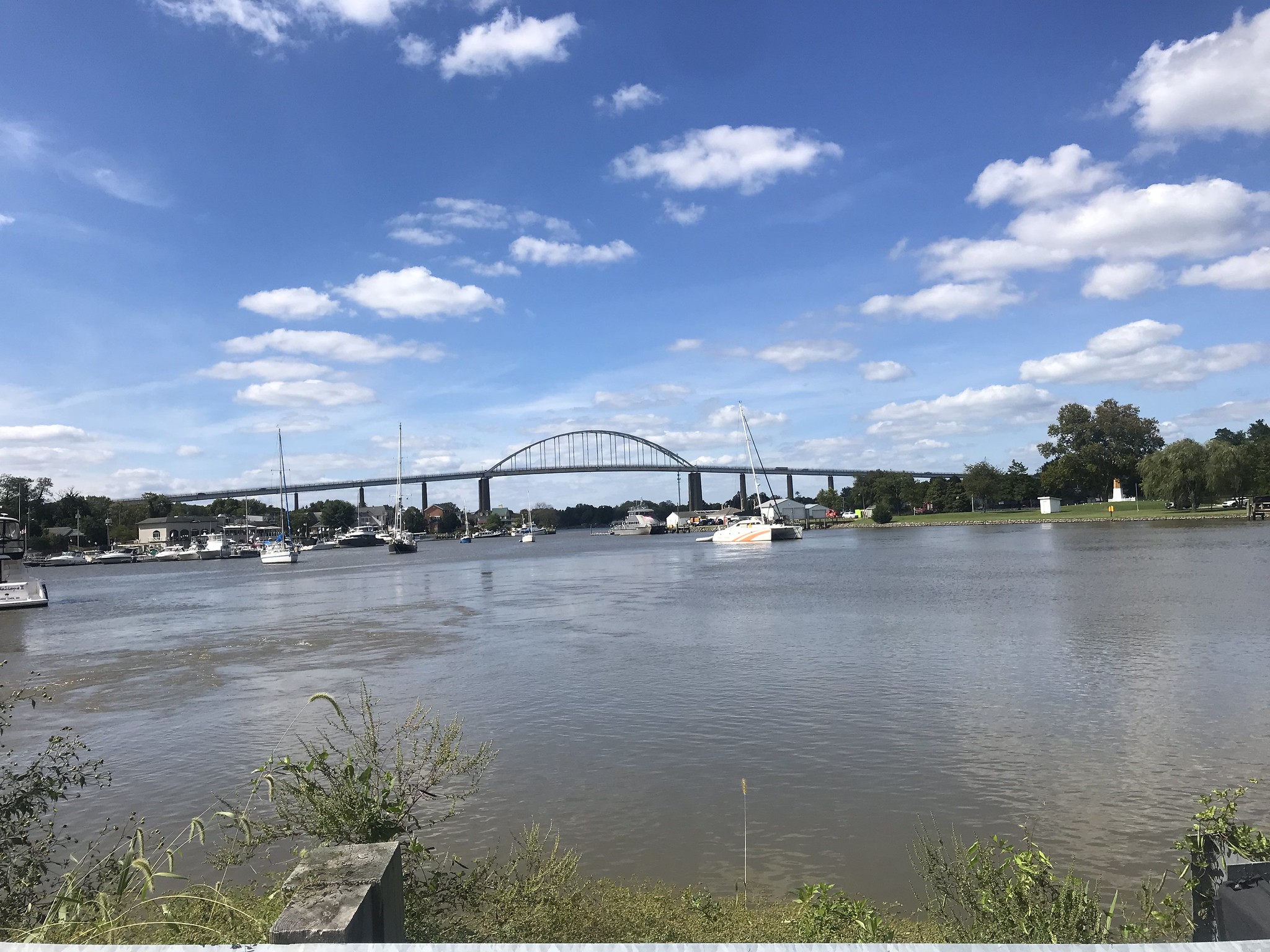
One highlight of the route is the descent to a drawbridge over the Sassafras River. The bridge connects Georgetown in Kent County with Fredericktown in Cecil County. The drawbridge has a metal grate for a surface so rider beware, especially when it rains.
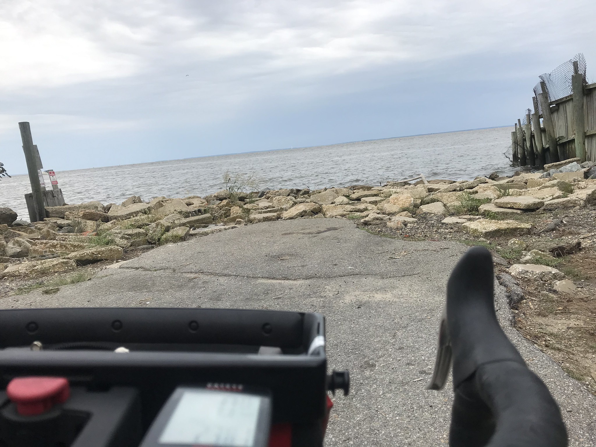
The northern most point of the ride is at Chesapeake City on the Chesapeake and Delaware Canal, which connects the Chesapeake Bay in the west to the Delaware River to the east. Years ago I rode on the Canal trail which is worth doing if you’re in the area and aren’t already mashing out 80 miles on the roads.
The ride back from Chesapeake City makes a small loop. The route then starts another small loop, or so the cue sheet and map say. Alas, one of the roads on this loop is closed. I checked it out and found a barrier across the road and woods beyond. From the age of the trees and underbrush, I suspect this route map is more than a decade old.
Using my phone, I improvised a course correction and managed to screw that up. I back tracked and found a road on the cue sheet. Following the route, I rode 19 miles back to Chestertown, going back over the first 19 miles of the ride. I ended up riding 78 miles with a nice tailwind for the last 14 miles. As it turns out, the part of the Pump House Primer route I lopped off was on the Historic County Loop route so I actually didn’t miss a thing.
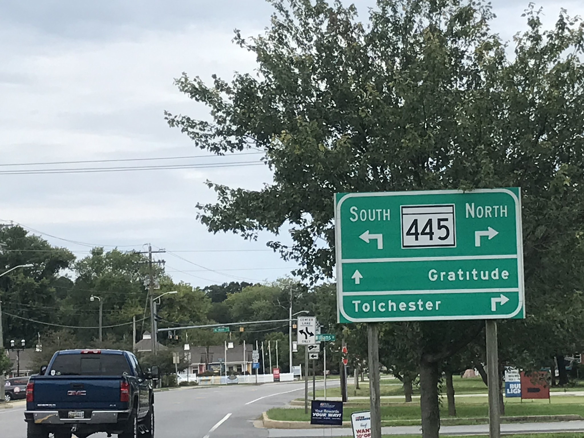
Grateful for Rock HallYour Basic Soybean FieldWeird How the Road Just Goes into the BayAnother Soy Bean FieldOne of Many Scenic Water SpotsChesapeake City BridgeRuh Roh!
I did these rides on The Mule but need to try them again on Big Nellie. Level and gently rolling terrain is what recumbent bikes are made for. All I need is a repeat of the amazing weather I had for these two rides.
If you are interested in these rides, plan to spend some time wandering around Chestertown, Chesapeake City, and Georgetown. They are small towns with buildings dating back to the 18th and 19th centuries.
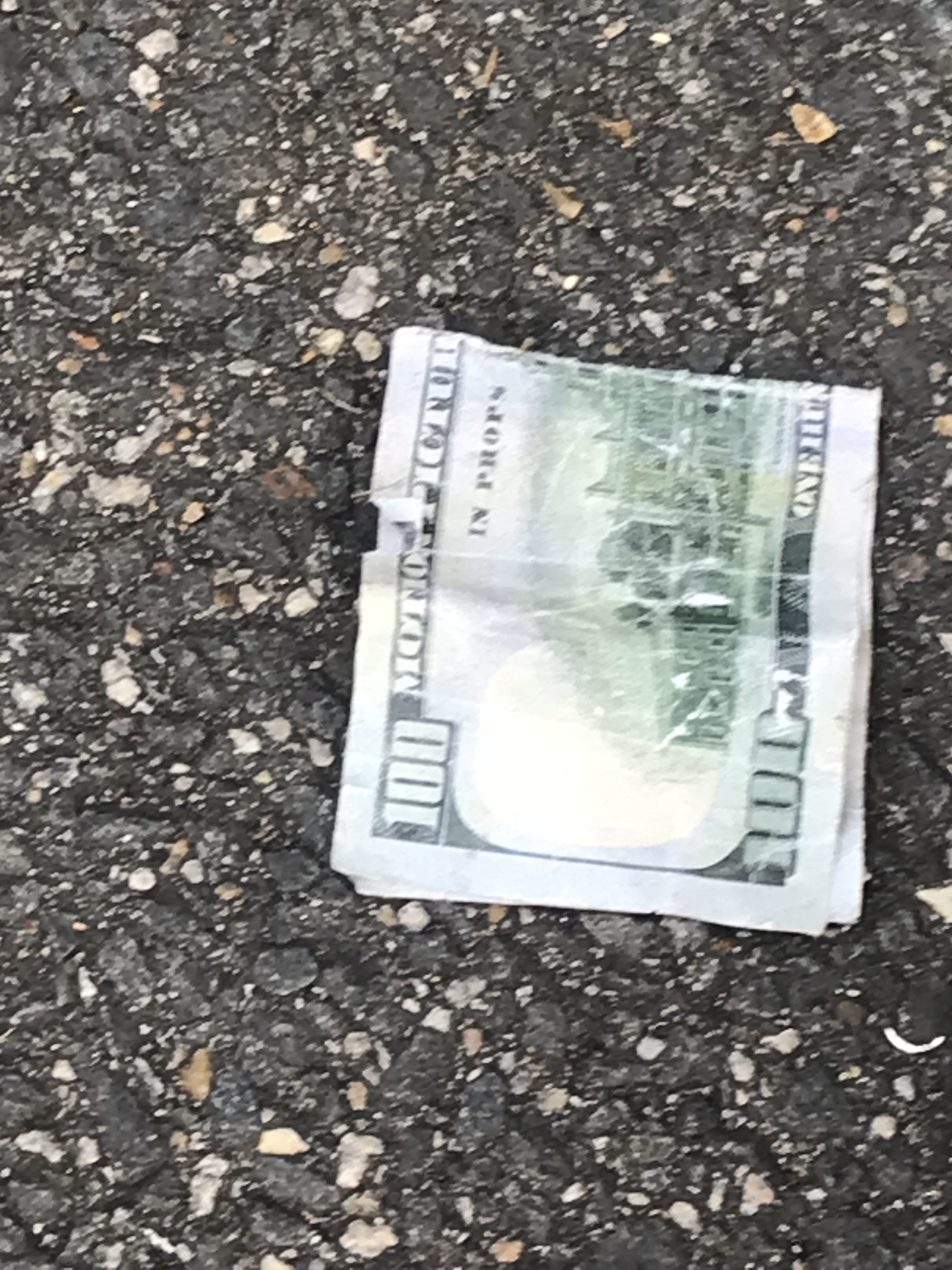
I took the bill back to the bank where the alert bank manager took one look at the bill and said, “It’s movie money.”
As you can see from the photo, it’s obvious. it clearly says “Motion Picture Purposes” in multiple places and the serial number begins with “MP”. And the motto on the back says, “In Props We Trust”.
Yesterday I took the $100 bill I found on the street to a bank. The tellers gave it a close inspection and said that it was fake. So I took it to a second bank. The teller there reached the same conclusion. From where I stand it was a pretty good fake printed on paper that seemed legit.
I asked the teller what to do with the fake bill and she said to google the U. S. Treasury Department. I already knew from a rather crazy incident in my grad school days that the Secret Service is the branch of government that deals with counterfeiting. I found the number for the nearest Secret Service office in my state and called them. They told me to turn the bill over to a bank and have the bank call them.
It’s a bit troubling that the person I talked at the Secret Service didn’t seem overly alarmed by the fact that I had found a counterfeit $100 bill. And there was no urgency to her instruction to take it to a bank. It’s also a bit troubling that neither bank knew that they were suppose to confiscate the bill and send it to the Secret Service.
I’m going to the bank tomorrow to turn over the bill. We’ll see what happens. There’s still the remote chance that it is a legitimate bill that was damaged by being out on the road.
Ever since my running days I have found things during my daily jaunts either on foot or by bike. When I was running I’d pick up a dollar or two each week in coins. My theory was that when people reached into their pocket for their car keys they’d pull out a few coins by accident. Most of my runs on the city streets in and around Providence were along parked cars so inevitably I’d scoop up some laundry money. The most I ever found back in my running days was a $5 bill. For a starving grad student this was a big windfall.
DC may not be such a great place to run (way too hot and humid) but it’s fantastic for roadside treasure. My most frequent finds are golf balls. This is especially true in early spring when the ground is hard and the golfers are rusty. Errant shots hit the hard ground and bounce clear off the golf courses. I have found as many as a dozen balls in a single 30-mile ride. I have a bag in my shed with over four dozen balls in it and that’s after giving away a few dozen over the last two years.
Every so often I find something else of use. I have a pretty nice pair of garden shears, a pair of pliers, and a phillips head screwdriver, all from bike rides.
From time to time I find cash. Not the change of my old running days but currency. Once again I figure this is the result of someone reaching into their pockets for keys or a phone and inadvertently pulling out a few bills. Six years ago I was shocked to find $140 – two $20s and a $100 bill – on the street in front of my house. It was garbage day and I suspected that one of the workers on a garbage truck dropped the money. I had no way of reuniting the money with its owner so I held on to it. Eventually I donated it at a fundraiser for the daughters of a woman named Rose who was run over and killed on Del Ray Boulevard in Alexandria.
It’s been a long time since I’ve found money lying around. This morning I went to the bank. After I was done I spotted a dime sitting on the chair I had been using in the waiting area. How strange, I thought. I don’t carry coins these days. I pocketed the dime and laughed. It’s my lucky day.
After my bank errand I went for a ride on Big Nellie. We were making our way along Fort Hunt Road heading for Alexandria city. I stopped at a red light. Big Nellie isn’t the fastest accelerating bike on the planet so we were only going about 5 miles per hour after we crossed the intersection on the green light. I noticed what looked like a dollar bill on the paved shoulder. After passing it, I hit the brakes and duck walked the bike back to the bill. It wasn’t a dollar. It was another $100 bill.
This is a test right? I mean who the heck finds a $100 bill in the road even once? Unlike the previous bills this one was pretty beat up. Maybe it had been there a while. Then, again, maybe not. After all, in a weird coincidence, today is garbage day.
What the most unusual thing you’ve found on your walks, hikes, or bike rides?
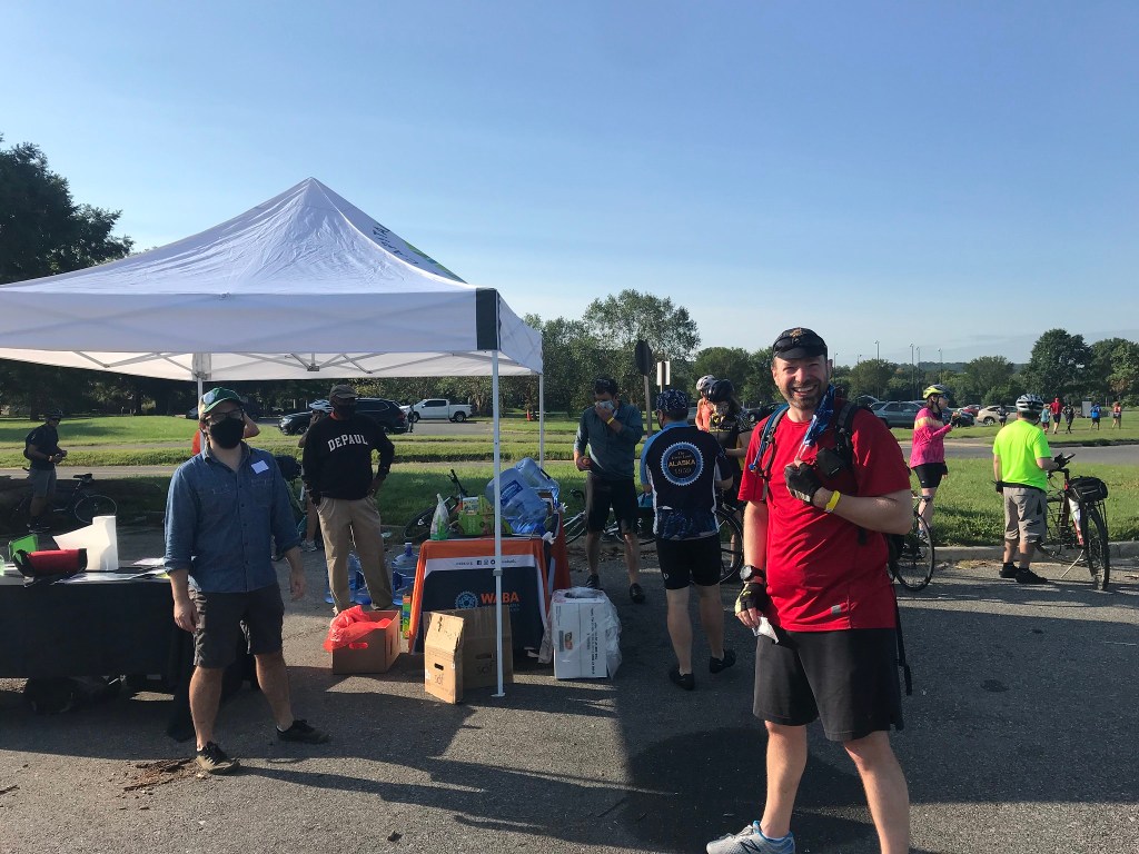
The 50 States Ride, the Washington Area Bicyclist Association’s signature event, is my (nearly) annual exercise in self abuse on a bicycle. I’ve done it all but three years since 2006. making this my 13th time. The course is about 60 miles long, weaving through all eight wards of DC so that riders pedal their steeds on the avenues named for all 50 States.
Each year the course is tweaked. This year for the first time that I know of the start of the course was moved from centrally located Adams Morgan to Yards Park in near Southeast DC, on the banks of the Anacostia River. The change moved the first 15 miles of flat terrain to the end of the ride. Yay! Oh, wait.
Starting at Yards Park meant that the first of countless hill climbs came at about one mile into the ride instead of 18 miles. Put on your big boy pants, this is gonna hurt.
And it did. Riding up Martin Luther King Boulevard in Anacostia, I was dropped by my posse – Michael B., Kevin W., Peter K., and Chris M., augmented by Shira and Steve O. piloting tandems with blind stokers. All of these riders are young whippersnappers and I knew I had no hope of keeping up.
After a brief descent from Alabama Avenue and a flat section on Mississippi Avenue we climbed right back up to an even higher point on Alabama. Dropped again. My posse humanely waited for me to catch up. Another flat-ish section was followed by a descent to Texas and another climb back up. Whose idea was this, anyway?
Kelsea (a short-lived addition to the posse) and Kevin (left); WABA’s Colin (with name tag) and Michael B. (in red)
The next 10 miles or so was relatively easy as the route descended to and over the Anacostia to the Hill East and Capitol Hill neighborhoods. Despite its name, Capitol Hill isn’t much of a hill. We rode north through NoMa and into Trinidad past my friend Dave’s ghost bike (a bicycle painted all white as a memorial to and reminder of Dave’s demise from an out-of-control driver in a stolen van).
After a brief pit stop, we began to climb again up aptly named Montana Avenue and up 18th Street Northeast. This long stretch on 18th was designed to put us on busy and traffic crazy South Dakota Avenue for the shortest distance possible. After three quick turns we were headed southwest on busy and traffic crazy Michigan Avenue. We took the lane and rode in a pack which gave us the illusion of safety.
Once past Catholic University we began another climb up bumpy Hawaii Avenue. At this point, Michael left us. He was riding a single speed bike and wisely opted to swap sanity for knee cartilage.
Next up was the Petworth neighborhood. This section was not particularly hilly but involved several turns (and a walk through a farmers market on Colorado Avenue). We headed north to the northern peak of the city. (DC is shaped like a diamond with a bit taken out of its lower left quadrant.) Here we stopped at the Takoma pit stop, home of Mike and Lisa, about whom I can’t say enough nice things. So I won’t.
(No seriously. They do this pit stop thing every year allowing totally sweaty total strangers to use their restrooms and trample their front yards. And they are Nats fans. Lisa maintains a bobblehead shrine. And they ride a tandem that has weird asynchronous pedaling. And Mike has a DC area GPS in his head and knows every street within a 50 mile radius. Also, he laughs at my jokes.)
Lisa and Mike – They’re the pits
After the pit stop we headed to Alaska. As we made the turn back toward the southwest we had our pictures taken by Patti Heck, who does this every year rain or shine. She posts the pix on her Flickr page so check them out. She even got a group picture of my posse. (And an shot of me too.)
We rode down into Rock Creek Park then back up the opposite side into Chevy Chase, home of posh single family homes. We continued working our way south to encounter a climb up Fessenden Street. Somehow I always forget about this monster. Dropped again.
Down and back up to ride Nebraska past American University. Then down a looong way to MacArthur Boulevard in the Palisades neighborhood. Now came the hard part. Up a short, steep stretch on Aspen. Then a reprieve for a mile followed by the longer, steep climb up Garfield Street. When the route started in Adams Morgan this beast came around the 55-mile mark. This year it came around 40 miles when legs were not completely spent. We managed it without much difficulty at all.
Unfortunately, about a mile after a descent from the top of Garfield came Cathedral Avenue, another tough climb my brain had blocked out. Fortunately, there was a water stop at the top of the hill. Unfortunately it was out of water. No worries; all of us had plenty of water to spare on our bikes.
The remainder of the ride took us back across Rock Creek Park to the start of the old route. From there we weaved our way down to downtown on flat streets. During this part someone on a bike yelled out to us. I had no idea who it was but one of my posse recognized the voice. It was Ursula who works for WABA. When we reached the final pit stop at City Center, she re-appeared. She was riding a shorter route with her parents. We chatted a bunch then the posse headed out for the finish. Down to Penn Quarter, over to Union Station, around the Capitol, through Southwest, past the Tidal Basin. We did a 3 1/2 mile loop to Hains Point in East Potomac Park. I had been feeling dead at that last pit stop but adrenaline kicked in and the wind-assisted ride back from the point felt like I was sailing.
The last bit of the ride took us past The Wharf and around Fort McNair. We then did a close pass of the northern end of the brand new Frederick Douglas Bridge, being careful to navigate a construction zone and beaucoup bridge traffic. After a half lap around Nationals Park we arrived at the finish. Knackered and chuffed, we joined the after party where we picked up our t-shirts and shared a victory beer and a slice of pizza.
The things this idiot will do for a t-shirt
As an added bit of pleasantness we were greeted by Jesse, a member of my 2018 50-States posse, and her friend Mike (the two of them housed me at the end of my 2019 tour in San Francisco) and Kitty, a friend who has been living in Brazil for the last few years.
As always, big thanks to all the volunteers (including my friends Monica and Josephine) and to the WABA folks, especially Anna McCormally WABA’s events coordinator, for making this ride a success once again.