Come On Baby, Drive South

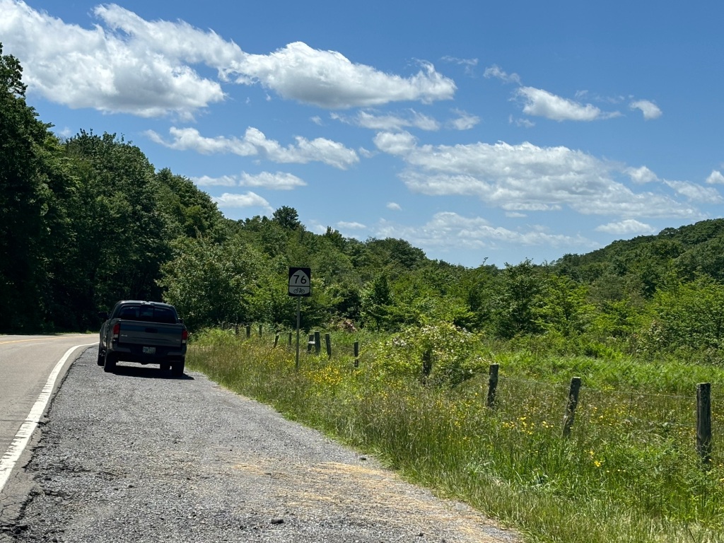
My training taper is done. I did 53 miles on Monday then 20, 30, 28, and 30. The last 30 miler was today. I slept not a wink last night and wondered if I was a little insane for riding to Friday Coffee Club. It was unbelievably 70+ degrees when I stepped outside to start the ride. There were a couple of minutes of light rain about halfway to DC but otherwise the conditions could not have been better.

The ride home featured a mild tailwind which was just what my groggy head needed. I had a shower and a snack then hit the sofa for a much needed two-hour snooze. (Tonight I am taking Gabapentin to make sure I am rested tomorrow.)

We were instructed to bring only two bags for the organizers to transport. I was also told that I could not leave my pannier on my bike for the shuttle on Monday from Jackson to Natchez. There was no way I could pack the pannier in either of my two bags. Then I got an idea…

After some of my tours, I shipped my bike home using a bike shop at my destination and Bike Flights, a shipping service. My gear had to either get checked at the airport or go on a train. The easiest way to do this and minimize baggage charges was to buy a cheap duffle bag at the destination city and put all my on-bike stuff in it.

When I started packing for this trip, I could only find one duffle bag. I am certain that I have at least four, one from each tour to the west coast and another from my trip to Key West. After some groping around in a closet, I found another duffle. In about ten minutes I had re-organized my luggage. Duffel number one contains my off-bike gear. Duffel number two contains camping gear and my pannier. When we get to Natchez, I will put my rain gear, a third bottle (insulated), and a few small items in the pannier. There are three nights when we stay indoors, so I won’t need to open the camping duffel which will simplify things. I have a third small duffel that contains clothing for the trip home. It will stay in my car.

The Day One shuttle from Jackson to Natchez involves putting our bikes on the roof of the van and putting our luggage in a trailer. The other day, one of the trip leaders said we should bring a small backpack for this two-hour drive and for riding around Natchez. Um, what happened to the two-bag rule? Yeah, well..

I am not bringing a back pack. My handlebar bag, cane, water bottle and helmet won’t fit so I’ll likely use a tall kitchen garbage bag instead.

After re-jiggering my baggage, I put everything but my off-bike bag in the car and attached the trunk rack. In the morning I’ll put my small toiletry and medicine bags in the remaining duffel, drop the Mule on the rack, and take off for points south. The drive will take 15 hours so I am planning on staying in Chattanooga (9 hours away) or Birmingham, 11 hours away. I gain an hour on the way so I can easily make Jackson on Sunday in time for check in.

As for weather conditions for the ride, it looks like we are in luck. There is likely to be some flooding of the Mississippi when we get to Natchez but the tour heads northeast, away from the river. Prevailing winds will be out of the south for five of the seven days including the two hardest days at the end of the ride. No rain is forecast for the entire week. We will deal with cold temperatures (40s) on our first couple of days of riding, after that temperatures will rise from mid-50s to mid-80s. That’s about as good as it gets!

13 hours to lift off….

I Really Need to Get It in Gear

I’m about a month away from the start of the Natchez Trace tour. By now I had hoped to have done a 50 mile ride in preparation. Then I caught my wife’s cold. Let’s just say it has not been a productive week on the wheel. Despite feeling lousy, I managed to do six 30-mile rides. One day when my cold was at it’s peak, I managed an hour and a half on Big Nellie in the basement.

To assuage my feelings of anxiety, I have been dealing with a number of annoying odd jobs, which someone on the interwebs called problitos. These are the things that you know you ought to do but the day never comes to actually do them. In the last month or so I’ve placed magnets on the doors of some kitchen cabinets to hold them closed (with only modest success), re-attached a piece of wood trim that fell off the top on one of the cabinets, tracked down and installed some florescent bulbs for a couple of under cabinet lights, turned on the water to the outside of the house, did 10 days of laundry (the result of waiting for a plumber to deal with a clogged drain), did our taxes, and found a yard service for the summer. I also downloaded the maps for the tour.

All that’s left is to go shopping for stuff for the tour. I need just a few items: a mess kit for eating in camp, a power pack for charging my phone and lights, a bigger camp pillow, and a handlebar mount for my cell phone. I was going to buy most of this today but REI is having a sale in a week so I decided to wait. I could order this stuff online but REI and Dick’s Sporting Goods (where I’ll get the mess kit) are about 15 miles away. Perfect for a rest day ride.

The last several days were cool and windy. Today, I rode 13 miles into a gale. I suppose that’s good prep for the tour but it wasn’t much fun. Until I turned around. On the way home I stopped and bought a book to tide me over until April.

I hope to ride 60-ish miles tomorrow, 70 on Tuesday, and maybe another 70 later in the week. The distances sound like a lot but as I alluded to above I ride about 30 miles a day with relative ease. The plan is to ride 30 miles. Eat lunch. Ride home.

Still, I continue to have pre-tour anxiety. My brain bounces between feeling confident in my level of experience (this will be my 14th tour) and my ridiculous mileage base (10,000 miles per year for seven straight years has to count for something) and feeling old (I’m 69 1/2) and fat (so many cookies, so little time). The daily mileages on the tour may seem daunting but I won’t be carrying half the crap that I do on my unsupported tours. That has to count for something.

I know that last two days of this year’s ride will be hilly. To get myself mentally prepared I took a look at the elevation profiles from my tours of the last two years. They look somewhat similar to this year’s tour but with one big difference: the scale. In 2023 I rode across the White and Green Mountains of New England. Admittedly the daily mileages were lower but dang were those climbs nasty! The Kancamagus Pass in New Hampshire alone was orders of magnitude harder than anything the Trace will throw at me. And I did that one in the rain.

Middlebury Gap in Vermont was nearly as bad. I did walk the last 200 yards of Middlebury Gap when I was unable to hold a straight line of travel. I think the gradient near the top was 12 percent. Oof.

I just need to keep in mind that when I’m bike touring I’ve got all day. No hurries. No worries. To paraphrase Steven Wright, everything is biking distance is you have the time.

With enough snacks, all things are possible.

Old Man on a Bicycle

Tour Prep Marches On

My preparation for the Natchez Trace tour is going okay. I can ride 30 to 35 miles without breaking a sweat. I could easily have done much more than 30 yesterday but high winds made riding unsafe. As it was, a large tree fell across the Capital Crescent Trail northwest of DC. I have had three close calls with tree falls so I’m not about to take any chances.

All but one day on the tour is longer than 30 miles so I need to up my mileage game. Fortunately, mother nature appears to be willing to cooperate. Daytime temperatures will be rising into the 70s next week. We’re saved! That, combined with the change to daylight savings time, should give me ample opportunities to go long.

Mow money, Mo’ bikes?

I’ve given myself plenty of time to ride this year; I hired a lawn service. I’ve never done this before but I had reached a decision point. My 20-year-old gas mower is all but kaput. It has a frozen blade, a broken handle height adjuster, a broken deck height adjuster, and a carburetor that clogs. Enough. A new electric mower would set me back north of $600. (Some self propelled mowers cost a stupefying $1,100.)

I honestly don’t mind mowing the lawn (except in the dog days of summer) but it turns out that the ideal weather for lawn mowing is also the ideal time for bike riding. Hmmm. Another consideration is the fact that when I’m away on my tours, my wife gets to do this chore which I am sure she doesn’t like. DIY lawn care also adds to the stress of family travel. If the lawn doesn’t get mowed before we leave, we come back to grass out the wazoo. Then there is the Rootchopper lawn quality pledge: do only the bare minimum. We haven’t aerated the lawn in 20 years and the ground is hard as a rock. Not surprisingly we have a pretty impressive weed farm.

Since I ride around the Mount Vernon/Fort Hunt area several times a week, I know which lawn services do a good job. I ruled out the services that work on high end properties figuring they’d be too expensive. I obtained three estimates, eliminated one right away based on a contract that was unclear, and did a cost comparison. I also checked Washington Consumer Checkbook, a sort of local Consumer Reports publication that gives user-provided reviews. Both companies had comparable feedback, all positive. So I went with the low bidder.

My wife suggested that once I get rid of the lawn mower I’ll have ample parking space for another bike. Who knew there’d be collateral benefits?

I’m beginning to like this lawn service idea more and more.

Temporary Southpaw No More

Tuesday morning was my first post-op appointment with my hand surgeon. As expected my (3) stitches were removed. They were replaced with three steri-strips, which will hold the incision together for the next week when they should fall off.

I disclosed all my symptoms to the surgeon and he said “That’s normal” over and over again. I have various pains in my hand and even my elbow but the doctor said that unless they persist they are not a big deal.

I go back to the doctor in mid-March for another status check. In the meantime, I can use my hand “as tolerated”. It was time to put the hand through its paces.

Later in the day we had our second significant snowfall of the season. Mrs. Rootchopper and I went outside after three hours of snowfall and had at it. There was about two inches of snow on the ground and more was coming down fast.

I started by using a tool to clear the snow off our cars. My right hand didn’t much like this but once I warmed up, adapted my grip, and gave most of the work to my left hand, I had no problem. Next I picked up a snow shovel and cleared the sidewalk, driveway, and other areas. No problem. My hand was a bit sore but functioned well. More snow fell overnight so I went back out before breakfast and had at it again. If anything, my hand tolerated round two of shoveling better than round one.

Second snowfall of the winter

Yesterday, I took The Tank out for a ride. This was my first time on a conventional bicycle since the surgery. I made it ten miles without discomfort. I soldiered on, moving my hand position and unweighting my right hand, for another 20 miles. At the end of the ride, my neck hurt much more than my hand. My body is a wonderland of pain. Before riding today, I rotated the handlebars a smidge toward me. That did the trick. My neck tolerated the ride just fine. My hand held up without discomfort for 18 miles. I continued on as before, for another 12.

My bigger concern during today’s ride was the scary drivers I encountered. One driver turned sharply across my line of travel. I made eye contact and yelled at him. I could see that his car showed signs of multiple fender benders.

Earlier I passed Porto Vecchio, a condominium on the Mount Vernon Trail. Today, a car blew through the red light across the trail to make a left turn across traffic heading in both directions. How the seemingly oblivious driver avoided a crash is beyond me. Not to be outdone, left-turn driver was immediately followed by a right-turn driver who blew through the red light, just as a driver who hit me at this very spot in 2019. I third car pulled up aggressively as if to blow the light. I yelled at the driver to stop as I about to cross in front of the car. WTF.

After the snow shoveling and bike riding, I iced my hand for a half hour. So far, my hand seems to be bouncing back from these efforts without problems.

Sooo,

Today, I signed up for the Adventure Cycling Association’s van-supported Natchez Trace bike tour. It’s 456 miles in seven days. I have been putting off this decision for days, thinking that I might not be in shape for some seriously long days in the saddle (the longest day is 82 miles). Thanks to the van, however, I’ll be touring, for the first time, without carrying 40 pounds of gear; I only have to carry rain gear, some basic bike tools that I carry all the time, and snacks.

My next objective is to lose some weight in the next seven weeks.

No gut. No glory.

The Mo Mo Tour: Day 18 continued – That’s a Wrap

I went to the rental car place as soon as it opened. They did not have the SUV I reserved. Instead I settled for a white Dodge Charger. I was prepared to drive to WalMart up the hill to buy a bike rack if necessary but the Charger’s back seats folded down giving me room for The Mule and all my stuff. Impressive. (Note: I did have to take off the front wheel and lower my seat.)

The drive to Berea went on a parkway west to London and north to Berea on an interstate. It took about two hours because, despite my sporty car, my brain had been dealing with 3 to 35 miles per hour for over two weeks. Big trucks were zooming past me as I puttered along.

The terrain was very mountainous until I arrived at Berea (the second “e” is long). It was like someone threw a big geological switch; the town was basically flat.

The drive gave me time to think. The original point of this tour was for me to complete the eastern third of the TransAm. I had already bypassed 20 miles of it from Hindman to Hazard. Now I had blown off roughly 110 more in the car.

Most journals I read were all dated five or more years ago They made it sound like the dog problem was no big deal but the eastbound rider I met at the Cookie Lady’s house was still stressed out about his dog experiences in Kentucky over a week later. The hostel contact in Booneville sounded downright scary. The rental agency person in Hazard had all kinds of tales about indifferent dog (and pony!) owners. Owners who don’t neuter their animals so when the puppies get big enough they turn them loose in the woods. A person in Berea told me that Booneville is near an old coal mining area. Since strip mines have taken over, these old coal mining families are screwed and bitter.

(Another thought about doing chemical warfare with loose dogs: I have ridden past a half dozen gun shops, most of which displayed signs advertising AR-15 style semi automatic weapons. Gulp. My wife’s uncle Terry lives in southern West Virginia. When you drive onto his property there is a sign that say’s “You are in range.” Terry’s a pretty funny guy but I’m not entire sure he’s joking. And he isn’t economically distressed like these Kentucky folks. (I’m pretty sure Terry doesn’t have an AR-15 but

So I get to Berea and I have a choice. Do I continue on by bike in a totally stressed out mental state? I took two Advil PMs last night and still didn’t sleep a wink. I am physically and mentally exhausted. The dog problem is supposedly no big deal west of Berea but I really, really, really do not want to deal with them anymore. It was time to call it a tour and head home.

So I investigated my options. I can fly for free on Southwest with credit card points so I checked to see where the nearest airport was on Southwest’s route system. It was Louisville, about 160 miles by bike. Not gonna happen. I called U-Haul in Berea. They only had a 15-foot truck which would have cost over $500. Nope. However, the U-Haul guy said to talk to the car rental agency in Berea. Maybe there was something we could work out.

So I went to the car rental agency and talked with Chelsea, a very intelligent and personable person. She said it was indeed possible to do a one-way rental. All she had to do was talk to someone up the corporate food chain. That person freed up her software to allow her access to interstate one-way rentals. So we closed out my rental agreement from Hazard and opened a new one. Recognizing that I had been needlessly charged for the Hazard to Berea rental, she marked down the price of my trip from Berea to home. Chelsea is the best,

So for the cost of having someone pack and ship my bike, I hit the road in a sports car, driving over 500 miles from Kentucky to home. Google Maps has a sense of humor. It routed me through central West Virginia on two-lane mountain roads for about an hour.

Now that I’ve had a day to mull it over, I can’t exactly call this a failure. After all, I did end up riding 840 miles which is more miles than my 2000, 2003, 2004, 2005, 2015, and 2016 tours.

That said, I have to admit that my last two tours have been a mental challenge for me. I love the riding parts of the tours. I won’t soon forget the fantastic ride to Damascus on this tour, for example. But I can really live without church hostels, campgrounds, Warmshowers homes, hotels, lousy GSCS food, etc. As my toddler son used to say over 25 years ago, “I want to go home. I want to sleep in my own bed.”

My advice to anyone who is planning to do the TransAm is: don’t. It’s glory days are long gone. The dog situation in Kentucky is just one example. Many of the towns in Kansas on the route are virtual ghost towns. The traffic in eastern Oregon is godawful. The legendary bike accommodations in Guffey CO are dreadful.

When the TransAm was designed in the mid-1970s, touring bikes were heavy and had ten-speeds and only rear racks. I can’t imagine how the first riders did the whole 4,000+ miles. (A friend who participated in Bikecentennial, the 1976 event for which the TransAm was established said that she was doing fine until Kentucky. Her knees were trashed when she finally left the Appalachians.

There is a new alternative to the eastern half of the TransAm. The Eastern Express goes from DC to Colorado in a more or less straight line. It was designed specifically to avoid the dogs and hills of Appalachia and the Ozarks. Or design your own route as I did in 2018.

And for a two-week tour, Yorktown to Damascus isn’t bad idea.

The Mo Mo Tour: Day 17 – Hindman to Hazard area

I neglected to mention an interaction with three old guys at a filling station. I stopped to buy a cold drink but this was an old fashioned filling station. Just car repairs and gas. The old men spoke mountain English. Fortunately I could understand most of what they said. “There’s a Faniky Dollar just up the road.”!one of them got up and fetched a cold bottle of water from his pickup and poured it into my empty bike bottle. Nice guy.

I should also mention the ten-year-old boy who helped me take my things up the stairs to the hostel.

I hung out in the hostel playing word games on my phone and trying not to think of steep hills and aggressive dogs. I skipped breakfast because mass quantities of pizza were still working their way through my tummy.

The hostel room is up some stairs from the street so it took some time to get started. I hit the road around 9:30. Two miles later I came upon this.

No bueno

A bridge was being replaced. This area of Kentucky was devastated by severe flooding in 2022. This bridge was one of the victims.

There was a steep, narrow dirt path on the other side of the equipment. At best I could get through in 15 minutes; at worst I could tumble over the side and die a quick death in the river. Now that I think about it, maybe I have that backwards.

I looked at Google maps and decided to improvise a detour. I backtracked to Hindman (just a couple of bored old dogs along the way). I headed over to Kentucky state highway 80, a four-lane road with very wide shoulders and rumble strips.

One kind of rumble strip was narrow and deep. If you hit them at speed you have to stop and pick up your filings. In Kentucky these strips are continuous, only broken when a side road intersects with the highway. That means you can’t cheat by using the travel lane then cutting through a gap in the rumble strip to safety.

The other kind of strip was quite shallow and spanned the entire paved shoulder (which was often 20-feet or more wide). I preferred the latter. It was no bumpier than the backroads.

After a long climb I came upon a detour sign that indicated I could return to my planned TransAm route. Nope. I like this four lane just fine. The only dogs I heard were caged at an animal shelter I passed.

Highway 80 – like riding out west. Note the deep rumble strip on the left.
Looks nasty but it wasn’t bad

The highway cut through the tops of mountains that came about one mile apart. The climbs were significant but not very steep. No walking today.

It’s a good thing today is another cool day because there was absolutely no shade on the highway.

After about a dozen of these hills I saw a sign for WalMart. I knew there was one across from my hotel but I wasn’t expecting it yet. Sure enough my hotel was only a quarter mile farther.

The Walmart was part of a shopping district on the top of one of the mountains. I’ve seen this in West Virginia.

There are several eateries in this flattop complex. I chose Wendy’s for lunch. A chicken wrap really hit the spot. I lingered to kill time until check in.

There’s a rental car agency next to the hotel. It has dozens of shiny cars. So tempting until I googled a return route to home. THERE’S NO WAY OUT OF HERE!!!

Tomorrow is a long, hilly one with more dogs and a possible flood-related detour.

Miles today: 22

Tour miles: 840

Final note: Today is my 36th wedding anniversary. Wife and me: 36. Trump felony conviction: 34.

The Mo Mo Tour: Day 16 – Breaks Interstate Park, Virginia to Hindman, Kentucky

This was a day that had it all. Which is not necessarily a good thing.

I slept poorly despite the lovely accommodations. I was groggy for the first ten miles. This is not a good thing because the road conditions here are bad. The shoulder of backroads often is a drainage ditch. Also, there were countless places where flooding broken off the edge of the road.

The day began with salad for breakfast because the park restaurant was closed. And because the salad would not have lasted much longer in my front left pannier.

I rolled out at 8 headed for Hindman, over 70 miles away because the small towns that used to offer shelter to bike tourists stopped doing so. No idea why.

I descended into the town of Breaks where I met a big floof of a dog at the side of the road. He seemed harmless and let out a WOOF then I started past him then he started growling. He began to chase me. In no time at all he had sunk a tooth into my right rear pannier. I was pissed! I stopped and, with the bike between us, confronted the dog. His face said,”Uh, oh.”

Then I began stalking him in a short green space along the road. He was totally freaked out. Where do I go? What do I do?

My actions caused him to completely disengage. Lesson learned.

A small hole from a big canine

I descended into Kentucky and came to the town of Elkhorn City.

There was a proper sign a mile with the Governor’s name on it later but this one sufficed.

I had decided to put my dog whistle in my mouth. A dog started trotted down a side road from a county building. I blew hard on the whistle and the dog seemed to say “fuck it“ and went back to the building. The problem with the dog whistle is that it is metal and rough on the teeth when bouncing along bumpy roads.

The country roads for most of my route passed homes, about half of which had a dog. Every so often I’d see a loose dog running toward the road. I tried my horn but discovered that it doesn’t work well when it’s not held vertically with the horn on the top of the gas cylinder. It did deter one dog, however.

Later two dogs started to give chase. The horn was peeking out and of my handlebar bag attached using Velcro. I hit the horn button three times and the dogs disengaged. Not bad.

Still the idea of waiting for a dog to be in full flight seemed like a bad strategy. So every time I saw a dog or dogs running toward the road, I stopped. This did away with panic pedaling with a dog snarling along side me. Instead the dogs chase instinct was short circuited. I still had to get past the dog but at least I now had some control over the situation. (When I watched a YouTube video describing this technique I thought the guy was insane. He has it right.) Of course, doing this slows my progress but after the dog disengages I’m much less stressed out.

One time a dog came off his porch and ran straight at me on a walkway perpendicular to the street. I stopped at the end of the walkway and told him to “Get in the porch” and he did.

Later I was chased by three small dogs. One of them was an old dachshund bitch that just wouldn’t disengage. I pulled out my mace and gave it a shot but she had pivoted in response to her owner and I only sprayed her butt.

The last dog was a somewhat muscular looking mutt. I stopped and yelled. There were kids and parents hanging out on a lawn about 50 yards from the road. They clearly didn’t give a shit about my predicament. After five minutes of my pleading with them to get their dog, they sent a ten-year-old girl to get it. The dog eluded her and kept harassing me. I appealed to the adults on the lawn but they didn’t budge. “He won’t bite you.” It took a good ten more minutes to gradually escape the situation with the help of pickups coming in both directions.

Dogs around here don’t chase motor vehicles. It’s something about the sound of a bike that sets them off.

There were five steep climbs on the route. I walked part of four of them, probably for a total of five miles. It sucked.

Backroads were pretty but the dog attacks ruined any ability to enjoy the scenery. Whenever I passed a building within sight of the road I went into scan mode.

The route did feature some fun downhills. One dog tried to give chase when I was hauling ass down one of these and the dog seemed to realize that he couldn’t catch me and stopped running.

I was on highways a couple of times. They were flat and had decent shoulders (marred, however, by rumble strips). It’s fun to cruise along at 15 to 18 mph and not have to worry about dogs.

I’m staying at another church hostel. These are big community rooms that have limited amenities. This one has a shower and a washer and dryer. There’s a take away pizza place across the street. I ate a medium all by myself. It was mediocre, a step above the Hunt Brothers variety on sale in every GSCS.

See. It’s pretty. Note the absence of dogs or an old man pushing a bike up a steep hill.

Mikes today: 71.5

Tour Miles: 818

Tomorrow I have the choice of a 60+ mile ride to a camping hostel at a church in Booneville or a semi-rest day of 20 miles to a hotel in Combs. I’ll decide when I wake up. Right now my back hurts and my hamstrings are so tight that I fall backward when I stand.

The Mo Mo Tour: Day 14 – Damascus to Elk Garden

The hostel was quite cold last night. And my knees were aching from yesterday’s hill fest. I didn’t sleep well.

At 8 I walked the block to the Damascus Diner where I ate dinner last night. I ordered “The Hogg” and I felt like one after eating it.

The Hogg

Before leaving town I stopped at a bike shop to use their floor pump. Next I headed along rolling country roads to Meadowview. It was a net gain of 100 feet of elevation over 15 miles.

The next 5.7 miles are a descent of about 500 feet to the town of Hayters (rhymes with highters) Gap.

Shortly after the town came the 3-mile, wooded climb to the eponymous gap at 3,000 feet. Fortunately, no trucks are allowed on this road so it is relatively safe despite numerous switchbacks.

Truth in Advertising

I made the first mile without much difficulty. I could tell the grade was increasing with each switchback. I decided to climb 1/3rd to 1/2 mile then rest. This worked well for a mile. I stopped to rest and put both feet on the ground. When I went to start pedaling again, I couldn’t get enough momentum to keep from toppling over.

So I started walking. I soon discovered that pedaling bike up a grade at 3.2 mph is much harder than pushing it bike up at 2.9 mph. So I walked the last mile to the top.

The top at Hayters Gap

The descent was equally steep, so much so that I stopped twice to let my rims cool.

Pretty roads after the gap

I stopped for the day at a United Methodist Church bike hostel at Elk Garden, 33.5 miles for the day.

Right on the route

I’m accompanied by Peter from Los Angeles who is traveling light and arrived from Troutdale.

Tomorrow’s destination is the lodge at Breaks Interstate Park. Their restaurant closes at 4 and doesn’t reopen until Tuesday so I need to get up and ride. It’s about 50 miles with some short, steep hills.

Miles today: 33.5

Tour miles: 703

The Mo Mo Tour: Day 13 – Whytheville to Damascus

Yesterday was the “I want my mommy” day of this tour. It ranks as one of the of the ten worst days I’ve ever spent on a bike.

Today was the “Who’s your daddy?” day. the last 20 miles are among the best I’ve ever ridden.

I slept in two to three hour spurts. Mindful of comments about my diet being rather inadequate to the task at hand, I had bacon and eggs with coffee for hotel breakfast.

Last night in a search to purge weight from my bags I found four BelVita packs and four apples. I decided not to grab food for the road from the hotel. Time to consume the consumables.

Before leaving I cleaned and lubed my chain and put a drop of lube on various places on my cables and derailers. Ready to roll.

I coasted downhill for a stop at WalMart then rejoined the route in downtown Whytheville. I didn’t feel very good but decided to continue anyway. On top of the brutal hills, I’ve been dealing with pollen issues for several days. Having sinuses filled with gunk makes me drowsy.

The route took me southwest on Lee Highway, US 11, the old main route through the Shenandoah Valley. Traffic was light and drivers gave me plenty of space. More importantly, the grade of the road was gentle, rarely exceeding 2 or 3 percent, despite what my map’s elevation profile said.

I seemed to be getting stronger by the mile. A light headwind didn’t seem to be slowing me. I came to Rural Retreat and stopped at an Amish-run bakery and coffee shop for second breakfast.

Note the sign at lower left that says “ Yoder’s”, an Amish name.

As luck would have it, today is National Doughnut Day. I bought a cup of coffee and was treated to a huge glazed doughnut. So much for my dietary improvements.

The best things in life are free. And big.

About a quarter mile later, I went into a grocery store and bought dinner, a big turkey and egg salad. My planned destination was a church hostel in Troutdale. There is no food there or in town so it’s BYOS.

According to the elevation profile, I had climbed about 200 feet to 2,500 feet.

I was now headed south toward Cedar Springs and Sugar Grove. Gradually I was gaining more elevation but I really didn’t notice. The wind was no longer on my face and I was locked in. I call it The Trance.

I was buzzing along on this two-lane country road, admiring the scenery and chatting with the cows and goats and horses grazing near the roadside. I look up and there are two cars coming toward me in the other lane. A third car starts to pass them in my lane!

The driver was an old lady with a permanent, white hair stacked up on her head like a helmet. She was taking her time. Coming right at me. No worries. I pulled off the road onto a mowed lawn. Old lady never blinked an eye as she drove by.

I could do this all day

At Sugar Grove I started the six-mile climb through the Mount Rogers Recreation Area to Troutdale. The ride wound through a beautiful forest. The grade was gradual. I just kept buzzing along. A raging creek and wild pink flowering bushes running along the road. My legs never tired. I stopped at the top for a snack then flew down the two-miles to Troutdale. Big fun.

Wow. Just Wow.

I arrived in Troutdale at 1:15. I’d ridden 38 miles, the weather couldn’t have been better, and my mind and body were ready for more. What a contrast to yesterday.

Make it stop!

I was at about 3,500 feet before the descent to 3,000 at Troutdale. I decided to ride 23 miles to Damascus. More gradual climbing to 3,700 feet then a couple more short climbs. None of the climbs bothered me in the least. I was cookin’ with gas. And the scenery was perfecto.

I could have taken dozens more but I didn’t want to spoil my downhills

I had the option to ride the Virginia Creeper Trail for the last 13 miles into Damascus. I didn’t bother. The road was a total blast, gently winding this way and that down to Damascus at 2,000 feet.

I’m staying at The Place, the first hostel to cater to hikers on the Appalachian Trail. It has been welcoming TransAm cyclists since Bikecentennial in 1976.

This must be The Place. The Mule abides.

I am two miles from Tennessee. I’ll save that state for a Natchez Trace ride in 2025.

Tomorrow is a short ride to a church hostel in Rosedale. The midway climb over Hayter’s Gap is 1,500 steep feet. These boots are made for walkin’.

I’ve booked a room at the lodge at The Breaks Interstate Park on the Kentucky border for Sunday.

Thanks to all the readers who bolstered my spirits after yesterday.

Miles today: 59

Tour miles: 668.5

The Mo Mo Tour: Day 11 – Christiansburg to Draper

I slept poorly last night until I realized the AC wasn’t turned on. I awoke shivering at 7:30 a.m.

The first order of business was to lay waste to the hotel breakfast bar. Mission accomplished.

I left late because my hosts for the night, 30 mikes away, won’t be available until 4 p.m. I stopped at a hardware store to pick up some Velcro strips. I’ll use them to attach my air horn and mace canister to me or my bike. I am preparing for the dogs of eastern Kentucky.

As for the dogs of Virginia, they seem to be on vacation.

The topography of this area is a series of ridge lines running southwest to northeast. I’m in between two ridges following country roads that rise up 100 or 200 feet then go down 100 to 200 feet. None of these climbs were particularly challenging but I walked two anyway because it’s really not much slower and much easier that grinding away at 3 mph.

Before Radford I saw the word SLOW painted on the road. Properly warned I zoomed down and around a steep hill.

In Radford I stopped for lunch at a hot dog place. I ordered a large Diet Pepsi. It was more ludicrous than large. The food was fine.

The drink was so big, it didn’t fit into the picture

I crossed the New River and continued south with dark clouds coming over the ridge to my left. The temperature started to drop. Winds increased. I stopped and put on my rain jacket. Small leaves started falling and swirling across the two-lane road.

I looked up and saw a 100-foot tree swaying ominously. Limbs started falling onto the road. A few football-sized rocks were dislodged from the jagged rock face to my right.

Time to get off the road. I came around a bend and saw a dozen or so big branches in the road. As luck would have it, the was a house with a covered porched to my left. I took shelter as the storm raged. In ten minutes the show was over and I was in my way.

The view from the porch. Doesn’t look too bad, but it was.

I arrived at my Warmshowers hosts an hour early. They were here and ready to greet me.

Corey and Mark were here in 2019
I’m staying with the owners of this vineyard

I started the day at 2,000 feet and ended it at 2,200.

Dinner tonight is spaghetti and meatballs.

Tomorrow’s planned destination is a church bunkhouse in Troutdale, near the Appalachian Trail. The 60-mile ride involves quite a bit of climbing to about 3,000 feet.

Mikes today: 33.5

Tour miles: 580.5