
The other day I was cleaning out my shed. In the process I came across an old map of a bike ride called The Bridges of Dorchester County. The map was a photocopy from the book The Washington Area Bicycling Atlas. The book is long gone mostly because I destroyed it making photocopies.
The ride aboard The Mule began at the Cambridge-Dorchester Regional Airport which was just off route. The first six miles were uneventful. Flat. Hot. Humid. Nice breeze. Soon I crossed a short, picture pretty bridge.
Soon I came upon an electronic road sign warning that the road ahead was closed. In my experience most road closures make the way impassible for cars but not bikes so I forged ahead. In short order I encountered a flatbed truck situated in the middle of the road and backing away from me. I pulled along side and asked the driver if I could get through. He said it was okay. A hundred yards later I came upon a motely road crew. Five guys in t-shirts standing around admiring their achievement. This appeared to involve tying off a large black tarp extending from a jersey barrier down an embankment into an overflowing creek. Well done boys.
I passed through with a minimum of chit chat, bewildered by what exactly these five knuckleheads were trying to accomplish.
Not a half mile later I came upon a detour sign. I ignored it, of course. Detours and road closures have the side benefit of keeping car traffic to a level only a tad above nonexistent. Good for me.
Next came a road sign that said “Bridge Closed”. Not having any idea how far away the bridge might be, I soldiered on.
From time to time, I crossed cuts in the road that were filled with hard packed dirt and loose gravel. There were about 20 of these. They spanned the road from one edge to the other and were about ten feet across. From what I gathered new culverts had been placed across the road to act as an outlet for the swollen creeks and drainage ditches that crisscross the area.
After about 15 miles or so the road bed began to deteriorate. The right side of the road was starting to cave in. There were small holes in the pavement that seemed to go down to nothing. In places half the lane I was in was shearing off. This didn’t cause me any trouble because the road was closed; I simply rode on the left hand side of the road.
Along this stretch a corporate jet came overhead. It was headed for a landing at the airport and was coming in hard and steep. I wonder who in this swampland has the money to afford a baby jet. In any case, I was thankful for the momentary diversion from the decrepit state of the pavement I was riding on.
Next up came a small group of goats munching on the grass and wandering in the road in front of a house. It occurred to me that being chased by a bunch of goats might make for a good story or an embarrassing demise. Alas, these goats were far more interested in leafy greens than white meat.
Seeing as how the road was literally falling to pieces, I was starting to get a little concerned about the bridge situation. I came to what appeared to be a low bridge over a narrow creek.There was a pile of concrete rubble on the right side of the road. And a large piece of road construction equipment parked on the left side. Hmmm.

Was this is the bridge that was closed?
Nope.
A short while later I spotted a wooden decked bridge that arched up about ten feet from the roadbed. AHA! The games afoot!
Just before the bridge three jersey barriers blocked the road. I walked The Mule around the barriers and approached the span. The asphalt on my side of the bridge ended and some oddly white concrete spanned the gap to the wooden bridge deck. The concrete was about a foot below the end of the deck and looked like it was liquid. Having never seen white concrete like this on a road before, I tested it with my foot. Despite looking like malted milk, it was firm so I stepped on it and hoisted The Mule onto the bridge deck.
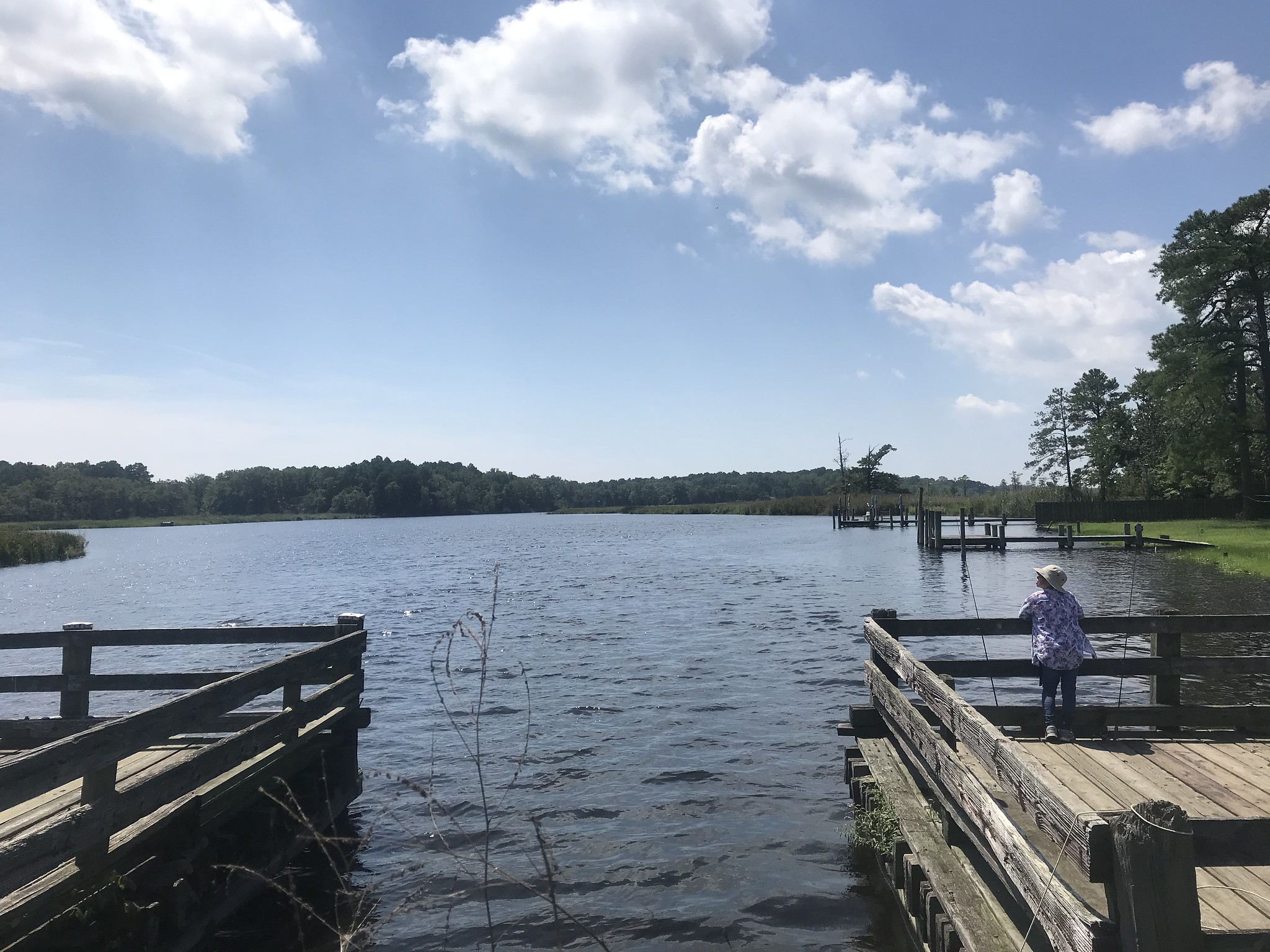
I walked The Mule over the deck which spanned 100 yards of water, part of the Chicamacomico River. I watched as two men in a small outboard fishing boat motored toward the span from the right. I figured that if I fell in for some reason at least that could pull me out.
At the far side of the span I encountered a bit of a problem. The decking ended. I could see the wooden support beams that ran perpendicular to the decking. They appeared to be about three to five feet above the river. Hmmm.
I could turn around and retrace my ride, turning a 30-ish mile ride into a 40-ish mile ride, or I could figure out how to get The Mule and me across the gap.
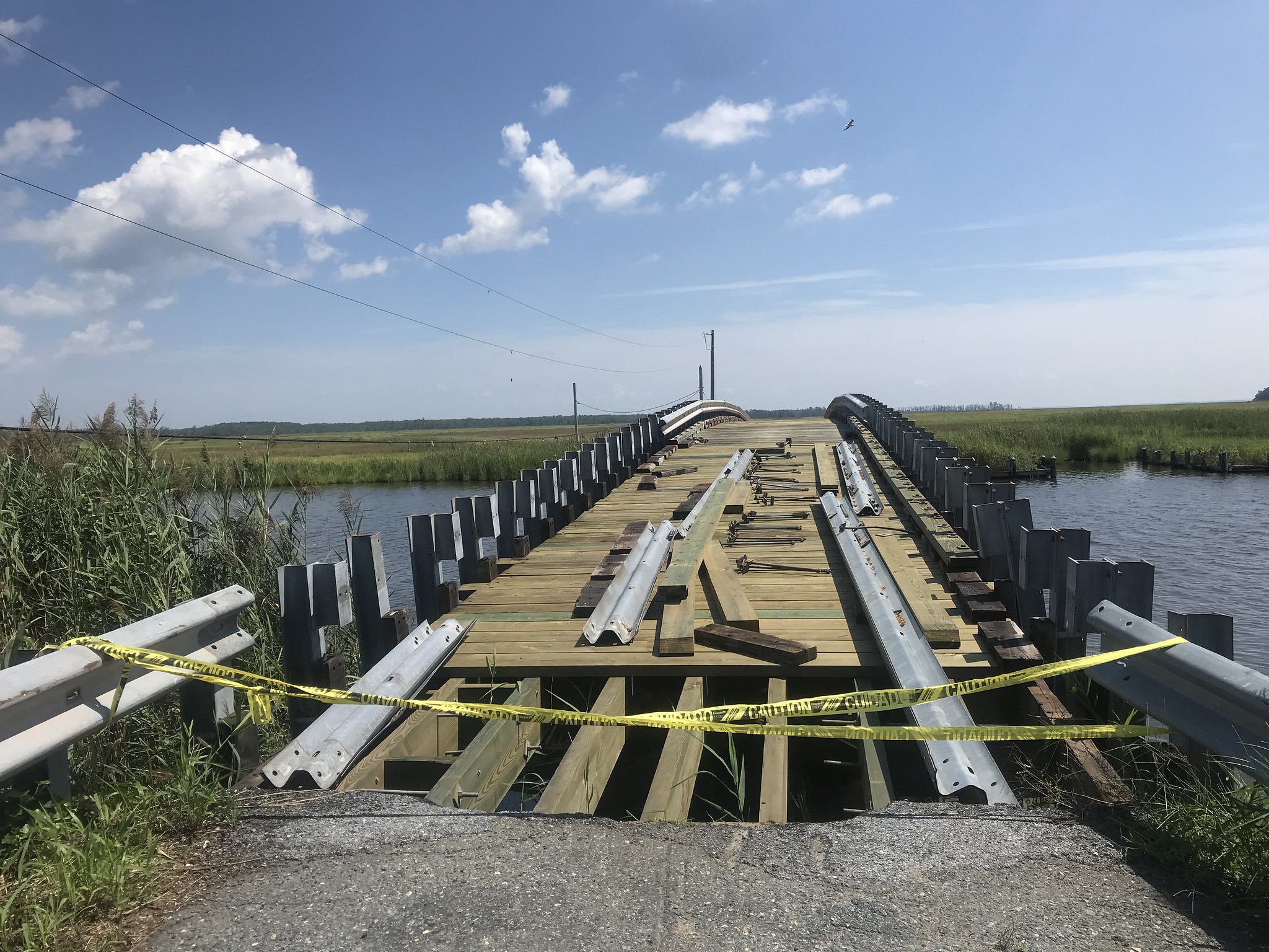
There were some metal guardrails lying on the deck. They had a convenient groove in them that was just the right size for a bike tire. On the side of the bridge was a series of low support pillars for the guardrails and a full length beam.
I placed The Mule’s tires in the guard rail groove and used the tops of the pillars as support for my left hand. Then I walked the ten-foot gap. Where the bridge met land on the far side of the gap was a steep drop off. The roadway was blocked by a loop of yellow police tape. I lifted The Mule’s front wheel over the tape and after a few snags, I had it on the roadway beyond. Then I stepped up and over the tape. Finally, I pulled The Mule’s rear wheel over the tape. Ta da!
No muss. No fuss. I walked The Mule around another set of jersey barriers and made notice of a large black pickup truck parked on the grass along the road. I reasoned that if the truck could get here, then I can get out. This was a good thing because the prospect of trying to cross the gap on the bridge from this direction looked considerably more difficult. (I later figured that I could work my way across the gap backwards. This kind of thinking would probably qualify me to be on a Dorchester County road crew.)
The roadway and one bridge for the last ten miles of the ride were perfectly enjoyable. This was a good thing because the 91 degree heat and oppressive humidity were starting to be a concern. The last few miles were vaguely familiar. I had ridden a short version of this ride about eight or nine years ago after a work meeting in Cambridge. I was on Little Nellie on that ride and had forgotten to bring a head light. I had one little white blinky light. It made for a creepy ride.
It’s a bit of a shame that the roads and bridges on this ride are in such poor shape. It’s an interesting place to ride. There are farms (mostly soybeans and sorghum), woods, swamps, and creeks. One home had dozens of purple martin houses in its backyard. I didn’t see any of these birds but there were quite a few vultures cruising in the sky, perhaps looking for a meal of dead cyclist. I hear they are quite tasty when left to rot on the asphalt in the hot sun.
I took a few pix and put them on my Flickr page.
