
Preliminaries
Most people who read my blog know that the Washington Area Bicyclists Association’s (WABA) Fifty States Ride is my favorite event of the year. This year marks the 12th time I’ve done it and each year’s ride is different. None more so than the 2020 addition this past Saturday.
For those of you late to the game, the 50 States Ride is the most ironically named gimmick ride ever. The 60-ish mile open-streets route (it changes a bit each year) takes riders all over the District of Columbia so that they ride on the streets named for the 50 U. S. states. The gimmick part is obvious. The irony is that the ride takes place entirely outside of the actual 50 states. (DC is not a state. Its residents do not have voting members in Congress, despite the fact that they outnumber at least two actual states.)
Although the ride is 62 (give or take a mile) miles long, if feels like 100 miles. Stop signs, traffic lights, traffic circles, and, well, traffic of all kinds (the streets are not closed) slow riders down. Downhill speed is forfeited at traffic lights. Uphills begin with a standing start. This means that instead of taking four or five hours, the ride takes all day. And you can cancel your evening plans because you’ll be trashed after the event. It is hard.
In every normal year, the ride begins in a park in the centrally located Adams Morgan neighborhood. In recent years the 50 States has also had shorter versions for the less insane. This meant that all 700+ participants gathered at a sign in point. Obviously, this is not doable during a pandemic.
So the folks at WABA got creative. They created shorter events for the two previous Saturdays. Then for the 50 States they established five starting points spread strategically throughout the city. Each starting point had three sign-in times, 7:30, 8:30, and 9:30. Each location and time were assign 25 riders. The only downside to this feature is that riders could not form large posses of friends. The upside was that the long lines at check in were gone. Also, in the past, the large mass of riders at the start caused congestion at stop signs and traffic lights for the first 10 miles or so. This was great for meeting people but really annoying for both participants and drivers. Another casualty of the pandemic was the loss of post ride celebration at a pizza place in Adams Morgan.
I chose to start in Meridian Hill (also known as Malcolm X) Park in Adams Morgan, a half mile from the former starting point. Other riders started in Anacostia Park in Southeast DC, Lincoln Park on Capitol Hill, and Forts Slocum and Reno in upper Northwest DC. Each of these points doubled as pit stops where riders could get snacks, water, and use a porta potty.
My History with the 50 States
I have previously done the 50 States Ride in 2006, 2007, 2010, 2011 – 2014, 2016 – 2019. In 2006, 2007, and 2010, I started alone, but ended up meeting people or chatting with old friends along the way. All my rides since then have involved posses of friends, new and old, which made for a festive day. Also, the first two or three times I did the ride, it was held in August. It was brutally hot and muggy. Thankfully, WABA moved the ride into September which often involved torrential rains. (Not this year, however.)
This Year’s Ride
To avail myself of free, on-street parking, I parked over a mile from the start. I arrived early at the 7:30 start and checked in without waiting. This year I had a posse of one, Kevin W. with whom I’ve done the ride two or three times before. Michael B. was unable to secure an early start time so he started an hour after us.
A Flat Start
We made our way west on streets wet from overnight rain out of Adams Morgan dispatching Wyoming and California without incident. After a brief downhill we began heading east picking off New Hampshire. After more easting we turned south and rode Rhode Island southwest to Vermont. (Geographic reality had no place in the 50 States Ride). Next we rode toward the White House. Security fences kept us off Pennsylvania Avenue for now. We zig zagged to the east and conquered New York. More zig zagging to the south and east found us harvesting Indiana. We circumvented the Judiciary Square area and headed along New Jersey where we took the exit for Louisiana. After a touching base in Columbia Circle in front of Union Station we back tracked on Delaware to the base of Capitol Hill.
Climbing the hill we turned southeast on Massachusetts Avenue before doubling back toward the Capitol on Maryland. 2nd Street took us behind the Supreme Court and through the Library of Congress buildings. We headed west to Washington before turning south again for Virginia. A security gate caused a brief departure from the route but we were back on track after a couple of blocks. At this point Kevin noticed that his front tire was losing air so we stopped for a repair.
With his tube patched, we headed west on Independence Avenue to 15th Street. Turning south we touched Maine before doing a nearly four mile loop through East Potomac Drive on Ohio Drive. Back on Maine we headed past the District Wharf area and down a long stretch of M Street within a block of Nationals Park.
Except for Capitol Hill, this entire 17-mile section of the route was flat, a warm-up for the hillscape across the Anacostia River.
Clockwise for a Change
At 11th Street we headed across the Anacostia River and made our way to the Anacostia Park pit stop along the river. Here Kevin noted that his tire was getting soft so he pumped up his tire. We snacked, used the blue room, and chatted briefly with my friend Josephine who had volunteered to take the early staffing shift. As we were dallying, Michael arrived. He was with a friend who wanted to ride at a faster pace than us. They were gone within ten minutes. Michael has been a part of the Rootchopper 50 States Posse for many years. Sad face.
We gave luke warm pursuit. This year, the route east of the river (EOR) was clockwise and otherwise somewhat different from the past. We wondered what surprises awaited. We followed the Anacostia River Trail to Benning Road, a high speed traffic sewer. Benning took us east away from the river, across DC 295 and into far briefly into Northeast DC. Soon we hit East Capitol Street where we picked up Texas. This section of Texas Avenue, new to the route, was a long, easy climb through a pleasant residential neighborhood transitioning to a still-uphill curvy road through Fort Circle Park. After our park ride, we rode west about a block on Pennsylvania before turning back toward the east on Alabama. The clockwise route now had us at the top of previous years’ long climb. The next 2 1/2 miles were mostly downhill.
At a stop light, an African American man at a bus stop asked to take our picture. “You’re the only white people I’ve ever seen in this neighborhood.” His joke had a point. The EOR neighborhoods were mostly black. We riders were mostly not. I pondered a bit what would happen if the shoe were on the other foot. 50 States comes with a heaping side of white privilege.
Down Alabama and a few steeper side streets and we found ourselves on level ground heading east along Mississippi Avenue. What goes down must go up Whittier. I dreaded the climb but it was not as steep as I recalled from all those downhills of years passed. Zigging and zagging to MLK Boulevard, Anacostia’s Main Street. After another long, steady downhill we found Good Hope and took it east to Minnesota.
With the EOR hills behind us we made a few more turns and came back to the river. I noticed a couple of riders about to climb a paved path up to the Pennsylvania Avenue bridge over the Anacostia. I shouted that they were going the wrong way. They would have ended up on the wrong side of the bridge. (Been there. Done that.) We all passed under the bridge then took it back across the Anacostia River.
Back to Level Ground
Around Barney Circle (maybe the goofiest name ever) to Kentucky Avenue and east through the aptly named Hill East neighborhood on the backside of Capitol Hill. Kentucky led to South Carolina which took us for the umpteenth and final time to Pennsylvania. We stopped at District Taco at Eastern Market so Kevin could get his burrito fix then headed up North Carolina to the pit stop in Lincoln Park. The ride was now only half over.
A few weeks ago, Lincoln Park was the site of protests over the statue of Lincoln standing over a slave in chains. Today, it was the site of parents and kids, playing in a playground in one spot, sitting in a wide circle listening to a singing storyteller in another. Dog owners were being walked by their dogs. DC, it’s a hellscape of anger and violence, don’t you know.
After the burrito and a tire refill, Kevin was ready to ride. I had lunched on free pit stop snacks. (Do not follow my nutritional regimen.) We left the park headed east on Tennessee until we found Oklahoma for all of a block. Next we back tracked on C Street and went this way and that out off Capitol Hill into Trinidad (not a state but a state of mind for sure) where we picked up Florida and West Virginia. (Geography in DC is rather warped.) Another mile of level ground ensued and then, after 37 1/2 miles, things got serious again.
Northeast Traffic Hell
A mile of flat West Virginia (not remotely like the actual state) led to the insane traffic circle where New York Avenue meets Montana. Around the don’t-kill- me circle and up Montana for a few blocks. We headed east for a 1 1/2 miles on 18th to the first of two hair-raising states.
South Dakota is a four-lane highway masquerading as a city street. Cars ignore the speed limit. Fortunately we were only on it for a few blocks. Despite having ridden this ride so many times, the left on Taylor Street snuck up on me. I glanced in my mirror, saw only a car in the distance, signaled, and turned left. In South Dakota, cars are closer than they appear. Kevin veered off to the right so as not to be run over by the car running up my rear wheel. I made it without harm and waited for Kevin. “That was close,” he remarked rather dryly. To our credit, neither of us wet our pants.
Taylor gave way to a dicey intersection at Michigan which we took back east. We used the sidewalk on the bridge over the railroad tracks in Brookland to Catholic University where Kevin once again refilled his front tire.
Aloha Bitches
A half-mile flat ride gave way to the bumpy climb up Hawaii Avenue. After a slight downhill and rest at a red light, we turned southeast and then east toward Petworth. A hard right and we were on Illinois Avenue heading north. Around Grant Circle and north toward the three-syllable streets. (Streets run east-west and are alphabetical, adding syllables with each turn through the letters.) After a left on Buchanan, we hung a left on Kansas and headed back to Petworth. A right on Varnum took us directly onto Iowa, right onto Arkansas, and left onto Georgia in quick succession. Georgia is another notorious DC traffic mess but the pandemic worked to our advantage by keeping traffic more or less sane.
To the Top
A left on Kennedy took us to a hard right on Colorado. Every year people seem to linger in the street at this intersection. Every year I avoid colliding with them. This year was no different. Colorado took us to Missouri. This splendid downhill was spoiled by speeding DC traffic. The left on Longfellow could not have come soon enough. Kevin spotted his friend Sam hanging in front of his house. Sam and Kevin walked a few blocks as I lolled along on my bike. We arrived in Fort Slocum for another rest stop. Here Kevin changed his troublesome front tire and I ate snacks. The snacks seemed to vaporize before reaching my stomach. Lunch would have been a good idea. I had a chat with Anna, the WABA event coordinator.
After leaving the park we headed southeast on North Dakota, which was decidedly saner than South Dakota had been. When we reached 3rd Street we turned back to the north, lefting and righting into the Tacoma Park neighborhood. We rolled past Mike and Lisa’s house where the Tacoma rest stop was before the virus. I rang my bell and waved at someone working on a bike in their garage. His mask made it impossible to ID him.
We’d now reached the northern most part of DC and turned south along Alaska Avenue. As in years past, Patty Heck was standing at the turn taking pictures of us as we made our turn south. She’s done this in all sorts of weather including downpours. Check out her pix on Flickr.
Alaska was all downhill to busy 16th Street. We took a left for a few hundred yards before banging a right through a closed traffic gate at Sherrill Drive into Rock Creek Park. To this point the day had been overcast. The sun was now fighting to break through and temperatures and humidity were rising. The shade on Sherrill was most welcome but we could have done without the wet leaves that turned the curving downhill into a nervous descent.
Was It Always This Hilly?
At the bottom of the hill we turned left onto Beach Drive in the park only to exit the other side on Bingham. Bingham has been closed for years and the roadbed has been allowed to deteriorate. It was rideable and only mildly annoying.
Next up was a left on Oregon Avenue which has been under construction and off the route for a couple of years. We took a left on Oregon. It had only one lane and of course was bumpy and up hill. Being good citizens, we pulled over after a while to let cars pass. At Military Road, another car sewer, I followed Kevin onto the sidewalk. We backtracked onto Utah and into tony Chevy Chase. If you have to ask you can’t afford it. After a turn south on Rittenhouse. we turned onto Nevada. Unlike the brutal desert basin and range of the real thing, Nevada was like a locale for Landscaping for the Rich and Famous.
We had climbed out of Rock Creek Park but the fun was only starting. At Linnean Street we went up some more. Then we took a left on Fessenden Street and climbed more. And more. And more. How did I forget about this? Really. It was looong.
We stopped at Fort Reno for a chat with WABA’s Kristin at the last pit stop. More snackage. Hey, these little cheese circles ain’t bad. And they go so well with Goldfish crackers.
A couple of blocks later we were climbing up Wisconsin Avenue over yet another hill to Tenley Circle. As we took a right onto Nebraska Avenue an impatient Mustang driver roared past us. (This was only the second aggressive pass of the day.) Mr. Mustang zoomed to a red light 100 feet later. As far as we could tell there was no cross street, just a cross walk. Karma for the gas horse.
Nebraska was flat past American University and through Ward Circle and onto Loughboro where the road turned down. A left down Arizona made for the best descent of the day. Of course, it was wasted by a red light at MacArthur Boulevard but only dreamers get the green.
Garfield Isn’t the Worst of It
We tuned left up the short hill on Ashby Street, then left to recover for a half mile on flat 49th Street. Just as the feeling in my legs returned, we took a right up dreaded Garfield Street. This sucker nearly killed me the last few years but Kevin said, “We’ve got all day.” We dropped into our granny gears and took the hill without undue pain. Then Kevin remarked, “There’s another one ahead that I really hate.”
What?
The other side of Garfield was downhill then up. The up was taken care of by our momentum. We stopped and turned left up New Mexico, a false flat. (Looks flat. Goes up. Kills your psyche.) Our next right turn took us up Cathedral Avenue. This was the hill Kevin was talking about. I think past torture on Garfield had erased it from my memory. UGH.
After the slog we turned left on 39th and crossed Massachusetts to Idaho. The good news was that we were now in Cathedral Heights, the last of the hills. The bad news was that the inside of my left knee was screaming at me. As we turned onto Macomb Street we could see National Cathedral to our right.
Starting up after a red light at Wisconsin Avenue was extremely painful. I felt like a knife was sticking in my left knee. Fortunately, the rest was downhill. A right, left, and right took us through Woodley Park onto Connecticut Avenue.
The WABA route maker always leaves this busy boulevard for last, when riders are exhausted and traffic is relentless. Except for this day. No cars! We took the left lane and sped downhill to Calvert Street where the oncoming cars let us make a left turn without stopping. My knee was grateful. After a mile we were back at the park where we started where Hannah and Chris, staffing the WABA tent, were there to congratulate us.
Fin.
A Dozen in the Books
It was a tough ride, but well worth the time and effort. Thanks to Kevin for being an excellent one-man posse. Sorry for nearly getting you killed on South Dakota Avenue.
To the participants, thanks for wearing your masks and maintaining social distance. Compliance was excellent.
The clockwise ride EOR was an interesting improvement. Somehow the same hills seemed much easier in the clockwise direction. We had to give up prior years’ screaming downhill on Pennsylvania Avenue, but it was well worth it.
Big thanks to the volunteers and WABA staff, especially the early shift who woke up before 5 a.m. and set up the starting points/pit stops in the rain.
Congratulations to the WABA team for creatively re-imagining this event. It worked! Unfortunately, the social aspect of the ride suffered but your hard work salvaged and, in many ways, improved the event.
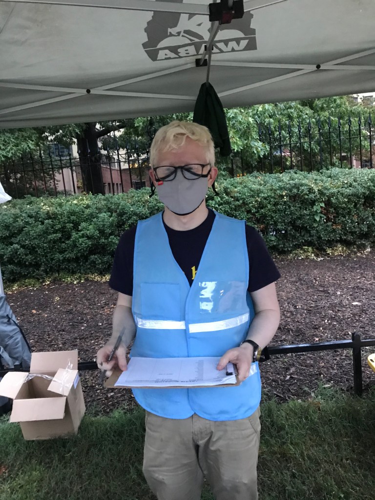
WABA’s Garrett Hennigan at the start in Meridian Hill Park 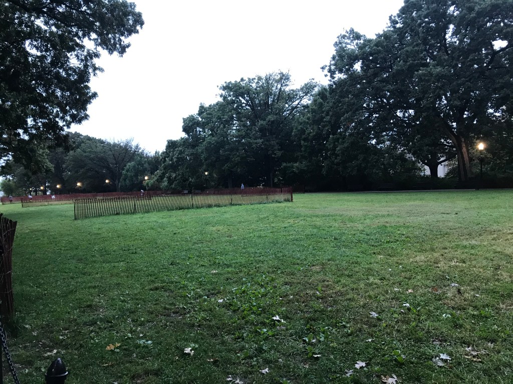
Meridian Hill Park before the start 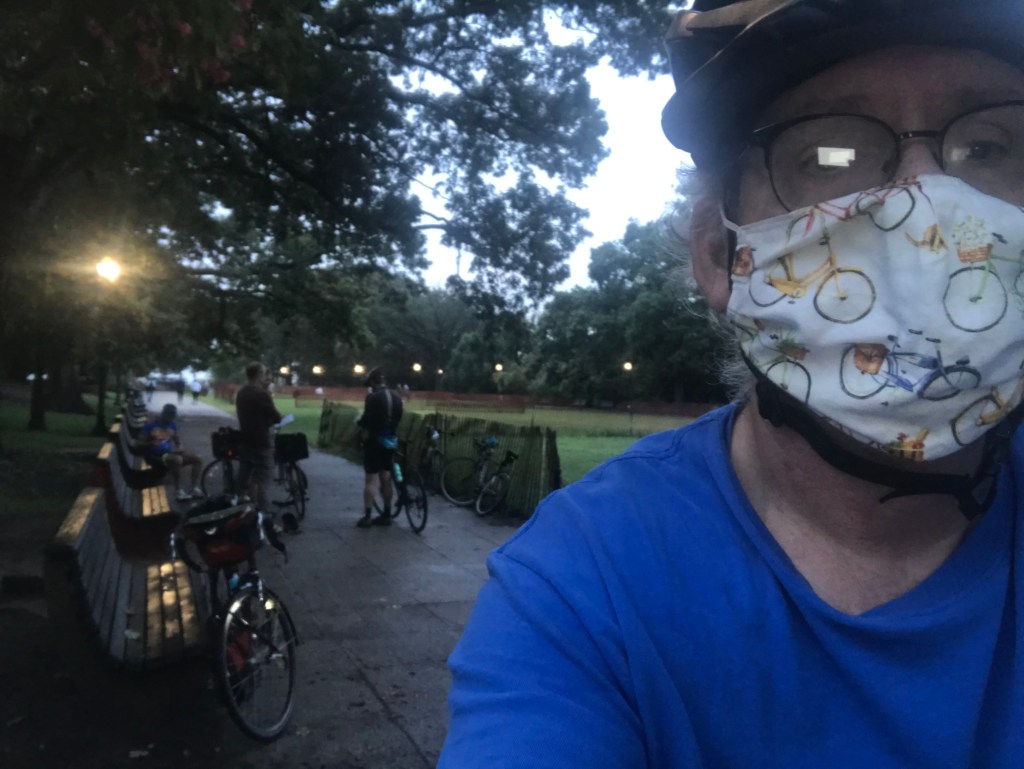
Me. Ready to ride or rob a bank, 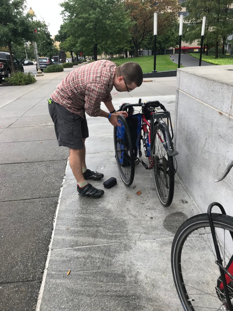
Kevin and his front wheel 
Michael and friend at the Anacostia pit stop 
Josephine at the Anacostia pit stop 
Kevin’s lunch stop 
Statue of Mary McLeod Bethune in Lincoln Park 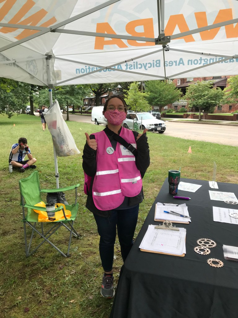
WABA’s Anna at the Fort Slocum pit stop 
WABA’s Kristin at the Fort Reno pit stop 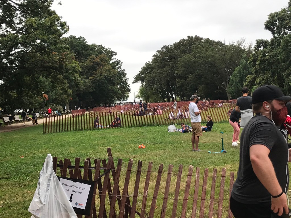
Meridian Hill Park after the ride 
WABA’s Hannah and Chris at the finish in Meridian Hill Park 
WABA spares no expense with finish line signage 
Kevin at the finish. Ready to ride again.
Scenes from the day.
