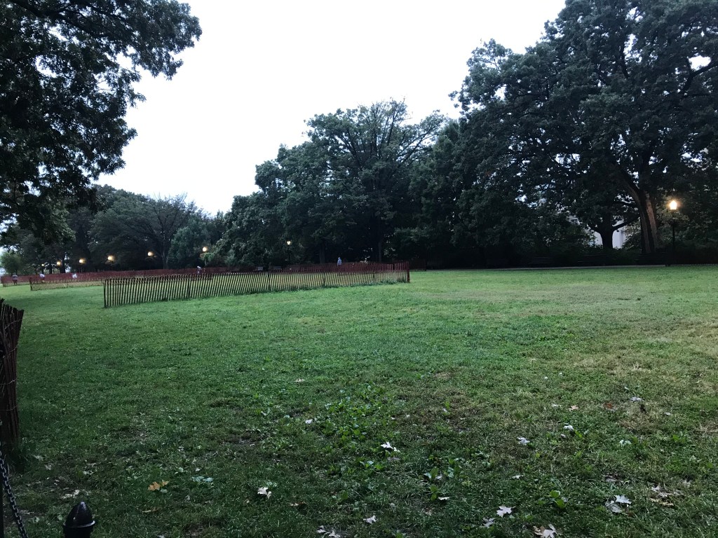
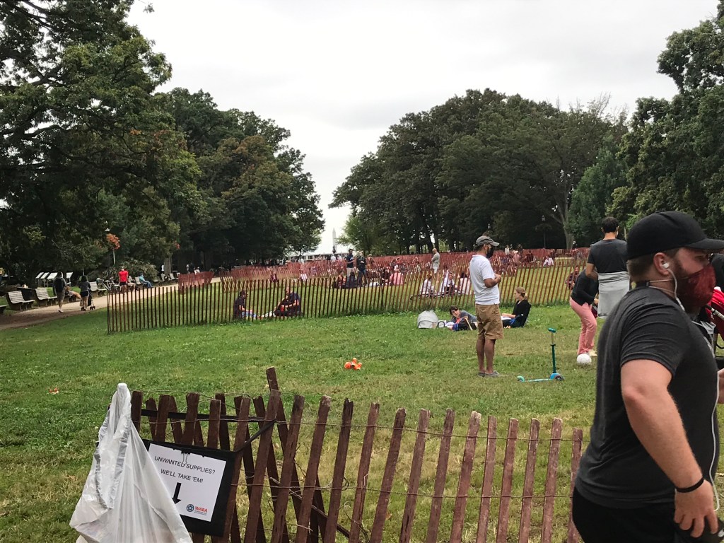
Yesterday I took part in the Washington Area Bicyclists Assocation’s Cider Ride. This annual event is about 13 years old. There are three routes; I rode the longest, 60 miles. This is a relatively flat ride, involving only 2,000 feet of climbing. After riding through residential neighborhoods in Northeast DC, participants hook up with the Anacostia River Trail system. The route has used these trails for 11 years after a couple of unpleasant forays in early December on suburban streets.
This year’s version was held in cool and windy conditions. There was no rain but temperatures didn’t seem to crest 60 degrees until the last third of the ride.
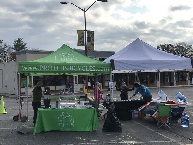
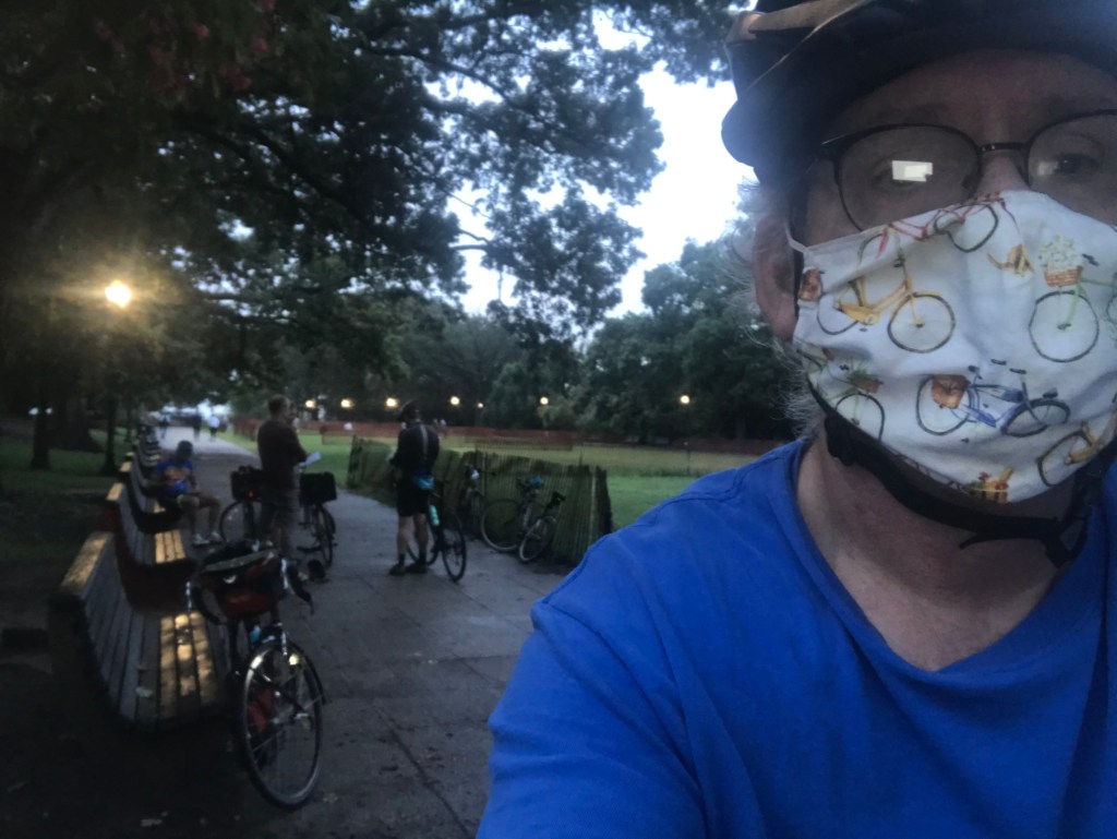
I rode with Chris, Michael, and Kevin. Despite the fact that Michael was riding on a bum knee, he kept pace with Chris and Kevin who seemed comfortable rolling along at 15 miles per hour. I decidedly was not. I woefully lagged behind, bothered by a mystery noise coming from my front wheel when I applied my brakes. The first pit stop came at 13 miles at Proteus Bikes in College Park, Maryland. There, a mechanic found the cause of my aggro, a small burr on the right side of my rim. He filed it down with a sanding stone and all was copacetic thereafter.
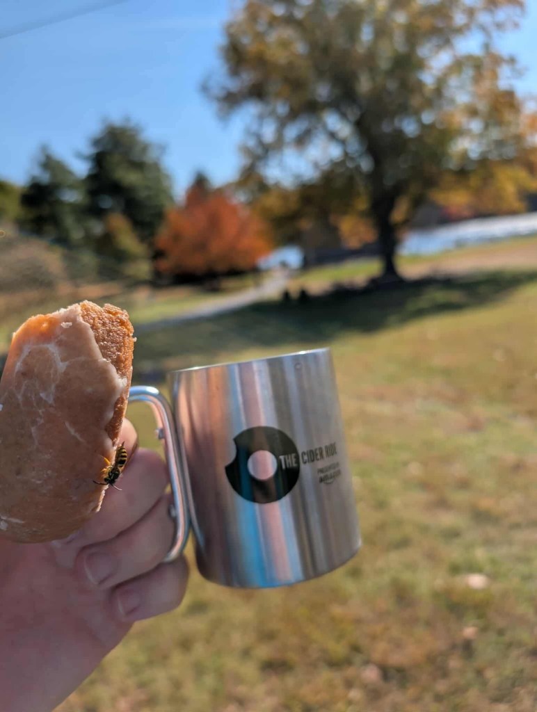
With my companions itching to ride on, I snarfed a half a donut and a small metal cup (provided to all participants) of warm cider. The next pit stop was 23 miles away. As someone who gets about 15 miles to the donut, I regarded this as a challenge.
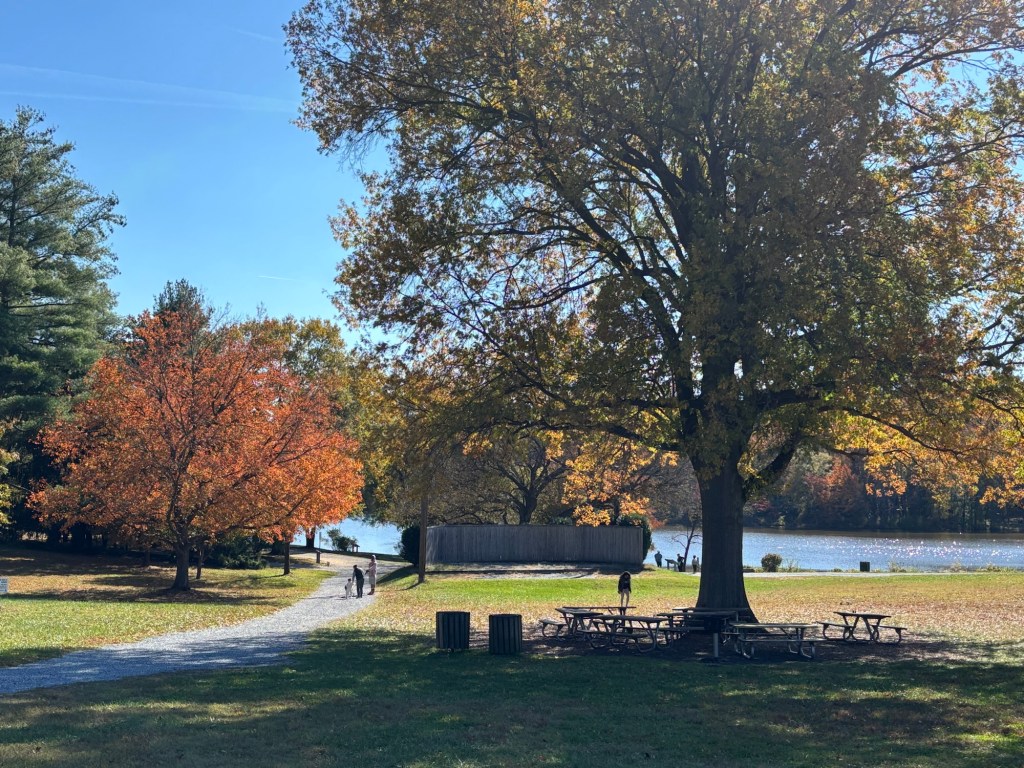
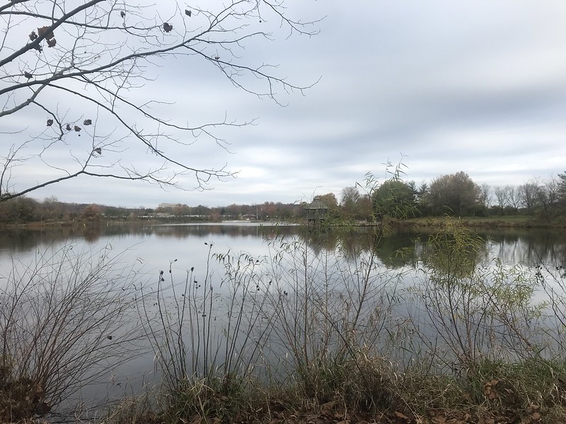
After the first pit stop we headed north into the Beltsville Agricultural Preserve where federal farm scientists work on such farm things. (I am a city boy so you’ll get no insights from me.) On the north-ish edge of the Preserve we turned east onto Powder Mill Road, a two-lane highway with smooth pavement and wide, paved shoulders. A couple of miles later we turned into the grounds of the Patuxent Wildlife Research Refuge where the access road wound through pretty darned amazing foliage.
We turned around and headed back the way we came taking a meander through suburban Edmonston, Maryland. At this point we began to whine about the winds which seemed to be headwinds no matter which way we turned.
Pedaling right back into the Agriculture Research Preserve, we headed straight across the mostly barren landscape on the cleverly named Research Road. Because of the shut down, a gate blocked our way but we gingerly rode in the grass around it. Take that, Congress!
Alas, the rest of Research Road climbs up the biggest hill of the ride. Just before the top we came to a gate that is always closed (to prevent commuters from cutting through the Preserve, I guess). Kevin and I walked through the narrow gap around the gate.
We rejoined the speed twins, Chris and Michael, who were waiting patiently at the top of the hill and rolled down to Pit Stop #2 at Buddy Attick Lake Park in Greenbelt. This pit stop is known for serving apple pie but there was no pie this year. (No loss. I’m not a fan.) There were donuts and cider, and plenty of bees competing for the refreshments. I had an entire donut and a cup of cider, thankfully without getting stung or swallowing any of my flying friends.
After the pit stop we returned toward the Anacostia River trail system, Along the way we passed a MAMIL (middle-aged man in lycra) who had crashed in the bike lane. He was being tended to by tow other riders so we soldiered on. Back on the trail system my youthful riding companions dropped me like a marketing call. Thankfully, they waited and led me into Hyattsville where there was some low speed congestion getting onto the Trolley Trail.
The Trolley Trail took us back to the Anacostia River trail system, around Lake Artemesia (which we rode around on the way north), and south to the final pit stop at Bladensburg Waterfront Park. Michael’s knee was starting to hurt so we made short work of the refreshments and headed south on the east side of the Anacostia.
Now Michael’s knee might have been hurting, but Kevin and I still couldn’t keep up with him and Chris. Our travels took us south on the east side of the Anacostia then back north on the west side. Here we rode around the skeleton of RFK Stadium which is being razed for a new football palace. We took the C Street protected cycletrack (which looks like it was transported from a European city. So nice!) on the gradual climb up the east side of Capitol Hill. After playing with cars for a half mile or so we picked up the 1st Street Northeast Cycletrack and connected with the Metropolitan Branch Trail which led us mercifully to the finish.
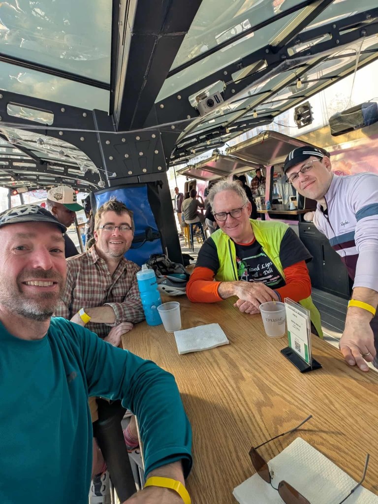
We convened for post-ride pizza (thanks Chris and Michael) and liquid refreshment at Metrobar, a repurposed Metro subway car.
I drove home with the expectation that I would fall sound asleep during the deciding game of the World Series. I glad I didn’t.
Thanks to the volunteers and WABA staff who woke up early to check us in and endured bees galore at the rest stops. Thanks to Chris, Michael, and Kevin.
And so ends my event riding season. I am pooped.
Getting ready to head back south at the Patuxent Research Refuge
The view at Buddy Attick Lake Park
Amazingly bee-free shot from Buddy Attick bee farm. Photo by Michael.
Michael’s snack at Bladensburg Waterfront Park. Photo by Michael.
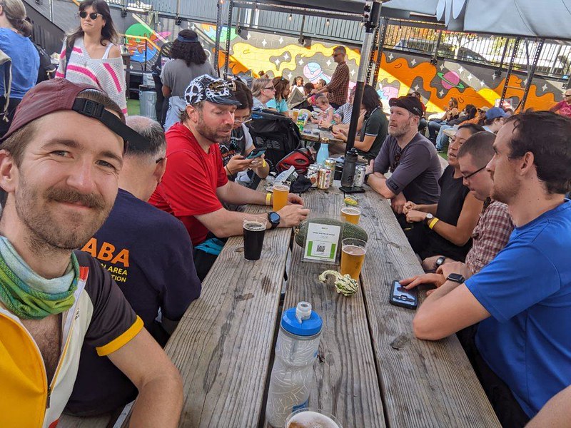
We ate all the pizza! (L to R: Michael, Kevin, me, Chris). Photo by Michael.
Last Saturday was the final event of my bicycling year, the 60-mile Cider Ride. This event is run annually by the Washington Area Bicyclists Association (WABA). I’ve ridden all six Cider Rides.. The first two were held on suburban roads in December. Riding in 40-degree weather on roads with impatient Maryland drivers did not make for a fun time. The second Cider Ride also featured rain. Woo boy. Thankfully my friend Reba’s chain broke about 13 miles into the event. We spent about a half hour in the cold rain trying in vain to fix it but we had neither the parts nor the expertise to get her rolling again. Cold and wet, we called for the WABA sag wagon and Gina picked us up in her blissfully warm van.
Ever since that lovely day, the event has been held in early November. This year’s event featured light breezes and 75 degree temperatures.
I rode in a group of ten riders. Michael, Kevin, and Chris and I have been doing WABA events together for several years. We rode the 50 States ride together in September. Chuck, Catherine, Jonah, and Sara who were also part of our 2022 50 States posse joined us for this ride as well. Our 50 States alums welcomed Jean and Domitille. It was a coincidence that they are both French. I seem to be making a habit of meeting French bicyclists after chatting with the French sisters in Boulder, Utah in 2018 and to two separate French riders in close succession this summer near the Oxbow, Oregon this summer.
Domitille only recently moved to DC so she was not at all familiar with where we were going. And she expressed uncertainty about her ability to make it beyond 30 miles. Little did she know that we at the Rootchopper Institute specialize in the care and support of newbies – such as Chris and Katie (Cider Ride), and Shane, Veronica, Richard, Tito, Jeremy, Emilia, Larraine, Jeannie, Elizabeth, Lisa, and Kristen (50 States Ride).
At about 9:15 we were off. The ride took us through middle-class, residential Northeast DC into Mt. Rainier, Maryland. There we jumped on a succession of bike trails along the Anacostia River and it’s northeastern tributary. Occasionally we’d ride under a canopy of trees with leaves floating down like giant puffy orange snowflakes. Near College Park we passed through a running event. Here I was surprised as I passed my old biking friend Lisa running in the opposite direction. Hi Lisa
Around the University of Maryland campus and the College Park airport we spun. Michael who knows these trails and the course by heart, led the way, keeping a steady 12 mile per hour pace. We arrived at the first pit stop at Proteus Bicycles in College Park. Warm cider and donuts! Yes!
Domitille pulled out a bag of personal healthful snacks and pulled out a stalk of celery. Domitille, you got some learnin’ to do. The truth is that the food table included healthful things like bananas and apples but they were right next to the icing-covered chocolate donuts. Mon Dieu!
In her defense, Domitille did explain to us how celery, in addition to being nutritionally beneficial, is every bit as good at cleaning your teeth as a toothbrush and toothpaste. Oh, give me some of that dental goodness! On my next event ride I’ll be sure to pack some Colgate.
All kidding aside, she was holding up quite well and having a good time so who am I to deny her such utterly healthy habits.
With full tummies and clean teeth, we headed off towards the Greenbelt USDA research farmlands. At the pit stop, I had assured Domitille that there was only one bad hill on the entire course. Sadly, I had forgotten about the four miles of rollers along Beaver Dam Road. It’s a wonder she didn’t whack me with a celery stalk.
Once clear of the farm land we rode into the Patuxent Research Refuge. It was a lovely three miles out and back through the woods. The turnaround had a pit stop of sorts: no food, just bathrooms. As we rode back toward the farm area we split off to the right, riding a big circle through a suburban neighborhood. I somehow caught my stride and sped clear of the group. They reeled me in after a mile or so. Back at the farmland we used Research Road to cross our outbound path. Now we had a noticeable headwind just in time for the day’s big climb. (At this point I was hoping that Domitille did not have a knife in her food bag.)
We all made it up the hill and around a couple of annoying gates designed to keep drivers from cutting through the Greenbelt neighborhood ahead. A mile of so later we arrived at Buddy Attucks Park and our second pit stop. There was more cider. More donuts. Snacks. And pie! Pumpkin or apple. Or, as Sara was to discover, BOTH! Also, there were lots of bees buzzing about. I made sure to check my cider cup before drinking.
By now we had gone about 35 miles. Domitille was holding up fine. Maybe there’s something to that celery thing after all. We headed back toward DC. Our route took us around Lake Artemsia which we had skirted a few hours earlier. Down the Northeast Branch of the Anacostia, the route took some streets through Hyattsville to ride the Trolley Trail. It was hard not to stop at the gastropubs along the trail but somehow we managed. (Did you know that IPA makes an excellent mouthwash?)
Back to the NE Branch Trail we crossed the Anacostia at Bladensburg and stopped for our last rest stop. I ate an apple. Domitille ate a donut. Will wonders never cease?
The next ten miles involved a ride down the river on the Anacostia River Trail (ART). We rode past an athletic field where a high school cross country race was underway. I must say some of the runners look quite unhappy with the heat and humidity. At Eleventh Street, we crossed back over the river and headed north to the RFK Stadium complex. We rode around the hulking decrepit concrete hulk, Joe and I reminisced about separately attending the Tibetan Freedom concert where lightning struck a young woman. (It was in my seating section. I was getting some liquid refreshment on the concourse above when I heard the BOOM.)
D to 14th to C Streets Northeast took us to and around Lincoln Park. After a brief spin along Massachusetts Avenue we rode around Columbus Circle and up the 1st Street cycle track to M Street. M took us to the Metropolitan Branch Trail which we rode a mile or so back to the finish at MetroBar.
We celebrated with a group picture and some snacks and liquids. We all made it in great shape. Celery and donuts for the win!
Kevin and Domitille following Jean on the Northeast Branch Trail
Me, powered by donuts on Beaver Dam Road.
Catherine leading Domatille on the ART
Kevin, Me, Michael, Jean, and Jacob on the ART
Chris, Kevin, Jean, Michael, Monica (our finish line greeter), Me, Jonah. Domitille, Sara, Catherine and Joe. All smiles after nearly 60 miles of riding. Not pictured: Chuck (who finished as well, see below).
L-R: Chuck, Me, Micael, Domitlle, Joe, Sara, Kevin, and Jonah at Metrobar after the ride
Sunday was the sixth Cider Ride, an event put on annually by the Washington Area Bicyclists Association. The first two Cider Rides were in December. This proved to be rather unpleasant, especially the second which was held in a cold (and I mean cold) rain. I’ve ridden all six rides but DNFed on the second. My friend Reba broke her chain. We stood in the cold rain for 20 minutes trying to fix it to no avail. I took the sag wagon back with her.
The Cider Ride has three lengths, the Candy Apple (10 miles), the McIntosh (30 miles) and the Honeycrisp (55 miles). Normally, these rides are held on the same day, but this year the shorter rides were held on Saturday to allow for social distancing. I rode the Honeycrisp.
I checked in at the Dew Drop Inn registration desk where I picked up a cue sheet and a Cider Ride tin cup. The cup has a carabiner built into its handle. I attached the cup to my saddle bag so that it could clank as I hit the bumps along the route.
Before setting off on The Mule, I made sure to partake in my favorite fall energy snack: warm apple cider and a doughnut. Having shocked my pancreas, I followed the route along neighborhood streets through Northeast DC and into Mount Rainier Maryland. Here, the route switched over to trails along the Anacostia River and its tributaries up into College Park Maryland.
Lake Artemesia
At about 13 miles, I hit the first pit stop at Proteus Bicycles in Hollywood. I had another cup of warm cider but, mindful of my health, I resisted the urge to snarf another doughnut and ate a banana instead.
Back on the bike, the ride followed roads and entered the USDA’s agricultural research facility. The research area was nearly traffic-free through fields and woods along Beaver Dam Road. You know you’re in nerd heaven when you cross Soil Conservation Road.
After a mile on Springfield Road it’s on to Powder Mill Road. This road is a two-lane highway, but has wide, smooth, paved shoulders. The Mule and I were cruising along with robust celerity thanks to my amazing fitness and a strong tailwind. A turn into the Patuxent Research Refuge began a three-mile bit of wooded Zen on winding Scarlet Tanager Loop Road.
After the loop, my pace slackened as I backtracked into the wind on Powder Mill Road. So much for Zen. We continued past Springfield Road until we hung a looey onto Research Road.
Research Road climbs over a ridge into Greenbelt. The half-mile-long hill was manageable. The headwind was not a particularly welcome addition to the festivites, however.
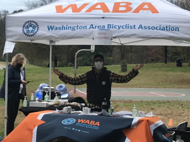
In Greenbelt I passed a socially distanced outdoor church service before hitting pit stop number 2 staffed by WABA’s Colin Browne. Few riders had come through so there was an abundance of cider and doughnuts. I did my best to remedy the situation. Burp.
After another mile or so on the roads, I followed the route back onto a trail. Here I encountered a chain link fence with a big, open gateway through which the trail passes. Bounding along the side of the trail were two deer. They saw me and flinched at cutting in front of me to use the gateway. I slowed in case the deer bolted across my line of travel which could have made for a rather unpleasant collision.
Free of the deer, I made my way down the trail then onto some residential streets into beautiful downtown Hyattsville Maryland. This town is loaded with shops and restaurants and watering holes. Many of these are located on route along the Trolley Trail. I was sorely tempted to stop at a trailside open air eatery for a beer and a hot dog. With profound inner strength I pedaled onward.
I followed the route to return to the Anacostia River about a mile later. From here I crossed over the river to Bladensburg Waterfront Park, and pit stop number 3, staffed by WABA’s Jeff Wetzel. Jeff and his volunteers were sitting facing downriver into the wind. They too had abundant supplies of doughnuts and cider. Having survived the caloric temptations of the Trolley Trail, I succumbed to my dietary fate and washed a doughnut down with a cup of cider.
Back on The Mule, I put my 10-page cue sheet away. From here I rode the Anacostia River Trail downriver eight miles into a headwind before taking the 11th Street Bridge across to the west side of the river. Next, we followed the west bank ART upriver past RFK Stadium. A left turn took us around the stadium and through Capitol Hill to the First Street Cycletrack at Union Station. A mile later we picked the Metropolitan Branch Trail. A tailwind pushed The Mule and me all the way back to the start where more cider and doughnuts awaited us.
Most people who read my blog know that the Washington Area Bicyclists Association’s (WABA) Fifty States Ride is my favorite event of the year. This year marks the 12th time I’ve done it and each year’s ride is different. None more so than the 2020 addition this past Saturday.
For those of you late to the game, the 50 States Ride is the most ironically named gimmick ride ever. The 60-ish mile open-streets route (it changes a bit each year) takes riders all over the District of Columbia so that they ride on the streets named for the 50 U. S. states. The gimmick part is obvious. The irony is that the ride takes place entirely outside of the actual 50 states. (DC is not a state. Its residents do not have voting members in Congress, despite the fact that they outnumber at least two actual states.)
Although the ride is 62 (give or take a mile) miles long, if feels like 100 miles. Stop signs, traffic lights, traffic circles, and, well, traffic of all kinds (the streets are not closed) slow riders down. Downhill speed is forfeited at traffic lights. Uphills begin with a standing start. This means that instead of taking four or five hours, the ride takes all day. And you can cancel your evening plans because you’ll be trashed after the event. It is hard.
In every normal year, the ride begins in a park in the centrally located Adams Morgan neighborhood. In recent years the 50 States has also had shorter versions for the less insane. This meant that all 700+ participants gathered at a sign in point. Obviously, this is not doable during a pandemic.
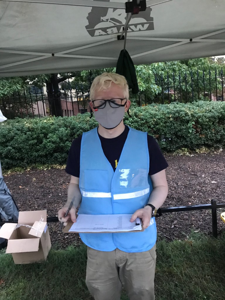
So the folks at WABA got creative. They created shorter events for the two previous Saturdays. Then for the 50 States they established five starting points spread strategically throughout the city. Each starting point had three sign-in times, 7:30, 8:30, and 9:30. Each location and time were assign 25 riders. The only downside to this feature is that riders could not form large posses of friends. The upside was that the long lines at check in were gone. Also, in the past, the large mass of riders at the start caused congestion at stop signs and traffic lights for the first 10 miles or so. This was great for meeting people but really annoying for both participants and drivers. Another casualty of the pandemic was the loss of post ride celebration at a pizza place in Adams Morgan.
I chose to start in Meridian Hill (also known as Malcolm X) Park in Adams Morgan, a half mile from the former starting point. Other riders started in Anacostia Park in Southeast DC, Lincoln Park on Capitol Hill, and Forts Slocum and Reno in upper Northwest DC. Each of these points doubled as pit stops where riders could get snacks, water, and use a porta potty.
My History with the 50 States
I have previously done the 50 States Ride in 2006, 2007, 2010, 2011 – 2014, 2016 – 2019. In 2006, 2007, and 2010, I started alone, but ended up meeting people or chatting with old friends along the way. All my rides since then have involved posses of friends, new and old, which made for a festive day. Also, the first two or three times I did the ride, it was held in August. It was brutally hot and muggy. Thankfully, WABA moved the ride into September which often involved torrential rains. (Not this year, however.)
This Year’s Ride
To avail myself of free, on-street parking, I parked over a mile from the start. I arrived early at the 7:30 start and checked in without waiting. This year I had a posse of one, Kevin W. with whom I’ve done the ride two or three times before. Michael B. was unable to secure an early start time so he started an hour after us.
A Flat Start
We made our way west on streets wet from overnight rain out of Adams Morgan dispatching Wyoming and California without incident. After a brief downhill we began heading east picking off New Hampshire. After more easting we turned south and rode Rhode Island southwest to Vermont. (Geographic reality had no place in the 50 States Ride). Next we rode toward the White House. Security fences kept us off Pennsylvania Avenue for now. We zig zagged to the east and conquered New York. More zig zagging to the south and east found us harvesting Indiana. We circumvented the Judiciary Square area and headed along New Jersey where we took the exit for Louisiana. After a touching base in Columbia Circle in front of Union Station we back tracked on Delaware to the base of Capitol Hill.
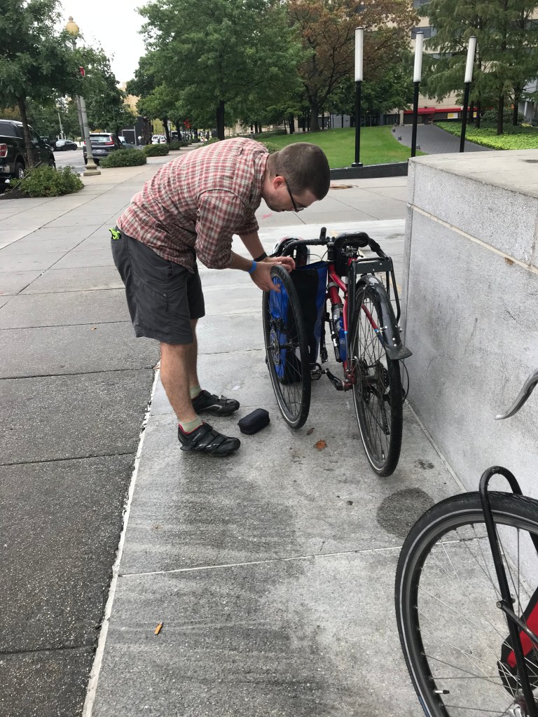
Climbing the hill we turned southeast on Massachusetts Avenue before doubling back toward the Capitol on Maryland. 2nd Street took us behind the Supreme Court and through the Library of Congress buildings. We headed west to Washington before turning south again for Virginia. A security gate caused a brief departure from the route but we were back on track after a couple of blocks. At this point Kevin noticed that his front tire was losing air so we stopped for a repair.
With his tube patched, we headed west on Independence Avenue to 15th Street. Turning south we touched Maine before doing a nearly four mile loop through East Potomac Drive on Ohio Drive. Back on Maine we headed past the District Wharf area and down a long stretch of M Street within a block of Nationals Park.
Except for Capitol Hill, this entire 17-mile section of the route was flat, a warm-up for the hillscape across the Anacostia River.
Clockwise for a Change
At 11th Street we headed across the Anacostia River and made our way to the Anacostia Park pit stop along the river. Here Kevin noted that his tire was getting soft so he pumped up his tire. We snacked, used the blue room, and chatted briefly with my friend Josephine who had volunteered to take the early staffing shift. As we were dallying, Michael arrived. He was with a friend who wanted to ride at a faster pace than us. They were gone within ten minutes. Michael has been a part of the Rootchopper 50 States Posse for many years. Sad face.
We gave luke warm pursuit. This year, the route east of the river (EOR) was clockwise and otherwise somewhat different from the past. We wondered what surprises awaited. We followed the Anacostia River Trail to Benning Road, a high speed traffic sewer. Benning took us east away from the river, across DC 295 and into far briefly into Northeast DC. Soon we hit East Capitol Street where we picked up Texas. This section of Texas Avenue, new to the route, was a long, easy climb through a pleasant residential neighborhood transitioning to a still-uphill curvy road through Fort Circle Park. After our park ride, we rode west about a block on Pennsylvania before turning back toward the east on Alabama. The clockwise route now had us at the top of previous years’ long climb. The next 2 1/2 miles were mostly downhill.
At a stop light, an African American man at a bus stop asked to take our picture. “You’re the only white people I’ve ever seen in this neighborhood.” His joke had a point. The EOR neighborhoods were mostly black. We riders were mostly not. I pondered a bit what would happen if the shoe were on the other foot. 50 States comes with a heaping side of white privilege.
Down Alabama and a few steeper side streets and we found ourselves on level ground heading east along Mississippi Avenue. What goes down must go up Whittier. I dreaded the climb but it was not as steep as I recalled from all those downhills of years passed. Zigging and zagging to MLK Boulevard, Anacostia’s Main Street. After another long, steady downhill we found Good Hope and took it east to Minnesota.
With the EOR hills behind us we made a few more turns and came back to the river. I noticed a couple of riders about to climb a paved path up to the Pennsylvania Avenue bridge over the Anacostia. I shouted that they were going the wrong way. They would have ended up on the wrong side of the bridge. (Been there. Done that.) We all passed under the bridge then took it back across the Anacostia River.
Back to Level Ground
Around Barney Circle (maybe the goofiest name ever) to Kentucky Avenue and east through the aptly named Hill East neighborhood on the backside of Capitol Hill. Kentucky led to South Carolina which took us for the umpteenth and final time to Pennsylvania. We stopped at District Taco at Eastern Market so Kevin could get his burrito fix then headed up North Carolina to the pit stop in Lincoln Park. The ride was now only half over.
A few weeks ago, Lincoln Park was the site of protests over the statue of Lincoln standing over a slave in chains. Today, it was the site of parents and kids, playing in a playground in one spot, sitting in a wide circle listening to a singing storyteller in another. Dog owners were being walked by their dogs. DC, it’s a hellscape of anger and violence, don’t you know.
After the burrito and a tire refill, Kevin was ready to ride. I had lunched on free pit stop snacks. (Do not follow my nutritional regimen.) We left the park headed east on Tennessee until we found Oklahoma for all of a block. Next we back tracked on C Street and went this way and that out off Capitol Hill into Trinidad (not a state but a state of mind for sure) where we picked up Florida and West Virginia. (Geography in DC is rather warped.) Another mile of level ground ensued and then, after 37 1/2 miles, things got serious again.
Northeast Traffic Hell
A mile of flat West Virginia (not remotely like the actual state) led to the insane traffic circle where New York Avenue meets Montana. Around the don’t-kill- me circle and up Montana for a few blocks. We headed east for a 1 1/2 miles on 18th to the first of two hair-raising states.
South Dakota is a four-lane highway masquerading as a city street. Cars ignore the speed limit. Fortunately we were only on it for a few blocks. Despite having ridden this ride so many times, the left on Taylor Street snuck up on me. I glanced in my mirror, saw only a car in the distance, signaled, and turned left. In South Dakota, cars are closer than they appear. Kevin veered off to the right so as not to be run over by the car running up my rear wheel. I made it without harm and waited for Kevin. “That was close,” he remarked rather dryly. To our credit, neither of us wet our pants.
Taylor gave way to a dicey intersection at Michigan which we took back east. We used the sidewalk on the bridge over the railroad tracks in Brookland to Catholic University where Kevin once again refilled his front tire.
Aloha Bitches
A half-mile flat ride gave way to the bumpy climb up Hawaii Avenue. After a slight downhill and rest at a red light, we turned southeast and then east toward Petworth. A hard right and we were on Illinois Avenue heading north. Around Grant Circle and north toward the three-syllable streets. (Streets run east-west and are alphabetical, adding syllables with each turn through the letters.) After a left on Buchanan, we hung a left on Kansas and headed back to Petworth. A right on Varnum took us directly onto Iowa, right onto Arkansas, and left onto Georgia in quick succession. Georgia is another notorious DC traffic mess but the pandemic worked to our advantage by keeping traffic more or less sane.
To the Top
A left on Kennedy took us to a hard right on Colorado. Every year people seem to linger in the street at this intersection. Every year I avoid colliding with them. This year was no different. Colorado took us to Missouri. This splendid downhill was spoiled by speeding DC traffic. The left on Longfellow could not have come soon enough. Kevin spotted his friend Sam hanging in front of his house. Sam and Kevin walked a few blocks as I lolled along on my bike. We arrived in Fort Slocum for another rest stop. Here Kevin changed his troublesome front tire and I ate snacks. The snacks seemed to vaporize before reaching my stomach. Lunch would have been a good idea. I had a chat with Anna, the WABA event coordinator.
After leaving the park we headed southeast on North Dakota, which was decidedly saner than South Dakota had been. When we reached 3rd Street we turned back to the north, lefting and righting into the Tacoma Park neighborhood. We rolled past Mike and Lisa’s house where the Tacoma rest stop was before the virus. I rang my bell and waved at someone working on a bike in their garage. His mask made it impossible to ID him.
We’d now reached the northern most part of DC and turned south along Alaska Avenue. As in years past, Patty Heck was standing at the turn taking pictures of us as we made our turn south. She’s done this in all sorts of weather including downpours. Check out her pix on Flickr.
Alaska was all downhill to busy 16th Street. We took a left for a few hundred yards before banging a right through a closed traffic gate at Sherrill Drive into Rock Creek Park. To this point the day had been overcast. The sun was now fighting to break through and temperatures and humidity were rising. The shade on Sherrill was most welcome but we could have done without the wet leaves that turned the curving downhill into a nervous descent.
Was It Always This Hilly?
At the bottom of the hill we turned left onto Beach Drive in the park only to exit the other side on Bingham. Bingham has been closed for years and the roadbed has been allowed to deteriorate. It was rideable and only mildly annoying.
Next up was a left on Oregon Avenue which has been under construction and off the route for a couple of years. We took a left on Oregon. It had only one lane and of course was bumpy and up hill. Being good citizens, we pulled over after a while to let cars pass. At Military Road, another car sewer, I followed Kevin onto the sidewalk. We backtracked onto Utah and into tony Chevy Chase. If you have to ask you can’t afford it. After a turn south on Rittenhouse. we turned onto Nevada. Unlike the brutal desert basin and range of the real thing, Nevada was like a locale for Landscaping for the Rich and Famous.
We had climbed out of Rock Creek Park but the fun was only starting. At Linnean Street we went up some more. Then we took a left on Fessenden Street and climbed more. And more. And more. How did I forget about this? Really. It was looong.
We stopped at Fort Reno for a chat with WABA’s Kristin at the last pit stop. More snackage. Hey, these little cheese circles ain’t bad. And they go so well with Goldfish crackers.
A couple of blocks later we were climbing up Wisconsin Avenue over yet another hill to Tenley Circle. As we took a right onto Nebraska Avenue an impatient Mustang driver roared past us. (This was only the second aggressive pass of the day.) Mr. Mustang zoomed to a red light 100 feet later. As far as we could tell there was no cross street, just a cross walk. Karma for the gas horse.
Nebraska was flat past American University and through Ward Circle and onto Loughboro where the road turned down. A left down Arizona made for the best descent of the day. Of course, it was wasted by a red light at MacArthur Boulevard but only dreamers get the green.
Garfield Isn’t the Worst of It
We tuned left up the short hill on Ashby Street, then left to recover for a half mile on flat 49th Street. Just as the feeling in my legs returned, we took a right up dreaded Garfield Street. This sucker nearly killed me the last few years but Kevin said, “We’ve got all day.” We dropped into our granny gears and took the hill without undue pain. Then Kevin remarked, “There’s another one ahead that I really hate.”
What?
The other side of Garfield was downhill then up. The up was taken care of by our momentum. We stopped and turned left up New Mexico, a false flat. (Looks flat. Goes up. Kills your psyche.) Our next right turn took us up Cathedral Avenue. This was the hill Kevin was talking about. I think past torture on Garfield had erased it from my memory. UGH.
After the slog we turned left on 39th and crossed Massachusetts to Idaho. The good news was that we were now in Cathedral Heights, the last of the hills. The bad news was that the inside of my left knee was screaming at me. As we turned onto Macomb Street we could see National Cathedral to our right.
Starting up after a red light at Wisconsin Avenue was extremely painful. I felt like a knife was sticking in my left knee. Fortunately, the rest was downhill. A right, left, and right took us through Woodley Park onto Connecticut Avenue.
The WABA route maker always leaves this busy boulevard for last, when riders are exhausted and traffic is relentless. Except for this day. No cars! We took the left lane and sped downhill to Calvert Street where the oncoming cars let us make a left turn without stopping. My knee was grateful. After a mile we were back at the park where we started where Hannah and Chris, staffing the WABA tent, were there to congratulate us.
Fin.
A Dozen in the Books
It was a tough ride, but well worth the time and effort. Thanks to Kevin for being an excellent one-man posse. Sorry for nearly getting you killed on South Dakota Avenue.
To the participants, thanks for wearing your masks and maintaining social distance. Compliance was excellent.
The clockwise ride EOR was an interesting improvement. Somehow the same hills seemed much easier in the clockwise direction. We had to give up prior years’ screaming downhill on Pennsylvania Avenue, but it was well worth it.
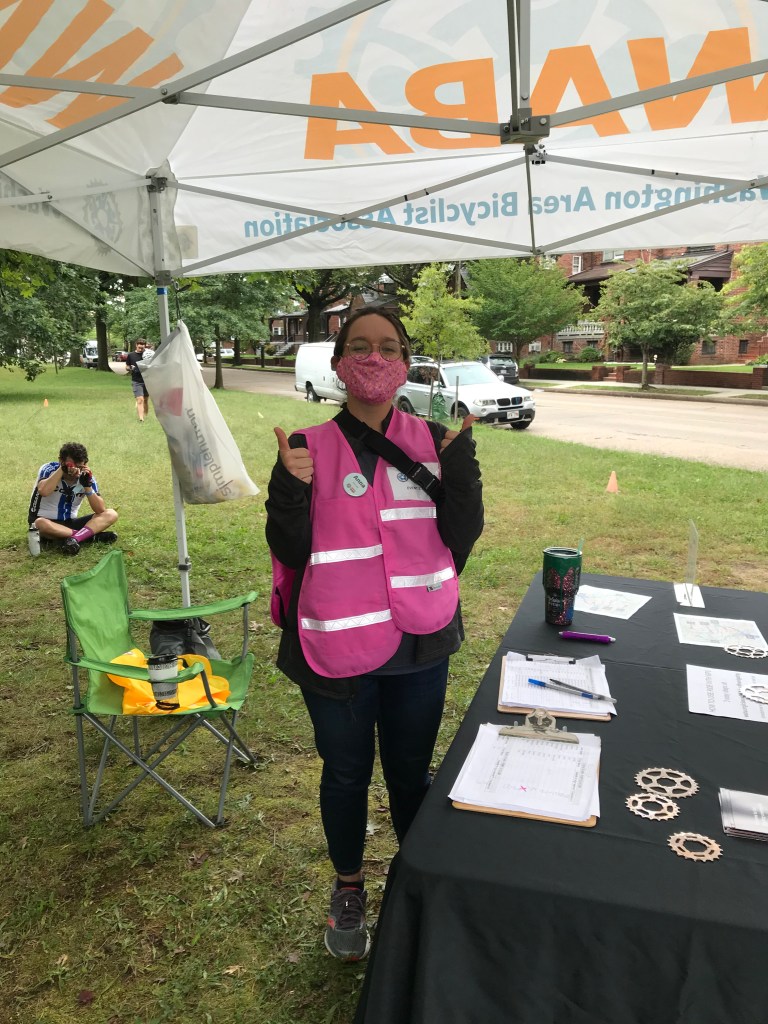
Big thanks to the volunteers and WABA staff, especially the early shift who woke up before 5 a.m. and set up the starting points/pit stops in the rain.
Congratulations to the WABA team for creatively re-imagining this event. It worked! Unfortunately, the social aspect of the ride suffered but your hard work salvaged and, in many ways, improved the event.
WABA’s Garrett Hennigan at the start in Meridian Hill Park
Meridian Hill Park before the start
Me. Ready to ride or rob a bank,
Kevin and his front wheel
Michael and friend at the Anacostia pit stop
Josephine at the Anacostia pit stop
Kevin’s lunch stop
Statue of Mary McLeod Bethune in Lincoln Park
WABA’s Anna at the Fort Slocum pit stop
WABA’s Kristin at the Fort Reno pit stop
Meridian Hill Park after the ride
WABA’s Hannah and Chris at the finish in Meridian Hill Park
Here at the Rootchopper Institute we’re social distancing our butts off. Of course, my preferred SD method is to ride my bike alone. I’ve been grinding away at it for nine days in a row. Rather than getting worn out, I’ve been getting stronger. This is exactly what happens on a bike tour. It makes no sense either on tour or at home but it is what it is.
Yesterday’s ride took me over the Woodrow Wilson Bridge, down the corkscrew ramp on the Maryland side, and up the long hill past the casino complex to Oxon Hill Road. From there I made my way into DC via the streets of Anacostia. I rode past the derelict buildings of Saint Elizabeths (no apostrophe) Hospital and down MLK Jr. Boulevard. Eventually, I made it to the Anacostia River and took the Anacostia River Trail to Benning Road. There I crossed over to the west side of the river, rode south between the river and the rotting hulk of RFK Stadium all the way to the Navy Yard. Soon I was passing Nationals Park, Audi Field (soccer), and the Wharf eventually making it down to Hains Point to check out the not-ready-for-prime-time cherry blossoms. (I did managed to shag three golf balls from the rusty spring hackers on East Potomac Yard course.) Then it was up the Potomac River past the Jefferson and Lincoln Memorials, across the Memorial Bridge to the Mount Vernon Trail and back home. A nice 43-mile spin in 70-degree temperatures.
Today’s ride was a recovery ride. I made it six miles, nearly to Old Town Alexandria, before I realized that I had forgotten my water bottles. I used the Wilkes Street tunnel to turn back home. On the way I passed my local bike store. The plan had been for the store to re-open in March, but from the looks of things it’s going to be quite some time before that happens.
View from front. You can see all the way to the exterior wall in the rear
Side view in rear, Note the missing roof.
Rear view with poles buttressing the rear wall
Within a mile or two of this bike shop there have been two other large fires in the last month. And sometime in the last few months a hotel was struck by lightning. Coincidence?
After fetching my water bottles I made my way down to Mount Vernon, home and burial place of George and Martha Washington. I can’t remember the last time I saw it closed, but such are the “circumstances” these days.
My ride home took me to Route 1. As I waited at the traffic light I took note of the remarkable fall in gasoline prices since the financial and commodity markets went haywire.
There were long lines at this station and the one next door. Of course, the handles on the pumps may be a fine place for the Covid-19 virus to hang out but you take your chances when you can save 40 cents a gallon.
The ride home was brisk. I don’t know what got into my legs lately but I was accelerating up small rises in the road and I didn’t have a tailwind.
After the ride, I spent 20 minutes scraping loose paint from an exterior wall on the house. During dinner, I had a slight and very brief twinge of nerve pain in my lower right back. Oddly, this is good news. I am scheduled to have a new kind of injection in my lower back on Monday, but I haven’t had the slightest bit of pain in six days. Tomorrow I go on a six-mile hike. If that doesn’t bring about some serious pain in my back or my left leg, I am declaring myself cured and cancelling the injection.
Now if only I could do the same for the coronavirus. I guess I’ll just have to keep bumping elbows for a while longer.
Nine years ago today, a 32-year-old bike commuting friend of mine posted these words on my Facebook page:
“I just could not feel my body in the cold. So I damaged it without noticing it!”
What a difference nine years makes! Today was almost summer-like in DC. I saw a roadside sign that indicated it was 78F degrees at 3:30.
Of course, I saw this sign while out on my bike.
I didn’t get started until just before midday. I had spent the morning eating diner food and going to the library with Mrs. Rootchopper. With my belly and brain satisfied, I was off on my Cross Check for a jaunt up the Anacostia River.
I began my ride on the Mount Vernon Trail. I crossed the Potomac River on the Woodrow Wilson Bridge Trail. Once in Maryland, I made the long slog up to Oxon Hill Road. The climb goes right past a massive MGM casino. The ginormous electronic sign indicated that Cher was performing there this month. I don’t gamble and I don’t Cher so let’s just say the whole casino thing is lost on me. I think the complex looks like the Imperial Star Destroyer from Star Wars. I prefer Mos Eisley bars to casinos.
Having reached Oxon Hill Road I made my way to Oxon Hill Farm and proceeded to ride right back down the hill to the river. Somebody’s got some explaining to do.
The Oxon Cove Trail winds its way to a enclave of public buildings including a police training facility, a city bus maintenance yard, some Smithsonian greenhouses and a vocational training complex. After perusing all these fine public sector facilities, I rode right back up the hill to Martin Luther King Jr. Avenue.
MLK Jr. Ave is not exactly where it’s at. I think maybe it’s were it might have been at about 80 years ago. It’s actually kind of depressing. My ride north took me past the grounds of St. Elizabeth’s nervous hospital. The complex is being taken over by the Department of Homeland Security which probably says something snarky about DHS.
The ride through Congress Heights and Anacostia was interesting. Drivers in this part of DC use the freestyle method of motoring. Random u-turns, lane changes, horn honking are the rule. I waved a thank you to a driver for not cutting me off and he laid on his horn. De nada, dude.
Suffice it to say, my rather precarious medical condition made me apprehensive for this part of the ride. I was happy to see the Anacostia River Trail which runs rather appropriately along the Anacostia River. And so, like a Yogi Berra malapropism, I took it. North. The scenery was still the grays and browns of winter but the temperature told me it was late spring.
I rolled along the trail past the garbage consolidation facility (helps with the sinuses don’t you know), past the Aquatic Gardens (the flower show happens much later in the year), through assorted fields, both natural and athletic, and around a cement plant to Bladensburg. As I crossed over the Anacostia, I passed about five priests (or, more likely, seminarians as they all looked pretty young). We waved at each other. I said “Mea Culpa” three times for good measure. (I was a altar boy who had to learn the Latin Mass and the English Mass, a biographical fact that dates the crap out of me. )
I am kidding about the Mea Culpas, by the way.
Once across the river I consulted the Google for advice on how to ride home without retracing my steps. I rode up the river until the trail split into the Northeast and Northwest Branch Trails. I took the latter and spotted a cupcake shop, a landmark from the Cider Ride last November. I didn’t stop. (I know, what a fool.) But I did find a trail that would take me back toward DC.
After a few miles I bailed on the trail It would have taken me to Queens Chapel Road which I am familiar with. Basically, it’s a bicycle death trap. So I started riding neighborhood streets and following the sun. I found myself back in DC riding a straight street to the west. In these parts “straight” almost always translates into “hilly”. As I slogged up one long hill, I passed an old man doddering around his front yard. He looked at me and remarked, “Better you than me.”
I love it when I’m mocked.
Soon I was in familiar territory. Monroe Street leads to 8th Street which leads to the Metropolitan Branch Trail. How nice of someone to put a trail with very few cross streets right in the middle of a city. The trail took me back southward and after a wiggle and waggle I was on a cycletrack that took me right past the incomparably boring Bureau of Labor Statistics.
I rode past a scrum of photographers at a courthouse. They were waiting to take a picture of a Trump associate who was being charged with treason or money laundering or some such offense. (I can’t keep it all straight, to be honest.)
Soon thereafter I was riding along the National Mall pretending I was in the Olympic tourist dodge event. I was pretty proud that I didn’t hit a single one.
After the podium ceremony, I rode around the tidal basin and over the 14th Street Bridge to the Mount Vernon Trail. The 12-mile ride from the bridge to my house was interrupted by a stop at the gym, because nothing improves a 48 1/2 mile bike ride quite like lifting weights.
Fug.
I arrived home exhausted but still had some physical therapy exercises to do. I am doing these because my left shoulder is on the blink.
Despite trying really hard, I did not damage my body. I guess you need cold weather to do that.
Yesterday was my longest ride since November 4, 46 1/2 miles to and from Bladensburg by way of the Anacostia River Trail. The ride was about as flat as possible so I wasn’t exactly taxing my heart and lungs. I’d have gone further but when I turned from home, I inadvertently took a short cut of sorts. It turns out that there are entire sections of the DC area that I get lost in. I become un-lost when I stumble on a street that’s on the 50 States Ride route. Yesterday I was good to go when I found West Virginia Avenue.
Thanks to my CT scans I have a new wardrobe. You can’t wear anything with metal on it to a CT scan so sweat pants are ideal. Mrs. Rootchopper was so embarrassed by my threadbare sweat pants that she bought me two new pair. Now I have CT Scan clothes!
When I moved to DC I had to jettison my Mr. Michelin down winter coat. You know, the big, puffy green ones that keep you warm on the tundra. The coat took up a ton of closet space and had no usefulness in the mid-Atlantic. I also stopped wearing sweat pants because, well, you sweat in them. I get plenty of sweating just by living in this swamp I don’t need help from my wardrobe. I had three pair of sweats (one was thermal!) and they were all falling apart from age. My new sweat pants don’t have a heavy lining; they are more like pajama bottoms. Yes, I am that retired guy that lays around his house in PJs and sweats.
Ultrarunnergirl just tweeted a link to information about deep vein thrombosis and pulmonary embolisms. https://www.webmd.com/dvt/ss/slideshow-visual-guide-to-vein-and-artery-problems. She is awesome for doing this. And it reminded me that I haven’t seen her in ages. Ack! Massive hugs to you Kirybabe.
Even though I have read a ton of stuff about DVTs and PEs, I still am perplexed by what caused mine. Lately, I’ve been thinking that I’ve had PEs for a long time. But what caused the sudden eruption of clots in my lungs in December? The WebMD article offers some possibilities. Athletes, especially endurance athletes, tend to get clots more often from injuries, dehydration, and travel. https://www.webmd.com/dvt/ss/slideshow-dvt-surprising-causes I think the DVT forms from dehydration and travel. An injury to the DVT breaks a chunk of the big clot off and it travels to the lungs becoming a PE.
My ride to Key West had all three aspects.
I fell from a porch and my bike landed across my body. I don’t know if the bicycle frame whacked my leg. I was too worried about my smashed ribs. Still it’s the only impact injury I have had in a long time.
The south is humid. It’s hard to stay hydrated, especially when you are riding in a tropical depression and getting sandblasted by gale force winds.
I rode back on the train. Despite being able to walk around, I was stuck in my seat for several hours when my seat neighbor fell asleep.
Today is a rainy day. It’s warm enough to ride outside but the gloom doesn’t float my boat. So I re-acquainted myself with Big Nellie in the basement. I rode for 1:13 or about 13 miles at a snails pace.
A year ago I was riding my bike in northern Michigan. It was cool. Literally. Riding around DC in the summer is an exercise in adaptation. After 101 miles the other day, I feel adapted. Near death, but adapted. When I moved here in the mid 1980s I tried to maintain my New England running life. It was impossible in the summer. I’d lose a pound per mile in sweat and there were no water fountains around to get a drink from.
I often take pictures of the sky. So when life gets me down, all I need to do is look up. And well….
I took this picture while sitting at Nationals Park. It was so sunny that I couldn’t see the result on my phone. Then I got home and looked at it. Yeah, it was really this nice out.
A friend of mine recently posted a quote from Ray Bradbury on her Facebook page:
“If we listened to our intellect we’d never have a love affair. We’d never have a friendship. We’d never go in business because we’d be cynical: “It’s gonna go wrong.” Or “She’s going to hurt me.” Or,”I’ve had a couple of bad love affairs, so therefore . . .” Well, that’s nonsense. You’re going to miss life. You’ve got to jump off the cliff all the time and build your wings on the way down.”
Ray Bradbury, you are a putz. If we listened to our intellect, we’d never find ourselves in toxic relationships. Only an idiot jumps into business without thinking things through. Taking risks is foolhardy unless you minimize them first. It’s obvious that Ray Bradury never went on a bike tour. If you don’t use your head, you will find yourself in the middle of nowhere with a failing tire. In the rain. With a head cold. Miserable. Been there. Done that. Thinking doesn’t make you a cynic; it just makes you prepared. (Bring a spare tire, dummy!) Go ahead and jump off that cliff, but you might want to be wearing a parachute, because the rocks will mess your ass up. Or you can follow Old Ray’s advice and, as they say in Minnesota, thin the herd.
Our disagreement on the Ray Bradbury quote probably explains why I haven’t seen or heard from this particular friend in nearly two years. She’s a YOLO person. I’m a YODO person.
I signed up to dispense beer at the Tour de Fat in DC. It’s an event that celebrates bikes, beer, music, and such. And it raises money for local bike advocacy groups. Now if you think about it, you might not come. So forget what I said about Ray Bradbury and come on out. Even if you don’t drink beer and I haven’t seen or heard from you in two years.
I’ve lived in DC for over 30 years. For much of that time I could go out and not run into a single person I knew. It was very strange. It’s not that way anymore. There were four people that I know who visited Great Falls Park on the C&O canal this weekend. I only saw one of them as I rode past on Saturday but the coincidence is kind of neat.
Also during that 30 years, I have never seen the Kenilworth Aquatic Gardens when the water lillies are in bloom. That happens this month. I would love to go this weekend but I will be out of town. If you are in DC, you should go. And, best of all, you can bike there on the new Anacostia River Trail.
The weather was perfect for a bike ride. Yay, April. So off I went on Little Nellie to DC. As I passed beneath the Morningside eagle nest I spotted a white head sticking up from the nest. I couldn’t tell if it was an eagle or an opportunistic osprey but it gave me an idea for a destination: the National Arboretum and its bald eagle nest.
I took the Woodrow Wilson Bridge across the Potomac River. The climb away from the river passes the enormous new MGM casino complex. It’s a whole lot of ugly, but you can eat at posh restaurants and see a show and throw away your hard earned dollars there. Go get ’em. I’ll pass.
At the top of the hill, I took a sidewalk (because MDOT hasn’t figured out how to accommodate bicyclist for beans in this area) to Oxon Hill Farm and descended back to the river. You see this climb and descent is required because MDOT couldn’t figure out how to add a trail along the river as there has been in Virginia for over 45 years.
The descent was a little scary because my left hand is messed up from getting jammed in flood debris on my hike yesterday. I think a small piece of wood may be lodged in my left middle finger. So braking is rather difficult.
I rode through Anacostia and made my way to Anacostia Park where there was a big festival. I ran into Nelle and Ursula from WABA. They were busy getting set up for the event. At an adjacent booth I talked with Carlos (I think that’s his name) who used to work in my local bike shop. He immediately recognized Little Nellie and asked how many miles she had on her (17,500+). Carlos did good work.
After being social for a few minutes I went back into introverted rider bliss mode along the Anacostia River. Puffy clouds and blue skies were reflected in its calm waters. I crossed over the river on the Benning Road overpass and took busy Benning northeast. Not a lot of fun but it got the job done. No way I would ride this street on a weekday. Two more busy, bike-hostile roads (17th Street and Blandensburg Road) and I was into the Arboretum. I walked by bike past a road block allowing only pedestrians to enter. Alas, further up the road a more restrictive sign appeared. No entry. Period. So I turned around.
You can check out the bald eagle nest on dceaglecam.org. There are two very cute eaglets in the nest right now. They seem to be thriving for all I know.
After my eagle fail, I headed across town to the new REI store where a free beer event was to be held later in the day. I arrived way too early so instead of drinking beer I went gawked at all the merchandise. It’s a outdoorsy wet dream. Kayaks and bikes and clothing, oh my.
The store is in the renovated Uline Arena, the site of the first Beatles concert in the US. (The place was called the Washington Sports Arena back in 1964.) The store gives a nod to this history (and other events that happened there) by putting replicas of concert posters on the concrete support posts in the store. The Beatles concert occurred a few days before their appearance on the Ed Sullivan Show that I watched in my jammies. (I found it utterly incomprehensible. I had three older brothers who, like every other kid in the country, became big fans. As, eventually, did I.)
After being overwhelmed with retail madness I headed home. The traffic on the streets and the trails was quite heavy. Tourists were stopping without warning on their bike share bikes. A couple of Lance Mamilots tried to impress the word with their speedy and agile bike riding on the narrow Mount Vernon Trail. The annoyances were minor.
I made it home to watch the end of the baseball game and to re-lube my chain. Yesterday I removed the clipless pedals from Big Nellie. Today I remove the matching cleats from my biking shoes. I am an old school toe clip dude. Sue me.
Postscript: the piece of wood in my finger popped out while doing dishes tonight. All in one piece. That’s never happened to me before. It looked like a dark brown rice kernel. Ewww
Yesterday was the fourth annual Cider Ride, the last ride of the year for WABA, the Washington Area Bicyclist Association. The Cider Ride was the creation of Michelle Cleveland whose mission in life is to see me die of exhaustion, nasty weather, and other calamities while on a bike. I am happy to report that she failed again.
Michelle handed the reins for this ride over to Nick Russo. Every so often, a really good baseball team gets a new manager. Success is defined by not screwing a good thing up. Nick succeeded. This is partly because he went into the basement of WABA’s World Headquarters and disabled the WABA weather machine which is notorious for dialing up hurricanes, freezing rain, swamp heat, and tsunamis.
The first Cider Ride took us to the wilds of Prince Georges County, Maryland in early December. It was cold. The roads were bumpy and the drivers were somewhat impatient. One of them ran over a friend of mine. So it was decided to move the ride to Montgomery County, Maryland. This ride was colder than the previous ride plus it had wind and rain. Most people cut their rides short. I took the sag wagon. (Thanks Gina!)
Then somebody got the great idea to move the ride up a month to November and to make use of all the trails running through the Anacostia River watershed. Genius! Pretty fall foliage plus minimal car traffic made for a vastly improved experience. It also imported a tradition from WABA’s 50 States Ride: the impossibly complicated cue sheet. WABA’s motto: “Getting lost is part of the fun!”
(Actual cue written by Michelle Cleveland: “Just after the little intersection but before the traffic light, take a right on the sidewalk. Avoid the light poles, loose concrete, and accumulated sand while you thread your way under the darkest overpass ever constructed until you take a right to take a left at a the Walker Road traffic light. May god have mercy on your soul.” Michelle’s motto: “I have nothing to offer but my own confusion.”)
Last year’s ride was mighty fine. I got lost. I had fun. And donuts. And pie. And I got a mug. This year’s ride was the same except that in the weeks before the ride, a new section of the Anacostia Riverwalk Trail opened up. So the route was revised adding 5 more miles of complexity and confusion. Brilliant!!!
With no rain, calmish winds, and temperatures holding in the 50s the ride was a pleasant meander. Riders stopped to adjust their clothing. The cool air was just that sort of in between temperature that gives autumn bike commuters fits. The discomfort was minor. The foliage was major! Peak!
We endured the blinding colors.
After riding the streets of Northeast DC we hopped on the older Anacostia trails and headed north along the river. In College Park we stopped at Proteus Bikes where hot cider and doughnuts awaited. Next, we passed through the low traffic roads of the Agricultural Research complex and the National Wildlife Federation facility near Beltsville Maryland.
We headed back south and toured Greenbelt Maryland, a planned community dating to the New Deal. At a rest stop in a Greenbelt park we inhaled pie and hot cocoa. Also, a yellowjacket stung my right middle finger. It swelled up so much it was useless against obnoxious drivers for the rest of the day. (Actually, it didn’t swell up and I abstained from using my BSL, bicyclist sign language, for the duration of the ride.)
Somewhere on the return through Riverdale Maryland I lost my cue sheet. This was Michelle’s fault because I blame her for everything. Actually, I had lost my cue sheet holder thingie and forgot to bring a binder clip. So I was pulling the cue sheet out of my vest pocket throughout the ride until I apparently missed when I went to put it back in. Derp.
I followed the slowest group that ever remained upright on bicycles to another rest stop at a bakery where I hooked up with another more faster group that I hoped was going my way. It was.
We made our way to the brand spanking new section of the Anacostia Riverwalk Trail. Bravo to WABA for adding this to the route. This trail rivals the Mount Vernon Trail and the W &OD Trail west of Leesburg for scenery. Fortunately the riders ahead of me knew where to get off the trail (Benning Road) so that we could make our way to the finish. I overheard one of them say “C Street” before they rode away. No worries. I decided to take C to the 1st Street cycletrack to the Metropolitan Branch Trail. Two riders who were unsure of the route gave me their cue sheet and it confirmed that my route exactly matched the official route.
And so we rode the last few miles together.
I arrived at the finish at the Dew Drop Inn rather exhausted. Here’s why:
Suffice it to say that my legs were dead throughout the ride. But I still had a good time. And I got to see several #bikedc friends during the ride and at the after party at the Dew Drop.
After four years, the Cider Ride has really hit its stride. It’s an excellent addition to the Vasa Ride in March and the 50 States Ride in September.
Many thanks to the the volunteers, the providers of snackage and cider and cocoa. Special thanks to Nick for his hard work. And to Michelle, the Ginsberg of cue sheets, who I kid relentlessly and admire intensely.