Wandering through DC
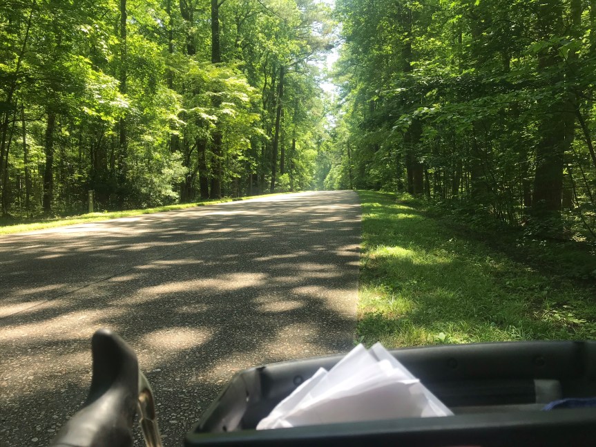
I am out of clever ideas for riding in this pandemic. On Monday I left home thinking I’d ride out the C & O Canal to Great Falls. When I got to the turnoff to pick up the towpath I decided not to turn. Instead I rode up Rock Creek Park for a mile and then exited up the short hill onto P Street.
From P Street I headed east until I spotted a statue. Must be someone important, I thought. It was the Bard of Ukraine. Yeah, well.

After checking out the bard, I moseyed over to Q Street where I found a statue of the man who united the Czachs and the Slovaks to create Czechoslovakia. He died a couple of years before the Nazis invaded. Timing is everything.

Next I started riding across town on Q Street. A cyclist rolled past. His bike was adorned with touring items, a set of front panniers, a rack bag, a tin cup hanging off the bag, etc. At the next stop light he turned and realized he knew me. It was Joe, a #bikedc friend. We had bonded over tails our our separate cross-country bike tours and the post-tour afterglow we both experienced.
Joe guided me across town through a chicane at Florida Avenue. He pointed out the gun sensor (used to notify policy of gunfire) and noted that we were in the neighborhood where the notorious drug kingpin, Rayful Edmond, ran his operation back in the days when crack was king. (Mr. Edmond was sent to the big house years ago.)

We made it through unscathed then took on the intersection of New York and New Jersey Avenues, the infamous Dave Thomas Circle. It’s actually not a traffic circle. It’s just one of dozens of places where avenues and streets intersect to form a traffic triangle. It gets its name (albeit unofficial) from the fact that there’s a Wendy’s in the middle of the triangle. City planners have promised to fix this mess for decades. I suggest a well placed explosive device would be a good start.
Joe guided me off road across the circle using curb cuts. I am impressed that he pulled this off without eliciting a single honk from drivers. We were fish on a reef swimming past the sharks. Back on Florida Avenue, we made our way into a protected bike lane. It had flexposts on the left hand side. This was great. It was filled with debris and park vehicles. This was not great.
To our left were several brand new high rise apartment buildings. Joe said his good byes and veered off to his posh abode. I continued on past Gallaudet University. A few blocks later I passed the ghost bike (a bike painted in white) that marks where my friend Dave was killed by a maniac driving a stolen van.
As depressing as the site is, I am always buoyed by think of Dave. He was a splendid human being.
Florida took me to H Street and Benning Road. I crossed the Anacostia River and took the Anacostia River Trail all the way to the South Capitol Street bridge. I rode on the side walk across the bridge and admired the new bridge being built to my left. They can’t finish it too soon. The sidewalk is falling apart.

Back on the west side of the river, I turned near Nationals Park. I managed to ride through a whole mess of construction, around Fort McNair, and down past the Wharf. This area is normally a beehive of activity but the pandemic…well, you know.
I decided to head for home and ended up riding 40 miles. Not bad for someone just wandering around.
Return to Yorktown
Yesterday, my wife, daughter, and I drove to Williamsburg VA so that my daughter could check out the law school at William and Mary University. We stopped in The Cheese Shop for sandwiches. The inside was very crowded. Everyone wore a mask but I still was very uncomfortable. We ate our sandwiches outside in perfect weather. Then I took off on my Cross Check for Yorktown.

It’s pretty easy to find. You get on the Colonial Parkway and in 13 miles you’re there. What’s the fun of that. I used the Google and found an alternate route. The first three miles were fine but for the next five miles I was on a four-lane highway with no shoulder, Not fun.
I complicated matters by missing a turn. Or two.
Thankful for my mirror, I boogied on until I saw a sign for Yorktown. Yay. I followed the sign then kept going and was rewarded with a placid two lane country road that led directly to the southern side of the battlefield.

As luck would have it I came upon the earthworks behind which the good guys had been positioned while starving the Brits in their encampment along the York River near the town.

It was near here (according to a road side sign) that Cornwallis surrendered his sword to Washington. (Cornwallis didn’t actually participate. He was sick. He send his second in command with his sword. The second in command didn’t know what Washington looked like so he tried to surrender to French General Rochambeau. Rochambeau set him right. Washington directed him to his second in command because protocol.
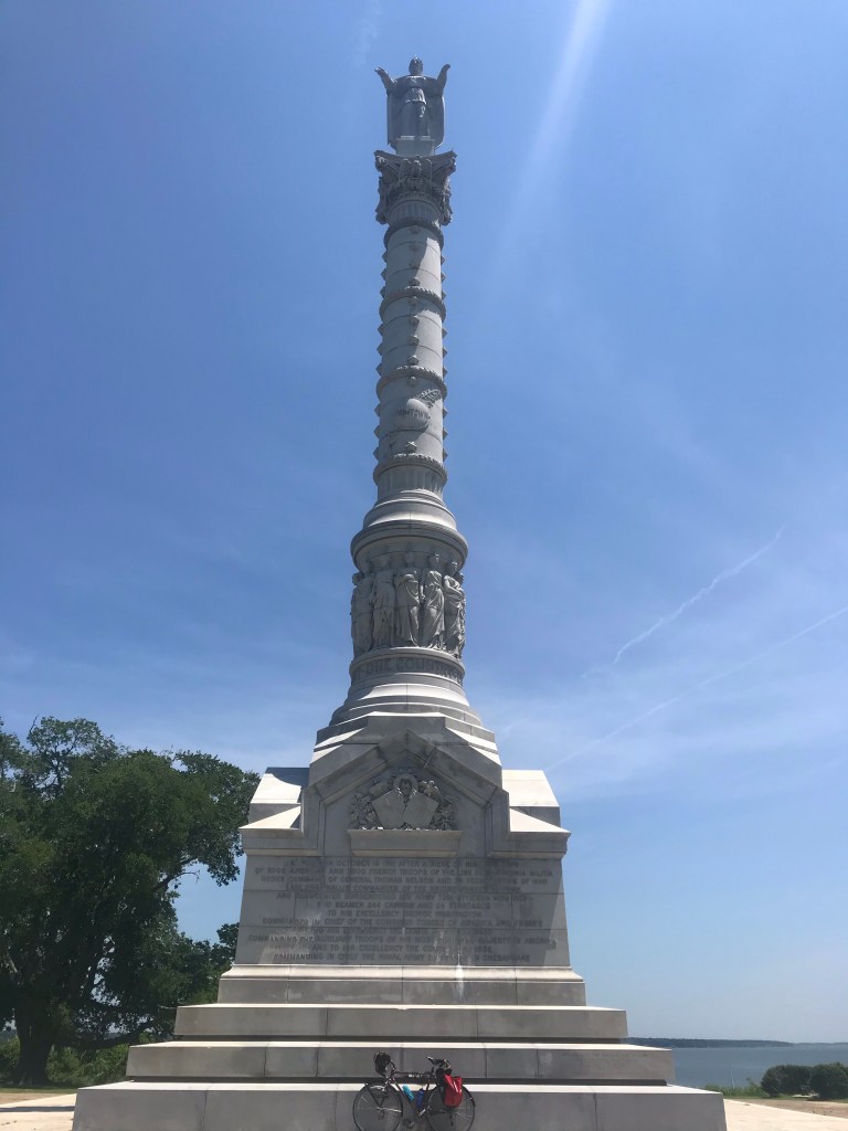
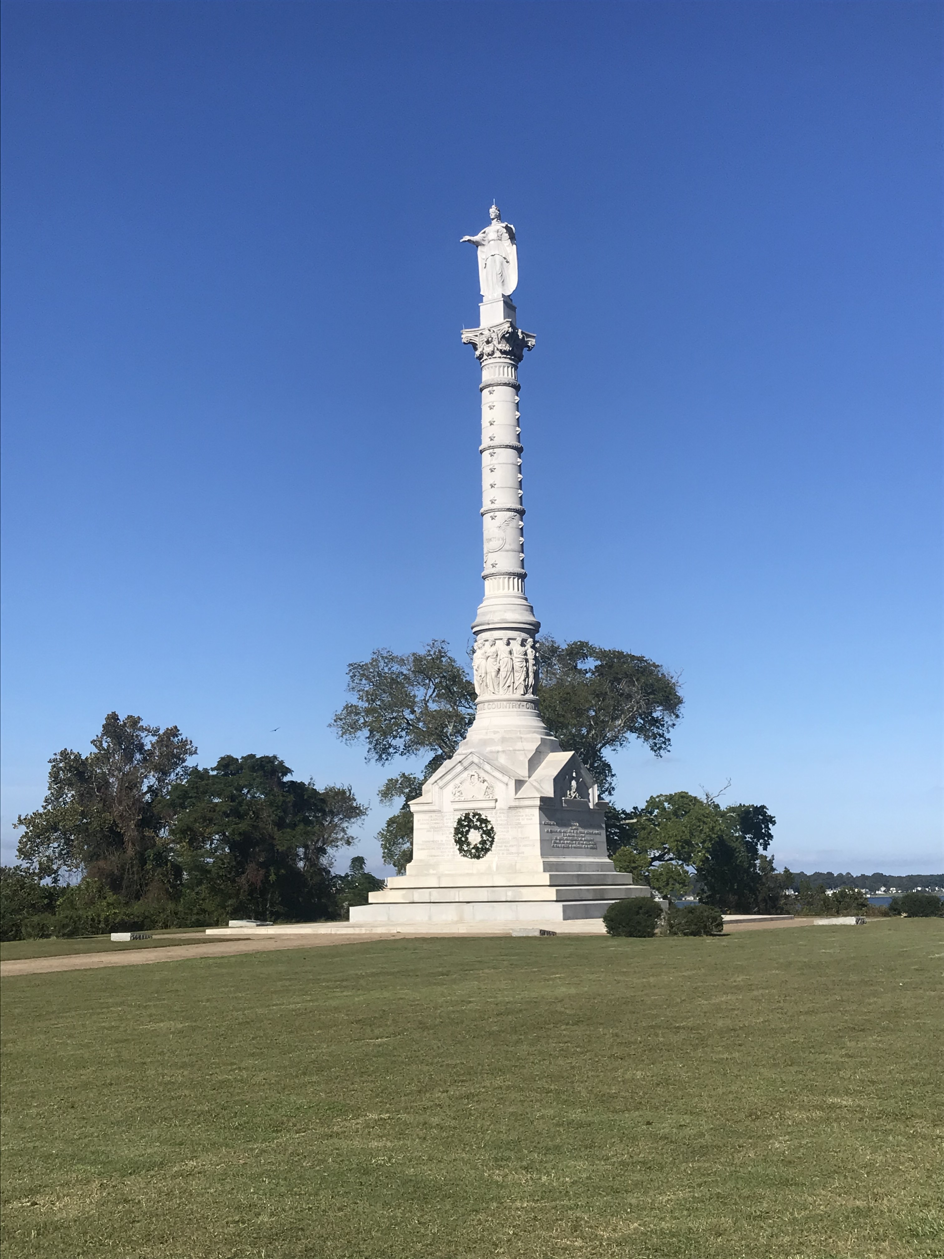
After this odd history lesson I rode past the victory monument, which is the eastern terminus to the TransAmerica bicycle route.
Using the Google again, I rode down to the beach along York River where so many cross country tourists have dipped their wheels.

I followed the river past the quaint town and along a bluff. This took me to the Colonial Parkway which made for easy navigation back to Williamsburg.
All of which is to say, if you don’t know where you’re going any road will take your there.