One Way on the WOD

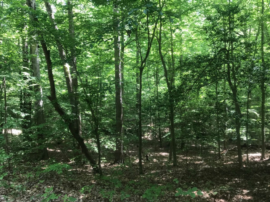
I’ve really been cooking with gas on my bikes lately. It always takes me a few months after winter departs to get my mechanics working right, but the last week I’ve been riding like a boss. After ten consecutive days of riding over 30 miles a day, I popped a 52 mile ride on my Surly CrossCheck. My route took me up to DC where I rode up Rock Creek Park to Bethesda. After a couple of miles of connecting roads, I hooked up with the Capital Crescent Trail for the return. Beach Drive. the main drag through Rock Creek Park, is closed to through auto traffic in the upper half of the park. This is a positive pandemic dividend. I hope the National Park Service continues this policy because it’s a beautiful ride.

Near the end of yesterday’s ride, the CrossCheck hit 20,000 miles. As is my practice, I am now switching over to other bikes for a while.

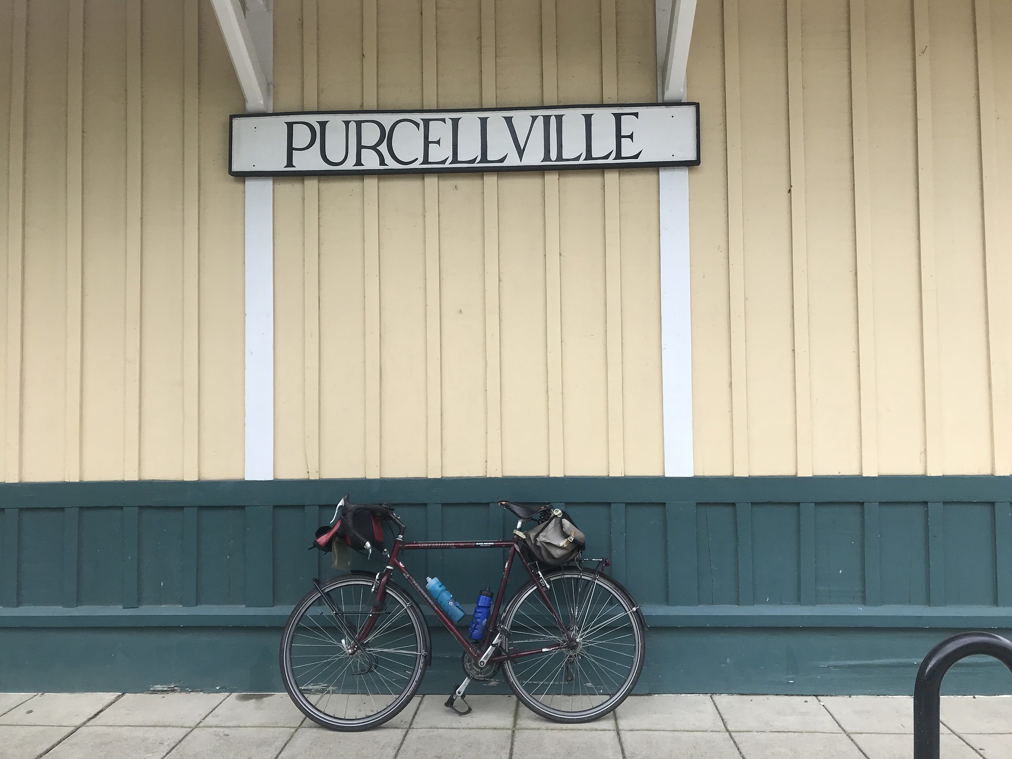
Today, The Mule got the call. My wife and daughter drove me out to Purcellville, Virginia where the Washington and Old Dominion (WOD) trail has its western terminus. I bid them farewell and headed for home.

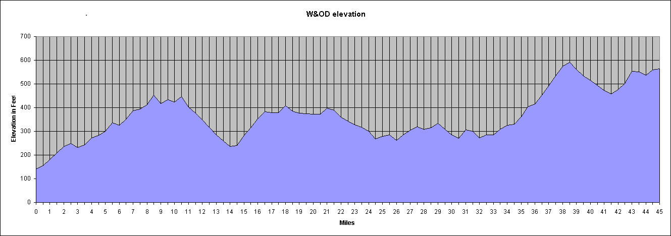
The WOD is about 45 miles long. (A few detours here and there add about a half mile by my odometer). Since it starts at the foothills of the Blue Ridge Mountains the ride loses about 545 feet along the way. The decline isn’t constant, but there are long stretches of gradual downhill that allow for riding at a respectable clip.

A couple of hundred feet from the start of the ride I noticed that my riding position on The Mule is much less aggressive than my position on the CrossCheck. I decided to try an experiment. I adjusted the tilt of the saddle down just a bit. At first it felt strange to have additional weight on my hands. And my butt seemed to have been raised much more than it actually was. After about three miles, I didn’t notice the difference at all and I seemed to have much better power transmission to the pedals.

Dang was I riding fast. I think I had about a 2 mile per hour increase in cruising speed.

To be honest, making a tweak to your riding position before riding 50 miles is not a particularly good idea. But for me. it work out okay.

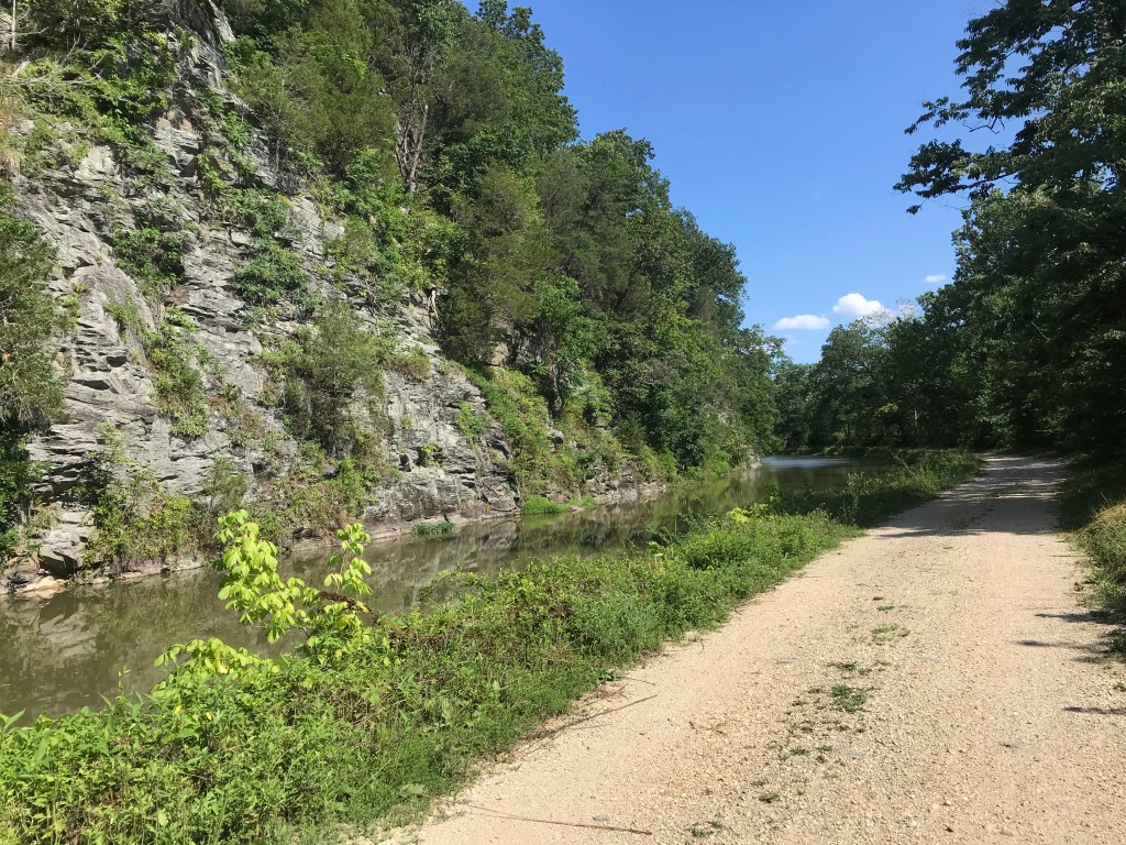
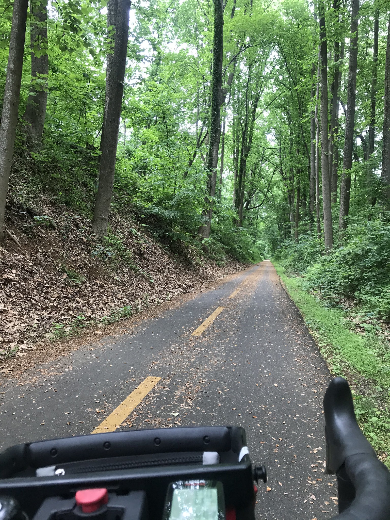
The more I rode, the more my body liked the new position. Cruising along at 20 miles per hour is not at all normal for me. I blasted through a tunnel of green for ten miles before stopping at Leesburg for a Mule photo op.

As I rode the din from the Brood X, 17-year cicadas was my constant companion. From time to time I heard other summer bugs such as the annual cicadas. The Brood X sound is a low pitched drone coming from the tree tops; the annual bugs make a higher pitched sound that seems to be only a few feet over your head.

The best part of the WOD is the ten miles from Purcellville to Leesburg. After that, development encroaches on the trail corridor. For those of us who remember when much of this area of the corridor was farm land, this change in scenery is a bit depressing.

It is what it is so you just keep rolling along. I past a few turtles in the Ashburn. Later I east of Vienna I saw a deer eating grass on the fringe of the trail. No worries.

Trail traffic was light probably because of severe weather that had raised the humidity noticeably since yesterday.

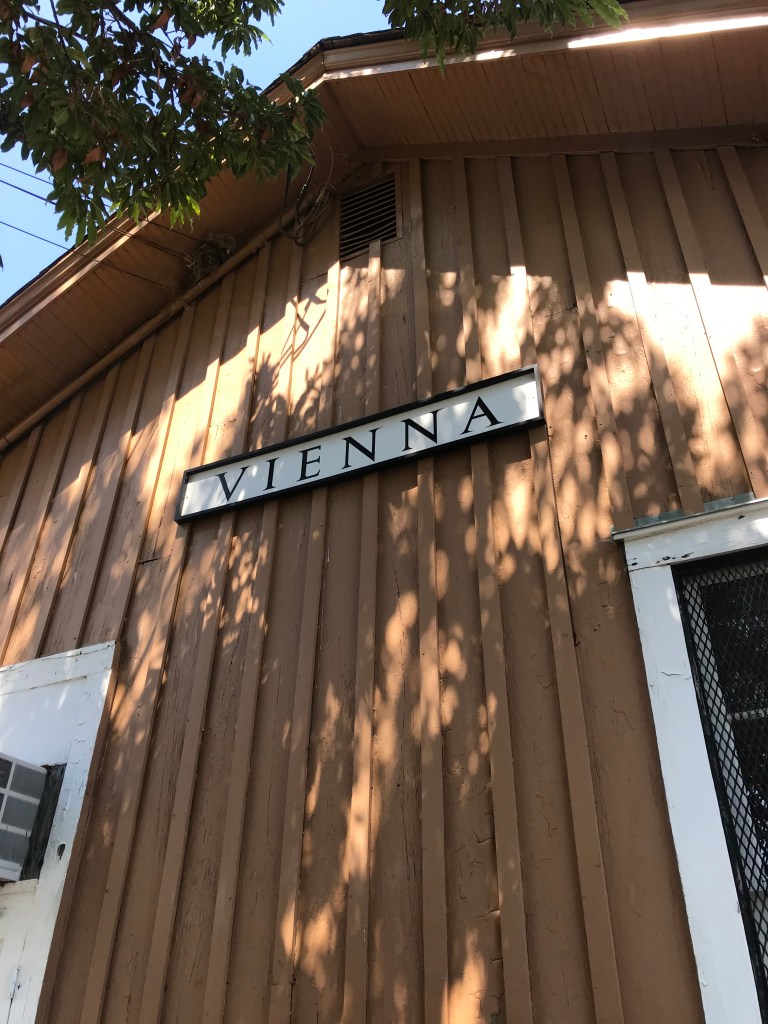
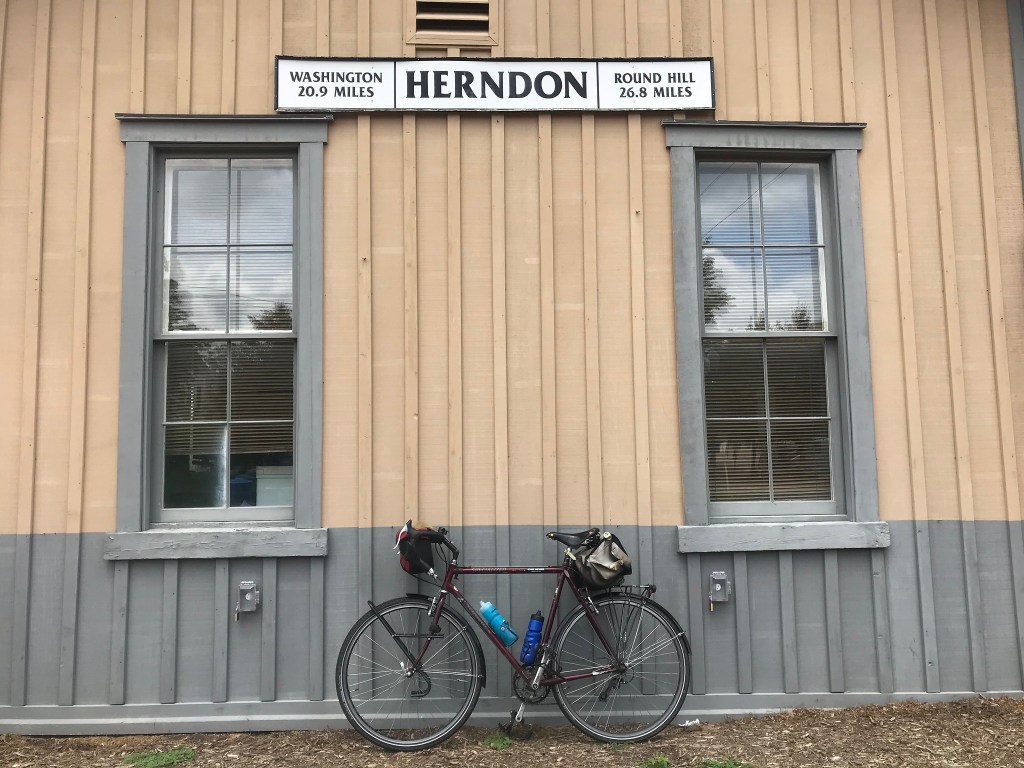
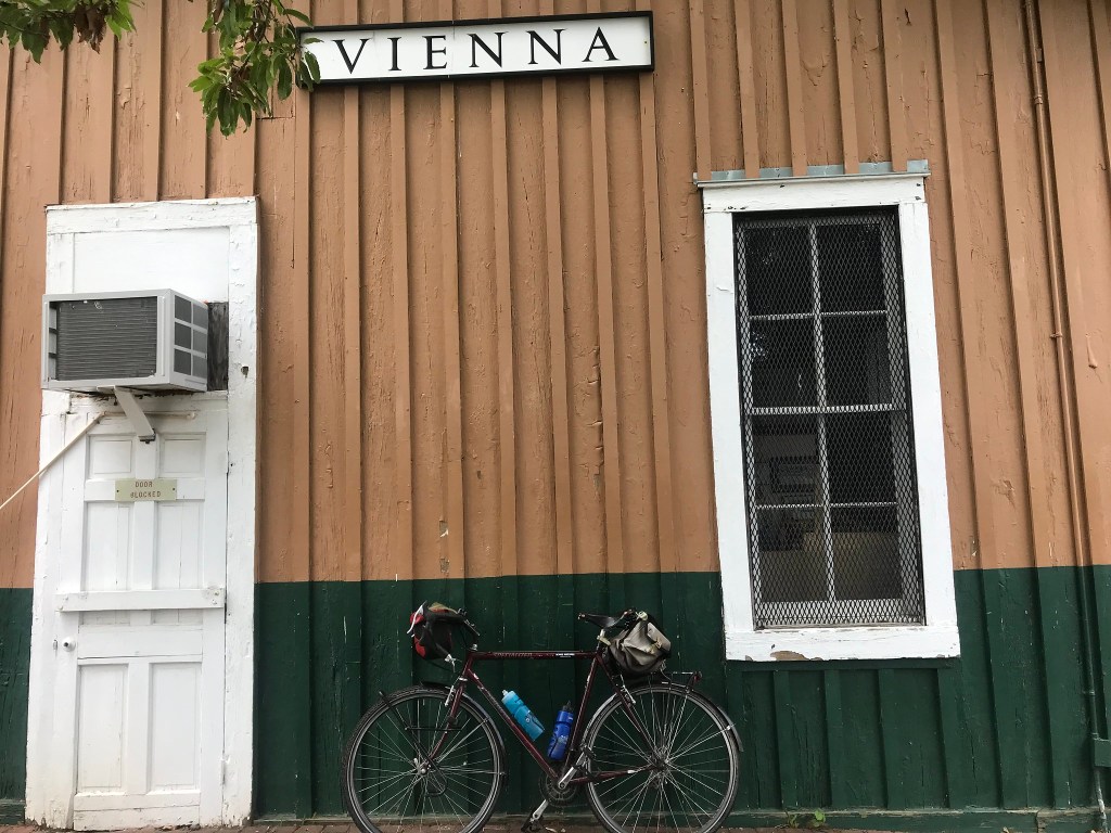
I booked along through Sterling and Herndon and Reston. Vienna came and went as did Falls Church where some major trail work caused a half mile on-street detour. It brought to mind the fact that I have very little idea what this area looks like beyond eye sight of the trail corridor.

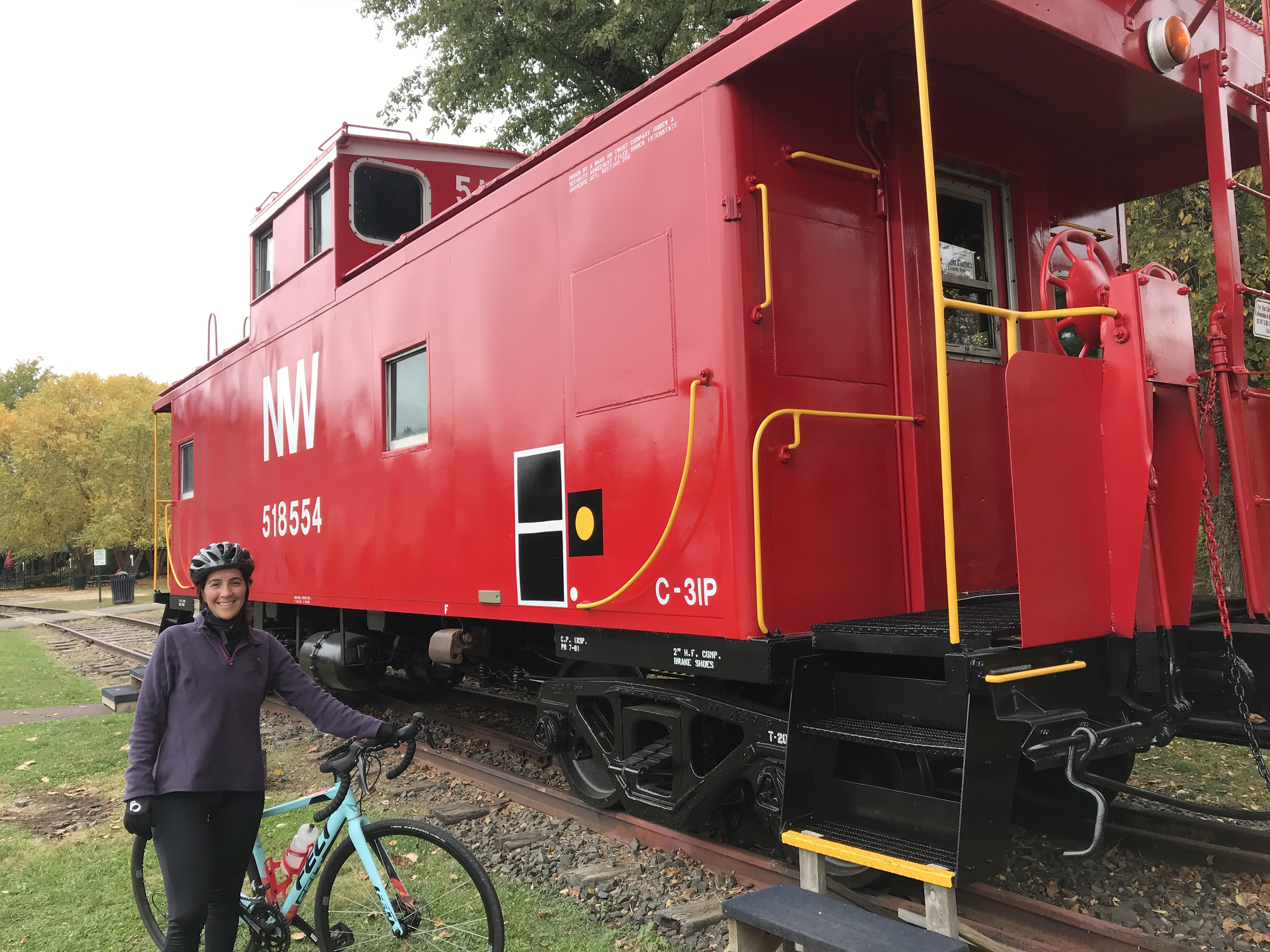
I ran out of WOD in Arlington and stopped for a couple of other photos, one of the trail sign and the other of the Weenie Beenie, an Arlington culinary institution for decades.

With the WOD conquered. I switched to the Four Mile Run Trail which took me three miles further east to the Mount Vernon Trail at National Airport. Turning south on the MVT, I made honest work of the last nine miles. My pace had slowed but by this point my brain had shut down and The Mule and I were on autopilot. Every few miles I had that how-did-I-get-here feeling.

Did I just ride 110 miles in two days? Why am I not crippled? A month ago I would have sworn that my 65-year-old body couldn’t stand a bike tour anymore. Now, it’s telling me “You still got it, kid.”

A Lot Can Happen in 61 Miles

Today was my first ride over 60 miles since the last week of September. It was also my 19th day in a row of riding and 11 days in a row with over 30 miles. My weapon of choice was Big Nellie, my long wheelbase recumbent.

My travels took me about 30 miles northwest to Potomac Village, Maryland. Along the way I passed Old Town Alexandria, a decommissioned power plant, National Airport, the Jefferson and Lincoln Memorials, the Kennedy Center, the Georgetown waterfront, historic Glen Echo Park, and a series of neighborhoods that grew posher by the mile. So many gorgeous houses. So much stellar landscaping. A suburban aspirant’s wet dream.

Along the way on the Capital Crescent Trail I spotted a sure sign of spring in DC. A dozen or more cormorants were perched in leafless trees overhanging the Potomac River. They wait there to pick off bass that are swimming upstream to spawn.

For a couple of miles I rode the rolling hills past the famous golf course of Congressional Country Club. This course has hosted four grand slam events since 1964. I haven’t played golf since the Nixon administration but I know an elite course when I see one. Dang.

At Potomac Village I turned back toward the river on Falls Road. After a ten minute break to devour a peanut buttered bagel, I rode the winding, wooded downhill on MacArthur Boulevard, north out of Great Falls Park. On a recumbent this is pure street luge.

Lunch stop

I re-traced my route back to Georgetown. Along the Capital Crescent Trail I was startled by a beefy looking hawk that swooped down in front of me and cruised about 15 feet above the path until it flapped its wings and climbed up through the trees and back toward the river.

All day I was seeing vultures surfing the winds, turning long graceful arcs as they searched for carrion to feed on. Vultures are so beautiful in flight and so ugly up close. At one point I spotted an enormous vulture doing its acrobatics along the river bank near the power plant. It was being shadowed by a much smaller vulture, a young one learning the tricks of the trade.

One advantage of riding a recumbent is the heads up riding position. You see so much more than when riding a conventional bike. Near Dyke Marsh I searched the trees for the bald eagle nest near Belle View Boulevard. Before I saw the nest, I saw a huge bald eagle perched high in a tree. It was standing guard over the massive nest immediately below it in a crotch in the tree. Pity the squirrel that gets too close to that nest.

My legs were pretty well spent when I arrived at home. 61 miles in the books.

When I went in the house and walked downstairs my left knee gave me a stabbing pain and buckled. Oops.

Maybe I should take a day off.

Nah.

Any road in a pandemic

Wandering through DC

I am out of clever ideas for riding in this pandemic. On Monday I left home thinking I’d ride out the C & O Canal to Great Falls. When I got to the turnoff to pick up the towpath I decided not to turn. Instead I rode up Rock Creek Park for a mile and then exited up the short hill onto P Street.

From P Street I headed east until I spotted a statue. Must be someone important, I thought. It was the Bard of Ukraine. Yeah, well.

After checking out the bard, I moseyed over to Q Street where I found a statue of the man who united the Czachs and the Slovaks to create Czechoslovakia. He died a couple of years before the Nazis invaded. Timing is everything.

Next I started riding across town on Q Street. A cyclist rolled past. His bike was adorned with touring items, a set of front panniers, a rack bag, a tin cup hanging off the bag, etc. At the next stop light he turned and realized he knew me. It was Joe, a #bikedc friend. We had bonded over tails our our separate cross-country bike tours and the post-tour afterglow we both experienced.

Joe guided me across town through a chicane at Florida Avenue. He pointed out the gun sensor (used to notify policy of gunfire) and noted that we were in the neighborhood where the notorious drug kingpin, Rayful Edmond, ran his operation back in the days when crack was king. (Mr. Edmond was sent to the big house years ago.)

A mural at a Q Street restaurant

We made it through unscathed then took on the intersection of New York and New Jersey Avenues, the infamous Dave Thomas Circle. It’s actually not a traffic circle. It’s just one of dozens of places where avenues and streets intersect to form a traffic triangle. It gets its name (albeit unofficial) from the fact that there’s a Wendy’s in the middle of the triangle. City planners have promised to fix this mess for decades. I suggest a well placed explosive device would be a good start.

Joe guided me off road across the circle using curb cuts. I am impressed that he pulled this off without eliciting a single honk from drivers. We were fish on a reef swimming past the sharks. Back on Florida Avenue, we made our way into a protected bike lane. It had flexposts on the left hand side. This was great. It was filled with debris and park vehicles. This was not great.

To our left were several brand new high rise apartment buildings. Joe said his good byes and veered off to his posh abode. I continued on past Gallaudet University. A few blocks later I passed the ghost bike (a bike painted in white) that marks where my friend Dave was killed by a maniac driving a stolen van.

As depressing as the site is, I am always buoyed by think of Dave. He was a splendid human being.

Florida took me to H Street and Benning Road. I crossed the Anacostia River and took the Anacostia River Trail all the way to the South Capitol Street bridge. I rode on the side walk across the bridge and admired the new bridge being built to my left. They can’t finish it too soon. The sidewalk is falling apart.

New and Old Frederick Douglas (South Capitol Street) Bridges

Back on the west side of the river, I turned near Nationals Park. I managed to ride through a whole mess of construction, around Fort McNair, and down past the Wharf. This area is normally a beehive of activity but the pandemic…well, you know.

I decided to head for home and ended up riding 40 miles. Not bad for someone just wandering around.

Return to Yorktown

Yesterday, my wife, daughter, and I drove to Williamsburg VA so that my daughter could check out the law school at William and Mary University. We stopped in The Cheese Shop for sandwiches. The inside was very crowded. Everyone wore a mask but I still was very uncomfortable. We ate our sandwiches outside in perfect weather. Then I took off on my Cross Check for Yorktown.

The view from The Cheese Shop

It’s pretty easy to find. You get on the Colonial Parkway and in 13 miles you’re there. What’s the fun of that. I used the Google and found an alternate route. The first three miles were fine but for the next five miles I was on a four-lane highway with no shoulder, Not fun.

I complicated matters by missing a turn. Or two.

Thankful for my mirror, I boogied on until I saw a sign for Yorktown. Yay. I followed the sign then kept going and was rewarded with a placid two lane country road that led directly to the southern side of the battlefield.

As luck would have it I came upon the earthworks behind which the good guys had been positioned while starving the Brits in their encampment along the York River near the town.

Earthworks at Yorktown Battlefield

It was near here (according to a road side sign) that Cornwallis surrendered his sword to Washington. (Cornwallis didn’t actually participate. He was sick. He send his second in command with his sword. The second in command didn’t know what Washington looked like so he tried to surrender to French General Rochambeau. Rochambeau set him right. Washington directed him to his second in command because protocol.

After this odd history lesson I rode past the victory monument, which is the eastern terminus to the TransAmerica bicycle route.

Using the Google again, I rode down to the beach along York River where so many cross country tourists have dipped their wheels.

I followed the river past the quaint town and along a bluff. This took me to the Colonial Parkway which made for easy navigation back to Williamsburg.

All of which is to say, if you don’t know where you’re going any road will take your there.

White’s Ferry Loop

One of the long rides I try to do every year is the White’s Ferry Loop. This ride links up several trails in the DC are for a 90-mile circuit. Including the 9 1/2 miles to the loop from my house brings the total mileage to 99. Typically, I add a mile somewhere along the way for the full century.

I chose to ride clockwise because the forecast called for heat and humidity. This would put me on the shaded C&O Canal towpath for the hottest part of the day.

I boogied along for 23 miles taking streets and two trails (see below) before stopping at the Vienna train station building to refill a water bottle. Then I was back on the W&OD Trail all the way to Leesburg, about 47 miles from home. Whenever I could I topped off my water botlles. To be on the safe side, I carried five bottles, two on the bike and three in a pannier. I also brought snacks. Peanut butter on bread, pretzel sticks, and a couple of old chewy granola bars.

I rode on King Street through Leesburg, which had many tempting places to eat. In fact, if you stopped at every microbrewery along the way you’d pass out before the ferry.

North of Leesburg is the sketchy connection to US 15, a busy north south highway. I lucked out as there were no cars coming. The highway has a big shoulder along this part (because bicyclists were hit and killed several times in years gone by).

After a half mile , I turned onto Whites Ferry Road for another 1/2 mile of quiet country road to the ferry. If cars are coming toward you, you can take your time, because the ferry is crossing back to Maryland. I arrived at the ferry and waited in the shade for the trip back. As ferry trips go, this one is pretty calm. It only takes five minutes.

The store on the Virginia side is up an embankment. The exterior of the building has marks with dates next to them showing the high water marks for major flood events. Suffice it to say, Hurricane Agnes did a number on this river valley back in the early 70s.

After some ice cream, Gatorade, and a port-a-potty break I headed south on the C&O Canal towpath. The double track of the past is gone, replaced with an unpaved smooth surface. For five miles, that is, until it’s back to the bumps. Riding a recumbent means you feel every bump because you cannot easily lift your butt off the seat.

Near Seneca Creek the towpath is muddy. I was slipping and sliding but I didn’t fall.

From time to time, I saw deer, squirrels, herons, and large ominous looking birds. Mostly I was just trucking along and enjoying the shade. I particular like the sections where you can see the river with all the large rocks randomly poking above the water line and the places where the canal is filled with water and bordered by ominous rock walls.

After 32 miles I switched back to pavement on the Capitol Crescent Trail. This brought welcome relief to my back. The bumpy towpath was messing with my stenosis and I was constantly dealing with achy feet and an achy butt.

The CCT leads to the nifty Water Street cycletrack which connects to a side path that runs past the Watergate and the Kennedy Center along the Potomac River. After passing the Lincoln Memorial I switched over to Ohio Drive, which is the epicenter of the Cherry Blossom Festival in the spring.

At the Jefferson Memorial, I crossed over the river on the 14th Street Bridge which connects to the Mount Vernon Trail and the 12-mile ride home.

All aboard!
Waiting for the ferry
Imagine water well above the treetops. It happens every so often
The White’s Ferry Store serves food and sells snacks.
Groomed towpath is a big improvement
Rocks in the river
Cliffs, canal, towpath
Little Falls Dam northwest of DC

Here’s a cue sheet. Most people just do the loop starting and ending at Step 3.

  1. Three Miles of suburban streets to the Mount Vernon Trail
  2. Mount Vernon Trail north 6 1/2 miles through Old Town Alexandria to Four Mile Run Trail.
  3. Four Mile Run Trail west 3 miles to the W&OD Trail
  4. W&OD Trail 35 miles to South King Street in Leesburg
  5. Right on South King to US 15 north of town, about 3 miles
  6. US 15 to a right on Whites Ferry Road, 1/2 mile
  7. White’s Ferry Road 1/2 mile to the ferry
  8. Ferry across Potomac ($2)
  9. Go 100 yards up the hill on the Virginia side
  10. Take a right on the C&O Canal towpath and ride 32 miles to Thompson’s Boat House
  11. Switch to paved Capital Crescent Trail and Water Street in Georgetown for 3 miles
  12. Right onto Rock Creek and Potomac Parkway path to Ohio Drive (1 mile)
  13. Ohio Drive to 14th Street Bridge (1/2 mile)
  14. Cross bridge to Mount Vernon Trail (1/2 mile)
  15. Take a right on the trail. Go 9 miles.
  16. Re-trace suburban streets home. 3 miles.

Finally, if you do this ride, bring water and snacks. There are pumps along the towpath but these may be turned off. Also, the National Park Service treats the water with iodine. The store at White’s Ferry has limited hours so I assume it’s closed. On this day it was open.

Minding the W&OD

“Everything is walking distance if you have the time.” Steven Wright

Q: “What’s the secret to a long marriage?”

A: “Don’t get divorced?” Olivia Harrison

After a rather ambitious week of riding (252 miles), I decided it was time to up my game. I had intended to ride the Whites Ferry Loop on Saturday but I got underway a bit late and decided to abandon the effort about 28 miles from home. The resulting 57-mile excursion left me wanting something more better.

And so I launched Big Nellie intending to ride the big beast to Purcellville. About 1/4 mile from home, its rear shifter cable snapped in two, so I returned home for The Mule. While changing out of my recumbent clothes (regular street clothes) into biking gear I had an asthma attack.

My asthma diagnosis is mild persistent asthma. It manifests itself not in wheezing episodes but in labored breathing and a fog of depression. One puff of a rescue inhaler (albuterol sulfate) and my lungs settled down. I hopped on The Mule ready to rumble.

The out-and-back route involves three miles on suburban streets to the Mount Vernon Trail. The trail takes me north along the Potomac River about six miles to the Four Mile Run Trail at National Airport. After another three miles the FMRT ends in Shirlington where I pick up the Washington and Old Dominion rail trail which goes 44 1/2 miles all the way to Purcellville at the base of the Blue Ridge Mountains.

I’ve probably done this ride ten times. It’s a good test of riding endurance and the ride (except for one hill on the way back about 2 1/2 miles from home) seems virtually flat. I said “seems” because ride gains elevation then gives it up, resulting in about 1,400 of gross elevation gain.

The scale of the chart is deceptive; each gain in elevation is gradual, but for a handful of abrupt rollers from time to time. The biggish hill from mile 32 to mile 39 is mostly uninterrupted. The one from mile 1 to mile 9 has several cross streets and traffic lights making it hard to take advantage of the favorable grade on the return.

Along the way the trail passes through Arlington, Falls Church, Dunn Loring, Vienna, Reston, Herndon, Sterling, Ashburn, Leesburg, Clarks Gap (the high point), Paeonian Springs, and Hamilton Station before ending in Purcellville.

It always seems like a long slog on the way out. Mostly I attribute this to the gradual elevation gain. There’s also a psychological element that I’ve never been able to get my head around. Going places somehow seems much longer than returning, regardless of your mode of transport.

The density of trail users fluctuated as I passed through more heavily populated areas. If you’re into beer, you can stop at several mircobrewies along the way. (I didn’t.) Many years ago the area near Dulles Airport was farmland but nowadays it’s suburban sprawl. From Ashburn to Leesburg is less developed. You can check out a quarry if rocks are your thing. From Leesburg to Purcellville is a tunnel of green bliss, easily my favorite part of the trail.

My odometer is rather sketchy but it read 56.36 miles when I reached Purcellville. I took a selfie with one of the Purcellville signs (the other had too many bikes under it so I had to go small.

Bikey mask courtesy of Mrs. Rootchopper

There’s an old saying among marathoners. The race is 26.2 miles long. The halfway point is around 20 miles. That’s when the bear jumps on your back.

I expected the same from this ride. I had about five hours of daylight left so I was definitely in Steven Wright mode. The way to ride over 100 miles is, like Olivia Harrison says, is to keep on going.

And there I was bombing down the long grade from Clarks Gap at 20 miles per hour. The downhill grade and the mental aspect of having already seen the sights put my mind at ease. I’ll get there when I get there.

On the way out I ate a bagel with peanut butter on it. At Purcellville I snarfed some trail mix. I stopped in Leesburg on the return for more snacks. A gatorade and some cookies got my energy back up.

The gentle rise in the trail just west of Vienna started to mess with my head. It’s a false flat; it looks level but it’s not. When I finished with it, I stopped at the Vienna railroad station (long ago made inactive) and ate a Snickers bar.

23 miles to go. No guts, no glory.

As I plowed along, body parts started to complain. My thighs. My lower back. My left shoulder. To ease my discomfort, I stretched as I rode. I got out of the saddle for the short climbs, anything to distribute the fatigue. (Sadly, you can’t do this in marathons. You’re body goes all wonky and you just have to run through it which is rather depressing when you can’t lift your thighs.)

Three miles from home I decided to climb a short steep hill to avoid adding a bit of distance to the trip. It was the only time I used my granny gear. My knees were thankful.

20 minutes before sunset, I rolled into my yard. 113 miles, my longest ride since June 2018, and only my third century since then.

Anything is biking distance if you have the time and don’t quit.

Round and Round in the Park

Today we’ve returned to typical DC summer weather. Hot and humid.

I checked the website for Prince William Forest Park, a national park that is oddly situated right next to I-95 about 30 miles south of my house. The website said the park was open so I put the CrossCheck on the back of my car and headed south.

Upon arrival I could see a barricade across the access road into the park. Hmmm. The website said the park was open. There were no signs restricting parking on the highway so I parked my car on the shoulder. I rode around the barricade and was soon surrounded by green.

My plan was to ride the park’s scenic drive which I recalled as being a 17- mile loop. As it turned out it was more like seven miles. No worries, Instead of two or three laps I would do four or more.

You ride uphill then down to get to the scenic drive. Riding in a counterclockwise direction, I started climbing as I entered the circuit. At one point the road has a cycletrack on it. (See the picture above.)

Since the park entry was blocked off, the roads were car free but for a couple of Park Service trucks going about their business. All the trees acted as a sound barrier; I couldn’t hear I-95 which was less than a mile away. No cars. Birds singing. Smooth pavement.

Bliss.

I saw about 15 people in total. Two on recumbent trikes, two on road bikes, and the rest on foot.

The loop road goes uphill for about a mile then seems to plateau for five miles or so. Then it descends and the road curves this way and that. I hit 40 miles per hour, an especially sweet experience without big metal things to worry about.

After the big descent the inevitable climb begins in three stages. The first two stages come at the end of the loop. These were hard and had me huffing and puffing. After the second stage comes another brief descent to the end of the loop. The third uphill stage is the start of the next time around the loop.

I did four loops. By this point I was running low on water and decided to ride out of the park. As I cleared the park, I emerged from the shade. My car was sitting in an inferno. I’m sure glad I picked a shady place to ride today.

Socially distant along US 1 in the soulless exurbs

After day riding in the basement yesterday, my soul couldn’t take it anymore. I hit the roads on The Mule. People on the Interwebs have been complaining about inappropriate crowding on the trails around here so I eschewed the trails and stayed on streets. I made my way across US 1 past WalMart and Cosco and the car wash and the trailer park and through the table flat streets of lower Hybla Valley. After five miles I was once again back to Route 1 where it passes through Fort Belvoir.

Fort Belvoir is an absolutely wonderful place to ride a bike but it has been closed off to civilians for many years. It seems our military can’t distinguish between a harmless old dude on a bike and a maniac intent on mass slaughter. (Hint: my frame pump does not have a bump stock attachment.)

Route 1 is a six-lane death trap that the geniuses at VDOT decided to put unprotected bike lanes on. They were so confident in their work that they put a wide multiuse path alongside the same roadway. Being a bear of very little brain I chose the bike lane. (You knew I’d do that, didn’t you.)

I made it all the way to beautiful Lorton, Virginia. According to one of my favorite DJs, Lorton rhymes with how Ralph Kramden pronounced “Norton!” (NAW-un, I think.) What a coincidence that it has all the style of a Brooklyn sewer worker.

Lorton is nothing but four lane roads and eyesores. It could be anywhere and feels like nowhere. Pharmacy. Car Wash. Bank. Strip Mall. Fake town square. Highway ramps. Endless traffic lights.

Once in Lorton I made my way further south on a road that follows the right of way of the main rail line to Miami and a buried natural gas line. These scenic parts are obscured by trash, scrub brush, and sumac.

After a couple of hills, I was back at Route 1 for a five minute wait to cross the highway at another forever traffic light. I rode past a gas station and a Seven Eleven, up yet another hill, and finally came to a stop at an unsignalled intersection. I was going to make a left but decided that it would be wise to yield to the endless stream of jacked up pick ups and SUVs that were clearly in a hurry to get someplace.

Funeral delayed, I took a left onto two-lane Old Colchester Road (Note to VDOT: no need for the “h”) and began a mile-long, shaded, winding downhill on brand new pavement. After 14 miles I was due for some decent cycling. There were modest homes on big, treed lots. One had horses in the yard.

After about four minutes I crossed a creek. There to my left was the one thing that can make an ugly sewage treatment plant uglier: construction of an even bigger sewage treatment plant. And, of course, it was back up a hill until I hit Route 1 again. At a light. A very long light.

Green! Off I went down hill on Telegraph Road through scenic small business parks. Table tops. Pest control. Landscape contracting. Pet food outlet. So much ugly to see. You could sell tickets.

Onward past Fort Belvior’s wee landing strip, up another hill, down a hill, up a hill, down a hill. Each hill was helpfully interrupted by traffic lights, strategically placed to steal your momentum. What made the traffic lights more annoying was that there was very little traffic to be controlled.

Down another long hill. My lovely little bike lane disappeared as I sped at 25 miles per hour into an ever narrowing roadway. Then I got a lane again to get through a new six lane intersection with two sets of traffic lights. Joy.

Once past all this it was up yet another hill. Red light at top, of course. Down again. Roadway narrows again until it expands into six lanes. Fortunately, all the drivers were home infecting each other. I cruised for a mile to Huntington Avenue, a four-lane road with no paved shoulders that goes past a Metro station. Empty.

Finally, I re-crossed Route 1 one last time, because what could be more fun. Yes, another traffic light. I made my way toward home, up two more hills on Fort Hunt Road.

Did I mention it was windy?

Did I mention that pollen levels were through the roof?

I arrived home after 30 miles, a couple of dozen hills, 212 red lights, and countless epic vistas of sub- and exurban ugliness.

The exurbs tried and tried to steal my soul but The Mule would not let them. The Mule abides.

Emilia and the Red Caboose

Yetserday, I rode the Great Pumpkin Ride in Fauquier County, Virginia with my friend Emilia. This was our fourth ride together. Our first ride together was the 2014 50 States Ride. She had a rough time. We did it again in 2017 and this time I had a rough time and she, despite missing several climbing gears, flew up the hills. She weighs about half what I do so it was reasonable to assume would bury my sorry old ass on a sod farm in the hilly Virginia Piedmont.

Lucky for me, the last ride she did was the New York City Century back in early September. Unlike me she skipped breakfast. So on an empty stomach and with legs that hadn’t spun a pedal in seven weeks, she insisted on riding the long, 67-mile route yesterday. She’s pretty tough.

We lined up next to the red caboose at the start/finish line. Soon we were off down a rail trail then onto country roads where we were treated to rolling hills, 60 degrees, calm winds, cloudy skies, and the occasional sprinkle as we cruised through the rolling terrain at between 12 and 13 miles per hour. The foliage was close to peak and every so often we oohed and aahed at natures show. The lifestock in the fields seemed utterly (pun intended) uninterested in our passing. I explained that during my ride across the northern plains last year, I could get cattle and horses to stampede. Their Virginia cousins were having nothing of it.

The police warned us not to ride side by side so Emilia followed close behind me for most of the ride. She rides a bit closer to the edge of the road than I prefer so there was little chance that we’d overlap wheels.

Emilia’s native language is Spanish. I take advantage by quizzing her about useful phrases that I typically forget. Mostly we just rode and listened to the voices inside our heads. It’s nice to have a riding partner who appreciates that.

IMG_3277
Just trees and hills and fresh air


Thanks to her layoff, we rode at exactly the same pace for nearly the entire ride. She’s a vegetarian and needed no prodding when we came to the first rest stop 19 miles into the ride. There she gorged herself on a thin slice of cinnamon bread and half of a banana. I noticed she had barely touched her water bottle. I thought “no bueno” but she was perfectly happy with her food and water intake.


We rode another 22 hilly miles before finding the next rest stop.  She was laboring a bit at this point so she gorged herself with a thin slice of pumpkin pie and a wee bag of potato chips. Then off we went.

IMG_3282 (1)
Emilia after pumpkin pie

The next thirteen miles were a bit hillier. I noticed at mile 50 she was laboring up a hill. Her thigh muscles were cramping. Her water bottle remained nearly untouched. No bueno. We slowed a bit and forged ahead. At an intersection with a busy highway she had trouble unclipping from her pedals and wobbled into the cross road. Fortunately no cars were coming but she knew that the little incident could have been bad news. I could see on her face that the layoff since early September was taking its toll. She was pretty tired.

The route to the final rest stop is out-and-back for about 2 1/2 miles. We saw riders returning from the rest stop turning toward the finish. Emilia did not have a cue sheet in front of her and got rather animated about following them. I briefly considered skipping the rest stop. That would have risked seeing her bonk all the way to the finish so I explained we needed to get some food in her and forged ahead to the rest stop at the Old Bust Head brewery.

Once there, she had pie, three small cheese quesadillas, a small portion of tater tots, a cup of pumpkin soup, and two cups of Gatorade. Smiles.

“Ok, John, I’m ready.”

Crisis averted. As we rode I counted down the next few miles.

12!

11!

Only tell me the single digits.

How do you say nine in Spanish?

Nieve!

Ocho!

She fell back on a hill, caught up, then fell back again.

Are we at seven?

No. Cinco!

You’re kidding.

No.

Big smile.

A few more hills and we found ourselves on the rail trail back into town. It always seems longer that it actually is. Emilia started looking for the caboose.

And there it was after 67 hilly miles.

IMG_3284 (2)
Emilia, her steed, and the caboose

Tired but todo sonrisas.

We hope to ride again next Saturday at the shorter and flatter Cider Ride in DC. There will be no caboose but the donuts and cider and pie will make up for it.

And some don’t get rained out

There is an old saying in baseball: you win some, you lose some, and some get rained out.

This is a story about losing, getting rained out, and winning. Leave it to me to get things totally out of sequence.

About two years ago the Red Sox were scheduled to play an exhibition game versus the Nationals at Nationals Park to mark the end of Spring training. I managed to get one of four tickets that one of my co-worker’s bought.

Losing

As I typically do, I set out on by bike for the ballpark. It was raining. I got about five miles from home when, heading northbound, I was hit by a black SUV on the Mount Vernon Trail. (There goes the no hitter.) The SUV was exiting a condominium complex and failed to stop before making a right on red. To this day I am shocked that I managed to escape from this encounter with only some bruises.

Getting Rained Out

A short time after the crash, I was informed by the Twitter that the game was rained out.

Winning

Fast forward 22 months. I am riding southbound on the trail to the exact place where I was hit. There, blocking the entire trail, was a white SUV. I came to a stop and shouted at the driver. “Why are you here? Why are you blocking the trail?” The driver looked at me as if to say “So what.” Then, before I could ride around the front of the vehicle, the driver took off, taking a right turn on red.

I had seen this behavior dozens of times and I finally decided to ask the city of Alexandria to do something about it. I wrote them a short note requesting a change to a sign. Drivers leaving the condo complex at this intersection face a traffic light with a sign that says “No Turn on Red when Pedestrians Are Present.” I asked that the city to replace it with a sign that says “No Turn on Red.” I deliberately kept my request simple thinking it would avoid getting bogged down in analysis and budgetary considerations.

I had no idea that there was an Alexandria City Traffic and Parking Board. My note was referred to them and the issue was placed on the February meeting agenda. My friend Erin Meter provided a statement on behalf of the Friends of Mount Vernon Trail. Her statement, and that of Zack DesJardins, went into details about traffic signal timing, signal delays, best practices on signage and traffic lights and the like. (Judd Lumberjack came and offered moral support.) Erin and Zack did some serious homework on this.

Two representatives of the condo complex spoke. One had several pictures of the scene. (I was half expecting him to talk about the circle and arrows and the paragraph on the back of each one. But I digress.) Finally, I gave a brief statement. (The order was not for dramatic effect. It’s just that I arrived last.)

I explained how I was hit. And that I see the trail obstructed on a regular basis which is obviously dangerous.

The Board then voted unanimously to change the sign and to study the signal and signage issues.

I couldn’t believe it. I actually had to ask Erin if we won.

We won.

A tip of the cap

Many thanks to Christine Mayeur, Alexandria’s Complete Streets Coordinator, for encouraging me to show up and give a statement.

And to Erin, Zack, and Judd for thoughtful statements, support, and photography,

Zack, Me, and Erin (Photo by Judd Lumberjack)

P. S. Teddy Ballgame would not have approved. I put on a tie and nobody died or got married.


Elizabeth and Brittany

Say It Ain’t So, Tin Lizzie

Today I was saddened to read Elizabeth’s blog post about the possibility of giving up bike commuting. Elizabeth lives and works in the busy Ballston to Rosslyn corridor of Arlington, Virginia. Many years ago Arlington planned this area out to be a place where you could do just fine without a car. As it turns out, Elizabeth could easily get to work by subway, bus, or bike. She’s been riding her bike on unprotected bike lanes and has had more than her share of close encounters with big metal things.

What’s doubly depressing about this is that Elizabeth mentioned my recent intimate get together with a red light running SUV as a factor in her thinking.  When I wrote that post it never occurred to me that it would put people off bike commuting. I should have put my event in context. I have had dozens of close encounters with motor vehicles over the years. Maybe I’ve been lucky, but in over 100,000 miles of riding, I’ve never been hit.  I have hit two cars. One right hooked me and I hit him in the back right fender. If I had been competent I would have missed him entirely. Another was parked and jumped out in front of me. (It was windy. I had my head down. It was really embarrassing.) I was doored a block from Elizabeth’s office a few months ago. I was going very slowly. The door hit my very full rear left pannier.  No harm, no foul. I gave the exiting passenger a dirty look.

Stuff happens. I could be in the hospital or a funeral parlor right now. But I’m not. I rode to work today – right past where I was hit. I did come close to a collision today though. A goose was hanging out in the center of the trail. An oncoming commuter scared it into my path. She laughed and so did I. I’m riding to work tomorrow.

If experienced commuters like Elizabeth quit, we are doing something seriously wrong as a community.

Snakes in the Trees

In completely unrelated news, I learned today that rat snakes grow up to six feet long and climb trees. They are known to inhabit Dyke Marsh where I take my sunrise photos for this blog. I can handle big black SUVs but I think if I had to deal with a six-foot black snake in a tree, I’d soil myself.  This picture was taken today, by the way.

Snakes
Photo from Friends of Dyke Marsh Facebook Page

The Bliss Comes Back

And now some good news. Blissful Britt came back to her blog today. I thought she was going to be gone for months. She lasted three weeks. Stamina is overrated.

And So Does Baseball

And speaking of bliss, baseball is back in DC. The Washington Nationals won their home opener, 4 -2. I couldn’t go, but Klarence did. She willed them to victory on my behalf. They’ve won the first game. The hope is they win the last one. Sometime in early November. Fingers crossed.