Any Road Tour: Day 4 – GAP Bliss

My host at the bunkhouse brought Ugg’s me food from town. Town is up a steep hill so this was very kind.

I left a little after 7, zooming down to the GAP trail for the slog up to the eastern continental divide. The shade of the trees kept me nice and cool as I ground my way up.

Every time I looked up I saw another WOW! This area is just indescribably beautiful.

Also my the ride a herd (?) of white tailed deer crossed in front of me. They just kept jumping out of the trail side bushes.

Later I rolled through a bunch of wild turkeys. They just bobbled about mindlessly. It cracked me up.

The downhill didn’t seem so forgiving on an empty stomach so I stooped for mega lunch in Rockwood.

The gut bomb worked. After a half hour my body woke up and I started enjoying things. The scenery changed every few miles with a river making relaxing music through the trees.

In Ohiopyle State Park the trail becomes so shaded it’s almost dark. A tunnel of green shade, small waterfalls, river sounds, and chipmunks. Ahhh.

In Ohiopyle town I finally acquired the elusive Fiber Fix spoke. And recharged my belly bank with a double dip ice cream cone. This powered me to my destination for the night in Connelsville. I am staying in an Adirondack hut but in a city park. Note to Kevin U. the huts now have anchors for hammocks.

A local hotel provides showers for campers for $10. So I rode over to clean up.

And just in case you thought I was kidding about what a nice day for riding this was. Here are a few more pictures.

If you ride a bike and live anywhere near the GAP Trail, ride it. But not in November (Michele!).

Total miles today: 76.5. So far: 282.5.

I am eating pizza and French fries for dinner. Don’t judge.

Any Road Tour: Day 3 – Critters and Mud

After a perfectly inadequate Motel 6 free breakfast (worth every penny) I rolled to a gas station to buy some snacks and backup water for today’s trek. The goal was Hancock to Cumberland, the western end of the C&O Canal.

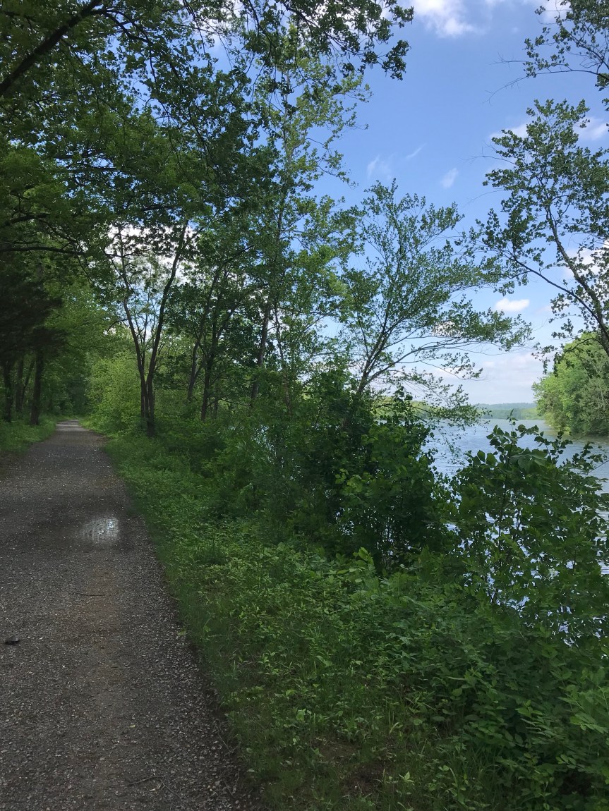
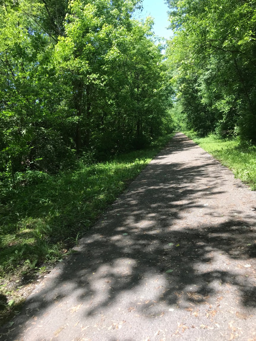
The first 12 miles were on the Western Maryland Rail Trail. Clipping along at 12 miles per hour in the cool of the Mountain morning. Wheee!

I saw deer and bunnies in abundance. Then I was startled to see a possum run across the trail in front of me. She had a baby possum on her back. Cool!

I came to a construction zone. They are extending the rail trail. I can’t wait to ride it. I cut over yo the towpath. The towpath is bumpy going on a good day but intermittent patches of mud made the next 48 miles really difficult. For the most part the mud was not deep enough to grab my front wheel. I think having loaded front panniers down low helped stabilize the bike.

Deer and bunnies and squirrels and turtles and bull frogs and snakes (including a long light brown one) and exotic sounding invisible creatures made for entertaining companions. I came upon a family of geese with several pre-fledging goslings. One of the adults rushed strait at me with its mouth open, flapping its wings. Okay, okay. Just passing through, dude. Chill already.

I stopped at Fifteen Mike campground and talked to a camper as bugs swarmed around us. He was quite a chatterbox. 70 years old but he looked far fitter than me. He advised me that mud was in my future.

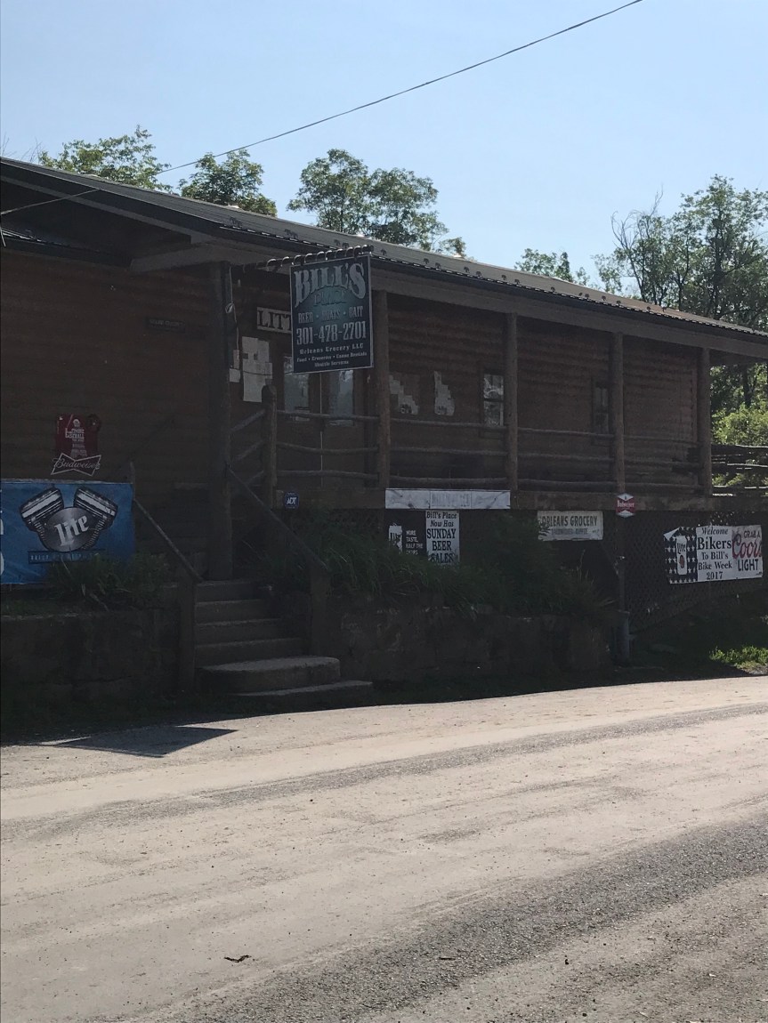
He told me how to find Bill’s Place, a canal landmark that I’ve never seen before. Unfortunately it was closed so I’ll just have to ride back to check it out someday.

I talked with a group of seniors who were being dropped off to ride the canal. 0ne was on an e-bike. I paid it forward by giving them info on the towpath section I had just ridden.

I took a bio break. You can tell you are near DC when you find a book about French history in a porta potty.

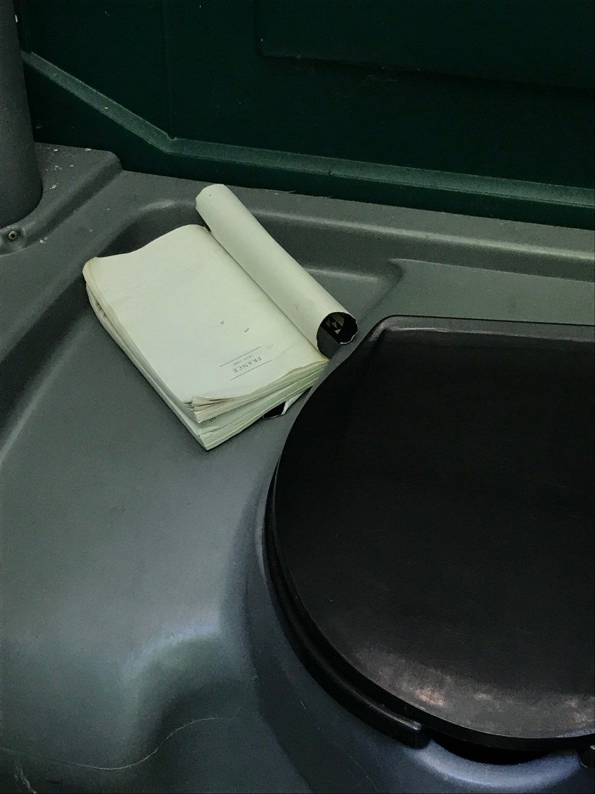
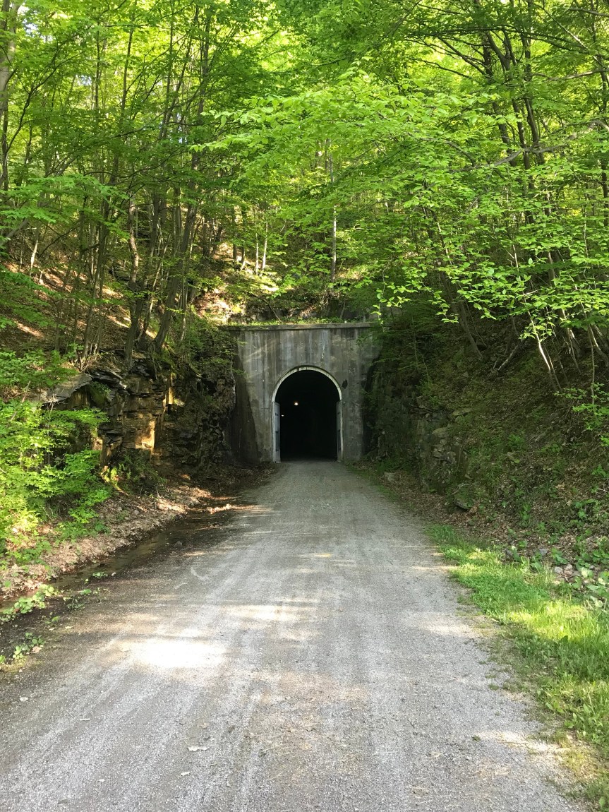
As I approached the Paw Paw tunnel the mud became a quagmire. I was lucky that the edge of the towpath was covered in a carpet of leaves, perfect for walking my bike through the muck.

The tunnel has a very rough trail surface. I walked it and was glad I did. It seemed to take hours with my claustrophobia increasing with each step.

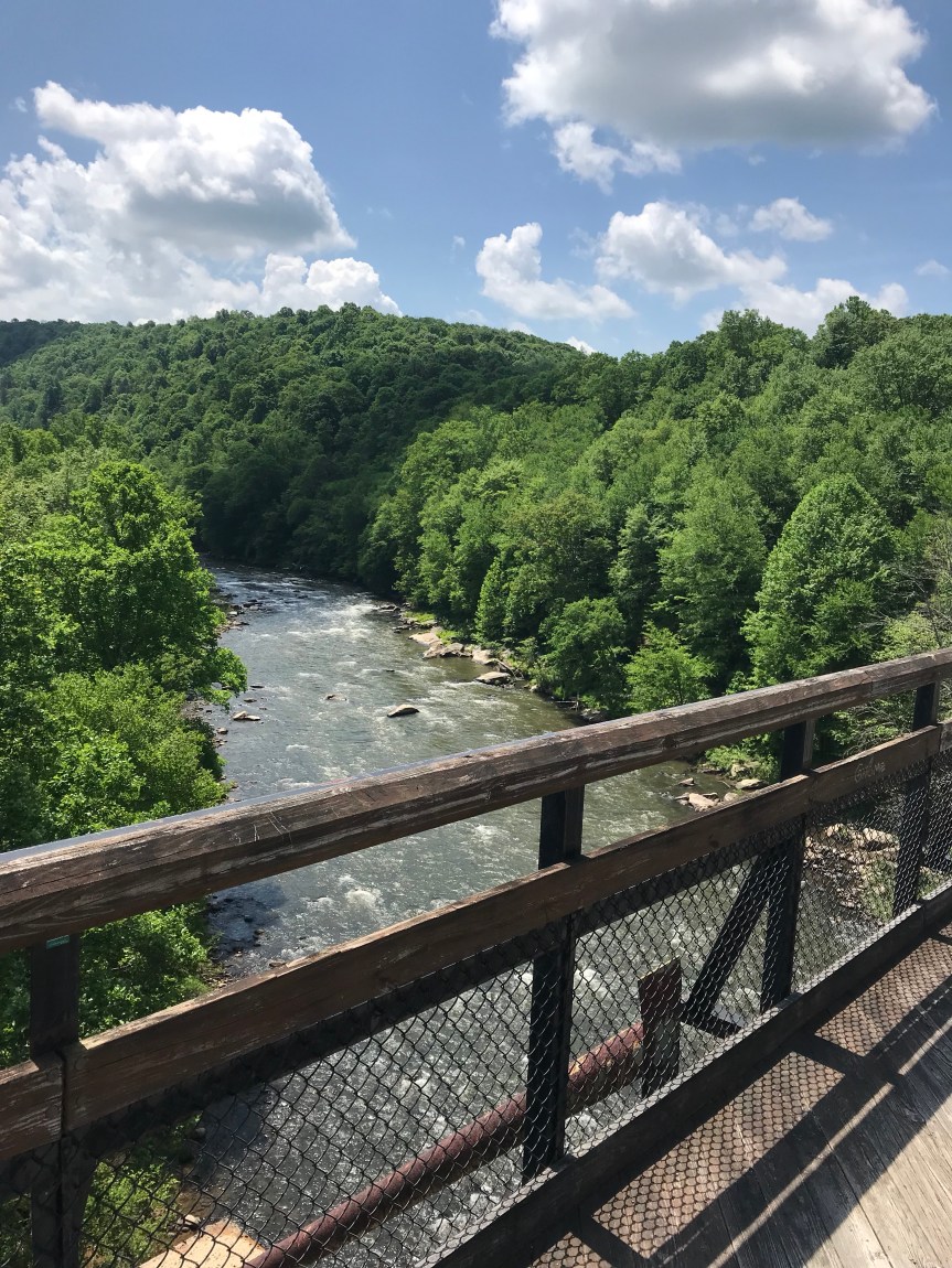
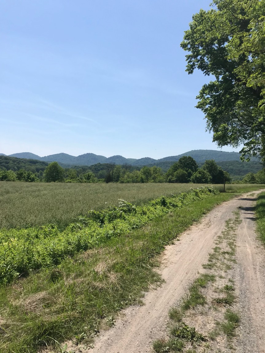
I think the prettiest section of the canal is west of the tunnel.

They told me of a cafeteria in a closed school in a place called Oldtown. I stopped there for lunch before slogging on through more and more mud.

Miles and miles of the stuff was wearing my old ass out. Each time I hit a muddy spot I’d tense up and my back would ache as it tried to keep the rubber side down. I considered taking a nearby road just to get out of the stuff. I was stopping every ten minutes to clear mud from under my fenders.

I arrived in Cumberland and a passerby took my picture.

I really should pull my pants up higher for the full geezer in a bike look, don’t you think?

I went into a bike shop to buy a Fiber Fix spoke, a gizmo that will allow me to replace a broke spike without tools. They were out of stock. They advised me not to break a spoke. Yeah well…

I used there hose to spray all the mud off The Mule. Afterward I ran into a couple who were doing a big loop bike tour: Albany to Erie to Cumberland to DC to Albany. John and Sara (I think. My fusiform gurus is on the blink again) and I talked for a good twenty minutes as we snarfed down goodies at a sandwich shop,

They headed off down the canal to find a camping spot. Happy mudding, y’all!

I tried to get a bed or room in a Cumberland hostel. It they were booked. The YMCA in town puts people up for cheap but it was apparently under siege by derelicts. I checked the Ramada but they wanted $110 and that’s not in my budget. So I headed 16 miles up the gravel GAP trail to Frostburg where I got a bed in a bunkhouse.

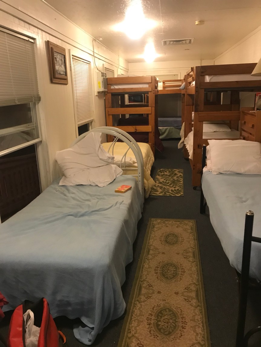
I’m the only one here so it’s not bad at all. I have a bed, shower, TV, and laundry.

All the muck and the gravelly uphill really wore me out. I was on the trails for 12 hours.

Bottom line: 79 miles (Tour total 206). I’m 16 miles further along than I planned. Tomorrow I ride 5 or so miles to go over the Eastern Continental Divide then downhill for the rest of the day. Zoom!

Any Road Tour: Day 2 – Ridges and a Desert Rose

Last night my left arm and knee were screaming at me. I took some ibuprofen PM to knock me out. It killed the pain but even with drugs I was too pooped to sleep.

The hotel breakfast was later than lame. Bad coffee, OJ, toast, and Rice Krispies. It would have to do.

Everything was packaged in plastic. So depressing after reading this:

After a brief tour of charming Frederick, I turned west on US 40 and began to climb into a headwind. For about an hour I went up Catoctin Mountain, in my granny gear. I thought I’d descend to a valley but after a 1 minute screaming downhill I was climbing again. Up and down over and over again. Will this ever end? I mean how far could Rice Krispies and last night’s gas station food take me?

As it turned out I had one minute more climb to go. I saw the sign for the Appalachian Trail and I knew I was creating South Mountain.

The downhill was glorious. A few more inconsequential rollers later I was in Hagerstown.

The hills were about as bad as I expected but my granny served me well. Not once did I run out of breath. Knee cartilage is another story altogether.

The Google showed me the way and I found US 11, a highway that follows the Cumberland Valley to Williamsport on the C&O Canal.

I stopped at the Desert Rose Cafe for food and karma. Ryan, Kevin, and I ate here on the No Wrong Plan Tour from Pittsburgh to DC two years ago. Good food. Nice people.

As it turns out, Rose does some shuttling of people around washed out areas of the canal. Good to know.

Rose told me the towpath was in good shape but I decided I wanted to try my luck on the roads. I stupidly expected level ground but got more granny worthy hills. The scenery was pretty epic but I found this stone farm most interesting.

I forged ahead and stopped to admire this roadside tribute to one Lancelot Jacques, maybe the best name ever.

I finally bailed out at Fort Frederick. Lots of stone here as well.

I didn’t stay because a towpath inspection awaited. Thankfully it looks to be in great shape.

I diverted to the paved Western Maryland Rail Trail and cruised the last ten gloriously level miles into Hancock.

I had planned to stay in the bunkhouse at the bike shop in town but it looks almost as rustic as camping.

With all the rain, the thought of camping near the river isn’t floating big my boat so I decided to check into a Super 8 motel just uphill from town. ($60 plus breakfast and a Nats game on TV. Also they have bike cleaning rags that I put to good use on my chain.)

The AC seems not to be cooperating. I probably won’t need it overnight though.

So for today 58 1/2 mostly very hilly miles. Total mileage so far is 127.

I am beginning to wonder why I am carrying all this camping crap. I’m sure I’ll get around to using it.

I am pleased with my progress. And with the prospect of a dry towpath to Cumberland in the morning.

Further.

Any Road Tour: Last Days of Prep

Here’s what I did to get ready to hit the road:

  • Friday – Volunteered for Bike to Work Day in the rain
  • Saturday – Road to and from and during DC Bike Ride in the rain (45 miles). Watched 2 baseball games
  • Sunday – Road to Vienna VA to return Bike to Work Day materials (47 miles). Watched baseball game. Went to concert (Brandi Carlile) at The Anthem in DC.
  • Pulled together everything I’m bring on the tour. Put it in panniers and rode The Mule 1 mile to see if I distributed the weight properly. Mowed the lawn that had made use of a week of rain. Watched my last baseball game at home. (I’d love to go to the ballpark but there’s just no way.)


Image may contain: bicycle and outdoor

It weighs a ton. (I am bringing a second water bottle by the way.)

I also kept track of the problems with the C & O Canal towpath. Sort summary: mucho mas. Came up with a workaround to get me beyond the damage and the quagmire. Printed out some routing information that I will need. Did some last minute banking. Obsessively checked the weather forecast for tomorrow. (Rain. Thunderstorms. Typical DC area summer weather.)

So there you have it. Time to put up or shut up. Tomorrow I roll.


Any Road to the PNW – Pre-tour Anxiety

Construction, Fires, Floods, and Lions

I can’t sleep. All I can think about is the cascade of things that are going wrong with my bike tour and I haven’t even left home yet. From past experience I know that I have to go all mindful and concentrate on the here and now. This will be easier once I am rolling.

The route I am taking keeps changing and troubles keep arising. First I was worried about road construction on the route west from Missoula Montana. Next I discovered that the passes to the central Cascades in Oregon are compromised from last years wildfires. (Can’t wait for this years. Derp.) Then I found out that the route down the Columbia River gorge to Portland Oregon is partially closed because of more forest fires. This would force me to ride along the Washington State side of the river, missing Multnomah Falls in the process. For the last few days torrential rains have been wiping out the 185-mile C & O Canal towpath from near DC to near Williamsport, at Mile 100. Needless to day, the free camping sites are probably a mess too. This morning I learned that a mountain lion killed a mountain biker about 30 miles east of Seattle.

That’s right fires, floods, and lions. Whose idea was this anyway?

The Packing List

So I have busied myself making a packing list. Here’s what I am bringing.

Camping

  • Two-person tent
  • Lightweight sleeping bag
  • Silk sleeping bag liner
  • Pillow
  • Bear bag (for keeping carnivores away from my food)
  • Carbiner and nylon rope (to hang the bag)
  • Toilet paper
  • Utensils
  • Ear plugs
  • Sleep mask (for hostels)

Personal

  • Prescription sunglasses
  • Shaving cream
  • Razor
  • Toothbrush
  • Floss
  • Medicine
    • Maintenance inhalers (4) (Asthma)
    • Rescue inhalers (1) (Asthma)
    • Eye drops (glaucoma)
    • Aspirin (blood clots)
    • Ibuprofen
    • Nighttime Ibuprofen
  • Sunscreen
  • Ear plugs
  • Chamois cream
  • Back up prescription glasses
  • Book (maybe 2. Probably ancient Tom Wolfe paperbacks)
  • Passport (for going into Canada or boarding a flight if I lose my other ID)

Clothes

  • Bike shorts (3)
  • Technical bike shirts (3)
  • Cotton t-shirt
  • Off -bike shorts
  • Belt
  • Technical underwear for either on or off bike
  • Socks (3)
  • Bike shoes
  • 1 old t-shirt to use as a rag after it gets worn
  • Floppy hat
  • Teva sandals
  • Rain pants
  • Rain jacket
  • Sunsleeves

Electronics

  • iPhone
  • iPhone cable and charger
  • iPhone earphones
  • Small back up battery
  • Head light
  • Head light charger
  • Taillight belt
  • Taillight belt charger
  • Camera
  • Camera charging cable

Bike Gear

  • The Mule (1991 Specialized Sequoia touring bike)
  • Water bottles (2)
  • Extra water bottle in pannier
  • Four Ortlieb roll top panniers (2 small for the front, 2 large for the rear)
  • Ortlieb medium handlebar bad with map case
  • Bicycling gloves
  • Multitool
  • Tire levers
  • Tubes (3)
  • Folding spare tire
  • Valve adapter
  • Topeak RoadMorph Pump
  • Lube
  • Lock
  • Cables
  • Zip ties
  • Duct tape

Other

  • Adventure Cycling Association Maps (14)
  • Rudi’s route to Little Orleans (A cue sheet to circumvent most of the C&O Canal. A very hilly route that I hope not to use.)
  • Trail mix
  • Energy bars/fruit

The new stuff for this tour is underlined. As you can see I have already crossed out a few items. I wouldn’t know what to do with a cable if I had to do a roadside repair so there’s no point in bringing them. And other than the fact that I can take pictures while riding, the camera is kind of useless. I can use my iPhone for photos, and it will force me to stop to take the pictures which is not a bad thing.

The Route

Whether I like it or not, the route is changing as I type. My current thinking is that instead of riding the canal directly west from DC, I use roads to get me about 100 to 110 miles upriver. So on day one will be spent riding on the roads to Fredrick Maryland. I’ll stay in a hotel. This replaces my first C&O Canal day. Day two will involve riding roads west from Fredrick picking up the Canal and the Western Maryland Rail Trail either at Williamsport or beyond and overnighting in Hancock Maryland at mile 125. (The bike shop has a bunkhouse with showers and WiFi and such.) Day three will be 60 miles of mud to Cumberland assuming the the trail is open. If not, the pooch is screwed. But I’ll mix my metaphors and blow up that bridge when I get to it.

Today’s Fun

My anxiety woke me up at 5 a.m. I have to ride 45 miles round trip to Vienna Virginia to return Bike to Work Day materials. I had volunteered to staff a pit stop 1 1/2 miles from my house. What I didn’t know was that I was responsible for picking up and dropping off Bike to Work Day materials for the Fairfax Advocates for Better Bicycling (FABB), our suburban advocacy group, 23 miles away. This easy volunteering effort ballooned from a 3 hour commitment to about 12 hours. Suffice it to say, I’ll choose my volunteering events more carefully next time. On the plus side, I get to do a shake down ride on The Mule.

When I get home, I’ll watch the Nats game, do some laundry, and go a concert in DC. Hopefully, I can sleep in tomorrow.


Any Road or Fire and Rain

I chose Any Road to the PNW as the name of my bike tour but it’s beginning to look like I may have to change to Fire and Rain (hell, add Wind because the Great Plains are not exactly a light breeze).

Up until today, I have been focused on road closures in Idaho and Oregon. These closures are the result of fires from last summer. In the last several days, the mid-Atlantic has been hit with a rain event that will continue through the weekend. (Can’t wait to ride DC Bike Ride on Saturday!)

The rain is washing out sections of the C&O Canal towpath, the unpaved, flat route through the Appalachians. My friend Rudi has given me a workaround that will allow me to bypass more than one-half of the towpath. There will be some serious hills in the bargain.

There is no word about the western third of the towpath as well as the GAP trail from Cumberland to Pittsburgh.

Gee, I can’t wait to get started!

Any Road Indeed

There’s one week to go to lift off on my Any Road to the Pacific Northwest so I thought I’d check out some of the roads through the Cascades. I knew that a 50 mile section of Idaho State Highway 12 through the Lochsa River valley would be undergoing heavy construction. Now I have found out that a section of the road and trail along the Columbia River in Oregon, west of the Route 12 construction, will be closed outright. Last summer wildfires in this area damaged the trail and highway. I have two options.

Option One would be to stay on the Oregon side of the river and ride I-84 with its big rumble strips for tens of miles. Not fun, but there are plenty of services along the way.

Option Two is to cross over to the Washington side of the river. This road has much less traffic but services are “few and far between.” Basically, I’d have to carry food and water and lord knows where I’d sleep. The “few and far between” section is 83 miles long into “fierce headwinds.” We’re having fun now!

Another big drawback to Option Two is that I can cross back over to Oregon just east of Portland, but well west of Multnomah Falls. I really want to see the falls; it’s one of the must see places in the Pacific Northwest. FOMO lives.

Long story short, I have to stay flexible. When I get to Missoula I can talk to bike tourists and staff at Adventure Cycling for recommendations.

Planning: Any Road Will Take Me There

  • I’m thinking of naming my bike tour the Any Road Tour. The reason is I can’t seem to decide on a route let alone a destination. And as lyric thief George Harrison said, if you don’t know where you’re going, any road will take you there.
  • So a special note to Tim Jones, Lindsey, and Brittany: I still don’t know if I’ll make it up to the Seattle area. As they say on the Facebook, it’s complicated. I should have a better idea if/when I get up your way in late June when I am somewhere near the Missouri Breaks.
  • The route options go through Missoula, Montana. They are:
    • Ride to Seattle directly from Missoula. Return home around July 22.
    • Ride through Portland then on to Astoria Oregon. Backtrack to Portland. Return home around July 24
    • Ride through Portland then on to Astoria Oregon. Continue north to Seattle. Return home around July 29
    • Ride to central Oregon Coast. Then to Portland. Then to Seattle. (I haven’t mapped this out). Return home around August 6.
    • Ride to central Oregon Coast then to Seattle by way of Astoria. Return home about August 6.
  • All these routes have pluses and minuses. And as Mrs. Rootchopper noted, I could make a separate, month-long tour out of them. (Seattle to Missoula to the central Oregon coast to Portland to Seattle, for example. Or maybe go south to Crater Lake…..)  So this routing uncertainty is a good problem to have.
  • I have met a couple of times with a local bike tourist named Marie. She and her husband Roy did nearly the same tour in 2015 and blogged about it. I didn’t want to read her blog because I thought it might include spoilers, but I finally gave in. It’s wonderfully written and contains all kinds of useful information.
  • I had lunch with Marie the other day. She gave me one of her Adventure Cycling maps of Oregon. And imparted some good advice
    • Feel free to wander from the ACA routes, especially east of the Rockies. There are some surprises, good and bad, to be had. The Google is a pretty good resource.
    • Each county seat in North Dakota has a motel (to sequester juries). So if I get sick of camping I can probably use the Google…
    • I will probably follow their route through the Twin Cities instead of around them. The ACA route goes east from St. Paul, then north, then west. Marie and Roy went northwest and re-connected with the ACA route.
  • Marie and Roy made the trip without camping. Other than staying with a friend or two, they just booked a hotel a day in advance and rode to it. They appeared to average about 2 miles per hour faster than I expect to ride.
  • With the weather finally settling into something resembling spring, I am getting antsy. I still have a few things to take care of for the trip, all of which happen just before I leave.