Little Devils Stairs – Not exactly a day off

After 14 days of bike riding in a row, I decided it was time to take a day off. What better way than to do a hike in Shenandoah National Park.

My friend Chelli and her daughter signed up to climb 19,000+ foot Mount Kilimanjaro in Africa. To get in shape, Chelli assembled a team of grad school friends to do day hikes outside DC. Most of these hikes were done while I was on my bike tour but I joined the team when I came home.

We did two hikes on Sugarloaf Mountain in Maryland. After that, Chelli and her daughter went to Africa and conquered the big one.

Chelli called us together again for a Columbus Day hike. I chose Little Devils Stairs in Shenandoah National Park. According to the website HikingUpward.com this hike is rated at the same level of difficulty as the Sugarloaf hike.

I’d done Little Devils Stairs once before and remember it as challenging and fun. Somehow in the intervening years the trail became much steeper. I blame plate tectonics.

A full moon and fog on the river were indications of a beautiful fall day emerging on the way to Chelli’s house in Arlington. Chelli took the wheel of her car and we drove to the park, After about 40 miles the highway leaves the ugly urban area and enters splendid Virginia countryside.

Dry weather meant that the unpaved road to the parking lot made for easy driving. We parked and headed up the trail. Basically, this trail goes straight up a gorge along Keyser Run. The trail is rocky, increasingly so as we ascended. There were perhaps 8 creek crossings but these were trivial because the drought in this area reduced the creek to a trickle.

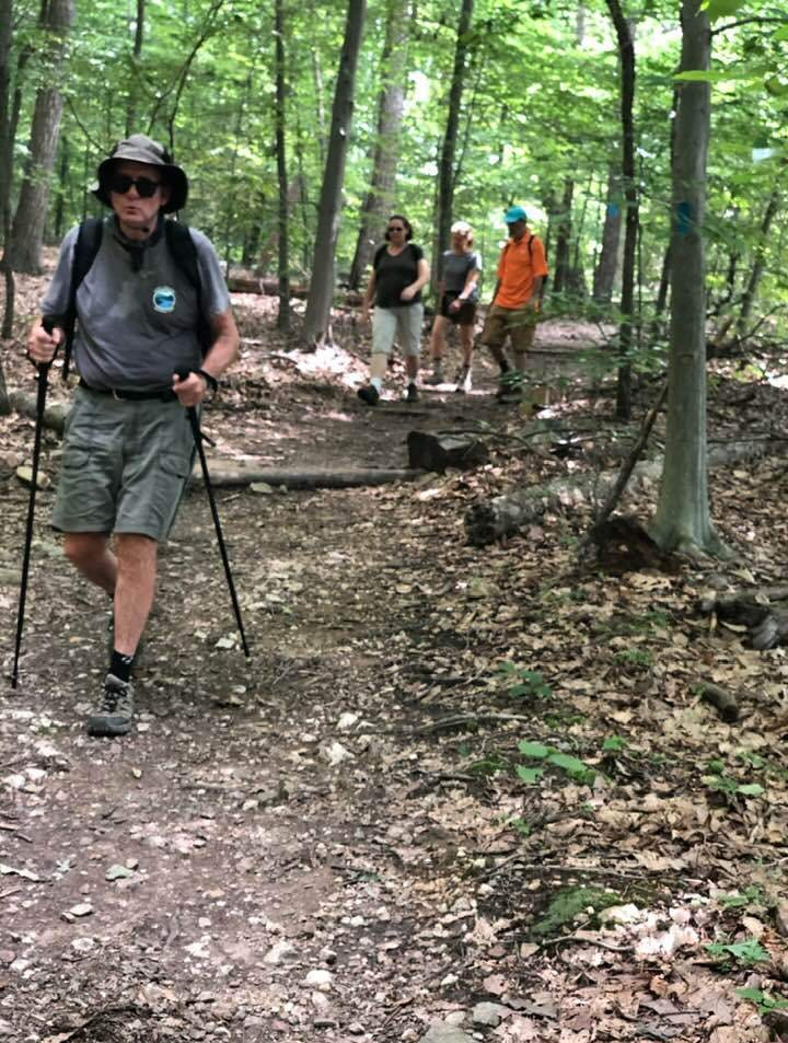
At one point in a particularly rocky section we lost sight of the trail blazes. No worries. We forged ahead and soon found the trail again. At a few points the hike became a rock scramble. I was huffing and puffing. We took some stops to gather ourselves. Then moved on and up.

The gorge was beautiful. The creek with a trickle of water, trees just beginning to take on their fall color, and sheer rock walls. I stopped a few times to appreciate how steep the trail was.

IMG_3248

After the rock scrambles there were some switchbacks. An Hispanic family of about eight people came down the hill toward us. One of them was carrying an unopened bag of tortilla chips. Somehow I refrained from assaulting him with my hiking poles.

Soon thereafter we reached Fourway, the intersection of four hiking trails. We stopped to eat lunch which Chelli had packed. Veggie burgers, crackers, and watermelon.

We were burning up on the way up the 2.2 mile climb, but now that we were sitting the cool breeze across out sweaty clothing brought a chill. Time to boogie.

We took a fire trail all the way back down the mountain. 3.8 miles. I was wearing new hiking shoes that were a half size bigger than usual. The extra room in the toes kept my feet happy.

IMG_3251

Along the way we passed an old graveyard. Several of the headstones indicated deaths in 1918. I speculated that the Spanish flu was the cause. Imagine being sick with that horrible disease up this mountain far from medical help.

As we left the graveyard the Hispanic family came hiking by.  Hiking down that gorge must have been tough but they seemed like they were having a good time. Their ten-year old boy was running up the trail. Don’t you just hate youth?

Walking downhill for several miles can really deaden your legs. We managed without too much difficulty. My wonky left knee and hip did reasonably well. I felt a pain in the side of my hip most of the way down the hill but my knee tolerated the descent without much discomfort.

Normally, getting out of the car at the end of a hike makes me feel like I’m 90 but today I felt okay. New shoes, cortisone, and PT to the rescue.

Not a bad day off.


They Don’t Call It Killermonjaro for Nothing

While I was away, my friend Chelli decided to climb Mount Kilimanjaro this summer. To get in climbing shape she’d been taking Mrs. Rootchopper and other friends on hikes in the Catoctin Mountains and on Sugarloaf Mountain. Yesterday, a day that will live in humidity, I joined the fun as the gang returned to Sugarloaf.

Sugarloaf has been the scene of two of my past misadventures. Five years ago I hiked the yellow trail with a ninja and a golden retriever. The experience left me cripple for days, and oddly marked the beginning of the end of an eight-year friendship. Another time I rode bikes around the base of the mountain with Science Mom. She somehow managed to end up falling ungracefully into a mud puddle. Our friendship survived even with her temporary loss of face.

Getting back to yesterday, Chelli parked strategically below the peak of the mountain. We started hiking upward on the blue trail, transitioned to the purple trail, and returned to the blue trail. After forty seven miles, we stopped at the white rock overlook to munch on pita sammies that Chelli had prepared. Paul chipped (sorry) in some Nacho Cheese Doritos. It was a lovely view and even lovelier breeze. 

Somehow the hike managed to seem all uphill. It took three hours and at least five gallons of sweat. Did I mention the humidity was off the charts?


sugarloaf-with-sticks-e1563202461365.jpg
Hiking with sticks on Sugarloaf – photo by sneaky Chelli

A few years ago I did a hike in Shenandoah National Park with Kirstin. She used hiking poles and highly recommended them. On a whim, I bought a pair of poles on sale this spring. I have to say they are a big improvement over pole-less hiking. They kept me from turning my ankles and from putting excess impact stress on my knees and back. It only took about a mile for me to get used to them. When the hike was over, my wonky knee and hip didn’t have their usual crippling pain. I’d been wary of hiking in recent years but now I’m eager to get back out there.

I still can’t get over how hard hiking is. When I was younger I could run and jump and scramble and feel perfectly fine afterward. Yesterday, we were passed by a number of energetic young folk during the hike. I had to resist the urge to bludgeon them with my poles.

It turns out that hiking is deceptively hard work, made all the harder by aging. And it’s probably good for you. All the same, I’m glad Chelli is hiking Mt Kilimanjaro and not me.


Rest? Moi?

After taking the first day of the month off, I managed to mash 204 miles in six days, ending with yesterday’s 63 miles of cold, hilly Vasanneuring. So I decided to take a rest day today.

By 11 a.m. I was going stir crazy so I jumped into the car and drove to Great Falls Park in Maryland for a recovery hike. As soon as I got out of the car, I could tell this was not going to be restful.

I took off up the canal towpath to the far end of the River Trail. This hike is about 2 miles round trip and totally flat. Just the thing for my tired knees and back. Along the way I did the runners calf stretch against a tree or two. This somehow loosens my back up.

Next I walked to the Olmstead Island Overlook located right in the middle of the river at the fall line. The Potomac was raging today in Mather Gorge. The sound of the rushing water was a tonic.

Once back to the canal, I decided to give a longer, hillier walk a go. I took off up the Gold Mine Spur Trail. I was intending to hike the Gold Mine Loop Trail but when I got to a fork in the road I Yogi-ed it.

My turn to the right took me back toward the canal. At one spot I had a nice high view of the gorge. I made my way back down to the canal via the Lock 19 spur trail. By the time I arrived at the car, I felt like the Tin Man in need of a joint lube.

I had walked over five miles. It was time to head home. Of course, this meant that I had to drive by the gym. Why not stop to lift some weights? So I did.

I feel all rested now.

Or not.


Billy Goating at Winter’s End

The low 40F Degree temperatures and the cooling breeze and clouds did not exactly call to my bikey brain today. Off I drove (yes, I have a car) to the gym to push and pull on the machines. The machines won.

Then it was off to Great Falls National Park in Maryland. I pulled into the Carderock area that is located about 2 miles outside the Beltway. The access road passes beneath the C&O Canal and towpath. After parking and getting myself all arranged with layers and hat and Buff and backpack full of water bottles, I set off the Billy Goat C trail, clockwise toward the river. I was walking upriver and the breeze was in my face. It took about a half mile to warm up. My legs had bounce in them and I was cruising along, resisting the urge to break into a trot. Slow. Down.

There were no leaves on the trees, so the place looked rather stark. I had good views of the river and they didn’t disappoint. After about a mile, the path looped back to the towpath. I headed further upriver on the towpath.

The canal in some sections has water. I noticed some tall reeds near my side of the waterway. Inside the grass was a great blue heron shopping for lunch. A few hundred yards later I could hear the quacking of a duck. The duck was with about sever others, paddling about near the far side of the canal. I saw something move in the tall grass on the canal’s far bank. It was a fox, stalking the ducks. No worries. They kept themselves out of paw’s reach.

The sky was full of bird’s chirping. A massive flock of birds filled the trees beyond the canal. Suddenly, they became quiet and flew of in a cloud of winged mayhem. Seconds later they landed in some trees no more than a hundred yards from where they started. The racket began anew. Birdbrains.

I kept walking past the sign for the Billy Goat B trail. I was taking the canal to the western entrance so I could loop back along the river. Like the C trail and the towpath, the B trail was practically deserted. I was also fortunate that it was dry. The towpath, which is flat and has poor drainage, had some muddy sections.

Back along the river, wind at my back, I cruised along. My legs were still fresh but my decrepit lower back was not on board for the fun. Fortunately, I came upon some big rocks on the river’s edge. I sat down and pulled out a water bottle. The water was rushing over some rocks about 50 yards into the river. Once my breath calmed, I listened.

Is there anything more relaxing than the sound of rushing water?

I listened.

The cool breeze tried to distract me. It failed.

I listened.

After perhaps 15 minutes, I decided to get up before I fell asleep. If it had been 10 degrees warmer, I’d be curled up in a ball snoring.

It took a few minutes to get myself back into an ambulatory mood. Rock scrambles, none too difficult for an old dude with balance issues, persuaded me to get with the program.

I made it across a small stream. Most people would dance across on the rocks but my body seems to prefer stumbling.

Soon I was turning back to the towpath up two quick rises. With the wind at my back, I hiked the towpath beyond where I had parked my car to pick up the C trail. The trail took me back to the river and eventually, to the car.

My legs felt fine. My lower back was bitching up a storm. I didn’t care. My head felt great.

So my first hike, a six-miler, of the new year was over. A productive use to a cold and gray afternoon.

An Accidental Return to Ashby Hollow

The weather was perfect. I haven’t gone for a day hike in months so I grabbed a print out for Ashby Hollow – Mt. Weathers from a backpack I use for hiking and took off.

I had this weird feeling of deja vu. For good reason. This was my first solo hike on the Appalachian Trail a few years ago.

The drive up a dirt road to the start was an adventure. The road was all ruts and washboard. The car’s autotraction was going nuts. My wheels were spinning but I made it in one piece.

I immediately recognized the start. Oh well, no sense in going looking for another trail. Off I went down the rock trail.

I remember this hike as very difficult footing. And it was but not nearly as bad as others I have done since. The low humidity and comfortable temperatures combined with persistent shade to make this just a glorious day to be in the woods.

Once I warmed up, I could just truck along. Unfortunately I had to look mostly at the trail because of all the rocks and tree roots. While doing this it’s really hard to think about anything but the task at hand which ends up being kind of meditative.

This section of the AT is called the roller coaster. On weekends it’s crowded but today I only saw four hikers in three hours, two of them passed me withing 200 yards of the finish. This time of year there aren’t much in the way of flowers so I basked in the green. There were no vistas on this hike at this time of year. The foliage is just too dense. No worries.

Despite having hiked this before, I missed two turns. I haven’t seen a blaze in a while, have I? Nope. When you wander off, just return to the trail and begin again. Sounds like a Joseph Goldstein meditation video.

It took me about 3 hours to do the entire 6 1/2 miles.

The ride back took me past vineyards and horse farms and through tony Virginia towns like Upperville and Middleburg. With windows down and the sun shining through puffy clouds it was a lovely end to another day of slacking.


Hiking Up and Down to Raven Rocks

Today I did another out and back hike on the Appalachian Trail. At my current pace I should have the entire AT hiked by 2047.

I started at just to the west of Snickersville Gap, where VA Route 7 crests the Blue Ridge. I lucked out and got the next to last parking space in the trailside lot.

This area of the AT is known as the roller coaster because it goes up and down and up and down and around. The hike started with up to the ridge. The entire hike is heavily wooded. And rocky. And tree rooty.

IMG_0825

The start is up. And Up. Then down to a run, which in Virginia is a creek. The water level wasn’t too high so I made it across with ease. A family came a hiking behind me. They were a chatty bunch. I resigned myself to the fact that solitude would be elusive.

Next I hiked up to the ridge Then down with rocky switchbacks. Then up. Then down to a creek. Then up then down. Then up until I saw sky.

Ultrarunnergirl told me a few years ago that seeing sky is good. It was. The trail emerged from the woods to a rocky area, the top of a cliff. This is Raven Rocks. Chatty family were sitting across the part of the cliff top that had the best views.

I resisted the urge to push them over the edge and hike a bit further. There was another pretty decent spot to enjoy the view. A sole hiker was just beginning to get underway. She said “It’s a pretty nice spot. You can have it.” And off she went down the trail.

I took in the view for a few minutes. It was very viewy. There was gIMG_0833reen. And a pleasant breeze. I got down on my stomach and looked over the edge. I couldn’t see the bottom. I saw a lot of tree tops. I thought of Flogini who used to climb cliffs even higher than this. I can’t even….

I turned to go down. And the chatty bunch asked me to take their picture at the top of the cliff. Okay folks, step back. Once more. Ayyyyy!

I was nice and took pictures of them from multiple vantage points. The gods will reward me someday.

Not today though. On the hike back to the car, I caught my right toe on a rock and started to fall. I put my arm around a small tree in the middle of the trail. My momentum swung me around the tree so hard that I came out of my left shoe. I swung completely around the tree and landed on my butt between two big sharp chunks of granite. The bark of the tree took some skin off my left arm. And somewhere in the spin I cut two fingers on my right hand. There was blood.

IMG_0832

Feeling like a complete spaz, I put my shoe back on and dusted off my pride and hiked onward. A group of 20 somethings came by with music playing. Bad country music. I resisted the urge to hoedown.

Along the way coming and going I encountered plenty of backpackers and some other families. This is apparently a pretty popular place for a day hike.

For good reason.

It lasted only about 4 hours, quite a bit less than I expected. On the way home, I bought a cherry pie at a place in Round Hill. It’s a bit of a cheat. People thought that the pies were made on site, but the Washington Post did an article about the place and exposed the pies as factory made by Sara Lee. They’re still damned good and a suitable replacement for a shower beer.

IMG_0837

There are a few more pictures in an album on my Flickr page.

Keys Gap to Buzzard Rocks Overlook on the Appalachian Trail

Last night I pondered my Sunday choices: bike ride, bike ride to a Nationals baseball game, or hike. I decided on a hike guessing that there might be some rain during the game.

Last weekend I hiked from Keys Gap to Loudon Heights, heading north on the Appalachian Trail. This weekend I headed south toward Buzzard Rocks overloook. which held the hope of a view of the Shenandoah Valley.

The weather report was for temperatures in the 60Fs. And no rain. Well, there was rain but it mostly happened before I started making for a muddy track. There was a bit of rain in the middle of the hike but the tree canopy protected me.

I tried to avoid the mud but it was pointless. So I let the little boy in me out and I made my peace with the slop.

The trail here is much less rocky than the trail just to the north. Without the mud you could cover this trail lickety split.

There was quite a lot of traffic during my first 2 1/2 miles. Boy scouts. Groups of adults. They all looked like they had camped overnight. They didn’t seem strained by their packs so I assumed (correctly) that the terrain would be forgiving.

The only steep section had rock steps, easy to negotiate. And it was rather striking to look at.

Along the way I was treated to my favorite: ferns. I tried to plant ferns in my side yard. They all died within weeks. Ferns are best left to the woods.

As the trail rose to the ridge, I walked into the clouds. This was great for atmospherics but the ruined the view from the overlook.  I did get one picture where you can vaguely make out the Shenandoah Valley.

The hike was 7.7 miles and that’s a comfortable distance for me. I didn’t feel all banged up like last weekend.

I was surprised to learn that it was raining heavily in DC. Sometimes you guess right. The Nats game started 90 minutes late.  Works for me.

There are some more pix on my Flickr page.


Hiking to Loudon Heights

It was finally, finally time to get out of the city and into the woods. I’d been biking and baseballing and graduating and concerting for weeks and my brain needed a long solo hike in the woods.

Harpers Ferry, West Virginia sits at the confluence of the Potomac and Shenandoah Rivers. Alas, the Shenandoah gives it up and from here to the Chesapeake Bay the river is known as the Potomac. Just southeast of Harpers Ferry the Potomac passes through mountains. On the northern side of the river there are two overlooks. I hiked 19 miles in one day to check them out. Today I explored the overlook on the southern side of the river on a ridge known as Loudon Heights. I got the idea for this hike from a fellow blogger who did a shorter, steeper version of this hike in January 2016. Her hike began in Harpers Ferry, crossed the Shenandoah and climbed up to the ridge about 1 1/2 miles from the overlook.

It was my intent to do this same hike but then I found another hike that was longer and more gradual. This hike begins at Keys Pass 5 1/2 miles to the south of the overlook. It follows the Appalachian Trail for about 4 miles along the ridge line then switches to the Loudon Heights Trail to get to the overlook.

The skies were overcast. Temperatures were in high 50Fs when I set out. There was so much green. The path was somewhat muddy. Then it became rocky. Then smooth. Then rockier. Then smooth. Then ludicrously rocky. Then not so much. Did I mention that it was rocky.

The AT is rocky. How anybody with a full pack gets through the Virginia portion of the trail without breaking an ankle is beyond me. I am a tenderfoot. Literally. I hate rocky trails. I came to a kind of truce with this one out of necessity. There are so many rocks that you have to look down nearly the entire time you are hiking. You lose track of time. I couldn’t believe that 90 minutes had passed since the start. Focusing on the rocks is meditative, annoyingly so. It had a rather interesting benefit for me. I noticed that my tenderfootedness was caused by me tensing my feet up as I walked among the rocks. Walking on them instead and focusing on keeping my feet relaxed made for much easier walking. I didn’t exactly end the hike with happy feet but I managed to enjoy what would otherwise have been a miserable experience.

Since I was spending so much time looking down, I had to consciously stop and take in the scenery. Most of the hike is through a forest on a ridge line. And I looked up at the through the canopy to the clouds above. Ahh.

Being at the top of things also meant that many old trees succumbed to winds. The trail is obstructed by a few dozen downed giants. They are easy enough to get past though.

For the first 3 1/2 miles I didn’t see or hear a single person. Not one. For the next 2 miles I did encounter a few people here and there but, thankfully, none of them were loud.

Getting to the overlook actually involves hiking down from the ridge. When I got there I had it all to myself for about 3 minutes. I was all set to just park my butt on a rock for a half hour. Then another hiker showed up. Yeah, well….

After taking some pictures of Harpers Ferry (the view of town is much better from Maryland Heights, by the way) I started back. Good thing I left. More and more people were heading my way. I group of young men came by. The last of them was actually talking business. I resisted the urge to dope slap him.

When I got back on the AT, I started encountering serious backpackers heading north. These dudes were in tip top hiking shape. A solo hiker and I stopped to chat. He was a large human, 6 foot 4 or so and easily 250 pounds. He was hiking 20 miles or so today on his way to Harpers Ferry.  His pack looked hefty. He was all smiles. Nice guy.

The last three miles were a bit of a slog. I really need to learn to ease into these things; 11 miles was a bit much. I stopped to stretch my hamstrings from time to time. The last half mile was mercifully light on rocks and was nearly flat. I needed that.

Unlike most hikes I’ve done, I had very good cell service on this one so I instagrammed my ass off. I posted all the pictures on my Flickr page.

Finishing What I Started

The Potomac Heritage Trail is the closest hiking trail of any decent length near my house. It’s about a 20-30 minute drive. I lucked out. The parking area at Chain Bridge was full but a pickup pulled out and I pulled in.

The goal of the day was to hike the trail upriver to the point where I turned around last weekend. The good news is that this section of the trail involves very little rocky stuff. The bad news is the turn around point was about 1 mile less distant that I thought.

The first half mile or so follows Pimmit Run. In Virginia creeks and streams are called runs. (There are no hits or errors.) Perhaps the most well known run in Virginia is Bull Run.

At a half mile I needed to cross the run and, after studying the rocks in the stream, I made it across without getting wet.

The next section climbs up to Fort Marcy. It wasn’t a particularly difficult climb.

After crossing the parking lot, the trail winds through some more woods within sight of the GW Parkway.  The cars wizzing by really messed with the vibe. Near the end of the hike, I crossed the Chain Bridge Road exit ramps. Not exactly a zen experience.

To my surprise the turnaround point was only a couple hundred yards beyond the exit.

On the way back the hills seemed easier. I tuned out the cars and made it a point to focus my attention on the smooth track, a little beetle and the blue sky above.

It seemed liked someone had moved the rocks around in Pimmit Run. I could not figure out how I made it across. So I worked my way downstream looking for a better option. I stopped three times and found myself in mid-stream with no chance of leaping to a far rock to finish the crossing.  The banks of the creek were piled high with flood debris. I put my foot on top of it and my foot went in like it was a snow drift. A few minutes later I started to sink in again and reached out with my left hand making contact with the debris. I ended up with several splinters and cuts. There was blood. Just enough to make a mess of my pants when I wiped my hand on them.

After 15 minutes I found a spot with a downed tree sticking across the creek at a height of four feet. I jumped from one rock to another grabbing the tree. Thankfully it took the weight of my left side without breaking (which would have caused me to fall into the creek.)

I made it across and found myself back at the car in short order.

My next hike will likely take me out to Shenandoah National Park.

Dumbo in Trumbo Hollow

Reading on the deck just wasn’t happening this morning. It was beautiful out. You know, puffy white clouds, gentle breezes, low humidity. So I decided to go for a hike.

I chose Trumbo Hollow because I was getting started late and wanted to make sure I could find a place to park my car.

The highways were all but deserted and there was ample parking. So an hour after I left home I was on the Appalachian Trail heading south.

IMG_0122.JPG
Think you can find the AT?

After a half mile of gently flat trail, I started up. And up. Switchback after switchback. Rocky footing. Eventually the hill and rocks  gave way to a grassy meadow. This was a first for me. Mostly woods lead to more woods. After the meadow came a downhill to a street. Then across the street and uphill again. You’d think they’d designed these trails so that they don’t go up and down and up and down. Just for me because I am the only important person in the universe.

IMG_0130.JPG
Rocks
IMG_0123.JPG
Meadow

There were quite a few other people hiking today. This included a group of about 14 hikers who were getting their social fix where introverts like me go to get away from people like them. I am grateful that they were heading in the opposite direction.

There were some couples here and there out on a date hike. It’s apparently like a bike date except you leave the bikes at home. You know you’re getting somewhere with your date when she tells you to bring a tent. Hike dates are not at all subtle that way.

The hike took me a little over 3 miles to a shelter that served as a landmark for the turnaround. One of the date couples I saw earlier had passed me and were hanging out there. She was on the phone. In my book she is not tentworthy.

I turned around and headed back. About a mile later, on a mostly smooth part of the trail and a rock reached up and tripped me. I swear it moved. I went down HARD on my forearm. Thankfully I landed on a rock-free part of the trail. My forearm just missed landing across a basketball size rock. This would have been ugly. Snap. Scream. Blood. Pain.

But it wasn’t. A stabbing pain went up my arm into my shoulder nonetheless. Ow. F-word. This HURTS. I stayed down for a minute as the pain subsided and came to realize that I didn’t break or dislocate anything. In all the arm fun, I missed the part about my left knee whacking the ground. It was bloody and aching. Both my palms hurt too. Suffice it to say a bruised knee and two bruised palms is a less than idea condition to ride 100 miles with. So tomorrow’s century ride will be interesting indeed.

IMG_0127
Albino caterpillars have been known to trip hikers

I dusted myself off. Poured water over the bleeding bits and continued on. But for the limp and the icky blood I was having a pretty good time. About a mile from my car a through-hiker came barreling toward me, aided by his adept use of two hiking poles. These hikers are in phenomenal shape. He had earbuds in. This kind of ruined my mental picture of through-hikers, but maybe he could hook up with phone girl at the shelter.

I made it back to the car in one piece but my knee was stiffening up. After stopping for some nutritious food (an M&M cookie ice cream sandwich counts, doesn’t it?…Oh, shut up. Don’t judge. I had a boo boo.),  I drove home. After a shower and some real food (involving a bagel, cheese, and a tomato) I came out on the deck and made good use of some frozen veggies. And a beer.

IMG_0132