Greetings from Elbownia

Here at the Rootchopper Institute we’re social distancing our butts off. Of course, my preferred SD method is to ride my bike alone. I’ve been grinding away at it for nine days in a row. Rather than getting worn out, I’ve been getting stronger. This is exactly what happens on a bike tour. It makes no sense either on tour or at home but it is what it is.

Yesterday’s ride took me over the Woodrow Wilson Bridge, down the corkscrew ramp on the Maryland side, and up the long hill past the casino complex to Oxon Hill Road. From there I made my way into DC via the streets of Anacostia. I rode past the derelict buildings of Saint Elizabeths (no apostrophe) Hospital and down MLK Jr. Boulevard. Eventually, I made it to the Anacostia River and took the Anacostia River Trail to Benning Road. There I crossed over to the west side of the river, rode south between the river and the rotting hulk of RFK Stadium all the way to the Navy Yard. Soon I was passing Nationals Park, Audi Field (soccer), and the Wharf eventually making it down to Hains Point to check out the not-ready-for-prime-time cherry blossoms. (I did managed to shag three golf balls from the rusty spring hackers on East Potomac Yard course.) Then it was up the Potomac River past the Jefferson and Lincoln Memorials, across the Memorial Bridge to the Mount Vernon Trail and back home. A nice 43-mile spin in 70-degree temperatures.

Today’s ride was a recovery ride. I made it six miles, nearly to Old Town Alexandria, before I realized that I had forgotten my water bottles. I used the Wilkes Street tunnel to turn back home. On the way I passed my local bike store. The plan had been for the store to re-open in March, but from the looks of things it’s going to be quite some time before that happens.

Within a mile or two of this bike shop there have been two other large fires in the last month. And sometime in the last few months a hotel was struck by lightning. Coincidence?

After fetching my water bottles I made my way down to Mount Vernon, home and burial place of George and Martha Washington. I can’t remember the last time I saw it closed, but such are the “circumstances” these days.

My ride home took me to Route 1. As I waited at the traffic light I took note of the remarkable fall in gasoline prices since the financial and commodity markets went haywire.

There were long lines at this station and the one next door. Of course, the handles on the pumps may be a fine place for the Covid-19 virus to hang out but you take your chances when you can save 40 cents a gallon.

The ride home was brisk. I don’t know what got into my legs lately but I was accelerating up small rises in the road and I didn’t have a tailwind.

After the ride, I spent 20 minutes scraping loose paint from an exterior wall on the house. During dinner, I had a slight and very brief twinge of nerve pain in my lower right back. Oddly, this is good news. I am scheduled to have a new kind of injection in my lower back on Monday, but I haven’t had the slightest bit of pain in six days. Tomorrow I go on a six-mile hike. If that doesn’t bring about some serious pain in my back or my left leg, I am declaring myself cured and cancelling the injection.

Now if only I could do the same for the coronavirus. I guess I’ll just have to keep bumping elbows for a while longer.

Connecting and Extending the Mount Vernon Trail

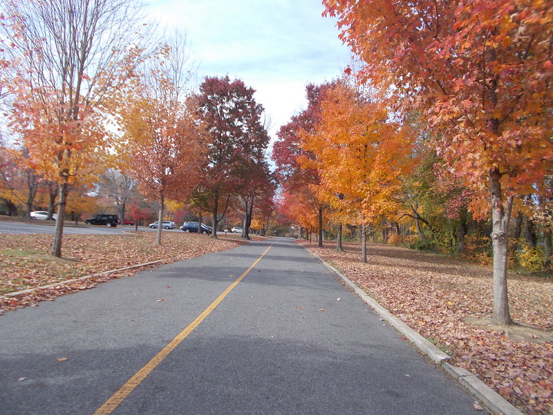
The Mount Vernon Trail, a facility of the National Park Service, is well known to cyclists, runners, and walkers in the DC area. It extends from Theodore Roosevelt Island in the north to George Washington’s Mount Vernon Estate in the south. Beyond Mount Vernon, there are trails of a sort but they come and go for three miles along the two-lane Mount Vernon Memorial Highway to US 1 where new trails continue south down through Fort Belvoir. (The mega re-design of US 1 to the north of Fort Belvoir will include separated bike lanes. ) The Fairfax County Department of Transportation is planning to connect the existing trail segments along the MVMH to provide a continuous trail that connects Mount Vernon to US 1.

Last night I attended the first public meeting about this project. It was run by Chris Wells, the Fairfax County Bicycle and Pedestrian Coordinator with significant additional remarks by Dan Storck, the Mount Vernon District Supervisor.

Beyond its local significance the Mount Vernon Trail is part of other much longer trail systems, including the Adventure Cycling Association’s Atlantic Coast Route, the East Coast Greenway, and the Potomac Heritage National Scenic Trail.

The project is an admirable one, but it has significant shortcomings.

The Mount Vernon Trail itself stops at the southern end of a parking lot. To continue south cyclists have two options. They can walk the sidewalk in front of the entrance to Mount Vernon or ride (illegally) on the George Washington Memorial Highway for a few hundred yards. Neither of these shortcomings is addressed in this project.

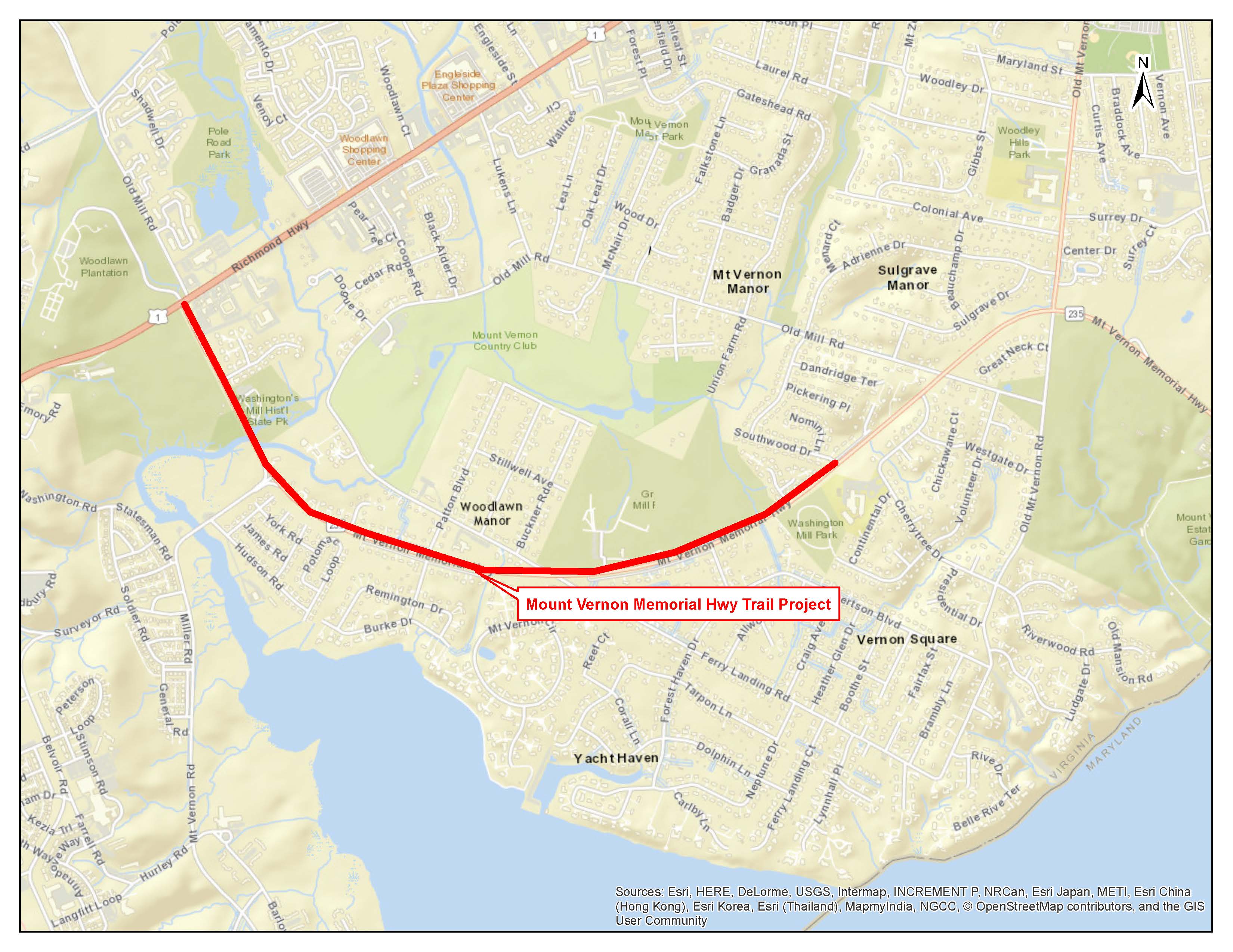
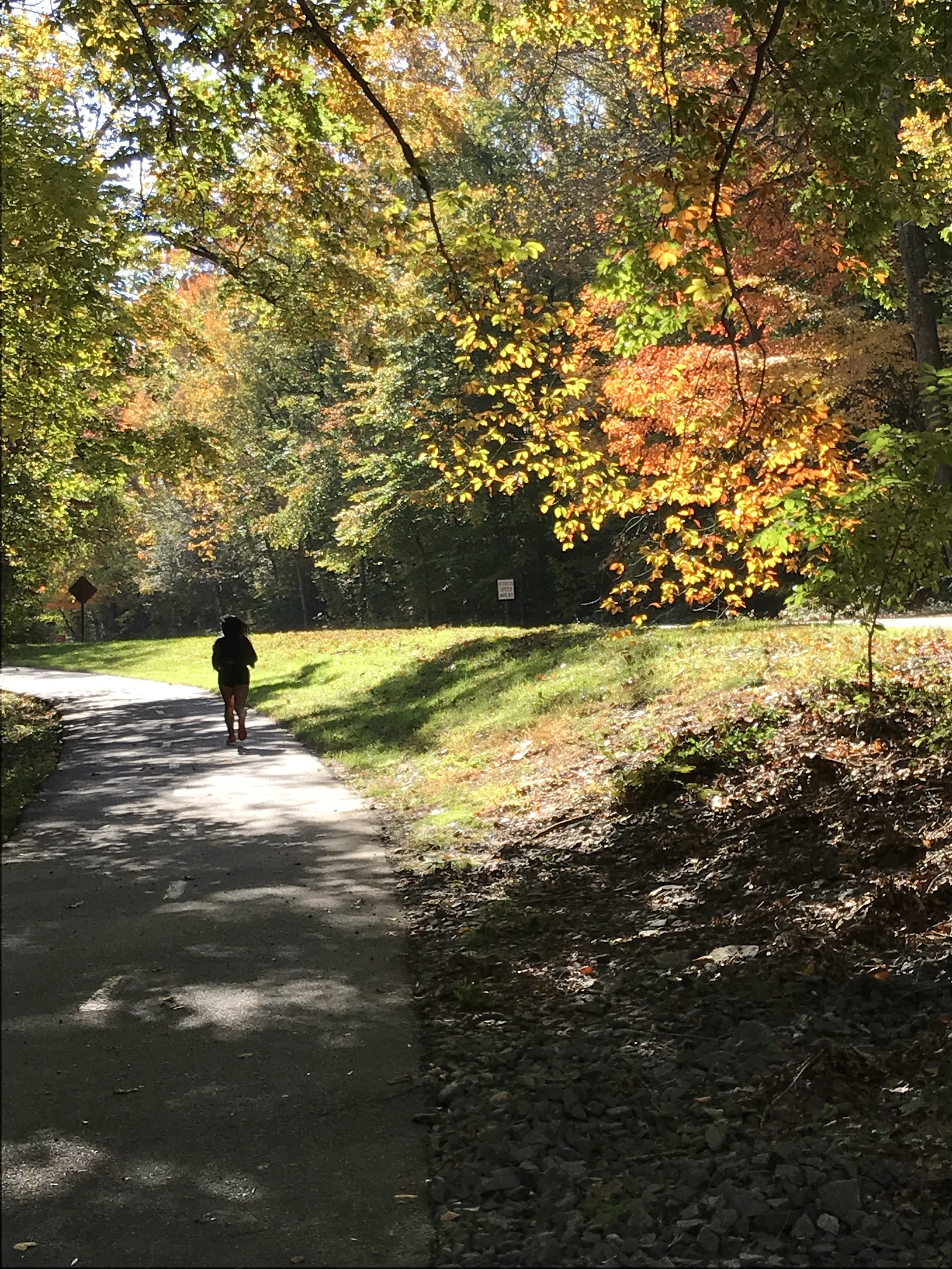
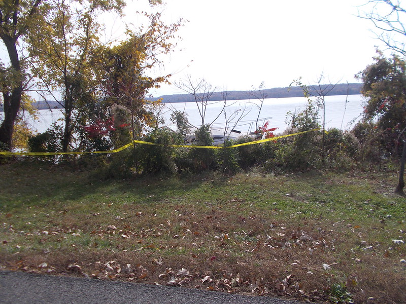
The GW Parkway ends at Mount Vernon. To continue south, travelers use the MVMH. At this point a new-ish side path exists for about 1/2 mile to a traffic light at Old Mount Vernon Road. After the light, there is an old, narrow asphalt path that is in lousy shape with tree roots and debris. After a few hundred yards that path ends and path users need to cross the MVMH to get to another similarly decrepit path along the MVMH. This path has the added feature of a series of abrupt ups and downs. This path segment ends after about 1/4 mile at Southwood Drive. Local residents report that these three parts of the trail are virtually impossible to ride on a bike and in such poor condition that even running is problematic. Unfortunately, improvements to or realignment of these side paths are not included in the project scope.

The first of the proposed new segments would begin on the opposite side of the MVMH from this last bit of path. It would continue only a few hundred yards to another existing side path that extends from Peartree Landing (a neighborhood street) to the entrance to Grist Mill Park, which contains soccer fields, a large playground, and the area’s free mulch collection. This existing segment is wider and newer than the others describe above. Nevertheless, the local residents I talked with said this segment also has problems with tree roots.

Beyond Grist Mill Park a new trail segment is planned that will cross the southern end of Old Mill Road until it reconnects with a little used, existing frontage road. After the frontage road, the new trail will begin again and cross Dogue Creek on a new steel and concrete bridge.

After Washington’s Grist Mill, the new trail segments will end. Those wishing to continue south on a trail will have to re-cross the MVMH to connect with a new existing trail that continues a couple of hundred yards to US 1.

The project plans include wayfaring signs, as well as improved crosswalks and bus stops.

The project team’s consultants were in attendance. Maps of the project were on easels for review. There were about 40 – 50 people in attendance. Considering the fact that this was a preliminary meeting, this was an impressive turnout. Attendees included people who live along the project corridor and others, like me, who use the corridor for cycling.

Concerns raised included:

  • The design of the Dogue Creek bridge. It will be steel and concrete which will hopefully lessen the crashes that are endemic to the Mount Vernon Trail’s wooden bridges.
  • Crossing the MVMH is dangerous now. Recently, a 15-year old runner was hit by two cars as she crossed the road. (She lived but is in for a long recovery.) Attendees asked for traffic signals of some sort and consideration of sight lines when positioning cross walks.
  • Local residents say that traffic has increased significantly since the military base re-alignment moved thousands of personnel to Fort Belvoir. The residents say that the 45 miles-per-hour speed limit is too high considering the highway traverses a residential area. This is clearly one of those places were Virginia DOT prioritizes moving commuters over residential users.
  • Local residents also decried the condition of the decrepit existing trail segments.
  • The crossing at Old Mill Road is a potential problem. Local residents cut through a neighborhood and a wooded perimeter area to access the park now to avoid this intersection.
  • Drainage is a problem now for one resident whose home abuts a new trail segment.
  • The trail right of way could be 20 to 30+ feet depending on the type of drainage used at the highway’s edge. One resident noted that his driveway is only 40 feet long.
  • Residents clearly would prefer to limit the trail to one side of the highway.
  • Trees will have to be removed to accommodate the new trail assuming it stays in its current alignment.

The next step is for the project team to do a detailed analysis of the corridor and produce a preliminary design for public comment. That process will take six to nine months.

As readers of this blog know, I do not much enjoy doing bike advocacy work, but I have to say that this meeting was actually fun. There was concern without anxiety on the parts of the attendees. I think they had plenty of time to have their say. Chris Wells and Dan Storck did a great job of listening and making thoughtful observations. Project team members and Dan Storck were taking notes. With projects like these the old saying “The devil’s in the details” holds.

As for me, I was encouraged to see that Chris has picked up where Adam Lind (currently cavorting in Santiago, Chile) left off as Bike/Ped coordinator. This was my first interaction with Dan Storck. My district supervisor is an avid cyclist. Obviously, he has to take into consideration all users and constituents but it is a great relief to know that he speaks my language.

As for me, I doubt I will use the new trail. I don’t use any of the existing trails segments. I am comfortable in the road, but I understand that others, most importantly the people in the adjacent neighborhoods, are not. I also doubt bicycle tourists, experienced recreational riders, and commuters will want to meander back and forth across the highway. However, the project clearly addresses many existing shortcomings for walkers and runners and less experienced cyclists.

Finally, I did get a chance to talk to Dan Storck about his annual Tour of Mount Vernon bike ride. When I first heard about it, I thought is was a dinky neighborhood ride. Wrong. It’s the real deal at 36 miles and he’s very excited that it’s catching on after only a couple of years. I didn’t ride it last year because I was already committed to WABA’s 4th Annual Cider Ride. Hopefully, this year WABA and Supervisor Storck can coordinate dates so I can do both.


Fall in Mount Vernon

After an early morning recon ride in the car with Mrs. Rootchopper, I went back on my bike to take some pictures of the local fall foliage. Fort Hunt Park has several maples that put on a show for about a week every autumn.

IMG_0637

And with the river, the foliage, and the angled sunlight, the Mount Vernon trail is simply beautiful.

IMG_0639

IMG_0641

There are a few more on Flickr.

Sunday Sight Seeing on the Mount Vernon Trail

On Sunday, two friends from my grad school days came over for brunch. Matt is not athletic. Mike is. Mike was going stir crazy staying with Matt so we agreed that I would take Mike for a bike ride after brunch. Fortunately, Mike is exactly my size so The Mule fit him. I rode my Cross Check.

Mike has a yard sale bike at home in Providence that he rides religiously once or twice a year. So I set a gentle pace. We did a tour of the Mount Vernon Trail bald eagle nests. Along the way Mike told me about how he recently used CitiBikes to ride around New York City. He said he would never have ridden a bike except for the fact that there are separate dedicated bike lanes. He felt totally safe. Mike should be the poster boy for urban bike infrastructure.

We made it to the Belle Haven nest but saw no eagles. As we rode further Mike told me about the  East Bay Bike Trail in Rhode Island. He loves it. I ran this once when it was a railroad line back in 1980 or 1981. It really sounds fantastic but Mike was annoyed that it wasn’t wide enough. Soon we entered Jones Point Park Mike was shocked to see a separate walking lane. (I didn’t have the heart to tell him that most walkers ignore it.)

Under the giant bridge and into Old Town. Then we took the Wilkes Street tunnel and Royal Street back to the Mount Vernon Trail. Continuing south we stopped at the Tulane nest. I could barely make it out with binoculars amid the dense foliage. Mike never saw it. Onward to the osprey (or maybe bald eagle nest) at the fishing hole. No birds, nice view.

Our next stop was the Morningside Nest which I couldn’t find at all amid the leaves. My bald eagle nest tour was becoming a bust.

We continued down the trail to Fort Hunt Park, stopping to admire Fort Washington on the opposite side of the Potomac River. We did a lap in the park then headed for Mount Vernon. About a half mile from the park  I pulled over for one more bald eagle nest. I just could not find it. As I was giving up, I looked up and there it was, right out in the open. Easily the biggest nest of all. Mike saw it too. And just as he focused on it, an eagle flew down and into it. The nest, or actually the outside structure of the nest, is so big that the bird just vanished. I could occasionally spot the bird’s head bopping up and down, probably feeding an eaglet. As we were watching the nest, a second bald eagle flew in circles overhead. Woot!

We started talking with a couple who were walking their dog. Just as we were about to leave they spotted a bizarre looking naval vessel making good time on the river heading toward DC. It had a sort of dazzle camouflage on its sides. Very cool.

I took Mike up to Mount Vernon. He did not much a
ppreciate the last hill. After a brief rest, we continued  beyond the estate for a photo op before heading back home.IMG_0023.JPG

23 1/2 miles, 1 strange boat, 2 bald eagles.Not bad for a lazy Sunday.

After he left things got at tad more interesting, but that’s a tale for another post….


Advocating and Zoning Out

Advocating

Last night I went to a meeting of the Fairfax Alliance for Better Bicycling or FABB. This is an advocacy organization with a geography problem. Fairfax County wraps around Arlington and Alexandria. This makes it impractical for people in the southeastern part of the county (where I live) to attend meetings in the northern part of the county. So I have never gone before. Until this year, FABB has focused on the parts of the county far removed from my home. Last night they moved the meeting to 1/2 mile from my house. So I went. Irony alert: I drove.

It was a pretty crowded meeting and without seven cyclists that I know who live nearby. Much was discussed. A representative from the Mount Vernon Supervisor’s office was there. (Supervisors are like mayors of the county’s various districts.) Also, Adam Lind, our fearless county bike person, came.

What became apparent was that the Mount Vernon District has issues that no other part of the county has. Despite the fact that Fairfax County is one of the highest income jurisdictions in the country, there is precious little money to spend on bicycle and pedestrian facilities, unless the project is part of a enormous road construction project. If you want a bike project funded you pretty much have to organize a whole mess of people and raise a big stink. Repeatedly. Ugh. Or you can move to Arlington or DC.

I have been saying for quite a while that Arlington and DC are far more attractive to young professionals that Fairfax because they are less car oriented and more livable.  I heard this same sentiment last night. I’d say Fairfax is at least 25 years behind Arlington and DC in its approach to livable communities. This meeting, like every meeting I have attended in Fairfax, has had at least one non-cycling resident who thinks everyday cycling is inherently reckless and that cyclists must be protected against their own inability to assess risks. This kind of attitude creates inertia that takes years to overcome.

Zoning Out

After a five-day break, I was back on the bike today. The ride to work was highlighted (pun intended) by the fact that the sun was out when I left the house. Yesss!!! This didn’t stop me from taking my sunrise picture though. There as a small amount of black ice on the Mount Vernon Trail but nothing I couldn’t ride over. I didn’t much care for the cold headwind but the fact that I wore sunglasses the whole way pretty much made up for the discomfort.

The ride home was in daylight for about 1/2 the ride. I could get used to this. Plus I had a tailwind. I was about 2 1/2 miles from home when I went into a bike commute trance. My meditation. I looked up and noticed houses that didn’t look familiar. I had missed a turn. A turn that I have made hundreds of times. No worries. I took a different route and had a laugh.


I Bike and I Vote

Today was a pretty nice day to be a bike commuter. On the way to work Little Nellie asked me to take her picture at Dyke Marsh. So I did.

Foggy day on #mvt #dykemarsh

I don’t remember much about getting to work. That’s a good sign though. It means I was in my trance.

My body hasn’t adjusted to standard time yet. I woke up at 5:25 and my body said, “Let’s get going.” This meant that I could leave work a little early. About a mile from the office I spotted the Washington Monument bathed in a faint red glow so I stopped and took another picture.

DC aglow #mvt

I wasn’t planning on voting today. I am really, really sick of politics. And my area of Fairfax County is so Democratic that most of the local election results are a fait accompli. During the day, however, I read Bree’s blog post about biking to the polls. It’s important for everyday cyclists like me to show up at the polls, not so much for our vote, but simply to wave our political flag. This year it was a way to demonstrate my support for the brand new bicycle lanes on Parkers Lane which happens to be where the school that houses my polling place is.

One nice residual effect of the bicycle lanes is that drivers are going a lot slower. Unfortunately, one driver, apparently afraid he wouldn’t get to vote, came flying into the school parking lot as I was leaving. My vote won’t matter a whole lot to me if I am dead. It’s going to take more than bike lanes to change the culture in Fairfax County.

Coffeeneuring with George Washington Foodcourt

I waited to long to go on my bike ride today. You see, last night I attended a bike poster art thing called Artcrank in DC. There were bike themed posters on display. They were very creative. As it turns out, my favorite was from Friday Coffee Club member Aaron. His poster was called No Bad Day and it showed a bike rider in silouette, half riding in foul weather and half in fair. It reminded me of my running days. My wife would look out the window and say, the weather sucks. My response would invariably there is no bad weather for a run. And out I would go.

The real highlight of the Artcrank event was the fact that there were 20 or 30 #bikedc people I knew there. (No way I’m naming names since I would surely leave some out.) And I met several people who I hope to see again soon. I’d say the first edition of Artcrank DC was a big, big success.

Aaron, is a year round, indefatigable bike commuter. He commuted in Minneapolis which is either badass or insane. Or, actually, both. We were talking with beer cans in their cozies in our hands when he mentioned that the cozies make excellent toe warmers for winter cycling. This is either badass or insane, but it is an economical (actually free) alternative to the stupid toes covers I bought a couple of years ago. They lasted all of two weeks before shredding.

Cozy toes? We'll soon find out

I put them on today but it wasn’t cold enough to make a difference. I’ll get another chance soon enough. (There is of course the possibility that Aaron was putting me on. I am unshamable, however.)

Fort Hunt Park never disappoints in the fall

My ride today was my sixth coffeeneuring ride. I decided to roll down to Mount Vernon and check out the food court. I’ll bet you didn’t know George Washington invented the food court. He was badass, too. On the way I took a lap around Fort Hunt Park. The trees in the park were a little past peak but they still impressed with their bold colors.

New bridge on the Mount Vernon Trail

Further down river on the Mount Vernon Trail I came upon a brand new bridge. This is really quite nice and was much needed. Thank you, National Park Service.

SS Minnow found at last

Just past the bridge I came upon a boat parked at the river bank behind some yellow tape. It could have been the S.S. Minnow, but maybe not.

Coffeeneuring No. 6: MV Foodcourt coffee

The food court was ‘Merica. Burgers and fries and pizza and other things that didn’t make my nose too happy. I bought a decaf coffee and a soft pretzel. The pre-ride coffee I made with my new coffee maker was more better by far. The soft pretzel was salty and took up sufficient space in my digestive tract that it might be classified as actual food.

The ride home along the river was lovely. It had warmed up a bit while I was decaffeinating and so it was quite comfortable.

Chain love with the Nellies

Back at home I had a chain lube party with my three favorite bikes. They are my favorites because they are the only three I have.

Coffeeneruing Rap Sheet

Place: Mount Vernon estate food court at the end of the Mount Vernon Trail

Drink: House decaf as bland as coffee gets

Miles: 13

Observation: There used to be a Starbucks in the foodcourt but now it’s just generic weak joe. The coffeeneuring pickings sure are few and far between in SE Fairfax County. The ride, however, is pretty darn nice.

Now We’re Getting Somewhere – Taking a Mulligan

I needed a grease injector to service my pedals. It’s a bit of a mess trying to do it with a baby medicine injector. Not enough oomph in the lilttle plastic plunger.

My local bike store doesn’t sell them but Performance does. I could have ordered it online but that would have taken away a prefectly good excuse to ride over to their Springfield store. A couple of weeks ago, friend of the blog, bike commuter, and Friday Coffee Club devotee Reba told me that Mulligan Road was now open.

Mulligan Road is the new road that connects US 1 with Telegraph Road near Fort Belvoir. Woodlawn Road used to serve this purpose but the military closed it for security reasons after the 9/11 attacks. Traffic has been a mess ever since. In true Washington area style it only took 13 years to fix the problem.

The road seems to have been recently renamed, Jeff Todd Way. Jeff Todd was a local businessman who was very active in the community. He died in a car crash in 2011.

Whatever the name, it was time to check out the road on two wheels. Big Nellie got the call.  I stepped out of the house and was smacked by searing heat. Labor Day may be the first day of meteorological autumn but somebody forgot to tell the weather gods.

To get to the new road, you ride the Mount Vernon Trail to the end at Mount Vernon. Then you keep going down the Mount Vernon Memorial Highway all the way to US 1. At US 1 you’ll see a mess of road construction which will soon be cleared up. Cross US 1 and you are are on the old Mulligan Road. It has been moved a bit to the south and widened. (The old entrance to Woodlawn Plantation has been removed. Access is now available from US to the south. Good luck with that if you are on a bike.)

In a half mile you come to Pole Road. This used to be the end of the line for Mulligan Road, but not anymore. A new road winds up (and I do mean up) through Fort Belvoir. It’s a four lane highway with a 40 mile per hour speed limit. The road isn’t quite done yet. For one thing it needs another layer of asphalt to make the road bed even with the concrete edge of the road. The right lane seems extra wide which I hope means there will be a bike lane.

Up, up, up. Put me in the zoo.

After cresting the hill, you get a nice reward descending through broad curves until you start to ride up again to Telegraph Road. Telegraph is a bit of a mess heading south. The hill you just came down now goes back up, and then some. There’s no bike lane (yet) so it’s just you and the constant flow of impatient drivers yearning to get to I-95 and go absolutely nowhere.

Just before the crest of the hill there is a sign saying “End of Bike Lane” which suggests that maybe there is supposed to be one. Not 30 yards later a new bike lane begins. Signage is not VDOT’s strong suit. This bike lane continues all the way to US 1 south of Fort Belvoir. I turned right at Beulah Road expecting to do battle with heavy car traffic but to my surprise I was given a bike lane of my very own. Yay! It continued all the way through Kingstowne to the Franconia Springfield Parkway. (It wasn’t actually my own. It was used by a man driving a car while messing with his smartphone. He kept weaving all over the road. I caught up to him at a red light and yelled at him to put the damned thing away before he killed somebody.)

I could have taken a side path all the way to Performance but the wide paved shoulder on the Parkway was too nice to pass up.

Mission accomplished thanks to the folks behind the Fairfax County Comprehensive Bicycle Plan.

The ride back was more better because the other side of Telegraph was in much better shape including an on-road bike lane. I turned right onto Mulligan/Todd and saw a wide side trail. I do hope this is not going to replace on on-road bike lane because the right lane is extra wide and can easily accomodate a bike lane.

Ever notice how the ride back seems so much faster once you know where the roads go? I flew down the long hill on Mulligan and zoomed right across Pole Road without so much as recognizing it.

Mulligan/Jeff Todd will be finished soon. I have sent a note to Adventure Cycling so that they may consider adding it to their Atlantic Coast route.

I took a whole bunch of pix so you can see for yourself over on my Flickr page.

Some Suggestions for Improving Everyday Cycling in Fairfax County

A recent comment to the blog from South Lakes Mom asked me if I was attending the Fairfax County Bicycling Summit at George Mason University (GMU) on November 4. I don’t plan on going since the focus of the summit is improving cycling in and around Tysons Corner, 23 miles from my house by bike.  I have been in or through Tysons Corner about 10 times in the last 30 years. (Most of my visits were to a VW dealer to get my  Golf repaired because the repairmen at the dealer near my home were incompetent.) Whether in a car or on a bike, I avoid it like the plague. I commend the County and the Fairfax Advocates for Better Bicycling (FABB) for trying to improve life in Tysons. No matter what they accomplish it will have no practical relevance to me.

The apparent reason for holding the summit at GMU is that it has lots of meeting facilities and it is centrally located in the county. It is also 25 very cycling unfriendly miles from my house. Go ahead, try and ride cross county from Mount Vernon to Springfield or beyond. I advise that you notify your next of kin before heading out.

But let me stop kvetching and add some suggestions, in no particular order, for better everyday cycling in my part of Fairfax County. Before I begin, let’s set a basic ground rule. I am talking about everyday cycling. Riding a bike to the store, the library, the farmers market, the pool, or the office. I am not talking about the Tour de Fairfax. The objective is to make cycling to these places as safe and convenient as driving. Here’s my list. It goes to eleven.

  1. Put a flyover bridge or a traffic light at the intersection of the George Washington Memorial Parkway and Belle View Boulevard. This is a primary connecting point to the Mount Vernon Trail and the intersection has one of the highest rates of vehicular accidents in the DC region. The Parkway is owned by the National Park Service which is more concerned with esthetics than safety.
  2. Allow bike commuters to park in Belle Haven Park (and other National Park Service lots) along the Mount Vernon Trail. Bike commuters currently run the risk of being ticketed so instead they park on the opposite side of the Parkway and have to make a crossing at grade at rush hour.  These parking lots are empty during the week. The Park Service could auction off slots for half the spaces and use the funds for improvements to the trail or parks. All that is needed is a “Yes”.
  3. There is no viable, route connecting Mount Vernon to the Lee District from the Beltway to south of Fort Belvoir.  The only way I know of involves riding over Beacon Hill which is reasonable only to Claudio Chiappucci and Fausto Coppi (and Coppi is dead).  There is a right of way through the northern edge of Huntley Meadows Park that would make a  wonderful, flat trail connecting US 1 to Telegraph Road. Since the county is now plowing up the edge of Huntley Meadows Park near the western terminus of this right of way so that motor vehicles can travel more conveniently, how about showing cyclists a little love. Oh, and to make my case, let’s take the responsible Fairfax and VDOT officials for a ride on the current, on-road route, South Kings Highway, a hilly, high-speed, two lane, shoulderless monstrosity. After their funerals maybe we could get some traction on this idea.
  4. Other than the Mount Vernon Trail there are very few north south bicycle routes in southeastern Fairfax County.  This is a shame because the Hybla Valley area is the lowest income area of the county and cycling is the cheapest form of transportation for distances over one mile. Start by thinking of ways to build trails with switchbacks to get over Beacon Hill from all directions.
  5. Speaking of the Mount Vernon Trail, how about a little plowing and sanding during the winter months? When left unpaved, the trail becomes a long series of icy foot prints that make the trail unusable to everyone.
  6. Connect the US 1 connector trail to something. ANYTHING. This trail connects the Mount Vernon Trail to US 1. Then you are on your own.  Was it designed by Sarah Palin?
  7. Fix the sensors embedded in the road at the traffic light at the Belle Haven Country Club so that users of the trail can get onto Fort Hunt Road without having to run the red light.
  8. How about some shoulders on the roads! And while you’re at it PAVE them! VDOT seems to think that  shoulders are bad road design.  Sometimes (e.g. Fort Hunt Road) the shoulder appears then disappears. When there is a shoulder it is sometimes paved and sometimes not. 
  9. Elected officials should be required to get to their offices by bike once per week. Pretty awful, right. Then have them ride to Old Town Alexandria on the Mount Vernon Trail. See the difference? There shouldn’t be one!
  10. A general note about bike trails: sidewalks are not bike trails. Slapping asphalt over unimproved soil makes for a lousy sidewalk and a lousier bike trail. Don’t try to impress the cycling community with the many miles of slapdash “trails” built in this fashion in the last 20 years. They are worse than worthless; they are dangerous. Stop building them.
  11. The recent addition of bike trail along Fort Hunt Road near the Belle Haven Elementary school is well intentioned and a big improvement over the slapdash trail it replaced. It will get very little use by everyday cyclists because it is too steep and narrow and has too many curves. If you have to ask why, imagine designing  a road for your car that mimics these design features. You wouldn’t drive it. If you think it costs too much to build a better alternative, you have two possible results. Either nobody will use it and you’ve wasted your money. Or, you can build it right a second time after the county gets sued by somebody who loses it on the steep, curvy descent.

If you can sense the tone of impatience in my words, you can see why I have little tolerance of the advocacy process. These changes should patently obvious. Many of them have been suggested and ignored by our elected officials for decades. So lets start with one or two. Can we agree to do that? Then do a couple more next year.