Bike Tour 2022 – Leoti, Kansas to Sheridan Lake, Colorado

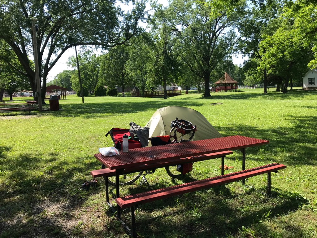
Upon arriving in Leoti, I pitched my tent in the town park (my repair worked!) and went to take a shower in the adjacent mini-hospital. The nurse in charge wouldn’t let me use the shower, presumably out of Covid concerns. (I was wearing better protection, an N95 respirator mask, than the hospital staff. Go figure.)

I was dispatched to the swimming pool where I took a very cold shower. I felt rather like George Costanza when I was done.

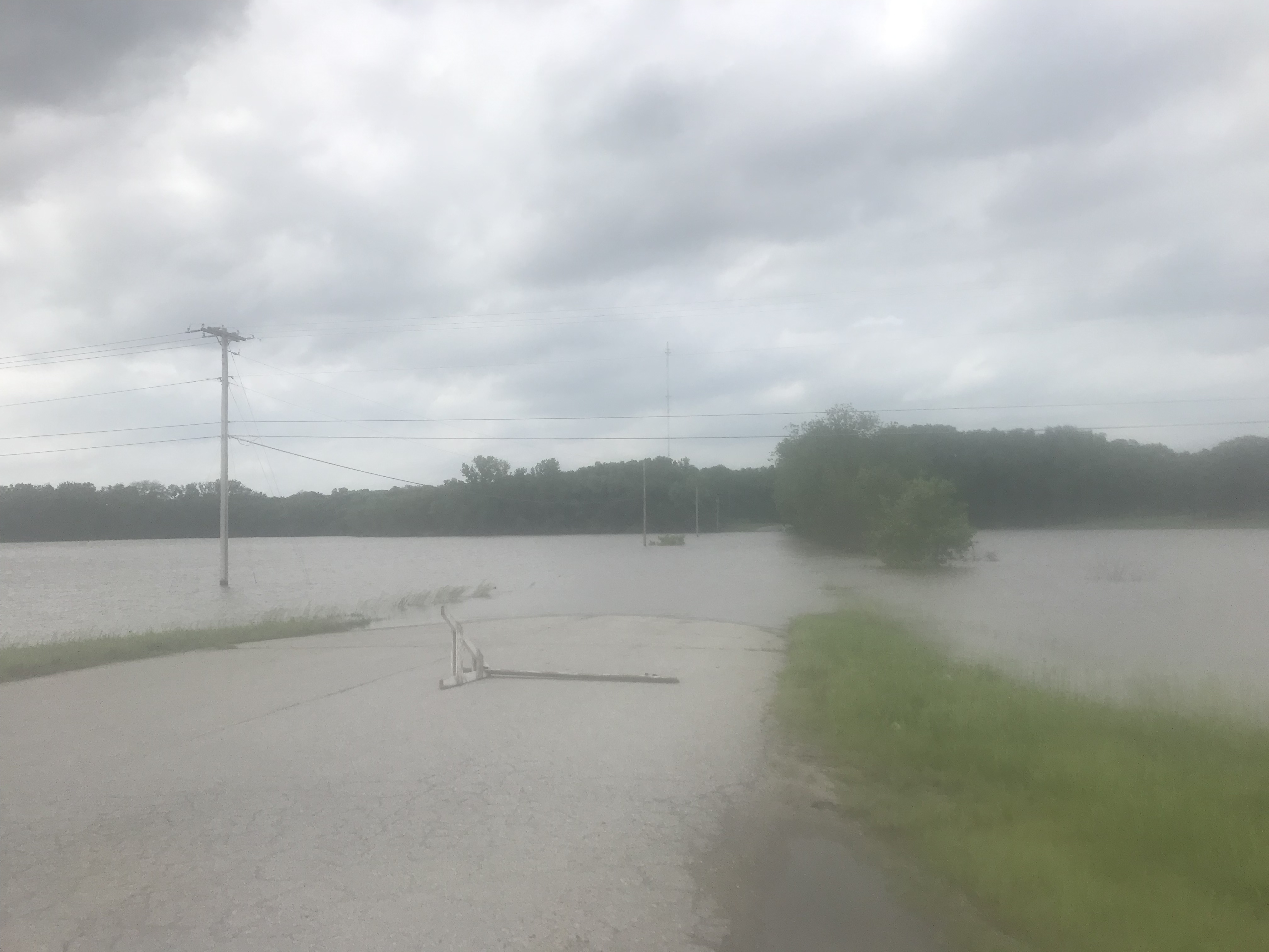
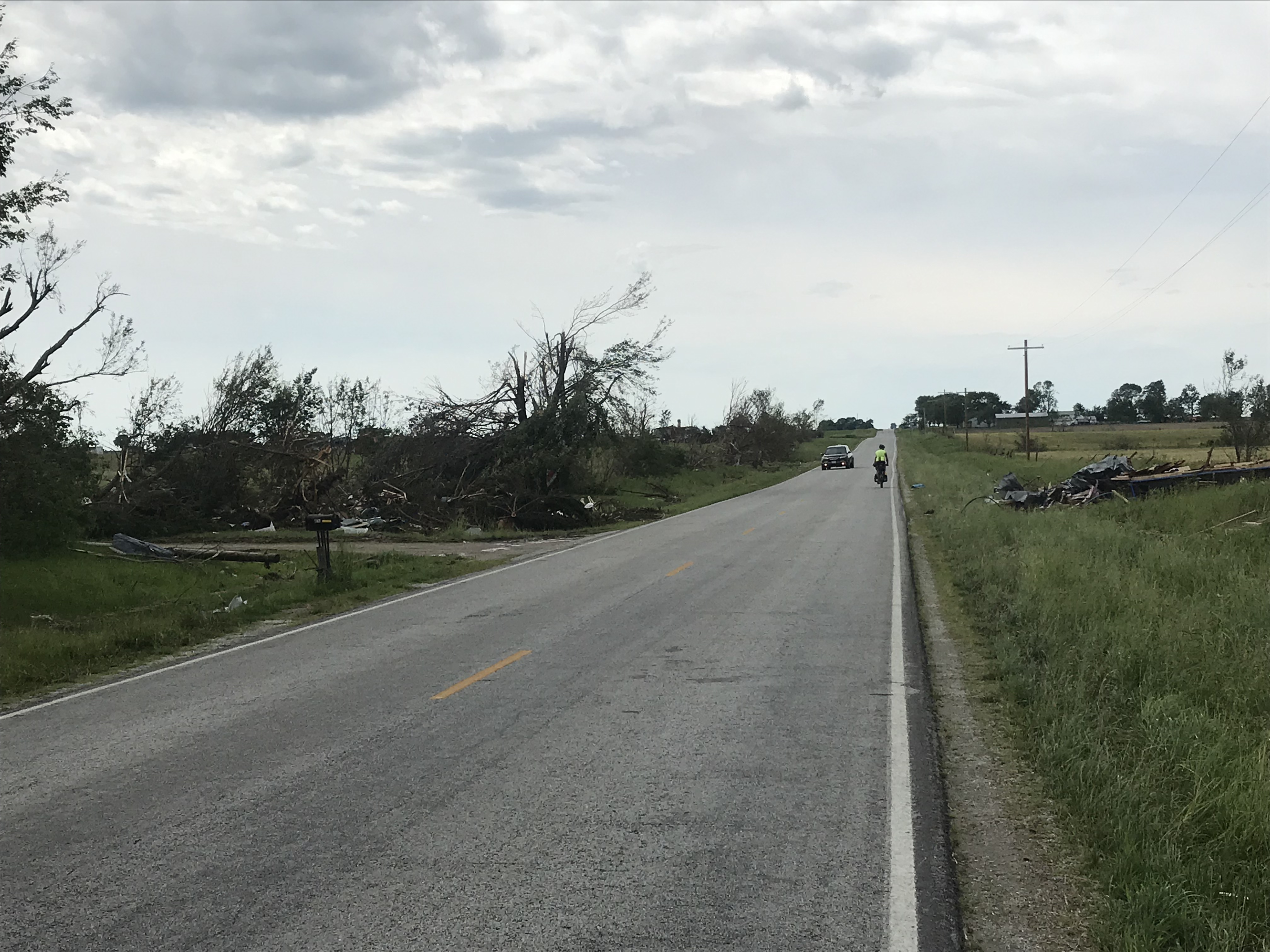
I had dinner at the town bakery, where I ate in 2019. When I left for the bakery the skies were partly cloudy when I returned they were black.

I quickly got into my tent then all hell broke loose. Big gusty winds and a mighty rain ensued. I hoped that I set up the tent properly and that it didn’t leak. Yes on both counts.

After an hour I took an Advil PM and re-emerged. I could see the next wave of storms bearing down. Back in the tent I went. Another raging storm came through. My tent held firm and dry. With ear plugs in and eye mask on I fell asleep until 3 a.m. It was still raining, but not inside my little sanctuary.

I arose with the birds and twiddled my thumbs until the town diner opened at 7. It had a big circular table where ten large men gathered to discuss whatever men discuss. Every single small town has this.

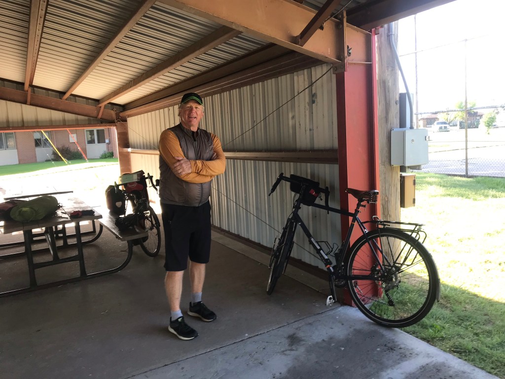
Back at the park I was packing up and about to leave when Bob Eakins rolled up. Bob and I met in Monticello, Utah in 2019. He had just finished riding from Sacramento and was DONE, exhausted mentally and physically. It made me wonder what I was about to get myself into. I felt the same as Bob when I arrived in San Francisco.

Bob is riding west to east from Pueblo. I thought he was well to the east by now but he rides relatively short days. A bit surprising considering his relative youth – he’s 65.

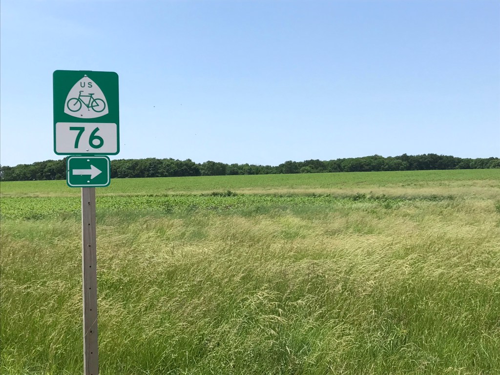
After an hour he returned to his motel room and I headed straight west on Kansas Highway 96. Into a headwind of course. I was working hard, curiously taking big gulps of fresh air.

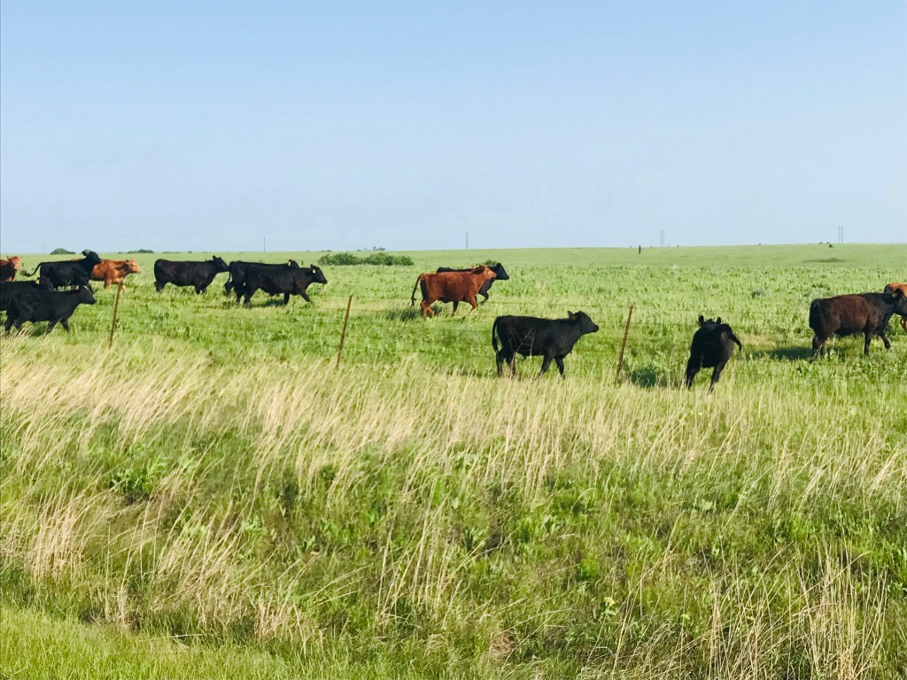
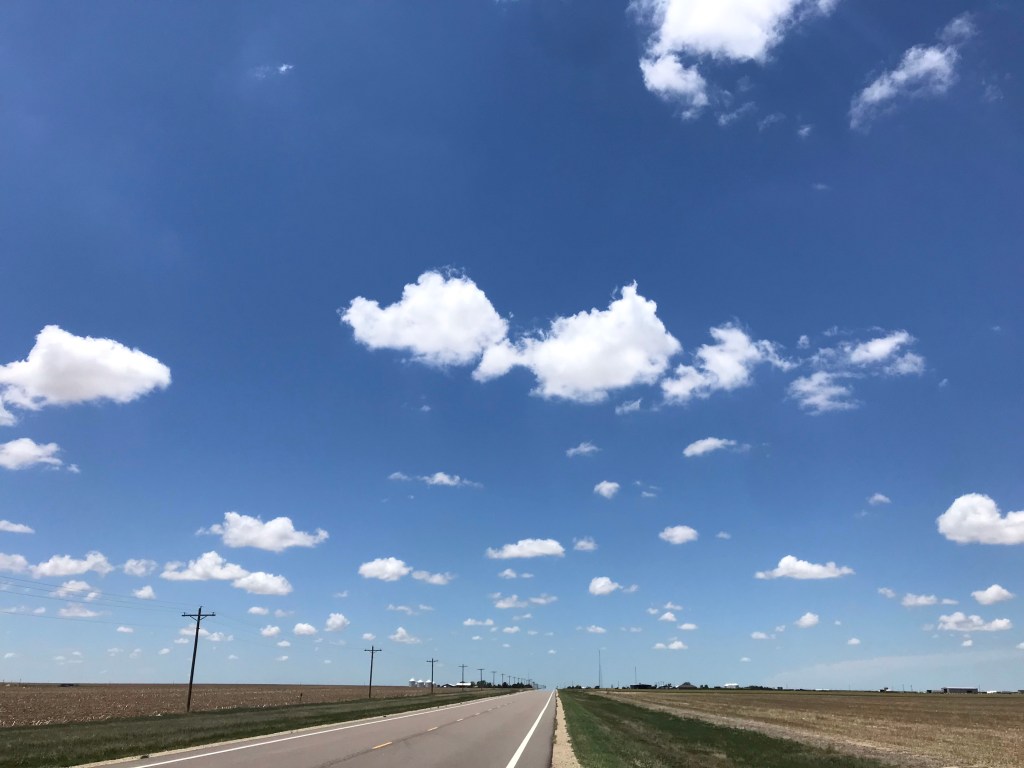
The farms on either side of the road went on forever and the sky was picture pretty with puffy white clouds. Every so often one of the clouds would block the sun and the temperature would drop. Aah.

I arrived 23 miles later in Tribune where I stopped for lunch. Chicken strips and green beans. Fine dining.

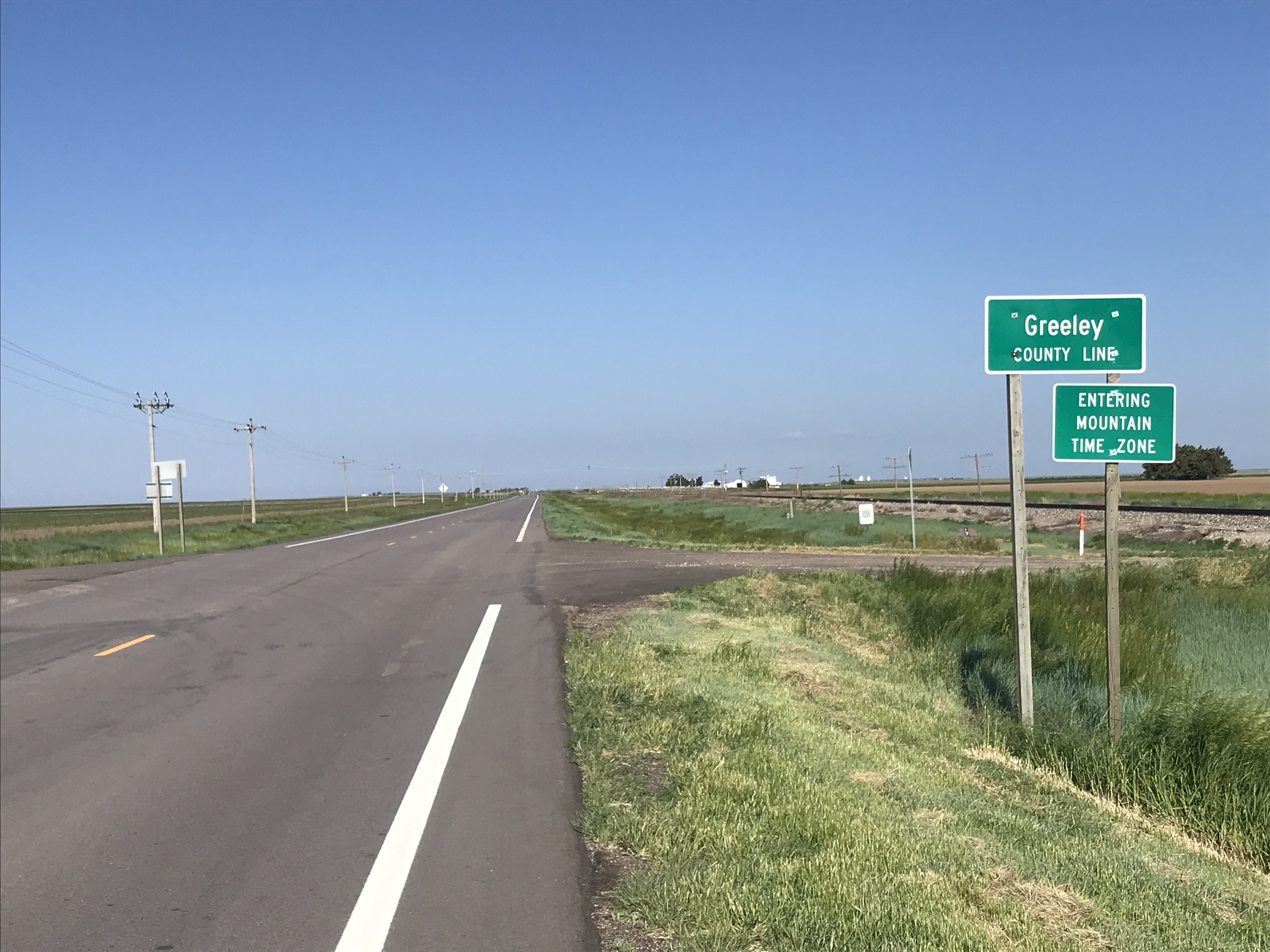
Tribune is in Greeley County. I lit out west on 96 and soon passed the small town of Horace. Go west young man indeed.

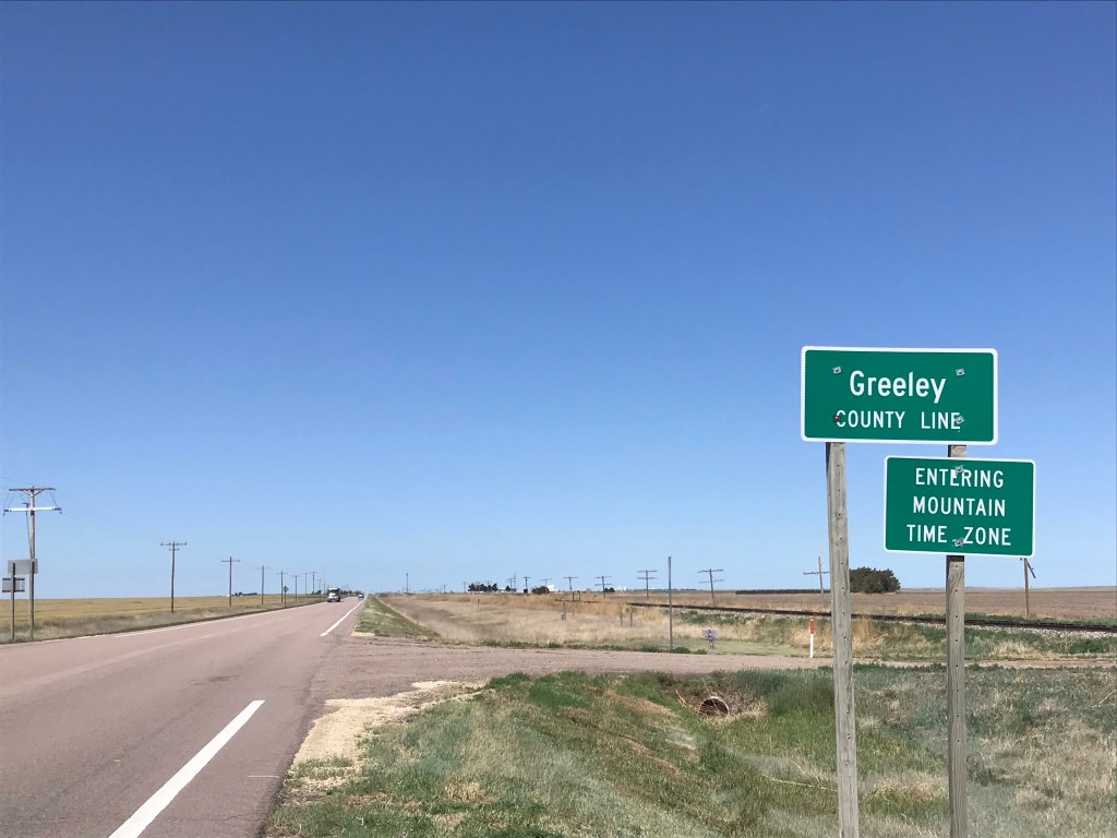
The wind was more of a cross wind after lunch but I still seemed to be working awfully hard. A reward of sorts came when I left Kansas and entered Colorado. I will Kansas no more forever. (Except on the 50 States Ride, of course.)

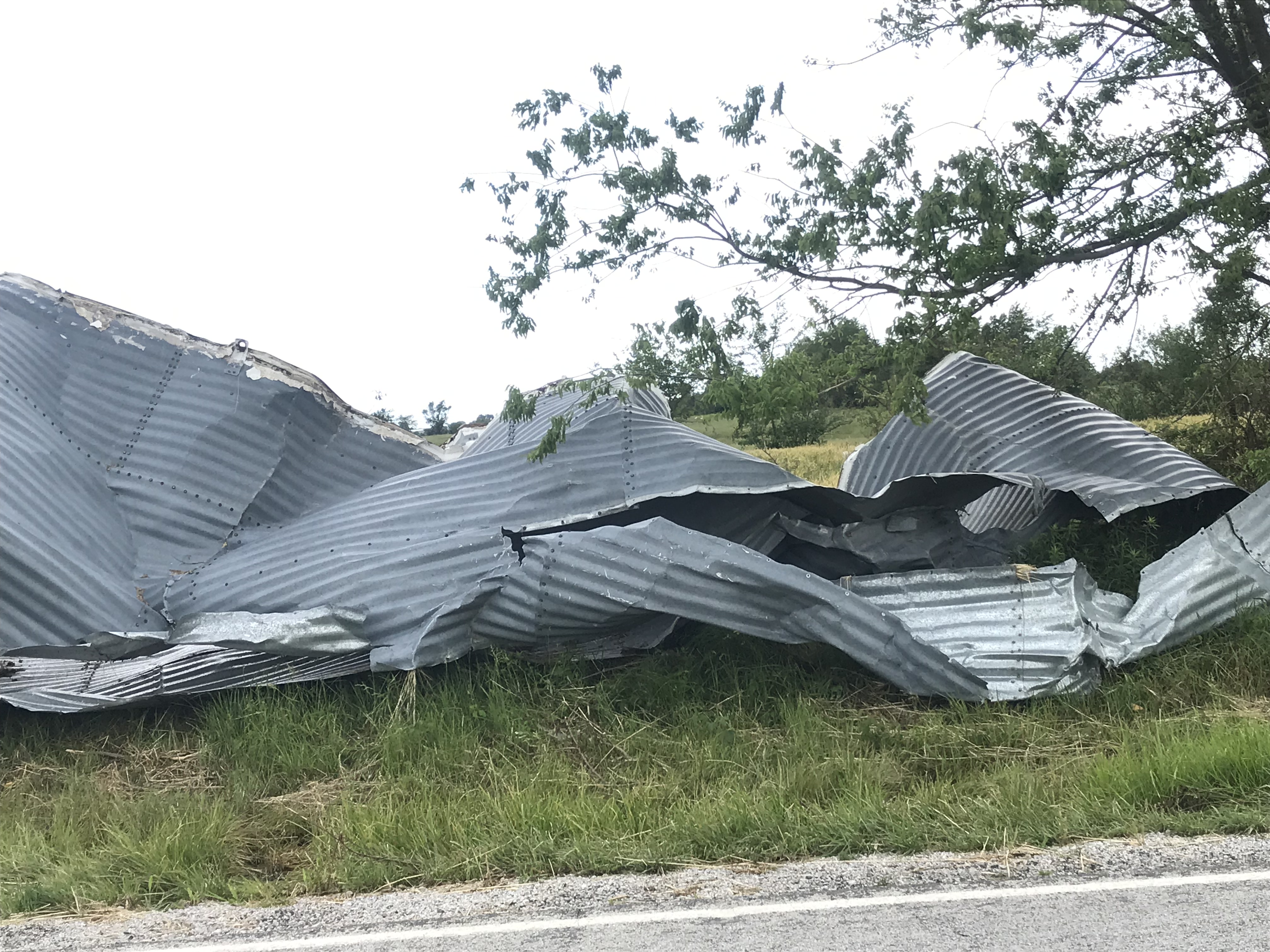
In Colorado the road had expansion joints, what every cyclist’s ass hates. Thankfully they didn’t continue for more than a few miles. I was passed by oncoming farm equipment that looked like Transformers.

I arrived in Sheridan Lake, population 88 if you count the pets, and chatted with the clerk in the town gas station/convenience store. She grew up in Towner, which I had passed through a few miles previously. Towner’s population is 22.

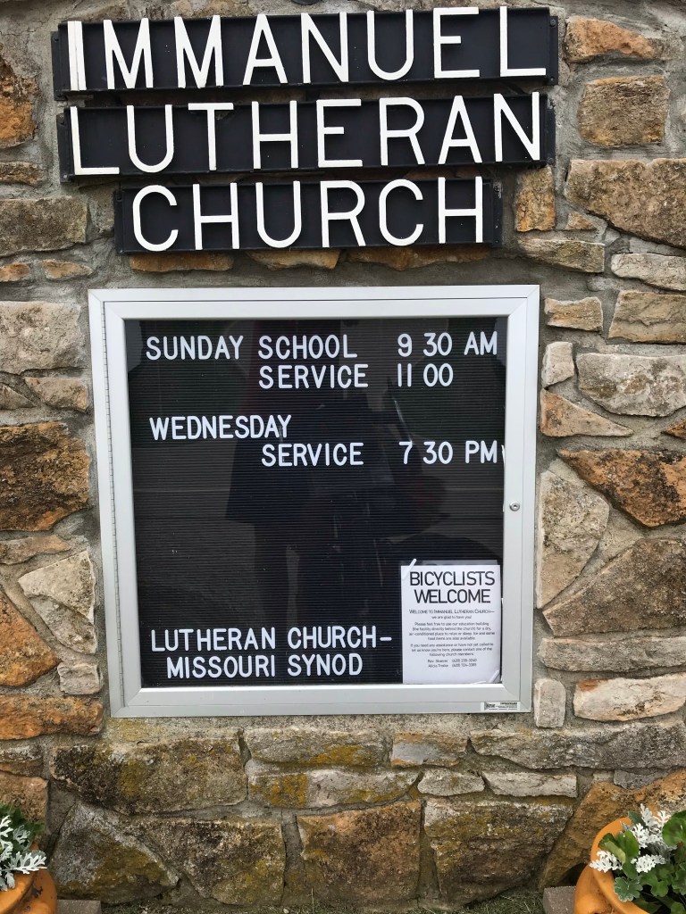
On the way into the store I waved to a bicycle tourist coming from the west. He and I are staying at the Sheridan Lake Bible Church which has hosted bike tourists every summer for many years.

My east bound friend is Mike, from Switzerland. He’s a fascinating man. He trekked in Nepal, visited Cambodia and Vietnam, flew to Los Angeles, then flew to Denver where he bought a bike and a Burley flat bed trailer and set out across America. Mike had a catalytic converter business in Europe that he sold in 2005. There’s no future in it, he rationalized. His mother’s side of the family developed the Schindler company, a manufacturing conglomerate. Among other things they make escalators and elevators. I wonder if my 2018 bike tour friend Martin who worked in elevator repair in Switzerland worked for Schindler. It would be an interesting coincidence.

Ernie, the pastor of the church came by and chatted for a long time. He has all kinds of stories about bike tourists who’ve stayed here. Imagine living in the middle of nowhere and meeting people from all over the world.

Mike is camping outside despite the threat of bad weather. He doesn’t like to sleep on the floor. He knows a thing or two about bad weather; he sailed across the Atlantic twice.

For those of you who think I’m a little old to be doing this, Mike is 85.

I’m now at 4,071 feet. I gained about 700 feet today. Gotta gulp that air now.

Bob Eakins- We meet again!
Time zone change
Just a surreal sky all day
Roadside grain tower in Towner. I watched a crew building one of these. Truly impressive. They added band after band of wraparound rebar using a crane from the top.

Today’s miles: 54. Tour miles: 1,006.

Bike Tour 2022 – Eureka to El Dorado

Last night was full of worry. How was I going to ride 72 miles with no services in a brutal crosswind with gusts up to 50 mph? Add to the challenge my super hard 84-mile ride yesterday and the fact that the only breakfast place in town was closed for Memorial Day.

What’s a Rootchopper to do?

For a start I spotted cars pulling into the Pizza Hut across the highway as I was lubing my chain last night. I decided to buy a pizza and save some for breakfast. That solved one aspect of the problem. I had saved half a Dagwood sub from yesterday’s lunch at Lizard Lipps. (Basically it’s a small brick of meat and bread.) I could get 30 miles out of that bad boy, for sure.

But the crosswinds would be even stronger. Gusts of up to 50 mph were forecasted. About 58 miles of the TransAm route would have featured crosswinds.

I woke at 4 a.m. and came up with an alternative. Instead of following the TransAm route through Cassoday to Newton, I’d ride 31 miles straight west to El Dorado on a two-lane highway. If I was feeling my oats, I could continue on to Newton from El Dorado. This route would be a few miles shorter than the TransAm and give me a viable bailout point if things got nasty.

After downing some cold pizza, I headed for El Dorado. The first 19 miles coincided with the TransAm. I figured that if things were going well, I could scrap the El Dorado idea.

Things did not go well.

The first four miles weren’t too bad but the winds intensified as the ride wore on. Once, again, again, again, and again gusts blew me off the pavement onto the 8-foot wide unpaved shoulder. My right arm was getting worn out from trying to control the bike’s direction. Big vehicles zooming past at 60 mph either hammered my front with their wake or sucked me to the left. The latter was quite scary.

I had to be on my toes constantly. (Speaking of toes, my shoe repair last night seems to have worked. Dunno about the tent repair.)

I plodded along going slower and slower up the ridges in the Flint Hills. Every so often there would be a wind break but increasing elevation seemed to anger the wind gods. By mile 14 I’d been blown off the road 10 times. Then a truly powerful series of gusts knocked me off the road four times in a mile.

I gave up trying to spin in my lowest gear and started walking. When the winds calmed (to perhaps 20 mph) I started riding again.

At the town of Rosalia, where the TransAm turned north, I decided to continue west to El Dorado. I was pooped. What a shame to miss out on 20+ miles of tailwinds to Cassoday.

The highway dropped the unpaved shoulder but I still had about three feet of paved shoulder to work with. The big gusts had abated and there were continuous wind breaks for several miles. Yay! My speedometer rose into double digits . Yay!

But I was toast. I stopped every two miles to rest. I made it to El Dorado a little after noon about four hours after I left Eureka.

Having already had lunch for breakfast, it seemed logical to have diner breakfast for lunch. Bacon, eggs, hash browns, toast, coffee, and two gloriously tall glasses of ice water.

Kansas has the best bacon. Wide, crisp, and salty. So salty. Did I mention salty?

Once I got back on the bike, my legs decided that I was done for the day. I rode to one motel then another to find one with laundry machines. The Baymont Inn not only had them but they were operated by credit card.

Tomorrow the winds out of the south will continue until late morning then shift to the northeast. Storms are forecasted for much of the day. It’s about 40 miles to Newton. I’ll stop there unless the wind gods push me to Hutchison where there is free lodging for cyclists. Then I’ll let the weather forecast and motel availability decide if I’m going south to check out the Gyp Hills Scenic Highway and Dodge City.

I’m pretty much on schedule to get to Canon City by June 11. Plenty of time to take a day off unless something unforeseen happens.

Mileage today: 34. Tour mileage: 544.

Long overdue OCP, obligatory cow photo
There’s lots of flint in these hills. The further west, the more rocky the fields were.
Couldn’t resist buying this yesterday. Came in handy at laundry time.
Well played, Mule

Bike Tour 2022 – Fort Scott to Erie

My apologies up front for not taking pictures in Fort Scott. There are several mansions that are now B&Bs. They have Victorian features but are built of brick, of course.

After the hotel breakfast I made my way south in search of a new bike lock. I tried to give my business to two hardware stores but their wares were inadequate. I ended up in WalMart and succeeded in a scoring a lame cable lock and some thin lube, Finish Line 2 in 1, which supposedly allows you to skip the chain cleaning step.

I put the lube on the moving parts of my front detailer and on the cable where it passes through the underside of the bottom bracket, the lowest point on the frame. I also tweaked the barrel adjuster on the cable to tighten it. I had one delayed shift to my granny gear all day. I’ll call that a success.

I rode south on a highway out of town into a 10 to 20 mph headwind. I decided to stop looking at my speedometer and just focus on constant effort.

Most of the drivers gave me plenty of room but as the day wore on the drivers’ patience wore thin. Oddly the only cars that honked were approaching not following.

After 20 miles of head winds I turned west to enjoy 34 miles of sidewinds. Having four panniers on my bike made the turn west a dubious improvement. The panniers act as sails forcing me to leave plenty of space between me and the non-existent shoulder.

I was now on US Bike Route 76, which a bit further on became the TransAmerica Trail.

I stopped at a Lutheran church that shelters bike tourists. I used the restroom, refilled my water bottles, and made off with some munchies. (Yes, brother Joe, I took some crunchy Cheetos.)

On this two-lane, 60 mph road I noticed a turtle making its way across the eastbound lane. I saw a car coming eastbound so I turned across the road and waved at the car to move over so as to avoid the turtle. The car slowed and, with the passenger side window down, the driver cursed at me. It was a kid who was apparently challenged by seeing an obstruction in an arrow-straight road in broad daylight. I didn’t react. I think the turtle made his escape.

About a minute later I was back on the right hand side of the road when a minivan pulled up beside me. It’s passenger side window was open and I could hear the driver raging at me. Just completely out of control. I didn’t look at him because I wanted to avoid his car which was very close to my left side.

He yelled that his kid was 14 years old and could have crashed because of me.

How reassuring!

He may be a crappy driver but at least he’s got the road rage thing down just like dear old dad. Mom was in the shotgun seat giving me the business too. I didn’t react. As they drove off Mom asked me why I swerved. “To save a turtle’s life.”

I may be mistaken but I doubt this was a family of Buddhists.

They turned around in the next driveway and roared past me. I waved. All fingers.

These back to back road rage incidents were only the fourth and fifth of my tours. I could go on about how inane it was. As I rode on it occurred to me that I was lucky they didn’t pull an Easy Rider on me.

A few miles later I rolled into Walnut where the local police had given me permission to camp in the town park. I stopped in the town convenience store and had lunch. A bologna sandwich on wheat with potato chips flavored with Argentinian spices, washed down with a Gatorade. Fine dining.

The store clerk told me that the town of Erie had restaurants and a park with camping so I lit out 9 more miles. Erie is two miles south of my route which meant two more miles of headwinds. I found a camp site conveniently near an empty RV slip where I could use a water pump and recharge my phone. All the comforts of home!

Despite the winds I pitched the tent without much difficulty. After washing up I headed to Main Street for vittles and grog. (Craft beer here is Natty Boh. I resisted the urge to ask for a Gansett.)

Tomorrow promises more strong southerly winds. I’m heading north for at least seven miles so I’m feeling the joy already. I’m looking forward to seeing bike tourists along the road.

Todays mileage: 48. Tour mileage: 525.5

Hello, old friend.
Bless me father for I have spinned.
Cuisine de Walnut
All the Groc you can handle
I was getting sick of motels.

Bike Tour 2022 – The Night Before

The car trip to St. Louis went without a hitch. All told it took about 15 hours including a stop to visit an ailing family member.

The last two hours were through torrential rains and blustery winds. We stopped near Frankfort, Kentucky for the night. Despite the weather, The Mule arrived in one piece.

Before we left yesterday morning I took The Mule for a quick spin so that I can legitimately say that I’ve ridden a bike in Kentucky. US 60 where the motel was located is a godawful road to ride on so I dipped into a neighborhood and declared victory. 15 states to go.

The last five hours of driving yesterday involved super strong crosswinds. Weather in the Midwest is surprisingly violent. After we arrived thunderstorms raged through the area for the next 24 hours.

Today we attended my niece’s wedding. It was a lovely affair. My only concern is that all the human interaction doesn’t come with a side of Covid which could hit when I’m nowhere near medical facilities.

The tour starts tomorrow. There is some discussion of a post-wedding get together in a park near here to have donuts for breakfast. The hotel we are in is very close to the Katy Trail so finding it will be a breeze.

The weather for the next two days will be cool, 50s and 60s, before giving way to two or three days of rain. This is a concern because indoor accommodations are spaced about 20 miles apart. Also the trail is unpaved which can cause problems with cables and such. And to add to potential problems, the trail runs along the Missouri River which is prone to spring flooding.

It looks like I’ll be rendezvousing with Mark and Corey in Canon City, Colorado instead of Colorado Springs. This works out great because Canon City, unlike Colorado Springs, is on the TransAm and is easy to get to. my hope is that I can get there a day early to acclimate to the altitude.

I may have to modify my route, because of the weather and Memorial Day weekend crowds. I’ll try to stay flexible.

Tour Planning – The Pile, The Route, The Body and The Brake

The Pile

I have been building the pile o’stuff for my tour. It’s getting pretty big. In a couple of days I’ll stuff it all into the panniers, load it on the bike, and try not to crash from the sheer enormity of it. At this stage, I keep thinking of things to bring like butt wipes and little bottles for castille soap and chain cleaner. (I hope I don’t mix them up. Could make for an interesting laundry or bathing experience.) There’s also a small jar of peanut butter. And a bigger camp towel. And clothing. I am debating whether to bring allen keys and a chain brake. If I do I may leave my multitool at home. It’s a pain to use. Another item that may get left behind is my water bladder. I used two in the deserts of Utah and Nevada but they were hard to use. In any case, I should have no trouble finding bottled water along the way. The U-lock is for use before the trip. I’ll use a lighter Ottolock for the road. You may also notice a Covid quick test kit in the pile. I’ll organize the small items into Ziplock bags, one for tools, one for medicines, one for maps, one for toiletries, etc.

The pile is growing. Gotta find a way to cut weight.

Of course, every tour begins with too much stuff. Then, after a week of slogging all this up hills, I’ll go to a post office and mail thing home.

The Route

My original plan, Plan A, has been to follow the Adventure Cycling Association’s Lewis and Clark Trail to southeastern Nebraska. This would involve about 200 miles on the Katy Trail, an off road route, then country roads along the Missouri River. The route continues across Nebraska before angling down to Colorado Springs where I meet up with Mark and Corey. This first part of the trip is about 1,000 miles. The three of us will follow the Transamerica Route up to Yellowstone then eventually to the Oregon Coast, another 2,000 miles.

The other night I mapped out a more southerly route. Using Plan B, I’d stay on the Katy Trail to the end in Clinton, Missouri. Then head south to Bentonville, Arkansas. Next I’d head west into far northeastern Oklahoma before angling up to Medicine Lodge, Kansas. There is a road through the Gyp Hills from Medicine Lodge to Coldwater that is supposed to be one of the best cycling roads in the country. After Coldwater I could ride to Dodge City because cowboys, Wyatt Earp, and buffalo hunters. From Dodge I’d angle up to Pueblo, Colorado then up to Colorado Springs.

There are several drawbacks to this route. It looks pretty hilly getting to and from Bentonville, for a start. Also, I can’t find much in the way of cheap or free accommodations on this route. I’d be hopping from one hotel or motel to another. It’s also over 300 miles and five days longer than Plan A.

Plan C is pretty simple. Ride the Katy Trail to Clinton. Then ride two days south to Ash Grove, Missouri which is on the Transamerica Trail. There’s a guest house there with a pool that welcomes bike tourists. (This is where I met Corey and Mark in 2019.) I would just take the Transamerica Route west to Pueblo as I did in 2019. There are three very big advantages to this. Nearly every town on the route has free camping or cheap hotels. The TransAm is the oldest long distance route in the US, so people who live along it expect to see bicycle tourists. And, probably most important, I’d be certain to encounter other bike tourists who can offer help, information, and companionship across the rather boring plains.

A final idea is to use the Katy and TransAm to Hutchison, Kansas, northwest of Wichita. Then I could angle southwest to Pratt. From Pratt I’d go due south to Medicine Lodge. Then the scenic road Gyp Hills road goes straight west to Coldwater. After which it’s a couple of days northwest to Dodge City. From Dodge it looks pretty straightforward to ride back to the TransAm at Scott City.

The red dots are the TransAm.

The Body and the Brake

In 2019, I did my ride from north central Indiana to San Francisco on one good leg. My left knee and hip were aching most of the way. It didn’t help that my front brake pads rubbed most of the way.

In 2022, the knee, hip, and brake problems are fixed. Alas, I am now 66 years old with an 86 year old back. I kind of like to think along the lines of Augustus McCrae: the older the violin, the sweeter the music.

The End and the Beginning

I’ve lived in the DC area for more than half my life. I’ve been to most of the touristy spots multiple times. Like many people, when our kids were little we took them to the Williamsburg area where there is much to see and do. On the historical side, we visited Colonial Williamsburg and Jamestown, but, for some reason we never got around to Yorktown, where the British army surrendered to end the Revolutionary War on October 19, 1781.

On Tuesday, I remedied that omission on two wheels. Starting at the Williamsburg visitor center I rode the Colonial Parkway 13 miles to Yorktown. The roadway surface, composed of aggregate (small stones in concrete), is a bit rough. It is oddly three lanes wide with no lane markings. Distance is measured not with mileposts but with kilometer posts. I can’t recall seeing this anywhere else in the U. S. It was hot and humid but the ample shade kept me comfortable until the parkway reached the banks of the York River.

Colonial Parkway

The river is wide, perhaps a half-mile or more. The parkway, now unshaded, turns to the southeast following the river and passing through marshy areas and by narrow beaches. After a gentle upslope, the parkway ends at the entrance to the Yorktown Battlefield. The visitors’ center was closed, of course. A few people wandered around zombie-like listening to a virtual tour on their phones. To tour the battlefield takes three hours by car. Unless you’re a serious war wonk, you can cut to the chase and head to the Victory Monument.

The 98-foot tall monument was erected in the 1880s. It has a massive base which supports a column topped by a figure of Liberty. (Liberty has twice been damaged by lightning, Make of that what you will.)

There are extensive inscriptions on each side of the base. These writings make clear that the Yorktown battle and siege, to a very great extent, was a French operation. It was the French navy that fought of British ships off the Virginia coast, thereby preventing an evacuation of the British army by river and sea. Of the 17,000 land forces on the American side, 5,000 were French soldiers. Without the French we Americans would spending pounds, drinking warm beer, and singing “God Save the Queen”.

And so the war ended and the new country, no longer under mortal threat from Britain, could begin in earnest.

In 1976, the year of the U. S. bicentennial, the monument became the start and finish of a new tradition of sorts. Bikecentennial was an event that sent small groups of bike tourists across small town America between the Oregon coast and the Yorktown Monument. The route they followed was named the TransAmerica Trail. It traverses over 4,000 miles through Virginia, Kentucky, Illinois, Missouri, Kansas, Colorado, Wyoming, Idaho, Montana and Oregon.

The Mule and The Monument

Fittingly, for some TransAm riders, Yorktown is the beginning. For others, it is the end. For all it is a profound experience. In 1981 I met someone who was in one of the 1976 Bikecentennial groups. Equipped with a ten-speed bike and a whole lot of heart, Anne Meng rode with six other scruffy riders from west to east. I found pictures of her group on Flickr. (Search under TAWK518, the code for their group.) They show snow, fatigue, endless roads, and joy. Oddly, she never mentioned that she crashed and spent a night in hospital in Montana.

Today, the Bikecentennial organization is called Adventure Cycling. They have mapped over 50,000 miles of bike routes in the United States. My 2016, 2017, 2018, and 2019 bike tours were nearly all on Adventure Cycling Routes including parts of the New York to Chicago, Great Lakes, Lewis and Clark, TransAm, Northern Tier, Pacific Coast, Western Express, and Atlantic Coast routes. By my count, I’ve done about 9,800 miles of their network.

After returning to Williamsburg, I headed to Jamestown Island, adjacent to the Jamestown settlement, where the ships landed. A tunnel near Jamestown village was closed to bikes, necessitating a detour into the village. It was quaint and uncrowded but for re-enactors of early colonial life and a few tourists. Back on route I rode past the Jamestown Settlement site (which I visited with my family years ago) and onto Jamestown Island. The one-lane, level road through the woods was closed to cars. Yay, pandemic.

The rest of my ride took me in a twelve-mile arc around the western side of the Williamsburg area. This was unremarkable exurban and suburban riding in blistering heat. I stopped at a gas station convenience store for drinks and snacks. Half the people in the store were not wearing masks which made me very uncomfortable and angry. I suppose causing someone to suffocate in their own blood is worth the inconvenience of wear a piece of cloth over your face.

In 30 minutes I had reached the end of my 60-mile adventure.

No Name Tour: Day 21 – Flying to Ordway

Last night after setting up our tents in the city park in Eads, a nasty thunderstorm blew into town. The clerk at the Sheriff’s office advised us to break camp and go to the town motel. We decided to stay put but to ride out the storm at the town restaurant about a half mile away.

We left just in time. The storm was pretty ugly. After waiting for it to pass, we walked back expecting to find our tents and bikes blown all over town. But everything was just as we left it. Water penetration in the tents was minimal so we camped out.

After breakfast at the same place, we lit out for Ordway, 60 miles to the west on Highway 93. The ride gained only 100 feet with some gentle uphills, downhills, and curves to keep things entertaining.

We are in desert or something close to it. Lots of sand, sagebrush, cactus, yucca, and such. The road service went from big expansion joints to smooth pavement and back. Winds were light and mostly gave us a nice nudge.

The day begins on Highway 96

Anyone know what’s up with this sign?

The desert-like terrain nearly matches the road

Corey sets the record as Mark looks on

Corey went crazy taking pictures. His phone was loaded with dozens of fantastic shots of flowers and the landscape. His picture of this caboose broke the TransAm Trail record for most pix on a tour and he’s still only halfway. He should try out for Jeopardy.

We decided to take a room at the Hotel Ordway. We could have camped in the park across the street but the sprinklers and the 4 p.m. cloudburst put us off. Good thing because the winds carried a noxious smell from the town feedlot after the storm.

We have two beds and Corey volunteered to sleep on his camping mattress on the floor, thereby saving all of us some money.

Tomorrow is the last ride together for our trip. After Pueblo they go north and I go west.

We both go up. They will be riding toward Hoosier Pass. I’ll be heading toward Monarch Pass. Both are over 11,000 feet.

Eek.

Miles today: 62

Tour miles: 1,311.5

No Name Tour: Day 19 – Dust in the 💨

I barely slept at all last night in my new tent. It withstood high winds and rain. I did not withstand neighborhood noises (the bird calls here remind me of Sydney Australia) and my messed up left knee. Because of the steady climb we haven’t been able to glide much. Just a constant grinding away. Tonight I’m putting in ear plugs and taking Ibuprofen PM. I’ll be dead to the world.

Leoti has a small bakery where the male breakfast burritos and brew coffee. That was enough grub to fuel our morning.

Heading west again on Highway 93, we encountered the same old, same old. A straight road that climbed a one percent grade with uncanny consistency. The calm winds of the very start of the ride soon gave way to 12 – 15 mph headwinds. I decided to just listen to my body. It said 9 mph. And do The Mule and I rolled, well behind Mark and Corey.

They are at the halfway point of their journey. Both are having hand discomfort. Mark taped a kitchen sponge to the left side of his handlebar. Corey fashioned cushions for both hands out of a pool noodle. I am not making this up.

Pool noodles to the rescue

We finally encountered our first east bound TransAm rider today. Adam is from Wales. He started in Seattle, rode to, then up the Columbia River. Then he picked up the TransAm Route. Adam confirmed that the route is open through the Rockies with snow on the ground at higher elevations. As you might imagine he said it was beautiful.

Adam with a tailwind smile

So Mark and Corey are good to go. As for me, I know of one road closure from a rock slide on my route in Utah. I’ll be checking with state DOTs for more tonight.

Along our route we passed a grain elevator along the parallel railroad tracks. I’d have taken a picture of the train waiting to be filled but it wouldn’t fit into the frame. Mark estimated that it had about 200 identical hopper cars.

We took a snack break in Tribune, Kansas. Then hit the road for another 22 miles. Fortunately the wind had died down but the uphill grind still wore me down.

We crossed into the mountain time zone soon after lunch.

Soon thereafter we posed at the Colorado state line sign.

Me, Corey, and Mark

Tonight we are staying at the Sheridan Lake Bible Church. No showers or bed but air conditioning, bathrooms, and a well stocked larder. No complaints from me.

We are now sat 4,079 feet, meaning we climbed another 700 feet today.

Miles today: 52

Total miles: 1,219

I haven’t had a day off. Tomorrow we plan on riding only 28 miles.

No Name Tour: Day 12 – It’s Supposed to Be an Adventure, Right?

Another monster storm hit today. Fortunately I was in a nice comfy hotel room when it did. It was rainy so hard st one point that it sounded like someone was blasting my room’s window with a hose.

I waited it out then hit the road knowing that some of the roads to Chanute, today’s planned destination, were closed because of flooding.

Instead of taking the Adventure Cycling route which left the southern part of Pittsburg, I opted to head north then take a two lane highway west all the way to Chanute. Or so I thought.

A quarter mile into the ride I had to detour to avoid downed power lines. The neighborhood I rode through had standing water all over the place.

Back on the highway I enjoyed a huge tailwind. 20 mph was not a problem. I stopped after a couple of miles to admire some descendants of the plains that white settlers nearly wiped out in the 1800s.

It wasn’t much of a herd.

Back on the road I flew north for a few more miles then turned left. For six miles I dealt with a side wind. It probably slowed me a couple of mph. Not a big deal.

In Girard I stopped at a gas station convenience store where I learned the road into Chanute was closed. When I looked at the google it seemed to indicate that Chanute could only be entered from the west. All the access roads were flooded.

I was about to throw in the towel on the day and ride north 24 miles to Fort Scott when Corey rode by. I yelled to him and he pulled into station. It turns out Mark was at the station across the street. (Two gas station convenience stores constitutes a central business district in Kansas.)

We assembled for snacks and Corey got the google to map out a route to Chanute. I thought it was bogus and wouldn’t work, Corey said “So what. This is supposed to be an adventure. If the road is closed we can ride in the railroad tracks.”

Clearly the heat was getting to him.

But he had a point. Except about the railroad tracks. I ain’t riding no trestles. The Mule would not abide.

Off they went and I followed. The next six miles were due north. The tailwind blasted us past one farm after another. The gently rolling terrain felt level.

We then turned west and that tailwind was now buffeting is from the side. The other two pulled far ahead. I wanted to leave something in my legs in case this backfired.

About 15 miles from Girard Corey and Mark were hanging out in a roadside convenience store. Sadly, they had learned that Corey’s google route was blocked by flooding.

As we were pondering our alternatives a local man walked in and announced that a road to Chanute was now open.

Were saved!

Just go west to the stop sign turn north then go left on highway 39.

He made it sound like the stop sign was just up the street.

It was nine miles away.

Corey and Mark took off and I followed from a distance. When I finally got to the stop sign the turn to the north gave me that amazing tailwind again. Ahhh…

Then the turn to the west turned it into a side wind for 11 miles.

There was water everywhere. In the fields, in the drainage ditches on the side of the road, and in swollen creeks that were far over their banks.

This was nothing compared to the flooding in Chanute. The Neosho River was nowhere to be seen. In its place was a massive flood plain.

These pictures don’t come close to doing it justice.

One thing’s for sure, I’m getting out of here before more rain hits.

I grabbed a hotel room south of town. I cleaned and lubed my chain. Then I spent 30 minutes setting up my new tent for the first time in my hotel room. It’s incredibly complicated. Good thing I did a trial run in the comfort of my motel room,. Had I bought the footprint it would have been easier.

Many thanks to Corey and Mark for convincing/shaming me to take a risk that worked out very well.

Miles today: 62

Trip miles: 765.5

No Name Tour: Day 11 – Church, Pie, Tornados, and Flooding

I miss central Montana where nothing happened for days and days. Biking in Missouri is surreal by comparison.

Corey and Mark left the Ash Grove bike house early in the hopes of beating bad weather to our west. Maybe if the storm tracked to the north we’d be okay.

Such fools we are.

I left about a half hour later with a tummy full of peanut butter tortillas and whole wheat bread and butter. Nutrition is my middle name.

The terrain seemed gentler for a few miles before the road crossed a series of creaks. Down to the creek then right back up.

At one point I went by a farm with some cattle. With very little urging I had them running beside me on their die of a wire fence. Stampede!

The weather seemed to be off in the distance until it wasn’t. Thunder. Lightning. Rain, growing heavier by the minute. I was grinding up a long hill when I stopped to put on my rain jacket. Minutes after the clouds opened. A car pulled up along side me. The passenger window rolled down and the woman told me “There’s a church at the next cross roads. You’re welcome to come in…if you make it.”

I said “Thanks. I will.”

Then I thought “if I make it?”

I made it. Mark and Corey were hanging out under the covered entry to the little white church. Soon the congregation arrived and we all went in for services.

Religion and I don’t get along so I watched the service with bemused and confused detachment.

The service starts with three pledges of allegiance: to the US flag, to the Christian flag (I never knew there was such a thing), and to the Bible. I resisted the urge to start humming “Imagine”.

While the service was going on the storm was raging. The windows of the church were frosted so all you could see were flashes of lightning. I went outside for a moment and it was raining about as hard as physics would allow.

After over an hour and a let up to the rain, the three guests on six wheels headed west.

Lest I sound ungrateful, thanks to the good folks at the Pennsboro church for taking us in.

The terrain leveled and we made good time to Golden City. Actually Mark and Corey did; I lagged behind. We learned during church that three people died in Golden City last week when a tornado touched down. I didn’t see any evidence of it as I went into town to eat lunch with the two amigos.

The restaurant was crowded so it took a long time for lunch. Corey was certain that they gave bike tourists a free piece of pie but they turned out to no longer be the case. The pie was good anyway.

We headed due west with los dos dudes way in front of me. I noticed a pile of corrugated steel in a farmer’s field to my right. Then I saw Mark and Corey stopped up ahead and looking to the left side.

There was a house with a couple of outbuildings utterly devastated. Nearby trees were torn up. You could see exactly where the tornado touched down. It was stupefying. With all these wide open spaces, how unlucky these people were.

The other two headed west again well above The Mule’s top speed. We knew the road were taking was closed up ahead because of flooding.

A driver stopped me and advised me about detours. As I researched possibilities on my phone, Corey texted me. They took off their shoes and walked through the flooded section of road without a problem. So I did too.

After a brief chat with a couple in a VW bug who decided not to test the waters, I continued west. The wind was now in my face and the road began to roll again.

It took a frustratingly long time to get to the Kansas state line.

After that I pushed on another five miles to Pittsburg. With all the flooding I saw today, I didn’t even bother to ask about camping in the city park. The first hotel I checked had flood damage on the below grade first floor. I went up the street to a Comfort Inn. A nice bed, laundry, and pizza. Soon I’ll be saving logs. My apologies to the other guests.

Miles today:72

Miles total: 703.5