The Washington Area Bicycling Atlas included a ride on the Eastern Shore of Maryland called the Rock Hall Ramble. I lost the book but used the Google to find a cue sheet to the ride online. And off I went.
The ride through Kent County begins in Chestertown, Maryland. Founded in the early 18th century, Chestertown is a quaint place with just over 5,000 residents on the Chester River. The town is filled with lovely eateries and old buildings, as well as Washington College, a small liberal arts college founded in the late 1700s.
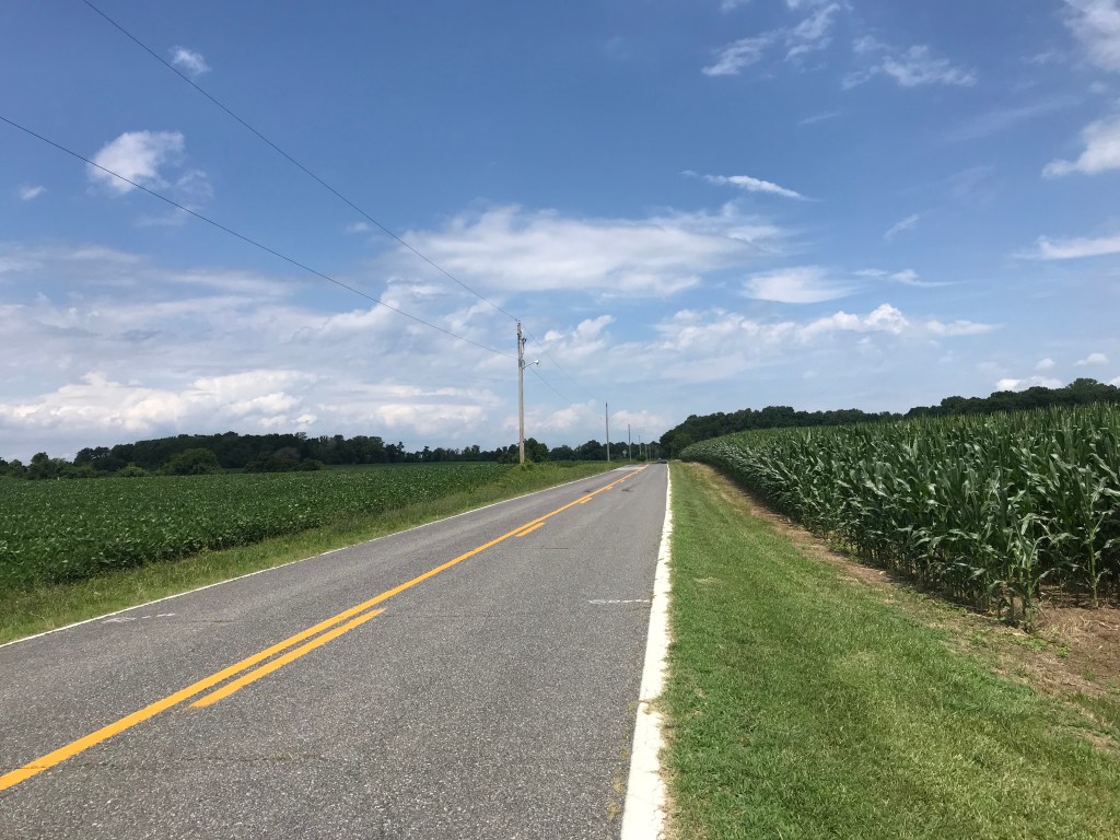
The ride makes its way southwest on quiet country roads to the town of Rock Hall on the Chesapeake Bay. Here you can dine like a proper Maryland savage by ripping crabs limb from limb. Ick.
Heading south from Rock Hall, the route enters the Eastern Neck Wildlife Refuge. I saw a deer and a rather humongous vulture, as well as bunches of noisy ospreys. The road dead ended at a rather drab field so I turned around and checked out a historical marker. It was a memorial to the dead son of a colonial landowner. The son it seems died at sea captaining a ship during the Revolutionary War.
On the way back to Rock Hall I stopped at Bogles Wharf for another view of the Chester River.
Once through Rock Hall the route became rather disappointing. The road was flat but the scenery did not inspire. Basically, this is a highway to the town of Fairlee.
Then it’s back to Chestertown. The town closed High Street, the main drag, for a farmers market in the morning. It was re-opened when I arrived after my ride. As I was leaving I noticed it was closed again. Moving traffic barriers is a full time job here.
All in all the ride was not half bad. Low traffic. No hills worth mentioning. Decent views of the Chester River and the bay. A respectable place to pedal 52 miles.
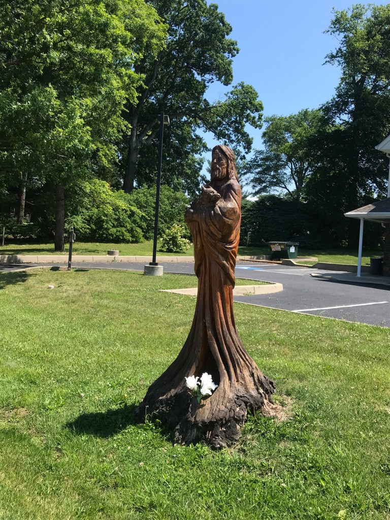
A fine ship in ChestertownSoy left. Corn right. Clouds up above. Works for me.The dock of the bay in Rock HallLost at SeaMural in Rock Hall
The other day I was on the Facebook reading about the dental woes of my friend Sam. Sam has recently learned that she needs dental implants. Despite the fact that she has two kinds of dental insurance the implants will cost her $5,000 out of pocket. A real kick in the teeth, don’t you agree?
I once had four fillings start to break down. I needed crowns for all four teeth. I discovered this in November. In December during open season for insurance for federal employees, I signed up for dental insurance. In January, with the dental insurance in effect, I had the work done. The following November I canceled the insurance. I think I save something like $2,000.
As I was typing this insurance anecdote in a reply to Sam on the Facebook, one third of a veneer crown on one of my front teeth sheared off. I am not making this up.
The vaneer was about 30 years old so I am not complaining. In fact about ten years ago, the vaneer on my other front tooth fell off entirely as I was trying to pull the plug off the top of a water bottle on my ride home from work.
So I went to the dentist today. I was more than a little anxious about this because I’d have two people in my face for over 30 minutes during the procedure.
I pulled into the parking lot and it was empty. So far so good. I put my Washington Nationals mask (hand crafted by Mrs. Rootchopper) on and went in. The waiting area was empty. The receptionist used one of those Star Trek thermometers to check my forehead temperature. 98 degrees. Then she gave me a coronavirus quiz. It was a Yes or No test. My answers were: No. No. No. No. No.
Jackpot. The dentist will see you now.
I was shown back to an examination room by a technician wearing a mask and a hair covering. Along the way I passed several other examination rooms, all of which were empty.
The technician gave me a mouthwash to rinse with for 30 seconds. Then she took an x-ray and made a mold of my front teeth for use in making my temporary crown. After that she put a Q-tip with vile tasting numbing stuff onto my front gum. The dentist came in wearing two masks and gave me some novocaine. Ow. Ow, again. He then examined the mold and found it not to his liking so he made another.
Then the carpentry began. The rest of the old vaneer had to be removed. Then the tooth itself had to be shaved down to a fang to accept the crown. This took a good 20 minutes and involved lots of suction and fluids and noise. For this part the technician and the dentists wore face shields. I felt like I was in a science fiction movie.
The face shields and drilling made it hard to hear what they were saying. The dentist kept telling me to lower my jaw, even pushing my head down from time to time. I thought this was odd but in retrospect he was doing his best to keep me from spraying saliva and rinsing water all over the place.
Once the tooth was fanged he made another mold for the final crown. Then he put on a temporary crown and shaped it. He’s pretty good at this carpentry stuff, because ten hours later it feels like a real tooth.
The dentists picked some color samples out and we played matchy matchy with my other front tooth. My new crown won’t match exactly partly but it is made of zyrconium, a stronger material.
If I get covid from this dental visit it won’t be because the dentist didn’t do everything he could to be safe. Taking my temperature. The screening quiz. One patient at a time. Masks (in his case two). Face shields. Hair coverings. And that odd bit about keeping my jaw down.
There’s the old story about Groucho Marx. I heard it as the reason his TV show was taken off the air. The details vary in the telling. While interviewing a man/woman/couple that have been married for 10 (or more) years, they related that they have 12 (or more) children. Hearing this Groucho says to the husband, “I like my cigar but I take it out once in a while.”
It never happened. But it’s a good story.
Well, I’ve ridden my bike for 22 days in a row. I woke up today and decided that I like my cigar, but it’s time to take it out.
Instead of riding I mowed the lawn in suffocating heat and humidity. Then I did about an hour of light yard work. I wore a t-shirt, sun sleeves, and swim trunks in anticipation of a sweat fest. When I was done, I was soaking wet. My sun sleeves were so wet they slid down to my forearms.
After a snack and a rewarding nap, I am ready for another string of bike rides. I am in striking distance if getting on a pace to ride 10,000 miles this year, but I need to bang out a few longer rides. Lately it has been so hot and humid that I haven’t dared to try to ride over 50 miles.
I found a bunch of rides online in Kent County Maryland. The shortest is called the Rock Hall Ramble. It’s about 50 miles but can be easily expanded to 70 miles by riding a spur into the Chesapeake Bay. Two other rides are over 80 miles. All three start and end at Washington College in Chestertown. I’ll probably do the ramble and save the other two rides for another day. All of these rides are ideal for a recumbent but cross winds on the Bay Bridge make me weary of hanging Big Nellie off the back of my car. Getting blown into the Chesapeake can ruin your whole day.
Time to fill some water bottles and make some snacks!
At this time in each of the last three years, I was riding somewhere far away. In 2017, I was crossing the Upper Peninsula of Michigan. In 2018. I was in the Idaho panhandle. In 2019, I had finally left the high mountains and landed in San Francisco. This year I am in hell.
We are in the midst of a heat wave here in the mid-Atlantic. Temperatures have been in the 90s for days on end. Humidity is stifling too. Today, at the end of my bike ride the temperature was 97, but the effect of the high relative humidity made it feel like 108.
Seriously.
I managed to crawl 21 miles on Big Nellie before throwing in the figurative towel. Too bad it wasn’t a literal one; I was dripping wet, as if I had fallen into a pool.
Yesterday, despite the brutal heat, I rode to the Kenilworth Aquatic Gardens. In July, water lilies, lotuses, and a few other types of flowering plants bloom. The Gardens has a series of ponds separated by walking paths. The lotuses were showing off. The water lilies were being shy. Riding there was a 23 mile jaunt. I brought a trekking pole to help my back handle the walk around the ponds. What I really needed was a parasol. I managed about 30 minutes blossomy zen before heading home.
On the way home I cut through Capitol Hill. The streets on the eastern part of the hill were littered with piles of spent fireworks and snacks., the detritus of a night of prodigious DIY celebrating. Whoever lives in this area spent thousands on fireworks.
My return route took me to Lincoln Park on Capitol Hill. The park is a square awkwardly bordered by city streets. It’s a beautiful oasis filled with green grass and majestic old trees. The Emancipation Statue in the middle of the park has been the subject of protests; it depicts Lincoln standing tall and a freed slave on his knees looking up at his liberator. Right now it is surrounded by a series of jersey barriers which are surrounded in turn by a chain link fence, to deter protesters from trying to take the statue down. You may have seen all the ruckus about the statue on the news recently. You probably didn’t see what I saw as I rolled past: folks from the neighborhood relaxing on the lawn, hanging out in the shade. DC is an interesting place.
The longest six months ever came to an end yesterday. Despite the pandemic, or maybe even because of it, my beat up body is finally starting to feel normal again. I am hoping that Indiana Jones was wrong when he said, “It’s not the age; it’s the mileage.” Then again, at my age, I doubt there’s much difference.
I closed out the first half of the year with a 66-mile ride on The Mule from Potomac Village to Glen Echo to Heightstown and back to Potomac Village. All in Maryland west of DC. The route was designed by the DC Randonneurs, those crazy people who ride hundreds of miles in one go. For fun. I think they need professional help.
This route is what the Randos call a Populaire. It’s a sweetener intended, I suppose, to lure riders into doing longer randonneering rides. God help them.
The ride is supposed to start in Glen Echo but I decided it would be easier to park in Potomac Village and make a figure 8 out of the route. Glen Echo is near the Potomac River so the first five miles were downhill. From there I headed back to Potomac Village and on to Heightstown, not far from Frederick. The outbound route is uphill in the form of a series of unrelenting rollers.
It was a typical DC day, hot and humid. I’d put a lot of miles in my legs recently, including 13 yesterday with a lawn mowing job thrown in for bad measure. Suffice it to say, my legs were not fresh and I could tell by the 22-mile mark. My thighs were wobbly going up the steep rollers. I normally would stand and ride over these but I resorted to granny gearing. Over and over again.
The route passed through some very scenic countryside, much of it thankfully in shade. There were many curvy country roads which makes for fun riding. At 22 miles, I ate half a bagel and hoped for a bit of a bounce from the calories. The next 14 miles were more up and down riding. Bounce or not, I was pooped by Heighstown. I stood in the shade and finished the other half of the bagel then headed back.
Lucky for me the next 12 miles over a different set of roads were mostly flat. I made a pit stop in Poolesville for some panther piss, an Arnold Palmer, a Snickers bar, and a water bottle refill.
My liquid break made the next few miles a bit sloshy. It was a good thing that these were also level riding. Finally, I arrived at River Road for the last ten miles beginning with the biggest downhill of the ride. I was flying until the road surface became a series of small moguls. This was not a lot of fun at 38 miles per hour. All I could do was relax my arms and hope I didn’t get bounced into a passing BMW.
After the bumps, I endured nine miles of huge rollers and speeding cars. The sun was frying my back. I was very happy to see the parking lot in Potomac Village.
As hard as this ride was, I once did it from my home on Big Nellie. How I rode up the steep rolling hills is beyond me. It was 113 miles. I can’t even.
I was so focused on not dying that I only took one picture. A simple field of grain at mile 50.
The ride also marked the end of June. I rode 1,102 miles in the month. For the first half of the year I’ve pedaled 4,901 miles. I think I have a decent shot at 10,000 miles for the year.
Since it was the last day of June I recommend some Finn therapy.
Here’s to a better second half. Wash your hands. Keep your distance. Wear a mask. Call your momma.
I discovered the website Bikewashington.org many, many years ago. It’s especially useful for newcomers to the DC area. Luckily, it’s list of day rides holds a few surprises even for those of us who’ve lived here a long time. And so I found myself doing the North to Gettysburg ride on what started as a splendid early summer day.
The ride starts in Thurmont, Maryland, a small town located not all that far from Camp David, the presidential getaway place. As I began my ride, I saw two Marine helicopters heading in the general direction of DC from the nearby mountains. Melania must be bored.
It was about 70 degrees F with a strong southerly breeze when I started out of town. The old downtown has a few log cabin buildings but this historical quaintness soon gave way to more modern residential houses, farm buildings, and the occasional machine shop as I left town.
The route is specifically designed to avoid the nearby mountains which contain several challenging climbs. Being an old fart with bad knees, I appreciated this aspect. As I headed north on curvy country roads, I couldn’t believe my good fortune. This area is just rural bliss and perfect bike riding. There’s enough variation in the terrain to shake things up a bit without having to go blue in the face and feel fire in the legs from exertion. I’m sure I could have done every one of the short climbs on this ride without using my granny gear, but I decided it would be best to be kind to my worn out left knee.
Yeah, I’m old.
Somebody must have had time on their hands
As I approached a turn I saw a sign warning that a bridge over the Monocacy River was out of commission on Bullfrog Road. I was following a paper cue sheet and decided to follow the detour signs. After three miles I came upon Bullfrog Road. Hey, wait a minute. I consulted the Google and learned that the route never actually crossed the Monocacy on Bullfrog, rather it left Bullfrog staying entirely to the west of the river. Doh!
Well, I guess my 46-mile ride had now become a 52-miler but so what? The Mule abides.
Looking west. Miles and miles of these views. Not too shabby,
After more country roads than John Denver could a guitar neck at, I found myself crossing the Mason Dixon line, the border between Maryland and Pennsylvania. The pavement turned from black to gray but the surface remained bike-friendly. Soon I found myself turning onto a narrow lane into Gettysburg National Battlefield. The route runs along Cemetery Ridge past Little Round Top, Round Top, and the Angle. Tourists and families scrambled about the hillside imagining the Confederate army attacking up the hill into defensive fire from the Union positions. It’s remarkable that they nearly succeeded more than once.
Mason Dixon Line
The battlefield is dotted or perhaps I should say strewn with dozens of monuments to Union states and militias and military brass of the day. At the northern end of the ridge I stopped to have a snack before turning south to begin the ride back.
Snack stop in the shade of the sign. Was hoping for a free meal but it was closed.
US Business 15 bisects the flat land across which Pickett made his charge. One look at the lay of the land reaffirmed my lifelong disdain for blindly following orders. It’s a miracle his troops didn’t frag him. Instead they died by the score although some momentarily breached the Union defenses at the Angle. The South’s military headcount was vastly outnumbered by the North. That Lee would waste so many soldiers in such an obviously futile assault puts the lie to the notion that he was a superior military commander. Don’t believe me? Go to Gettysburg and see for yourself.
My route turned to the west from the battlefield and then headed south along the western side of the valley. By this time, the lovely morning weather had given way to a typically swampy mid-Atlantic summer day. The terrain seemed hillier but increase in effort may have been caused by the headwind that was wearing me down.
More hills and curves and farms and cows. Even a longhorn. I startled a yearling deer crossing the road. It turned tail into the roadside bushes. A little further on a hedgehog did a u-ey and waddled under a barn. At least the wildlife has some pep yet, I thought.
I rolled into Emmitsburg on the Maryland side of the border and, after missing a turn, found myself cruising through Mount Saint Mary’s College campus. The campus is situated along US 15, a four lane divided highway. But for this misfortune, the campus would get an enthusiastic thumbs up from me. It’s stone buildings practically intoned Catholic academia. It’s metal sided gym, really an oversized quonset hut, somehow amusingly fit in. The seminary building to the rear up a hill was the crown jewel.
Another ten miles or so to go. Up and down and around. I was running out of energy, a peanut butter bagel apparently being enough for 46 miles but not for 52.
After crossing US 15, I followed the windy (in both senses of the word) country roads to the final payoff, a covered bridge over Owens Creek. Why the heck did these things even exist? No matter, they are charming and, as long as you don’t catch a wheel in the gap in the boards, they are a treat to ride through.
Frederick County Maryland is known for its covered bridges
Back into Thurmont an annoyed driver honked his horn at me as I passed him. I pointed to the stop sign that he was about to ignore and successfully shamed him. To prove my point the route had me follow him through town. His impatience was accomplishing nothing but raising his blood pressure.
If you live in DC, I highly recommend this ride, without the unnecessary detour. I must admit that I resisted taking pictures otherwise I’d still be out there riding. It’s beautiful country.
I’ve lived in the DC area for more than half my life. I’ve been to most of the touristy spots multiple times. Like many people, when our kids were little we took them to the Williamsburg area where there is much to see and do. On the historical side, we visited Colonial Williamsburg and Jamestown, but, for some reason we never got around to Yorktown, where the British army surrendered to end the Revolutionary War on October 19, 1781.
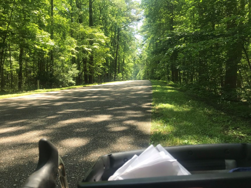
On Tuesday, I remedied that omission on two wheels. Starting at the Williamsburg visitor center I rode the Colonial Parkway 13 miles to Yorktown. The roadway surface, composed of aggregate (small stones in concrete), is a bit rough. It is oddly three lanes wide with no lane markings. Distance is measured not with mileposts but with kilometer posts. I can’t recall seeing this anywhere else in the U. S. It was hot and humid but the ample shade kept me comfortable until the parkway reached the banks of the York River.
Colonial Parkway
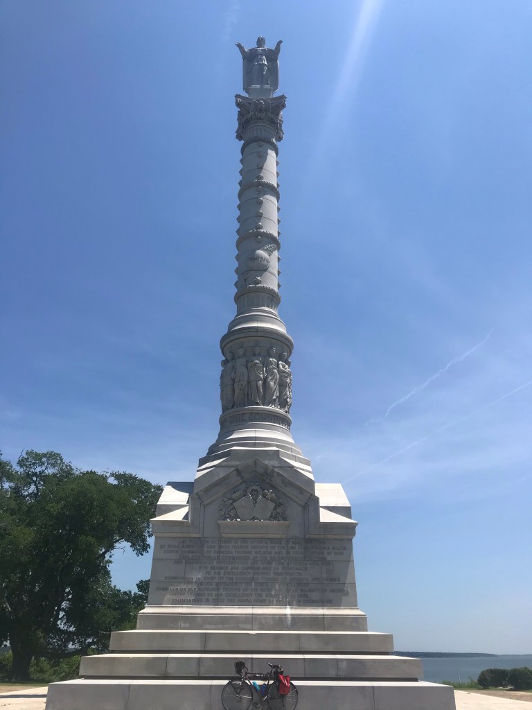
The river is wide, perhaps a half-mile or more. The parkway, now unshaded, turns to the southeast following the river and passing through marshy areas and by narrow beaches. After a gentle upslope, the parkway ends at the entrance to the Yorktown Battlefield. The visitors’ center was closed, of course. A few people wandered around zombie-like listening to a virtual tour on their phones. To tour the battlefield takes three hours by car. Unless you’re a serious war wonk, you can cut to the chase and head to the Victory Monument.
The 98-foot tall monument was erected in the 1880s. It has a massive base which supports a column topped by a figure of Liberty. (Liberty has twice been damaged by lightning, Make of that what you will.)
There are extensive inscriptions on each side of the base. These writings make clear that the Yorktown battle and siege, to a very great extent, was a French operation. It was the French navy that fought of British ships off the Virginia coast, thereby preventing an evacuation of the British army by river and sea. Of the 17,000 land forces on the American side, 5,000 were French soldiers. Without the French we Americans would spending pounds, drinking warm beer, and singing “God Save the Queen”.
And so the war ended and the new country, no longer under mortal threat from Britain, could begin in earnest.
In 1976, the year of the U. S. bicentennial, the monument became the start and finish of a new tradition of sorts. Bikecentennial was an event that sent small groups of bike tourists across small town America between the Oregon coast and the Yorktown Monument. The route they followed was named the TransAmerica Trail. It traverses over 4,000 miles through Virginia, Kentucky, Illinois, Missouri, Kansas, Colorado, Wyoming, Idaho, Montana and Oregon.
The Mule and The Monument
Fittingly, for some TransAm riders, Yorktown is the beginning. For others, it is the end. For all it is a profound experience. In 1981 I met someone who was in one of the 1976 Bikecentennial groups. Equipped with a ten-speed bike and a whole lot of heart, Anne Meng rode with six other scruffy riders from west to east. I found pictures of her group on Flickr. (Search under TAWK518, the code for their group.) They show snow, fatigue, endless roads, and joy. Oddly, she never mentioned that she crashed and spent a night in hospital in Montana.
Today, the Bikecentennial organization is called Adventure Cycling. They have mapped over 50,000 miles of bike routes in the United States. My 2016, 2017, 2018, and 2019 bike tours were nearly all on Adventure Cycling Routes including parts of the New York to Chicago, Great Lakes, Lewis and Clark, TransAm, Northern Tier, Pacific Coast, Western Express, and Atlantic Coast routes. By my count, I’ve done about 9,800 miles of their network.
After returning to Williamsburg, I headed to Jamestown Island, adjacent to the Jamestown settlement, where the ships landed. A tunnel near Jamestown village was closed to bikes, necessitating a detour into the village. It was quaint and uncrowded but for re-enactors of early colonial life and a few tourists. Back on route I rode past the Jamestown Settlement site (which I visited with my family years ago) and onto Jamestown Island. The one-lane, level road through the woods was closed to cars. Yay, pandemic.
The rest of my ride took me in a twelve-mile arc around the western side of the Williamsburg area. This was unremarkable exurban and suburban riding in blistering heat. I stopped at a gas station convenience store for drinks and snacks. Half the people in the store were not wearing masks which made me very uncomfortable and angry. I suppose causing someone to suffocate in their own blood is worth the inconvenience of wear a piece of cloth over your face.
In 30 minutes I had reached the end of my 60-mile adventure.
“Everything is walking distance if you have the time.” Steven Wright
Q: “What’s the secret to a long marriage?”
A: “Don’t get divorced?” Olivia Harrison
After a rather ambitious week of riding (252 miles), I decided it was time to up my game. I had intended to ride the Whites Ferry Loop on Saturday but I got underway a bit late and decided to abandon the effort about 28 miles from home. The resulting 57-mile excursion left me wanting something more better.
And so I launched Big Nellie intending to ride the big beast to Purcellville. About 1/4 mile from home, its rear shifter cable snapped in two, so I returned home for The Mule. While changing out of my recumbent clothes (regular street clothes) into biking gear I had an asthma attack.
My asthma diagnosis is mild persistent asthma. It manifests itself not in wheezing episodes but in labored breathing and a fog of depression. One puff of a rescue inhaler (albuterol sulfate) and my lungs settled down. I hopped on The Mule ready to rumble.
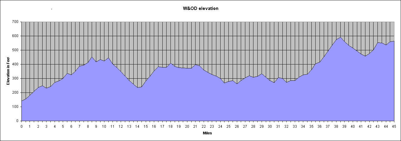
The out-and-back route involves three miles on suburban streets to the Mount Vernon Trail. The trail takes me north along the Potomac River about six miles to the Four Mile Run Trail at National Airport. After another three miles the FMRT ends in Shirlington where I pick up the Washington and Old Dominion rail trail which goes 44 1/2 miles all the way to Purcellville at the base of the Blue Ridge Mountains.
I’ve probably done this ride ten times. It’s a good test of riding endurance and the ride (except for one hill on the way back about 2 1/2 miles from home) seems virtually flat. I said “seems” because ride gains elevation then gives it up, resulting in about 1,400 of gross elevation gain.
The scale of the chart is deceptive; each gain in elevation is gradual, but for a handful of abrupt rollers from time to time. The biggish hill from mile 32 to mile 39 is mostly uninterrupted. The one from mile 1 to mile 9 has several cross streets and traffic lights making it hard to take advantage of the favorable grade on the return.
Along the way the trail passes through Arlington, Falls Church, Dunn Loring, Vienna, Reston, Herndon, Sterling, Ashburn, Leesburg, Clarks Gap (the high point), Paeonian Springs, and Hamilton Station before ending in Purcellville.
It always seems like a long slog on the way out. Mostly I attribute this to the gradual elevation gain. There’s also a psychological element that I’ve never been able to get my head around. Going places somehow seems much longer than returning, regardless of your mode of transport.
The density of trail users fluctuated as I passed through more heavily populated areas. If you’re into beer, you can stop at several mircobrewies along the way. (I didn’t.) Many years ago the area near Dulles Airport was farmland but nowadays it’s suburban sprawl. From Ashburn to Leesburg is less developed. You can check out a quarry if rocks are your thing. From Leesburg to Purcellville is a tunnel of green bliss, easily my favorite part of the trail.
My odometer is rather sketchy but it read 56.36 miles when I reached Purcellville. I took a selfie with one of the Purcellville signs (the other had too many bikes under it so I had to go small.
Bikey mask courtesy of Mrs. Rootchopper
There’s an old saying among marathoners. The race is 26.2 miles long. The halfway point is around 20 miles. That’s when the bear jumps on your back.
I expected the same from this ride. I had about five hours of daylight left so I was definitely in Steven Wright mode. The way to ride over 100 miles is, like Olivia Harrison says, is to keep on going.
And there I was bombing down the long grade from Clarks Gap at 20 miles per hour. The downhill grade and the mental aspect of having already seen the sights put my mind at ease. I’ll get there when I get there.
On the way out I ate a bagel with peanut butter on it. At Purcellville I snarfed some trail mix. I stopped in Leesburg on the return for more snacks. A gatorade and some cookies got my energy back up.
The gentle rise in the trail just west of Vienna started to mess with my head. It’s a false flat; it looks level but it’s not. When I finished with it, I stopped at the Vienna railroad station (long ago made inactive) and ate a Snickers bar.
23 miles to go. No guts, no glory.
As I plowed along, body parts started to complain. My thighs. My lower back. My left shoulder. To ease my discomfort, I stretched as I rode. I got out of the saddle for the short climbs, anything to distribute the fatigue. (Sadly, you can’t do this in marathons. You’re body goes all wonky and you just have to run through it which is rather depressing when you can’t lift your thighs.)
Three miles from home I decided to climb a short steep hill to avoid adding a bit of distance to the trip. It was the only time I used my granny gear. My knees were thankful.
20 minutes before sunset, I rolled into my yard. 113 miles, my longest ride since June 2018, and only my third century since then.
Anything is biking distance if you have the time and don’t quit.
One of the limiting factors in my bike riding during the pandemic has been the availability of restrooms. As a male I can get by for number 1 but number 2 is fraught with peril. Today I discovered that Maryland gas stations with convenience stores have opened their restrooms. Ahhh.
Today I drove nearly three hours to Princess Anne, Maryland on the Eastern Shore. It’s a lovely little town with many old brick buildings and many more rather run down frame houses. At one end of town is an old home with a boxwood garden in front. The boxwoods haven’t been trimmed in a while but it’s still a lovely sight. I am biased because the perimeter of my backyard when I was a kid was a boxwood hedge. We had seven kids and a dog. We gave those boxwoods a beating and they held their own.
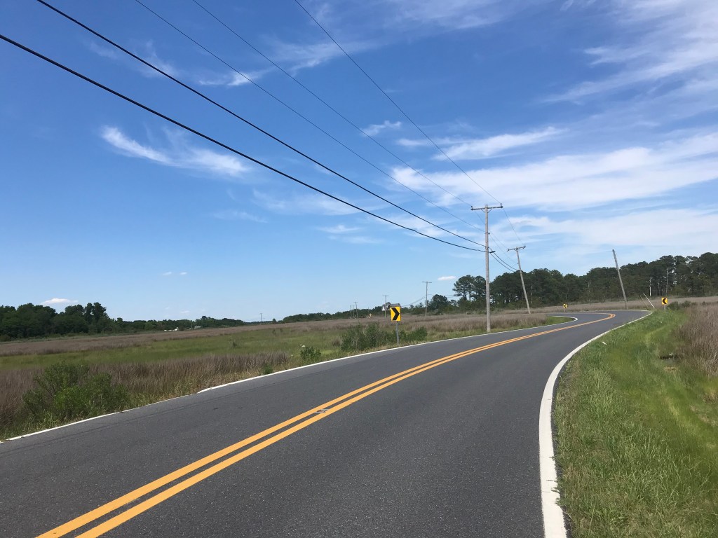
The ride I did was from Princess Anne to Deal Island on the Chesapeake Bay. It was a straight shot along highway 363. The road has rumble strips about three feet from the edge of the pavement for the first seven miles. I managed to avoid hitting them but they definitely detracted from the riding experience.
After some farms and woods, I rode through salt marsh with plenty of bird life. Red wing black birds and ospreys protested loudly as I passed them. Egrets and herons flew silently way. Turtles seem to be losing the battle with big metal things. I saw one living turtle on the road and three who had been gruesomely crushed by passing cars.
Once through the Deal Island Wildlife Management Area, the road winds through the towns of Dames Quarter and Chance before crossing over to the island and it’s historic district. A mile later the road ends at Wenona. In Winona there are stacks of crab pots and boats to charter for fishing trips on the bay. These towns look like working and middle class towns; there is little sign of the kind of moneyed living you see farther north on the Delmarva Penninsula.
Wenona was nearly deserted and rather underwhelming. I rode half way back to Princess Anne before turning off the highway to take some backroads through farmland. The land here is so flat and the weather so agreeable that the 39-miles I rode was effortless.
Here are some pix.
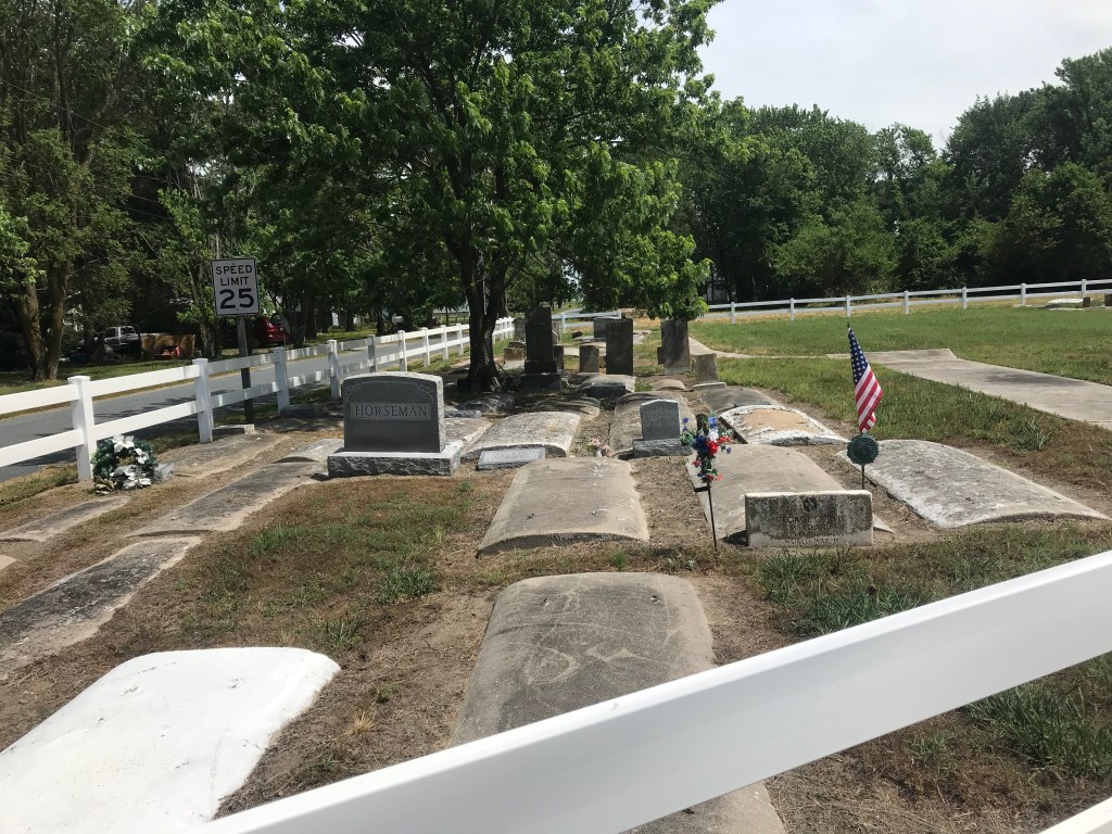
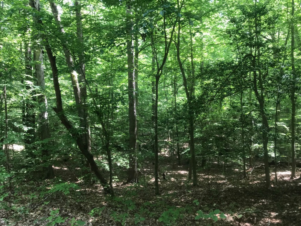
The harbor at WenonaTrolling and chumming. I think I’ll pass.The water table is so high that the graves are not buried. The highway through the salt marsh.More salt marshPoultry is big on the Eastern Shore. Back roads through some woodsSpacious skies and amber waves of grain.
Today we’ve returned to typical DC summer weather. Hot and humid.
I checked the website for Prince William Forest Park, a national park that is oddly situated right next to I-95 about 30 miles south of my house. The website said the park was open so I put the CrossCheck on the back of my car and headed south.
Upon arrival I could see a barricade across the access road into the park. Hmmm. The website said the park was open. There were no signs restricting parking on the highway so I parked my car on the shoulder. I rode around the barricade and was soon surrounded by green.
My plan was to ride the park’s scenic drive which I recalled as being a 17- mile loop. As it turned out it was more like seven miles. No worries, Instead of two or three laps I would do four or more.
You ride uphill then down to get to the scenic drive. Riding in a counterclockwise direction, I started climbing as I entered the circuit. At one point the road has a cycletrack on it. (See the picture above.)
Since the park entry was blocked off, the roads were car free but for a couple of Park Service trucks going about their business. All the trees acted as a sound barrier; I couldn’t hear I-95 which was less than a mile away. No cars. Birds singing. Smooth pavement.
Bliss.
I saw about 15 people in total. Two on recumbent trikes, two on road bikes, and the rest on foot.
The loop road goes uphill for about a mile then seems to plateau for five miles or so. Then it descends and the road curves this way and that. I hit 40 miles per hour, an especially sweet experience without big metal things to worry about.
After the big descent the inevitable climb begins in three stages. The first two stages come at the end of the loop. These were hard and had me huffing and puffing. After the second stage comes another brief descent to the end of the loop. The third uphill stage is the start of the next time around the loop.
I did four loops. By this point I was running low on water and decided to ride out of the park. As I cleared the park, I emerged from the shade. My car was sitting in an inferno. I’m sure glad I picked a shady place to ride today.