A Year in the Woods

This was my second year of doing day hikes. Early in the year I made a list of hikes that I wanted to do on my white board at work. I modified the list, adding three hikes that friends of mine did during the year and taking off two hikes, Bull Run Mountain and Sky Meadows, because they are in an area that is infested with ticks. (One of my coworkers contracted Lyme disease at Sky Meadows.)

Hike List 2015

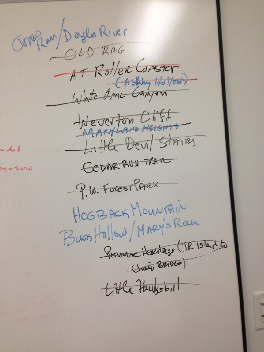
As you can see I cross off quite a few hikes.

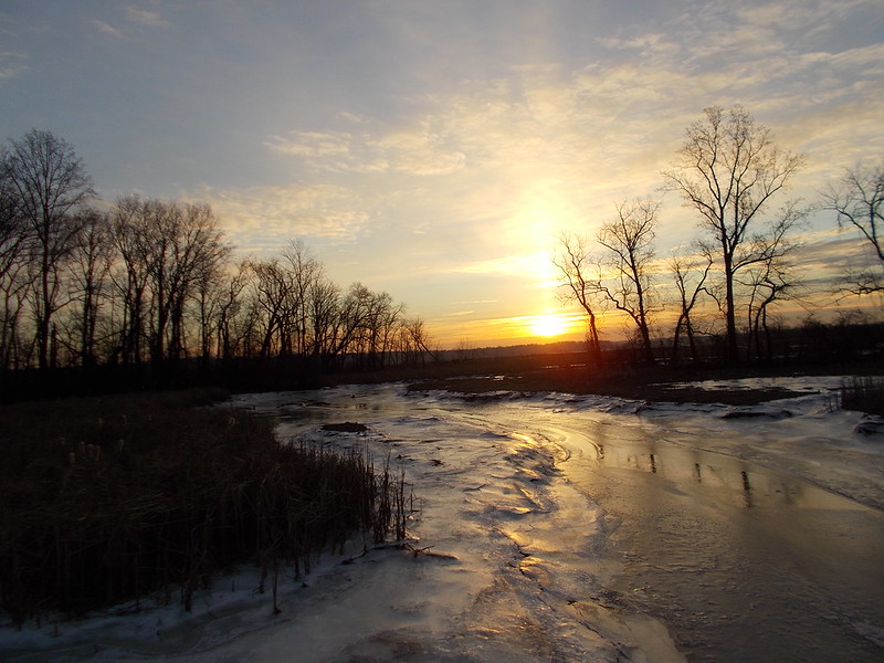
To get the year off on the right foot, I went up to Great Falls Park in Maryland and did the Billy Goat B and C trails. I had done this last summer and enjoyed the route but not the heat. This is about a six mile hike, mostly flat.  It was a good way to start the year.

For the next several months I forgot about hiking. I don’t honestly know why. When I realized that I had missed some of the year’s best hiking weather I kicked it into gear on the first weekend in June and re-visited Rock Creek Park. This time I did the Valley and West Ridge trails in a counter clockwise direction. It’s a good hike, about 10 miles or so.

It was time to get away from the city. The next weekend I found a hike online that seemed to offer some solitude. It was an out and back hike on the section of the Appalachian Trail in Virginia known as Ashby Hollow. The trail was rocky and the the ups and downs lived up to the nickname Roller Coaster. I was amazed that through hikers did this section of the trail carrying big backpacks. I saw a couple too.  More power to you folks.

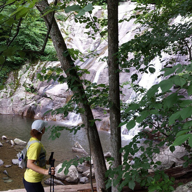
I was on a roll. A luck would have it Ultrarunnergirl was looking to go for a hike in the Shenandoah National Park. We headed out to White Oak Cannon. Here, she advised me to buy a year pass to the National Park system. Great idea. We hiked up the canyon, enjoying waterfalls all the way up.  At the top of the trail we took a fire road up to Skyline Drive. At her suggestion, we hiked up the steep trail to Little Hawksbill, the highest point in the park. Hiking down beat the crap out of my legs. To get back to the start we took the Cedar Run Trail. This was a pretty trail but it was also rocky and the rocks were slippery. Ultrunnergirl’s iPhone went for a swim. She went for a rock slide near the end of the hike. This was my first non-solo hike since college. It was also my first hike in Shenandoah National Park. If you live in the mid-Atlantic and do not take advantage of this park you are really missing out.

A couple of weeks later, I headed back to the park for a hike up Little Devil Stairs.  This was pretty challenging and involved crossing and re-crossing a stream. Well worth the early wake up on a day off from work.

I took the rest of July off.

I started August with a hike on the exotically names Potomac Heritage Trail. It was not the best hike but it was close to home. Then, in mid-August, on my 60th birthday, I did the most popular hike in these parts, Old Rag. It was quite challenging. I was a bit annoyed by the rock scramble. At one point I had to wedge myself into a gap between two boulders and hike vertically, with my back against one boulder and my feet on the other. Not my style at all. The view from the summit was pretty darn nice. If you want solitude, find another hike.

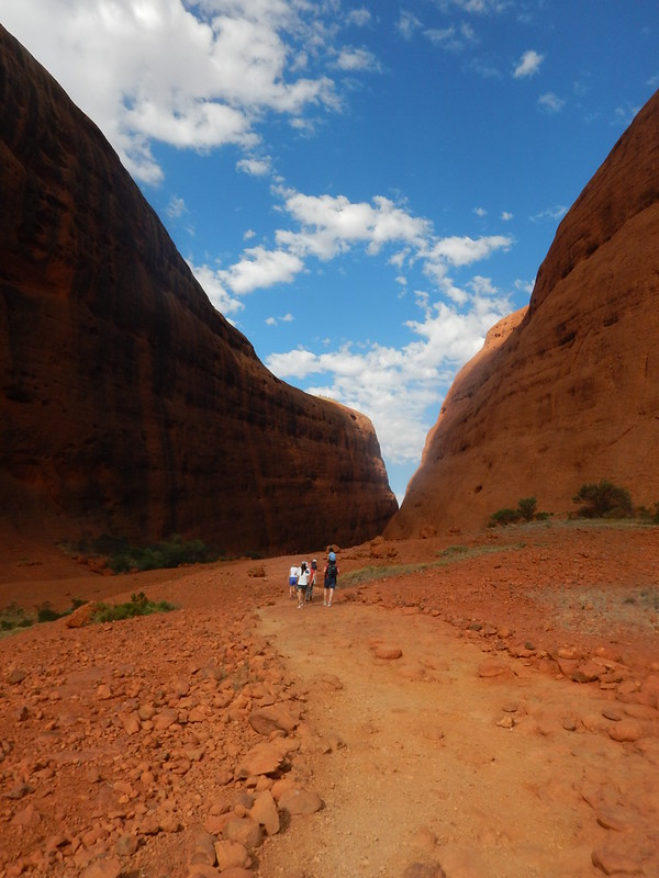
In September we took a long vacation in Australia, New Zealand and Thailand. We did a whole mess of walking including an easy short hike at  Kata Tjuta in the outback.

Kata Tjuta Walk


After returning home, I made my way back to Great Falls Park in Maryland for an easy hike along the River and Gold Mine Loop trails.  I’d done each of these before but separately.

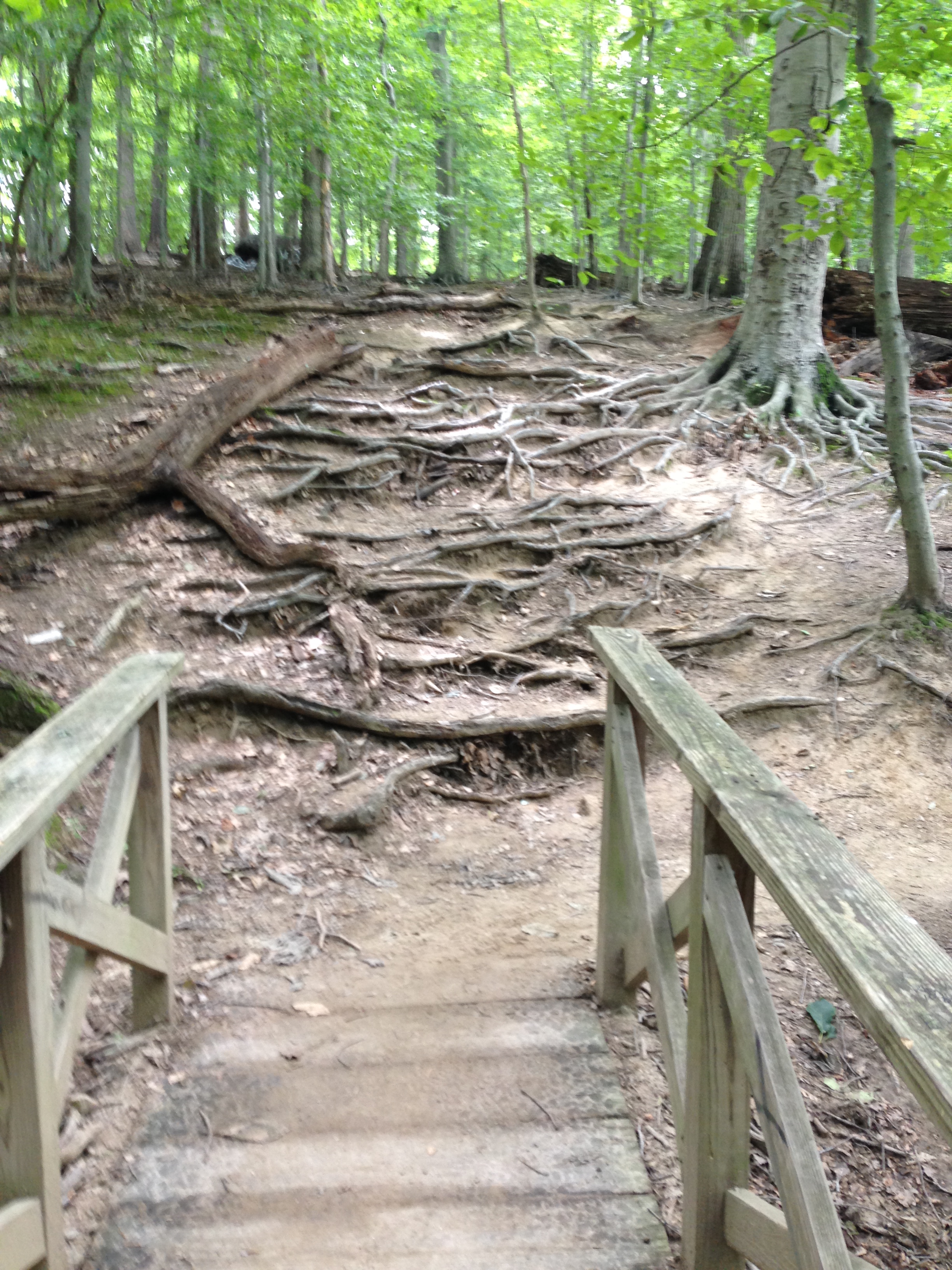
The next week, I drove to Prince William Forest Park down near Quantico. The trails here are not very well marked so I was a bit confused as to where I was or where I was going. Nevertheless, I cobbled together a pretty successful loop hike.

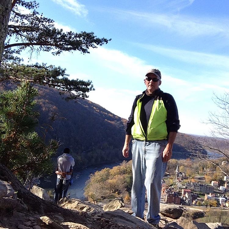
My last hike (unless I get really motivated in December) combined two hikes near Harper’s Ferry. Maryland Heights and Weverton Cliff offer fantastic overlooks of the Potomac River, Harper’s Ferry and the Shenandoah River.  This was my longest hike by far. Probably about 3 miles longer than I was comfortable doing.

I am learning what I like and don’t like about hiking. I am not a big fan of rocks. I don’t like rock scrambles. Nor do I like rocky trails. I am not a big fan of fording streams either. I am afraid that I am going to turn an ankle, fall, or get soaked. Since most of my hikes are solo, any one of these would be bad news.

So that’s how I put my best foot forward this year. I hope next year that I do more hiking with friends. So if you live in DC and wanna go for a trek in the woods, I’m all ears.

Two Hikes near Harper’s Ferry

A friend of mine used to hold health retreats near Harper’s Ferry. If the weather was good, she’d take her guests for a hike. I honestly don’t know where she took them but when I started hiking I search for hikes near Harper’s Ferry. There are two hikes that are very popular. They each include an overlook with spectacular views of the Harper’s Ferry area.

I began at the Harper’s Ferry train station. My year pass for all national parks allowed me to avoid the $10 parking fee. Thanks again, Ultrarunnergirl.

Off I hoofed across the railroad bridge from Harper’s Ferry to the C&O Canal towpath, all the while looking at Maryland Heights across the way. I am going up there?  I headed northwest along the path for a half mile, crossed the empty canal, and a two-lane road and the climbing began on the Maryland Heights hike.

Up, up, up. This trail is relentlessly up. And steep in some sections. I was breathing pretty heavily until my lungs caught up with my legs. I took a side path to what I thought was the overlook but it was just an old battery. The Heights were strategically important in the Civil War. There are batteries and a fort along the trail.

Up some more. The trail began to narrow and become rockier. I hate rocks in a trail but that’s what most of the trails in this area are like.

#hike #Marylandheights #harpersferry overlook

I crested the hill and now found myself winding back down to the overlook. More rocks. The leaves on the ground made footing slippery. Soon I was at the overlook. Well worth the effort, especially on this beautiful fall day. A young couple was canoodling so I decided to take a couple of pictures and head back up to the main trail. On the way up I must have passed 20 people coming down. So much for canoodling in peace.

Back on the main trail I took a right to climb to a ridge line. It was really steep and rocky but I just kept at it. Soon I arrived at an old stone fort. I would have hate to have had to build this thing. There’s no structure to the fort, just stone walls.

During my hike I twice was passed by a group of ultramarathon runners. Essentially these people are speed hikers. How they managed to move so fast without turning an ankle is beyond me. They were apparently doing and out and back run because I saw them again about 30 minutes later.

I headed back down on a mercifully smoother trail paralleling the ridge. Judging from the number of people coming up, this must be one of the most popular trails in the area. I was grateful to have arrived before the crowds.

Back on the towpath I headed south east for about 3 miles. The views of the river were magnificent and the sound of the water rushing over the rocks was incredibly calming.

I was now on the Weverton Cliff hike. This also the Appalachian Trail. I ate my apple and watched a parade of 20 fully loaded hikers coming my way as I walked to the steep trail to the cliff. This sucker is tough going. I would not want to do it with a full backpack. The backpackers that I saw were pretty scruffy but they moved with deliberate speed. Not fast, exactly, but they were relentless and focused.

Across the railroad tracks, up a side trail, under a highway, up some more trail, across a street and the real fun began.

Up into a seemingly endless series of switchbacks. The bigger trees had all dropped their leaves but the undergrowth was bright yellow and orange in the slanting fall sunlight. It’s good to have pretty when you are suffering.

On the Maryland Heights descent I fell when the leaves gave way under my feet. I just landed on my butt and slid. As I climbed up to the cliff and woman did the same thing right in front of me. She just laughed it off.

Switchback after switchback then finally a sign pointing the AT to the north and the overlook to the south.

I had to hike down a few extremely hundred yards to the overlook but the view was really excellent. The sun had come out and I basked in its warmth for a few minutes as I watched the sunlight glittering over the Potomac River.

View from #wevertoncliffs #hike #harpersferry

I dreaded the hike down but found it to be surprisingly easy. I passed a woman who looked to be well into her seventies. I sure hope I am that fit when I am her age.

I made it back to the towpath in good shape and headed for Harper’s Ferry. At this point I was wishing I had brought more than one apple. I was hoping I wasn’t going to hit the wall. I started following a guy with a backpack on. He didn’t seem to be putting any effort into his stride but I still could not keep up with him.

So I looked at the sunlit yellow leaves, watched a bunch of vultures soaring next to the rock face of Maryland Heights and enjoyed the final two miles as much as my tired body would allow.

If I were to come back to Harper’s Ferry I think I’d park at the base of Weverton Cliff, hike up to the overlook turnoff and take the AT north. Despite all the rocks, it was a pretty damned nice hike. Maryland Heights was just as hard but the crowds would put me off a return.

My Flickr page has all the pix I took.

No Spokes Just Laces – A Hike in Prince William Forest Park

I know it’s a blog about bicycling. What can I say? It was 40 something degrees outside when I finished breakfast. I didn’t want to freeze my noo-noos off riding a bike so I decided to go for a hike.

Prince William Forest Park is located right next to Quantico and just off busy I-95. Sounds like a crappy place to hike doesn’t it? Well it’s not.

The park is owned by the National Park Service. Since they are not a charity and since our government is run by a bunch of fiscally incompetent cheap bastards you have to pay a fee. Fortunately for me, I bought and annual National Parks Pass. (Thanks again, Ultrarunnergirl, for telling me about this.) I got in free.

I drove to the park on US 1 because I-95 was, as usual, a parking lot. US 1 is some kind of ugly. For some reason I have lived near it for most of my adult life. South of DC it is an urban planners nightmare.

Having endured nearly an hour of suburban and exurban ugly, I was ready to commune with the forest. Prince William did not disappoint.

I am somewhat notorious for my inability to navigate trails. I always screw up. I found that the trail markings in this park defied comprehension. At one point a mountain biker (I think he was riding illegally but he knew where he was and I didn’t so more power to him) gave me directions. I hiked the Laurel Trail to the South Valley Trail which foll22278796395_595eed0555_zows the south fork of the Quantico Creek. The best part about these trials was the fact that they were smooth. Some of the trails I’ve hiked in Shenandoah National Park and Sugarloaf Mountain in Maryland are so rocky that my feet are killing me after a mile or two. Not here. Sure there are a few rocks now and then and some tree roots but sure footing was the rule of the day.

Quantico Creek sure is pretty this time of year. Leaves were changing from green to yellow, brown and red. T22281844875_69700a106f_zhe leaves on the ground made a perfect swishing sound as I walked through them. Sunlight cast spotty shadows all through the surrounding forest.

Now and then I passed small waterfalls. Pretty for the eyes and the ears.

After a few miles along the creek I turned north, headed for the Turkey Run educational Center. I wasn’t looking for learnin’ I was looking for the Turkey Run Ridge Trail. This trail took me back to where the bike rider had given me directions. Along the way, I spooked a deer who was getting a drink in the creek next to the trail. It was a young buck with rather short antlers.

For quite a while I thought I was lost. I passed a couple coming my way. I had seen them on the South Valley Trail earlier so I knew they were hiking my loop in the opposite direction.

The finish was uphill back to the Visitors Center. The wind picked up. Trees started groaning as they swayed and rubbed trunks together. It made a spooky sound. Halloween’s coming, isn’t it.

Despite my proximity to one of the busiest interstate highways in the eastern US, I couldn’t hear any of the traffic. Just the sound of the forest.

The temperature was just right. Mid 50s with very little humidity. I barely broke a sweat. I wore a base layer under an old sweatshirt and shorts.

Tomorrow it’s back to bike commuting. It should be near freezing and dark when I leave home. I’m breaking out the winter gear and my new bicycle death ray. During the day tomorrow I’ll see if I can telecommute for the next five months from Buenos Aires, Christchurch or Melbourne. Maybe if I brought my boss a pumpkin spice latte (better him than me).

Old Bag on Old Rag

I started hiking last year to do some weight bearing exercise. I’d only done one hike before. It was when I was in college. We hiked several peaks in a day in the Adirondacks. I had a blast but then dropped hiking in favor of running, then bicycling.

When I started running I had to goal of working up to a marathon. I didn’t tell anybody but I ended up running seven over the course of four or five years. I set a more modest goal with hiking, to do Old Rag.

Old Rag is one of the most popular hikes in the eastern United States. It has a reputation for being challenging, for having tremedous 360 degree views at the summit, and for being incredibly crowded.

I left home at 5:30 and was hoofing it by 7:45. The first 0.8 miles is a walk along a narrow country lane from the parking lot to the trailhead. Along the way I passed a temporary shelter that had Tibetan prayer flags hanging from the edges of its canvas roof. I also passed a dilapidated shack and some hunting and fishing clubs.

The last bit of the road goes steadily uphill and the uphill continues on the trail. It took a while for me to get warmed up. I had ridden over 260 miles in the previous week and my legs were not exactly springy.

Lucky for me, the trail was deserted for the first half hour. There was plenty of room between all the small rocks for me to make decent walking speed. Soon I was hitting switchback after switchback. A couple came down the trail from above. Once they were gone, more desolation in the woods. I looked over to the right and saw a man puttering around his tent. His tent was on a giant rock reachable by walking along a huge felled tree. Very cool.

Soon I heard loud voices from below. Five kids went by me. I thought I was making a fast pace but these teenagers made me feel my age.

A young man and woman passed me. Then another group of teenagers. Among the teenagers were what appeared to be a husband and wife and a single woman. I later learned that one of the three was a high school cross country coach and these kids were the team doing a training exercise.

Soon they were far ahead.

Up and up. Switchback after switchback on the densely wooded mountain. This was reasonably hard work but after about an hour I was cruising along just fine. Every so often I would get a view of the nearby mountains then it was back into the tree cover.

Then a big boulder. This must be the rock scramble I’ve heard so much about. So I scrambled. A few more of these and then it was back to the trail as usual. I thought, “That rock scramble was much easier than I expected.”

Wrong.

The real rock scramble was just ahead. Boulder after boulder. Many requiring me to use my arms to yank myself to a foot hold. Some gave no option but for a good old fashioned butt slide. At one point the trail came to the meeting of two immense boulders with a two foot gap between. How the hell was I going to get past this? A hiker in front of me showed me two narrow footholds, one on the rock I was on, the other below on the other rock. Miss the footholds and it would be a very bad day. I dropped my right foot onto the first one, then dropped my left on to the second. Not fun.

It was just a warm up. In several parts of the rock scramble (which seemed to go on for an hour) there was nowhere to put your feet. I figured out that the way up involved propping my back against a boulder and pushing my feet onto an opposing boulder. Then I would push my back up the one boulder and walk my feet up the other. I the middle of this one of my water bottles paid the ultimate price, bursting open and soaking me and the rocks. Oh, joy.

A father in a Navy t-shirt came down through one of these scrambles with his teenage daughters in tow. Message to the boys at their schools. These girls are badass. Don’t go messing with them.

There were two or20501084569_edba35c98f_z three of these shimmy scrambles. All I could think of was my friend who used to rock climb impossibly high rock faces. She looked like a spider dressed in black and with a rope dangling near her. She liked this?

More scrambling. Some of the big boulders gave beautiful views of the mountains and valleys neighby. Of course, if you looked to long you might go right over the edge and die. Eek. Did I mention that I have a fear of heights? Did I also mention that I have balancing issues?

More and more scrambling. I noticed that assertive moves were much less likely to lead to slipping or falling so I copied some of the hikers around me. Hop across the gaps in the boulders. Use your hands to pull on the crags in the rocks. Turn around and move backwards if you can’t make progress walking. Get creative.

Had I not been soaked in sweat and water from my broken bottle I’d have been having a blast. Now all I wanted to do was get to the top. Soon a few of the cross country runners and I had made it. Look at the views!!! Then we heard voices down below. “You’re off the trail. The summit is over there.” We looked in the direction of the pointing hands and saw more of the runners standing on a much higher bunch of rocks.

We heard the roar of an engine and a red World War I era biplane flew past. Just somebody with a super cool hobby out for a spin, I suppose.

So we had to climb down and make a few more boulder crossings before we were at the summit. The entire mountain is strewn with huge boulders, many perched precariously on each other. This is what the top looks like. On top of the toppermost of the boulders were the cross country kids seemingly oblivious to the certain doom one false step would make.

20678460652_810c197834_z

Oh, and they were swatting at the bugs. The peak, and only the peak, was aswarm with some really annoying bugs. I took a pass on the glory of the top of the rock and walked around admiring the magnificent views all around.

Unfortunately the skies were cloudy. And, more importantly, I could see rain scattered about. I decided not to reverse course for about three miles and go back down the rock scramble. The other option was a six mile hike down a steep-ish trail. This trail had steps made from logs. The steps were arranged for the comfort of Andre the Giant.

Thud. Thud. Thud. My quads were not having a whole lot of fun. The dense forest was beautiful though. Every so often my solutude would be interrupted by a cluster of indefatigable cross country kids. Boing. Boing. Boing.

Then I heard what I first thought was a stream. No. The wind was blowing the leaves in the trees? No. Rain. Gentle,cooling rain. The trees were letting just the right amount through to keep me comfortable. Very nicely done, Old Rag.

Switchbacks and steps and switchbacks and steps finally gave way to an unpaved road. Then next four miles were steady downhill on this road to the trailhead. At a turning point four of the cross country kids were sitting waiting for the others. They told me that they were carrying 20 pounds in their knapsacks and would run the final three or so miles to the parking lot.

As for me, my quadriceps were toast. I was just going to plod away. After about five minutes of plodding, the cross country kids came bounding past. Among them were the adults. I was alone trudging along when suddenly I had company. Two tiger swallowtails flitted about me as I plodded along. They were joined by a pipevine swallowtail. My companions stayed with me for about a mile, letting me to forget that my quads felt like bricks.

About an hour later I was approaching the car on the country lane. I noticed that one house had a separate garage with a PUB sign hanging from the side. I’ll bet these folks make a nice buck selling cold beer to hot, tired hikers. Too bad it was closed.

And so I spent my 60th birthday with a bunch of high school cross country runners on a mountain. Their energy was inspiring but I have to admit the bounce in their step made me an Old Bag on Old Rag.

I took a bunch of pictures. They are on my Flickr page.

What Goes Up – Hiking in Shenandoah National Park

Hiking may be my new thing. If I recover from yesterday’s excursion in Shenandoah National Park.

Usually Kirstin and I ride bikes together. when we ride, I’m usually riding much slower than usual. Her name online is Ultrarunnergirl for a reason: she does long runs usually offroad. I think of this as high speed, long distance hiking. So yesterday, the hiking shoe was on the other foot as she took me to White Oak Canyon in Shenandoah National Park for a day of hiking.

We left her place at 6:30 and drove 2 hours to the trail head. The last few miles were some of the most scenic rural roadways I’ve ever driven. (One house we drove by was named Chateau Debris by its owner. It was actually quite nice.)

18814924729_ea8ceb1647_zWe decided to hike based on how we were feeling. We headed up White Oak Canyon trail. which begins around 1,000 feet above sea level. Basically, the trail follows a stream up hill past one waterfall after the next. It’s a moderately difficult hike (for me anyway) so it took about 20 minutes for me to get into a rhythm. Kirstin took mercy on me and went at my speed. She had hiked this trail before so she knew the best places to stop and check out the scenery. And there was a lot of scenery. It’s impossible to capture this using a camera. The sounds of the water, the sun streaming through the canopy, the quiet of the woods.

Bliss.

We made it to the top of the trail and made the decision to hike the fire road up to Skyline Drive. Somehow the trail maps we had made everything look shorter and easier than it was. The fire road was long but, unlike sections of the trail, was not at all technical.

And it went up. And up.

When we reached the road we stopped to consider our options. Just the first of what would turn out to be several ultrarunning friends and acquaintences of Kirstin came bounding by. She described where she had been running/hiking and where she was about to go. Clearly she was not human.

After she left, we decided to hike the Lower Hawksbill Trail to Hawksbill overlook, the highest point in the park at nearly 4,051 feet. (As a point of reference, Old Rag is 3,268 feet.)

It went up. It was relentlessly steep. We were soaked in sweat from the muggy air. And we made it. The overlook provided spectacular views to the north and northwest. Farmland. trees, mountains and towns for miles and miles. A cloud bank was drifting in from the northeast adding dramatic contrast to the view.

View from #lowerhawksbill #hiking #shenandoahnationalpark

We stayed at the summit for twenty minutes or so then started down.

Did I say down?

And down.

My legs had grown accustomed to the uphill which allowed me to use my bicycle quads and butt. Going down was all about beating the crap out of my legs to essentially stop me from careening and tumbling to a rocky face plant. Speaking of rocky, except for the fire road, these trails can make for difficult footing so you have to be mindul of not turning an ankle.

Once we made it to Skyline Drive we quickly decided to use the Cedar Run trial to hike back to the car. Kirstin remembered this as a relatively boring, non-technical trail. As it turned out, after about 1/2 mile of easy going it tuned into quite a difficult trail, mostly because it was really rocky.

As the humidity climbed, the rocks became slippery, much more slippery than they appeared to be. My feet slipped from time to time. Once requirng and awkward twisting of my torse to recover my footing. This is not good for someone with a history of back problems. Fortunately my back didn’t seem to mind.

Later I stepped on some slippery rocks than made both my feet slide out. I caught my backwards fall with one hand before my butt hit the ground. Graceful am I.

The rest of the hike down took much longer than either of us expected. As our legs tired, the constant pounding and carefull foot placement made for rough going. We stopped to admire an owl in a tree. I couldn’t get a decent picture of it. Kirstin might have but at our next stop her iPhone fell into a swiming hole. After retrieving it she went in for a soak. I took my shoes off and walked in a foot or two. The water was so cold my feet went numb.

We trucked on, somewhat surprised that in order to go down weDSCN4011_1128 
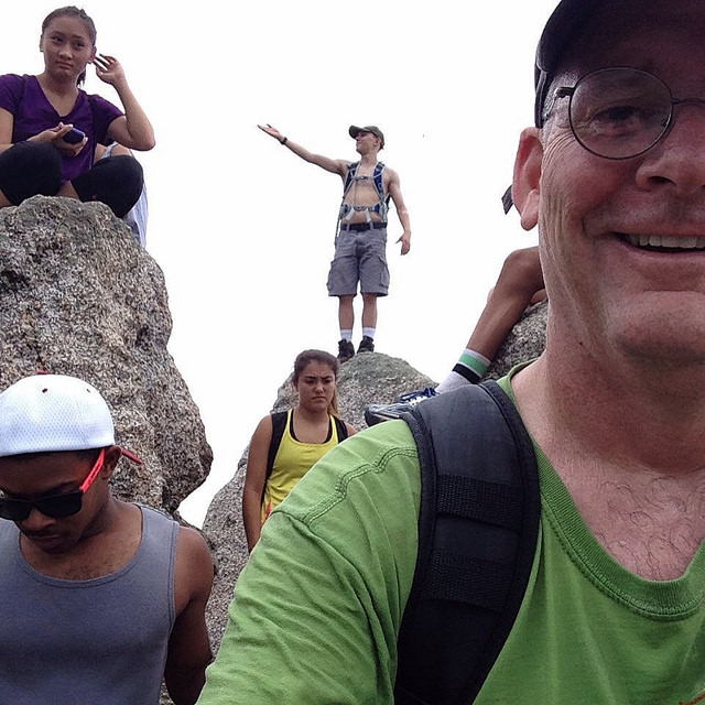
occassionally had to climb some pretty steep short bits.

We came to the waterslide. Some of Kirstin’s untrapeeps were having a blast sliding down the big rock face in the creek into a pool of frigid water. I had done this on the Ausable River in the Adirondacks and hurt my tail bone so I took a pass. Kirstin gave it a go. She tried to wave and her body twisted awkwardly. No worries she splashed down without a problem.

As we hiked the last 1/2 mile or so, visions of ice cold beer danced in our heads. Kirstin kept laughing because the distances seemed so much farther than the map indicated. When it was all said and done, we had hike 12 1/2 miles and done the equivalent of 322 flights of stairs (so said her Fitbit).

On the way home we stopped at the Griffin Tavern in Flint Hill. It’s a cool old house with a wrap around porch. We chose to sit in the barroom because that’s where the beer was. The beer was ice cold. The burgers were yummy. We were chuffed.

Some more pix of the hike are on my Flickr page.

Many thanks to Kirstin for taking me on my first bigtime day hike in the Shenandoah National Forest. What a beautiful place.

Aftermath: I was pretty sore after the hike, mostly because of all the downhills. I woke up this morning feeling as if I had run a marathon. Walking downstairs was very difficult. My quads and calf muscles are super tight. Lucky for me, Mrs. Rootchopper got me a sports massage for Father’s Day. I am going to wait a while before using it. My recovery will be an easy bike ride to the bike shop and to Old Town, followed by RICE: Rest, Ice (cold beer), Couch and Espinosa.

Cheers.

Fritterman Triathlon

I had no plan for the day. It started as most Saturdays. I ran the deck on the crossword puzzles in the paper. I screwed up the Sudoku. I drank all the coffee. With the important business of the day behind me, I decided to do a triathlon.

No, not the Ironman or even the Tinman. I did the Fritterman. It’s the suburban version.

First, event is the Hollin Hall Errandonnee. I rode my bike to the drug store. Then got a haircut. Then picked up ten pounds of birdseed. Then I rode home, stopping along the way to chat with Nancy Duley (on her awesome 1993 Hollands bike) and her friend Stephanie (on her blue bike of a sort I can’t recall). We stood in the road on a sidestreet and gabbed for ten or 15 minutes. (I do hope the folks driving by in SUVs could see that adults in suburbia can indeed function on a Saturday morning without 3,000 pounds of steel.) Then I rode home. Total mileage: 2 1/2 miles.

Back at home I snarfed an apple and went out for round two: the lawn mowing event. I actually like mowing the lawn. Like running and hiking (see below) it has a meditative aspect to it. And I refuse to pay people to do something I learned how to do during the Kennedy administration. I finished this event in 45 minutes.

After the lawn mowing (I came in first), I headed indoors for some nuked left overs. I watched the last three innings of the Nats game on the tube. (The Nats lost. Boo.)

It was 3:30 with plenty of daylight remaining so I drove to Rock Creek Park and hiked ten miles. I hiked the Valley Trail toward Maryland and the Western Ridge Trail back to my start at Pierce Mill. It was hilly. It was muggy. It was my first hike of the year. My legs were hurting at 4 miles. Rather than make it an 8-mile hike, I pushed on. This was a pretty good decision until I missed a turn and hiked down a muddy hill and then back up. And I was doing fine until the last 200 yards back down to Rock Creek. It was pretty much straight down and my legs felt like lead. And I was still hanging in there until I stepped off a curb awkwardly about 100 feet from my car and my back seized.

I made it to the finish.

It is not true that you are given fritters at the end of the Fritterman Triathlon. That’s because I was alone and there were no fritters in sight.

When I got home I looked like Mike Myers’ Middle Aged Man. I may not be able to walk tomorrow.

So it goes.

2014 in Pictures

This was a truly eventful year. I don’t normally talk much about my family here but today I will make a few exceptions.

Icy Sunrise over Dyke Marsh - 1/9/2014

January: I have been a year-round bike commuter for several years now. Ice and snow are usually deal killers for me. This day in January was an exception. The frozen Potomac River at Dyke Marsh was beautiful. Even in the dead of winter, my bike commute is the best part of my work day.

Woveling

February: For most of the winter and spring, I was dealing with severe back pain. The weather gods did not cooperate by hitting DC with several snow storms. I decided to fight back; I bought a Wovel. Damned if it doesn’t make snow shoveling enjoyable. And it didn’t bother my back one bit.

DSCN2890_032

March: I finally decided to take care of recurring, painful cyst on my middle finger. It made for fun pictures.

DSCN2903_086

April: In 2006 I met Charmaine on the 50-States Ride in Anacostia. We’ve done dozens of rides since. She got the idea to go to coastal North Carolina for a three-day bike riding event. We pitched tents on the banks of the Neuse River. Sunrise was something special.

Eamonn BS

May: My son graduated from Skidmore College in Saratoga Springs, New York.  After a summer job, he took off on the Great American Road Trip, which included a three-day hike to the base of the Grand Canyon. I am one proud and jealous papa.

SharrowsDC: The Ogremeister

June: I was getting ready to start the 2010 50-States Ride  when Mary came up and took my picture with Little Nellie. Sometime later, she, her husband Ed, Brian, and Lane launched Friday Coffee Club at M.E. Swings coffee house in DC. It has become a thing and has many imitators. I have been going nearly every week and have met so many great people. Here’s Brian, pre-coffee. You can tell by the fog.

She's Like a Rainbow

July: I really got into following the Washington Nationals. I love how the long season traces a story arc, something I first came to appreciate in 1975 when I was living in Boston. (Go Sawx!) I took my son and daughter to a Nats game and it rained like crazy for hours. The game was called but we got to see this amazing rainbow.

Thankfully, the Valley Trail hung a right just at the end of this bridge

August: I started doing day hikes this year. I was a little too ambitious at first nearly killing myself by hiking the Billy Goat A Trail in Great Falls Park on a sweltering day. I’m still getting used to the slower vibe. There’s so much to see, like this bizzarre series of tree roots from an 11-mile hike in Rock Creek Park.

Emilia Shows Off Her Trophy

September: Early in the year, my friend Florencia returned from over a year and a half abroad. We made plans to do the 50-States Ride in September. She had to cancel but not before sending Emilia my way. Emilia blew me away with her enthusiasm. 65 hilly and rainy miles later she proudly held up her prize.

Flor Tending to Sundance

October: Florencia and I spent many great days together this year, making up for the time she was away. In October, we took a golden retriever named Sundance to Sugarloaf Mountain in Maryland for a nearly four-hour hike among the changing leaves. Sundance had us worried as he wouldn’t drink any water all day. Here, back at the car, Flor watches with relief as Sundance finally drinks some water. Thanks for coming, Sundance. Thanks for coming back, Florencia.

Hawk on a Wire 2

November: We always seem to have some interesting wildlife near our home. In the spring we watched kit foxes play in our back yard. At the end of November this hawk stood guard over our neighbor’s house.

Accupuncture leg

December: Sometime in late November my right foot started to go numb. I suppose this is what I get for years of beating the bejesus out of my feet. I went to a neurologist who creeped me out something fierce. Then on the advice of Kirstin, with whom I cycled beaucoup miles this year, I went to see a sports acupuncturist. As of this writing I don’t know if the treatment worked but it was certainly an interesting experience.

In Memoriam

Brother Mike and Me

My younger brother Mike passed away in October. His death was not unexpected. I defy you to find a cuter baby or toddler, than he. When picture books gave way to word books, it was clear that Mike was dyslexic. Before the alcohol did its insidious work, Mike was a talented special ed teacher in upstate New York, turning his struggle with learning into a a gift for his kids.

Lore and Flor

I learned of the tragic death of Lorena Gimenez, one of Flor’s dearest friends, in September. I had seen her just a few weeks before at Flor’s birthday picnic in Meridian Hill Park where this picture was taken.  They were celebrating 15 years of friendship. Flor, as one of four “soul sisters”,  gave a brief eulogy at Lore’s memorial service. It made me laugh and moved me to tears. About a month later, we learned that American University will award Lorena a Bachelor’s degree in International Development next May. Well done, AU. Congratulations, Lorena.

IMG_0268

Speaker after speaker at the memorial told of how Lorena comforted them in times of crisis and gave them some simple advice. Her advice invariably  boiled down to three sentences that I subsequently put on my white board at work. She died on the eve of her 42nd birthday. She was wise beyond her years.

Hiking from the Hips in Great Falls Park

The prospect of going for a bike ride the day after my back went into spasm didn’t seem very inviting. Lying around and feeling sorry for myself wasn’t doing my back or my head a whole lot of good so I decided to drive up to Great Falls Park in Maryland for an easy hike. I’d also get to test out my new hiking shoes on some uneven terrain.

It was in the 40s when I arrived at the park. This passes for a cold day here in the DC area so there were plenty of empty spaces in the dirt lot. I headed out on the Berma Road Trail and, after turning onto the Valley Trail, walked into solitude. The winds were calm so all I could hear was the sound of my shoes swishing through the fallen leaves. It’s a sound that rivals rushing water for soothing the soul.

DSCN3544_686 DSCN3546_688 DSCN3551_683

I quickly discovered that following  a trail after the leaves have fallen can be tricky. Everything pretty much looks the same. Every so often I stopped and did a scan for a blaze just to make sure I was on the trail. At one of these stops a white tailed buck ran across the trail. He seemed to be following a trail of his own but there were no markings.

Soon I came upon the Gold Mine loop which I had hiked previously. It’s a pretty enough circuit. I would use it to make my way to the Great Falls Tavern at the C&O canal. Along the way, I took a wrong turn and ended up at the park access road. The trail that I took was crisscrossed with large fallen trees so it my little diversion had an adventurous aspect to it. I walked back to the loop trail and notice that the trees all about me looked like spires without their leafy coats.

I took a spur trail from the loop down to the tavern. Then after a quarter mile walk through the concrete I made my way onto the Ford Mine Trail. It turns out that gold was discovered in this general area over 100 years ago. So prospectors invaded the area in search of riches. There are few traces of their activity today save for the names of the trails.

The Ford Mine trail is an out and back oval. I chose to hike it counterclockwise. This meant that I would be taking on the hilly half of the loop first. Following this trail was difficult. It has many twists and turns, often to get across small brooks. I went off trail several times. In the process I figured out some more clues to where the trail might be.  One clue is to look for man made improvements such as cutaway sections of fallen trees. Another clue is to think in terms of switchbacks which cause the trail to twist and turn on hillsides.

Even with a gimpy back, I was hiking much faster than I ever have before. My new hiking shoes are closer to running shoes than proper hiking boots and the soles are grippy so there was no slipping and sliding as I had been doing in my old boots. I took hills with a speed skater gait swaying my arms from side to side. This somehow seemed to engage my cycling legs and get me up the hills with much less effort.

The Ford trail turned around after about a mile. The return trip along the side of the canal was much flatter and faster. Back at the Tavern I decided to hike the towpath for a bit to hear the rushing water in the river. The river did not disappoint, but the towpath was populated with loud kids so I decided to cross the canal and take the flat Berma Road Trail back to the car. This trail gives a birds eye view of the Widewater section of the canal. For my money this is the prettiest section of the entire 180+ mile canal.

The entire hike took about three hours. I think I walked around seven miles in all. I felt great the entire time. During the hike my left hip ached occasionally, probably the consequence of a bulging disk in my back. Other than that I had no trouble whatsoever during the hike. My body seems to be adapting to hiking. In fact, for most of the hike it felt like it did back in my running days. I used to say that I was in shape when I “ran from the hips.” It’s hard to describe but there is a point where your legs no longer seem to be making an effort; they seem to be swinging like pendulums from the hips. There were several points in the hike, particularly at the end, when I felt like just running for a bit. I think I owe my comfort during the hike to the new shoes that seem to be exactly what the hiking doctor ordered.

I took a bunch of pictures and put them on my Flickr page here.

October 2014 by the Numbers

I didn’t do half bad in October considering the disruptions. I missed three days of riding due to a business trip. Then another day for a memorial service. And then two days for a wake and funeral.  So I ended up riding only 22 days. 16 of those rides were commutes. One of the commutes was a whopping 3 ½ miles to and from a car mechanic instead of home.

My total mileage was 644.5. Commuting miles were 472.5. The rest of the rides were for errands, coffeeneuring, and the Great Pumpkin Ride.

Bike of the month was Little Nellie, my Bike Friday New World Tourist. I rode it 309 miles. Big Nellie came in second place at 250.5 miles. And The Mule got some action at 85 miles.

So far this year I’ve ridden to work 143 times. 62/51/30 for Little Nellie/Big Nellie/The Mule. I’ve ridden 6,641 miles so far. With 2989 on Little Nellie.

Highlights of the month were the Great Pumpkin Ride with Lisa, and Reba and Robert which had splendid weather and amazing food. And yet another hike, this time with Florencia and Sundance, who made for excellent companions on Sugarloaf Mountain.

The lowlights of the month, at least wth regard to cycling, were the theft of a bike (not mine) and a pump (mine) from the bike parking area at work. I learned a few days ago that another bike commuter had his bike tampered with last week.

I hope to get in one or two more hikes and another ride event in the final two months of the year. Onward.

Sugarloaf with Ninja Lady and Dog

The day dawned crisp with a blustery wind. The leaves had begun to turn. And I was itching to go for a day hike. Lucky for me, my friend Florencia and I had planned exactly that. Florencia is always full of surprises so today would be no different: we were bringing a dog.

I picked up Flor and Sundance, a golden retriever guide dog, at Flor’s place in McLean and headed out to Sugarloaf Mountain in Maryland. We took our time to allow for conversation and maximum leaf peeping. Once we were off the interstate, we drove down country roads through farmer’s fields stripped of their summer bounty.

We parked on the uphill on the road up Sugarloaf. I didn’t realize how far from the top we were but it barely mattered. Walking up the road was a good warm up. After listening to a family bitching and kvetching at an overlook near the road, we headed for the nearest trail to escape. We chose the blue trail in what we later learned was a counter clockwise direction. Flor, dressed in ninja black, and Sundance led the way. Sundance was a pretty methodical  hiker dog. Since he is a guide dog, he tended to stay very close to Flor and got tangled up in his leash quite a bit. Other than that quibble, he was a mighty fine companion making friends with people and other dogs throughout the day.

IMG_0296

The trail goes up and down the sides of the mountain, with occassional overlooks of the surrounding countryside. The clear air made for great views of the valley below and the foliage all around. At one overlook we were treated to the aerial acrobatics of two hawks riding the updrafts. Top of the food chain, Ma!

IMG_0298

The hiking trail itself was a bit rocky. I had to keep my eyes on the ground so as not to turn an ankle, trip, or slide down and land on my posterior assets. (I seriously need to get some proper footwear for these hikes.) Whenever I looked up it seemed that the woods around us seem to go on forever. Just as she does in cycling and rock climbing, Flor moved uphill without the slightest regard for gravity. I, being somewhat more Newtonian, had to put my butt in gear to keep up.

The blue trail ended with a steep section straight up to where we started. I have to say the length of the hike was just right for me. I was plenty tired but not really wanting more. We hoofed it downhill to the car which seemed suspiciously farther down than where I recalled parking it.

We drove home, stopping for some munchies and a pumpkin at a country store. Once back on the road, Sundance fell sound alseep. It was a good thing Flor and I had each other to talk to because I am pretty sure that the both of us could have used a good snooze as well.

Many thanks to Flor’s American mom Tracie for lending us Sundance and the use of her car, a little Subaru station wagon that I really enjoyed driving.

And, of course, thanks to the ninja lady, Florencia, for another excellent day moving through the outdoors. Who knows what surprise our next adventure will hold.

To see some pix from our outing today, check out this set on my Flickr page.