No Name Tour: Day 29 – Off Route to Norwood

I stayed up to watch game 7 of the Stanley Cup. Not that I cared but game 7s are usually exciting. This one was meh, mostly because this is only the second hockey game I watched all year. Time management is my middle name.

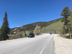
After my hotel breakfast. I rode westbout of Ridgway to Dallas Divide, an 8,900 foot pass through snow covered mountains and lush meadows. I hate the climbs around here but the scenery is amazing.

I was about a half mile from the top of the climb when I realized that I was killing myself to go 3 mph. I dismounted and walked the rest. The smile is one of relief.

Thank god that’s over

The ride down the other side was not as fast as I expected. Mostly I kept my speed under 25 mph.

I pulled into a general store in Placerville. I talked to a cyclist who had just ridden from Telluride. This was the route on my maps. He reported that he couldn’t find camping in town so he settled on a $180 motel room.

That’s a bit rich for my blood. I talked to the store owner. She confirmed that road over the mountain from Telluride is a killer climb and that the road on the downslope going into Dolores Co was partially blocked by a humongous boulder.

It would be cool to see the boulder but the climb would be to 10,200 feet. She, as did the people in Ridgway, recommended that I ride off route to Norwood, Colorado.

So I headed west to Norwood. This means I will miss Dolores and Cortez, Colorado. I’m sure they are scenic but the ride down the San Miguel Canyon toward Norwood was truly spectacular. The San Miguel River was gushing with snowmelt. The hills were red rocks, all jagged and menacing looking.

The road into the canyon
I started the climb of this “hill” way down there
The canyon looking west from near the rim

After ten miles of easy riding I hit Norwood Hill. I was lead to believe that this was no big deal but it was a climb out of the canyon. After a mile or so, I was once again grinding away for 3 mph. Time to push. I passed a crew working to clear fallen rocks off the road. I kept pushing and peaking over the edge of the road. There was no guard rail just a drop of several hundred feet.

I kept pushing and the base of the canyon kept getting smaller, until finally I was over the top and could ride into Norwood with minimal effort.

Norwood has three hotels. The working class motel had no vacancies. The tony Inn didn’t either. My last hope was the Back Country Inn on the west end of town. There was not a single car in the spotless parking lot. As it turned out this was because the motel’s guests were all road crews working in the area.

I asked the owner if there was anywhere I could camp. She offered me a space in the lawn behind the motel for $20 with shower, towels, and breakfast included.

Sweet.

No it’s time to head into town for some vittles. Tomorrow I ride over the mountains 70 miles with 4,000 feet of climbing and 4,200 feet of descending. I booked a room in the motel to be sure I won’t end up in the woods feeding Clif bars to the bears.

Miles today: 42

Tour miles: 1,689

Top speed: 31.6

By this point in a bike tour I am normally getting stronger. Not this time. The mountains and the thin air are very tough.

No Name Tour: Day 28 – Listening to My Body

After three 8,000+ foot summits, my body was really tired. I slept hard again.

After motel breakfast I hit the road, heading south in the general direction of Telluride.

I knew I was riding slightly uphill, so I decided to take in the scenery and plod along at 9 mph. The temperature was comfortable and the winds were light.

The scenery just doesn’t quit

Enough hops to make mucho IPAs

I spotted a coffee shop along the road at Colons don I took a break and had a coffee and a doughnut.

A customer in the shop started chatting with me. She recommended that I not follow the Western Express route over Lizard Head pass and ride off route to the town of Norwood instead. I am always wary of taking route advice from non- cyclists; the terrain looks different from behind the wheel of s car. I thanked her and we both hit the road for Ridgway.

The terrain was slightly hillier but not granny worthy. The lack of a shoulder and the idiots driving campers made sure I was adequately stimulated.

The last three miles into town were on a concrete trail. It went along a river, through a marsh, and into town. A big improvement over the highway.

I stopped at the town bike shop and talked to Nate about the Norwood thing. He agreed that it was a better route that would also bypass Dolores, CO.

Nate of Ridgway Wrench Bike Shop

I’ll see how I feel after riding through Dallas Divide, an 8,900 foot pass before Lizard Head.

During my ride today I never felt right. My right thigh cramped a few times and I felt light headed. I think my body is tying yo tell me something.

After talking with Nate I decided to have an early lunch and see if I felt like riding on. Lunch made me feel better but I was still a little lightheaded. I checked into a motel and called it a day.

Miles today: 28

Tour miles: 1,647

No Name Your: Day 27 – Three Pieces of Eight

The Wanderlust Hostel in Gunnison worked out great. I walked to dinner at The Dive, a not at all divey open-air bar and grill.

I slept well which is attributable to me being super tired, wearing earplugs, and taking a little something to help me sleep. About a week ago I bought some chewy edibles at a weed store. I bought them as s lark to see how high I would get. I barely felt a thing out of the ordinary the first night I took one but I slept hard and woke up with zero pain in my wonky left knee or anywhere else in my body. As a pain reliever, edibles worked much better than ibuprofen.

After a humongous gut bomb at a Gunnison diner, I headed west on US 50. I left my bike in the backyard of the hostel, not knowing that it has a sprinkler system for the lawn. My helmet and gloves were the only things that got wet. Do I began the day wearing my floppy hat and the long fingered gloves I bought for descending mountain passes.

I couldn’t finish this beast

The ride from Gunnison was virtually flat and the wind was low. This allowed me to enjoy the scenery in the Currcanti National Recreation Area. The scenery is amazing here. I took a bunch of pictures, too many to fit on this post so check out my Instagram page (Search for Rootchopper, of course).

About 19 miles into the day I came across Dan Hurwitz who is riding east from San Jose. Dan was at a pull out along the road. He was using a compact luggage scale to redistribute the load in his panniers, because his bike was wobbling during descents.

We exchanged info. He gave me his card. His blog is bikerdan.wordpress.com.

Speaking of blogging cycle tourists, my friends Mark and Corey have abandoned their TransAmerica trip after riding well over 2,000 miles from Yorktown, Va. I don’t know quite why they packed it in but I’m pretty sure thin air didn’t help. They were a real treat to ride with. I was hoping to meet up with them in Oregon.

He told me the hills between Sapinero and Montrose were difficult. I was amused when he said, “It is what it is.” This should be the touring cyclist’s mantra. He reports that today and much of his tour featured a tailwind.

Oh joy.

After Sapinero about 900 feet of climbing would take me to 8,500 feet in about 5 miles. That hill was hard and the headwind was no fun but the scenery of the Blue Mesa Resevoir at least took my mind off the misery.

After a short descent, the road rose up again taking me to 8,700 feet. Okay, that was hard too. A week ago it would have done me in but my wee granny gear and wicked awesome scenery got me to the tawp.

A ten-mike descent followed. The headwind was no match for The Mule in full gallop.

Snow melt filled the creeks all day long

Near the base of the descent I pulled into a general store. They had no restrooms or WiFi for dining customers. I would have walked out but my body needed something more than another apple. The sandwich, fries, and Gatorade hit the spot. I paid without leaving a tip, which is highly unusual for me.

He died waiting to use the restroom

A sign in the store said I could find a restroom 1.8 miles to the west. And, thankfully, the pit toilet at a pull out met my rather urgent need.

Then began climb number three. Oh joy. This one was about 900 feet in five miles.

I stopped every mile to let my legs and lungs recharge. The top came and I posed from the obligatory I-climbed-this-motherfucker photo. (Should I have hyphenated motherfucker? Discuss.)

After my selfie moment, I gradually descended over 19 miles to the city of Montrose. I passed by the Black Canyon of the Gunnison National Park. From what I saw it has a lot of hills that look to be made out of adobe.

When I arrived in Montrose I discovered that I was now at 5,807 feet; this was the first time since Pueblo that I’d been this low. I also discovered that it was 89 degrees. I can’t complain. Other than the headwind it was a very good day to be on a bike.

Miles today: 64

Tour miles: 1,619

Top speed: 33.1 mph

No Name Tour: Day 26 – Conquering the Monarch

It was 39 degrees outside when I woke up. Not gonna happen. I ate breakfast of sorts on my room then hit the road at 7. Before even leaving the parking lot, I took off my long pants and my jacket. It had jumped to the 50s and I had a tailwind.

I was heading to Monarch Pass in US 50. A few days ago I utterly failed on a 9,000 foot mountain. How’ll I ever get over this 11,300 foot beast?

Don’t get too excited. The first four miles were a false flat, an almost imperceptible incline to the road. I gained 400 feet in elevation on what looked like level ground.

At Poncha Springs, the fun began: 18 miles and over 6,000 feet of climbing. I surprised myself by doing the first six miles in my middle chainring. The tailwind surely helped.

But at about 8,500 feet I started to feel the effort. I took a hit of albuterol to see if it would clear my lungs. No dice. Thin air is what it is.

With 12 miles to go I implemented my climbing plan. Stop when I get tired. Drink lots of water, eat something. Start again when my heart rate comes back to normal.

I did this five or six times. Once I stopped because a family of mountain goats were coming out into the road. I gave them lots of room.

As I climbed riders on (mostly) road bikes we’re flying down the mountain. Go ahead; make my day. The road very much reminded me of US 60 in West Virginia at Hawks Nest.

My itinerary called for me stopping 2 miles

Ride the Rockies riders descending
Hours of this

My itinerary called for me stopping 2 miles from the top and camping. When I got there I thought “Why waste a tailwind and eight hours of daylight?” I was prepared to walk the last mile, which had switchbacks that looked brutal. After a five minute break, The Mule and I managed to find a nice pedaling rhythm and went right to the top.

The parking lot of the general store was filled with hundreds of bikes and their riders. They were participating in Ride the Rockies, an annual event in these parts. They had just arrived at the top from Gunnison about 45 miles to the west.

I went into the store and bought a cup of coffee. It was about 55 degrees outside but I was shaking. The coffee helped with my body temperature but made me nauseous.

I was starting to feel the elevation big time. I got my picture taken at the pass sign then took off down the western slope of the mountain. It was a thrill ride comparable to last summer’s descent from Washington Pass.

My summit picture

There were hundreds of Ride the Rockies participants crawling up the mountain. I dropped from 11,300 feet to 8,450 feet in ten miles. All the curves were banked and the road was clear of debris. And, yes, I rode in the middle of the lane. I was passed four times on the way down.

At the base of the mountain I stopped hit lunch. A BLT, fries, and three glasses of ice water took me and hour to eat but it revived me.

I am Groot

The shop owner offered me a camping spot by the creek out back. I was tempted but decided to ride 32 miles to Gunnison.

Looking back toward Monarch
Bizarro rocks along the road to Gunnison

Stupid me. The wind had changed direction on this side of the pass. A strong headwind beat me numb the whole way. Once I got a cellphone signal, I called The Wanderlust Hostel in town. There I will stay until the morrow.

Apropos of nothing, I saw more dead deer between Sargent and Gunnison than I’ve ever seen anywhere.

Miles today: 64

Tour miles: 1,555

Top speed: 37.9 mph

No Name Tour: Day 23 – Let’s Ride over a Mountain, Not!

I began the day by riding to a WalMart north of Pueblo to buy supplies. Then I rode to the Post Office to mail something.

I was on the road pretty early, well before 8. The route began by wending me through a city park and some nice neighborhoods of modest, well kept single family homes. One of the homes was apparently owned by a whimsical artist.

I love the glasses

After my tour of Pueblo, I headed west on Highway 96. Again!

The terrain immediately switched to rocky desert. There was a two-mile hill leaving town that I didn’t pay attention to when planning the day. It wasn’t hard but, having not taken a day off in over three weeks, I felt like my legs were full of lead. Not a good sign.

Leaving Pueblo

About 25 miles into the day I was caught by Yoni Doron Peters who’s doing the Western Express with a friend whom he’s meeting in Canon City. He was loaded even lighter than Corey and Mark. How do they do it?

After 37 miles I met two men who were finishing up the Western Express Route. Jagdish and Steve told me of a place a mile ahead with water and bathrooms. Steve is ending his ride in Pueblo; Jagdish is headed for Kitty Hawk, North Carolina.

It turns out that they ran into Corey and Mark there! It’s located in the town of Wetmore where the Western Express and the TransAmerica Trail diverge.

Of course, Corey and Mark we’re gone by the time I arrived. I stayed about 15 minutes then rode out only to spot one of Jagdish and Steve’s riding partners, Warren. I told him about the bathrooms and water. He was all smiles having descended from over 9,000 feet in 14 miles. He said the hill would be no problem. I noted that all three riders in his group had mailed home lots of gear to shed weight.

Jagdish and Steve
Warren, all smiles.

I bid Warren goodbye and began the climb he had just flown down.

Since I was not acclimated to the thin mountain air I decided to take it easy. The scenery was beautiful, conifers and aspen trees all over the mountain slopes. I didn’t see much of it as I had my head down, grinding away.

After three miles of nonstop climbing my heart was racing so I stopped on the side of the road until it settled down. I did this again at 6 miles, 7 1/2 miles, 8 miles, and 8 1/2 miles.

A woman in an SUV rolled to a stop as she was coming down the mountain. She asked if I was okay and offered me water.

This hill was the hardest climb I’ve ever done. And 8 miles into a 14-mile climb my legs were kaput.

Rather than risk a heart attack or a crash from the extreme fatigue, I decide to swallow my pride and walk. And walk. And walk.

From time to time I got back on the bike but my legs were gone. At one point my right leg muscles went into a cramp whenever I pushed down on the pedal.

Walk. Walk. Ride. Walk. Walk.

I had allocated 3 hours for what I originally though was a 10-mile climb. Suffice it to say it took more like 4 hours.

An ascent as pretty as it is painful
14 Miles of Up

My problem was a combination of not enough rest, too much weight, not eating and drinking enough, and age.

At the top the road gently rolled. A storm approached blowing me all over the place. Then I reached the descent. Wind howling, Mule flying. I saw a curve ahead with a 40 mph warning sign. I looked down and saw 37 and rising on my speedometer. I tapped the brakes to keep me from shooting off the road into the scrub and rocks.

It’s hard not to admire the landscape as you zoom downhill. Dead ahead loomed the ominous snowy peaks of the Colorado Rockies. Getting over them will be brutal.

I rolled into Westcliffe and looked for a motel that Jagdish and Steve recommended. The Courtyard Country Inn is a funky place with rooms arrayed around an outdoor courtyard with fountains.

Mo, the co-owner greeted me, and told me that there were no vacancies and probably none in town.

She took pity on me since I looked like I was about to keel over. She asked the Air B&B next door if they had anything. Only a $200 room. Then she remembered that some friends had booked tonight and tomorrow at her motel but said they might not come tonight. She called them and, indeed, they weren’t coming tonight. So I got their room!

Mo says they of anybody cancels for tomorrow night, I can have their room. I hope so; I like this place. Otherwise I’ll ride to Salida and get a room there.

Miles today: 63.5

Tour miles: 1,432.5.

Bike Tour 2019

Here’s my plan for my 2019 bike tour.

Big U Bike Tour Map.JPG

I start in Chicago (or north central Indiana). I follow U.S. Bicycle Route 66, the dark blue line, to southwestern Missouri. This route follows, to the extent possible, the old Route 66 highway. I switch to the TransAmerica Route, the orange line, and head west across Kansas and the southern half of Colorado. In Pueblo, Colorado I take a day off after 1,300 miles. I’ll need it. I leave the TransAm Route and head west across the Rocky Mountains and into Utah. If I have it in me, I’ll do a side trip to Bryce Canyon National Park. I’m not planning on hiking but the scenery alone in Bryce will be hard to pass up. 

Between Pueblo and South Lake Tahoe, California, there are dozens of mountains to climb. Most of them are higher and steeper than the seven climbs I did in Montana and Washington State last summer. My maximum elevation last year as a little over 5,600 feet. This route has climbs that go over 10,000 feet. To add to the difficulty there will be long stretches with no services, including no water. And did I mention some of these will be in desert? I bought a water filter and plan on carrying extra bottled water whenever I can.

I’d like to cut weight on this tour but there really isn’t anyway to avoid carrying a tent, sleeping pad, cold weather clothing, food, and water. The best place to cut weight is from the engine. Unfortunately, I now weight 213 pounds. No bueno. I need to be under 200 by the time I leave Pueblo.

Near South Lake Tahoe, I turn north along the Sierra Cascades Route. I thought this was going to be the hardest part of the trip, but now that I have seen the elevation map of Nevada, these mountains will be a relief (so to speak). This stretch of the tour will take me past Crater Lake. Once I get into Oregon, I’ll decide whether to continue following the Sierra Cascades Route to the Columbia River. There I can turn west following the river to the finish in Portland, Oregon. An alternative would be to switch back to the Trans Am route at Sisters, Oregon, climb over McKenzie Pass, and ride down to Eugene, or even continue to the coast. Either way, I would use the Google to route me to Portland.

Since I fully expect to be a hurtin’ unit for much of this ride, I have thought about places where I can call an audible and change or curtail the tour. For instance, I can cut out the Sierra Cascades entirely and ride one last climb west across the Sierras to Sacramento or, even, the Bay Area.

I planned a two-month itinerary, the same as last year, even though the tour is 700 miles shorter. The lower daily mileage has more to do with the availability of resources than with the difficulty of the route itself. For example, when I am faced with the option of a 45 mile day or an 80 mile day, I am planning on the 45 mile day. (I generally end up riding farther than plan because riding is preferable to sitting around a campsite or a motel.)

I plan to start on May 15. The original idea was to take Amtrak to Chicago. Mrs. Rootchopper has dangled the idea of driving me to her parents’ house in northern Indiana. I can ride west and pick up Route 66 in a day or two (and avoid the traffic of northern Illinois.)

I am open for suggestions as to what to call this tour. The Big U is one idea. YODO in the Wild West is another. If you have any suggestions, feel free to add them in the comments section.

Stay tuned.


Tour Planning 2019

  • Warm weather and improving health have nudged me to start thinking about a tour.
  • I went to Friday Coffee Club and talked to Felkerino about the Sierra Cascades Adventure Cycling Route. He said it was not a climbing hellscape, had lots of services, and is very pretty.
  • So I just sat down and mapped out a tour using Adventure Cycling’s interactive route map.
    • Take Amtrak to Chicago (I’ve ridden across Ohio and Indiana enough, thank you.)
    • Ride Bike Route 66 from Chicago to Marshfield MO. (Basically this is in west central MO.)
    • Hang a right and take the Trans America Route west from Marshfield to Pueblo CO.
    • Take the Western Express Route from Pueblo through the Rockies, the canyons of Utah, and the basin and range terrain of Nevada to Alpine Village CA, near the southern end of Lake Tahoe.
    • Switch to the Sierra Cascades Route north to Sisters OR.
    • Switch back to the Trans America Route and head west from Sisters to the Oregon Coast.
    • Ride from the coast to Portland and fly home.
  • This tour would be 3,700 miles long. That’s 600 miles shorter than last year. This one is considerably hillier and hotter, though. I guess I could do it in 65 days.
  • If I were feeling spunky, I could ride down to the north rim of the Grand Canyon. This would add 300 miles and a week. Also, a side trip into Bryce Canyon would take a couple of days.


Some Ride/Hike Ideas for 2016

About a year ago I was admonished by a friend for sounding wishy washy regarding my 2015 vacation plans. “Stop planning. All we have is today” was her way of saying don’t plan, DO!  Irony alert: in January 2014 she told me of her plans to obtain certification to teach in DC schools and to open a business. She followed through on none of it, eventually leaving town. Even so, she had a point.

I suck at advance planning. Somehow I managed to do a bike tour, a non-bike trip around the world, nearly a dozen day hikes, half a dozen bicycling events, and take in a bunch of Nationals games. So with that in mind I began thinking about things to do in 2016.

I anticipate one non-biking vacation (to Sweden and thereabouts) to visit my daughter.  (A return to Thailand in the dry season would be nice but I can’t face the 18 hours of flying right now. Maybe 2017.) That will leave plenty of vacation time. So here are some ideas I am tossing around in my head.

Hiking: there are still many, many hikes to do in the Shenandoah National Park. Also, I have barely scratched the surface of hiking in nearby Maryland and Pennsylvania along the Appalachian Trail. One possibility is to gear up and do some overnights. I have never done this and it would be an interesting extension of my day hikes (not to mention save on driving home after a day’s worth of hiking).

Biking Events: WABA swears that it’s going to offer a century ride this year.  If it works into my schedule, I’ll definitely do it. Then there are the usual events: Vasa, Cider, 50 States, Backroads, and Great Pumpkin. I’ve done all of these several times, but the Backroads course was moved to West Virginia this year. I was in Australia and missed it. I can’t wait to do the new version. Two more that I keep threatening to do are RAGBRAI and the Five Boro Ride in New York City. Both of them are cattle drives. Both offer logistical challenges. Some of what follows are a lot easier to do.

Bike Trails: There are all kinds of cool trails around here that I haven’t ridden. Here’s a list of Virginia trails:

  • The Virginia Capital Trail goes between Williamsburg and Richmond. This could be a fun 2-day deal or a long single day ride.
  • High Bridge State Park down near Farmville and Appomattox looks really cool with a long, high bridge.
  • The Virginia Creeper Trail is a bit of a drive from DC. It’s only 34 miles but could be a beast of an out and back ride.
  • The New River Trail is a 57-mile trail that looks really promising with 30 trestles and bridges and two tunnels. This is a two-day ride with camping I think.

In Pennsylvania the Pine Creek Rail Trail runs 63 miles through the Grand Canyon of the East. Looks like a good overnight camping round trip to me.

Bike Tours: Right now I have eight possibilities on my list. All in the Eastern U.S.

  • Skyline Drive and Blue Ridge Parkway: This is a monster tour, 578 miles from Front Royal, Virginia to Cherokee, North Carolina. How the hell I’d get back is anybody’s guess. It’s also super hilly so I figure I’d be lucky to average 45 miles per day, 13  days of riding. This could be beyond my physical abilities. (Never stopped me before.)
  • The Natchez Trace: This 444 mile road is truck free. Tack on another 90 miles or so and the route would go from Nashville to New Orleans. Logistics on this one is a bit pricey (two bike flights). Bike Friday to the rescue?
  • Figure 8 in Vermont, New Hampshire, and New York: Adventure Cycling has two routes that form a figure 8. One loops around Lake Champlain, the other does a lap of the Adirondack Park. This one would be logistically pretty easy as I have family in the Albany area where the Adirondack route begins. The total distance exceeds 700 miles. The riding in Vermont and upstate New York is incredibly nice. Also weather up yonder is pretty much perfect for cycling in June – August.
  • La Route Verte: There are over 5,000 kilometers of marked bike routes in Quebec. The possibilities are endless. Then there is the interesting prospect of conversing in my horrid, mostly forgotten high school French. The idea of cycling to Quebec City, which I have never seen, or around Montreal is pretty intriguing. Getting there is a bit of a haul, but c’est la vie.
  • A New Kind of Rail Trail – North: Amtrak now has roll on bike service on the East Coast. Theoretically (relying on Amtrak is always an iffy proposition) I could take my bike on a trail and ride to Brunswick Maine, then ride up to Acadia National Park and ride all or part way home.
  • A New Kind of Rail Trail – South: Alternatively, I could take the train to Florida, ride to Key West, ferry to Tampa and ride across the state to Amtrak in Miami. Or just ride home.
  • Around Lake Michigan: This one starts in Monroeville, Indiana, one of the most bike touring friendly small towns in the US. It heads north through lower Michigan into the Upper Peninsula. Then across to Wisconsin and returns by crossing Lake Michigan on a ferry.  It’s 1,100 miles. Logistics would be simplified by using my in-laws house in north central IN as an alternative starting point.

In the increasingly likely (yet still somewhat improbable) possibility that I retire there is this:

  • The Trans Am/Western Express/Northern Tier Cross Country Ride: There remains a faint possibility that I might retire this year. If so, adios, amigos! I don’t know which route I’d take but the possibilities are numerous. The Trans Am is the classic route from Yorktown to the Oregon coast through Yellowstone. The Western Express shortens the Trans Am by taking a b-line across Utah and Nevada for California. The Northern Tier goes close to the US-Canada border.

Once I find out when the WABA Century and the Sweden trip will happen, I’ll pick two of the tours and as many events and hikes as my aging bones can handle.