The Mo Mo Tour: Launch Eve

Well, for a start, the tour has a name. Since I’m riding to Missouri that’s one Mo. it’ll be my third time in Missouri so that’s mo’ Mo. I’m going beyond Missouri that’s mo’ riding. Since I’m dealing with the Appalachian and Ozark Mountains, we have mo’ mountains. If successful I’ll be adding three mo’ states (Kentucky, Arkansas, and Oklahoma) to my 50 states hunt.

The plan is to ride south to Ashland Virginia where I will pick up the Transamerica Trail. I’ll head west on the TransAm all the way to western part of Missouri thereby completing my personal TransAm. (I did the other two thirds of the Trail in 2019 and 2022.) After that the plan is to ride south to northwest Arkansas and then west to Tulsa, Oklahoma (and maybe Oklahoma City). How I’m getting back is anybody’s guess.

Saturday

For the first time in a week, I managed eight hours of sleep. Gabapentin is my jam.

The weather was lousy outside. Rain. Humid. Dank. Perfect.

I spent the afternoon, amassing the stuff I need for the tour. I started by emptying my saddlebag. It must weight 10 or 15 pounds! Spare tube, tire levers, patch kits, and pump were transferred to the “tour” pile. The bag became the “home” pile.

Next I grabbed a bunch of white kitchen garbage bags and some zip lock bags. I use the former as a liner for my allegedly water proof panniers. The latter contain small items organized by use.

My right rear pannier was first to load. Sleeping bag, sleeping pad, pillow, camp towel, camp washcloth, rope, clothes pins, and maps and medications I won’t need for the first ten days. I’m also packing a wire mesh bag for my food for camping in the mountains.

The left rear pannier contains clothing (for off bike and on), swim trunks, rain gear, a floppy hat, toiletries and daily medications, and sandals. Rain gear is in a separate bag. An empty bag is reserved for dirty clothing. I’ll also add a small bag with electronic stuff like cables, plugs, and batteries tomorrow. My back-up prescription glasses go in the bottom.

The front panniers are smaller. The front right pannier contains anything I need for bike maintenance. Tire changing stuff goes in one zip lock. Spare tubes in another. Tools (allen keys), a wrench, a master link tool, go in yet another. Small items like valve stems, my fiber fix spokes (a cord that can substitute for a broken spoke), and such go in a third. I also stashed a couple of cables in a small insert built into the pannier.

The front left pannier contains stuff I will need easy access to. Mostly this is food, my lock, sunscreen, butt cream, a back up water bottle when needed. (I decided to leave my water bladder at home.) I also included one small bottle of pickle juice and and another of electrolyte tablets.

The handlebar bag will hold my phone and headphones, wallet, dog defenses (whistle, horn, and mace), a pen, my map(s) of the day, prescription sunglasses, a power pack, a headlight, some pickle juice, electrolyte tablets, and snacks.

Finally, I will have a dry bag containing my tent, stakes, ground cloth, and collapsible cane.

Now you see why it took four hours to organize all this stuff. It will weigh a lot; it always does. In my experience the weight isn’t much of a problem – I’ll be going about 10 miles per hour – except for the hills. My biggest concern is how my body will hold up. I’ve done a number of 50-mile rides in recent weeks but my back and neck issues are utterly unpredictable. Lord knows, how they will hold up to tent camping. Even when in good shape, I have struggled to sleep well outdoors. Advil, Advil PM, and Gabapentin will help in that regard.

Sunday

Today I loaded The Mule with all the bags and went for a one-mile test ride. I tweaked a few things as a result and all seems fine. My last task is to go for a ride to a bike store for done butt cream packets.

The Mule with everything except toiletries, meds, cables, and batteries.

It being a nice day I decided to ride Big Nellie. On the way to Old Town we rode across the now officially opened Dyke Marsh Bridge.

It’s wide. It’s new. It’s about time!

Day one promises to be very long, 70 to 85 miles depending on where I stay tomorrow night in or near Fredericksburg Virginia.

Watch this space.

Down a pint

With warming weather, I am starting to bump up my mileage. On April 28 I managed 52 miles on Big Nellie. I chose the hilly route to Falls Church to buy some Halt pepper spray at a bike shop. It was closed. Derp.

I continued west to Vienna to see if Bikes at Vienna sold any. Nope. I did get to chat with the ever- loquacious Beth. She was dying to get her hands on Bike Nellie for service work, but that will have to wait until I wear out the chain later this year. She mention that she had a recent chat with Lawyer Mike, a loyal customer who is a regular at Friday Coffee Club. Mike bought an electric assist Hase Pino tandem. The front is a recumbent, the real conventional. Mike’s son is developly disabled so the bike allows them to go on weekend excursions. The son is the stoker, which means he sits up front on the recumbent half of the bike. Mike is the captain in back. It’s an amazing design and works great for them.

I had intended on continuing west of the W&OD trail to check out a new bridge over Wiehle Avenue in Reston but Beth told me it isn’t installed yet. So I headed back east. Not a half mile later Mike and his son passed me going west. (They stopped at Bikes at Vienna on their way to a milkshake place in Reston.) I can count on one hand the number of times I’ve seen someone I know on a bike in the last year.

Temperatures were unseasonably warm but I made it home in decent shape, making sure to take a swig of pickle juice to ward off leg cramps.

I did an easier 30-mile ride the next day, again on Big Nellie. I finished the month on Tuesday with a day off the bike and a blood donation at the Bloodmobile parked at the hospital down the street. Back at home, I set up my tent to make sure I remembered how to do it. I slept in it overnight. It rained. I stayed dry. I slept very deeply in three roughly two-hour stages. I guess the blood donation factored into that.

The weather on May 1 was perfect so I got on The Mule and headed out for what turned out to be a 52-mile ride from my house to Bethesda, Maryland and back. After emerging from the new tunnel under the Humpback Bridge on the Mount Vernon Trail, I noticed a couple of people standing around checking out some Canada geese. Among the adult geese were a handful of yellow-green goslings busily snarfing up grass. The first goslings of the year are always a welcome sight.

First goslings of 2023

I continued onward up the Capital Crescent Trail, stopping in Bethesda to snack on a few cookies I brought then I headed back, down Beach Drive in Rock Creek Park. The temperature was in the 80s but the shade in Rock Creek Park took the edge off the heat. Seeing all the green made me all but forget that stick season is barely over.

On my return, I crossed the Potomac River on the 14th Street Bridge. The ramp connects to the Mount Vernon Trail pretty much exactly were I saw the goslings. This time there were 20 of the fuzzy little critters being tended to by a pair of adult geese. As I stopped to enjoy the goings on, Miles, another Friday Coffee Clubber, came by on his electric-assist Brompton. What’s with these encounters? Miles was on his way home from work and he sped off south on the trail.

More goslings later on the day

After some gosling zen, I headed south as well. About four miles later I came upon a horrific scene on the adjacent George Washington Memorial Parkway. A crash had just occurred. (Miles passed the site before the crash and I arrived just after it.) A BMW was speeding north on the Parkway. The driver passed two cars in the right lane. The driver of the van had entered the Parkway from a perpendicular side street. Eye witnesses said the BMW was going “about 100 miles and hour”. It hit the van and sent the van airborne for what witnesses said seemed like three seconds before it landed on its roof on the Parkway. The BMW ended up upright in the wide median between the north and southbound lanes.

Insane crash aftermath

The force of the impact destroyed the front end of the van, sending parts, including the entire engine, off into the grass on my side of the roadway.

The engine and assorted other debris

The elderly driver of the van had been removed from the vehicle by passersby and was being attended to. He was in rough shape, but was conscious. A school-aged boy who had crawled out of the van was sitting on the grass about 20 yards away, surrounded by some super nice folks. He didn’t have a mark on him and seemed remarkably calm. (He complained to the ambulance crew that his back was sore but there were no surface injuries visible.)

It is amazing to me that no one was killed. (As far as I know, that is; the elderly driver, the boy’s grandfather, is in critical condition.)

The rest of the ride home was blessedly without incident.

Thursday I rode The Mule to a big box hardware store for some home repair supplies. I wanted to take it easy but the store was on top of a big hill so climbing was involved. After shopping, I went for an exploratory ride through Kingstowne and the Fort Belvoir areas The Kingstowne part of the trip was intended to avoid a brutal hill on the direct route to Fort Belvoir. The roundabout route I took cut the one big hill into three manageable ones.

It was hot and muggy during the ride. I drank all my fluids. At home I hit the floor to do my physical therapy exercises. When I went to stand up, the back of my left leg seized up with a humungous, very painful cramp. After it calmed down, I went straight to the kitchen for a shot of PJ.

Today I rode to and from Friday Coffee Club on only four hours of sleep. The weather was fantastic: 70 degrees and breezy. The pollen, however, was not. I had three coughing fits brought on by pollen coating the back of my throat. I used albuterol to calm my lungs and managed to ride home without incident. PJ was imbibed.

I was going to attend to a home repair project but the weather was perfect for napping on the deck and so I did.

Tomorrow I plan on riding 50 miles in the cold rain.

Comments on Improving the Mount Vernon Trail and the George Washington Memorial Parkway

The George Washington Memorial Parkway, despite its name, includes many other facilities besides the roadway. This component of the National Park System is a hodgepodge of disparate things that were thrown together years ago. One of these facilities is the Mount Vernon Trail. Plans are underway to rebuild the Parkway and Trail. Parkway construction upriver from Washington has already begun. The Park Service is taking comments from the public as part of the project’s required environmental assessment (EA). I took the opportunity to provide some. (I subsequently made one more comment that I neglected to save.) A few comments relate to the roadway, most discuss opportunities to improve the trail.

As the comments show, I am not a big fan of the GWMP administration. It’s nothing personal. Like the rest of the National Park System, the GWMP is grossly underfunded and has been for at least a couple of decades. Cutting taxes has its consequences. The problem which I will discuss in a future post go well beyond funding.


I am a 39 year resident of Northern Virginia and a 33 year resident of Mount Vernon. I have logged tens of thousands of miles on the Mount Vernon Trail on my bike. Years ago I also used the trail for running. Before retiring in 2017., I commuted by bike year round from roughly mile 5 to DC and Rosslyn. I am a long time member of the Washington Area Bicyclists Association and the Adventure Cycling Association.

The trail is subject to flooding in the Dyke Marsh area, about 1 mile south of Alexandria. In the area immediately north of the long wooden bridge, the depth of the water already approaches one foot (it came over the top of my hiking boots while I was riding through it on the way to work one morning). You may want to refer to the re-routing of the trail north of Slaters Lane about 25 years ago. Any trail improvements must include raising the trail. At today’s water levels, a few inches is insufficient in Dyke Marsh and many other areas. Future water levels will surely be higher and the trail redesign should take this into account. In addition to the Dyke Marsh area the trail should be raised wherever the trail is in close proximity to the river as it is in spots south of Fort Hunt Park,  in the Daingerfield Island area, on the northbound approach to the Memorial Bridge, and between the Memorial and TR bridges.

The trail needs proper drainage. Especially in the area north of Northdown Road. The trail in this area is subject to stretches of black ice in winter. In the short term this area would benefit from signage that warns users of icy conditions on the trail. (The current signage only refers to bridges.)

The trail needs to be level, except where curves in the trail require otherwise.  In many places the trail is canted toward the river, presumably to provide drainage. The slant in the trail causes inexperienced riders to veer off the trail and is particularly hard on runners’ knees.

The 2020 NPS report on the trail did not properly consider trail use during non-daylight hours. There are numerous areas where southbound nighttime riders are blinded by the headlights of northbound vehicles on the Parkway including along the pinch spot near the auxiliary runway at DCA, at the oxbow at Daingerfield Island, and at the southern most point of the Four Mile Run bridge. I have nearly hit other trail users because of this and have witnessed collisions. This is a BIG problem for commuters. In the short term, inexpensive remedies such as snow fences or other barriers such as bushes should be installed.

The trail surface needs to be treated in winter. Just like the Parkway. Trail users can’t safely commute on ice and snow anymore than drivers can.

Light use of the trail in Fairfax County is not a reason to delay the renovation of the trail. Light use is a consequence of neglected maintenance and the shoddy condition of the trail. 

The trail is part of several long distance bicycle touring routes.There is no viable alternative to the Mount Vernon Trail for north-south bicycle tourists in the DC area. Bike tourists (and others) have complained to me that the condition of the trail is so bad that they asked me for alternatives. One southbound tourist I talked with was even considering riding south on US1 in Fairfax County.The extensive damage to the trail south of the Beltway constitutes an unsafe condition for park visitors and needs immediate attention. I have advised Adventure Cycling of the trail conditions so they may warn their members.

Most of the bridges on the trail are made of wood. Other surfaces need to be considered. A particular shortcoming is the fact that the wooden bridges cannot support emergency vehicles or maintenance vehicles such as those used to plow snow or spread surface treatments in winter. To avoid damage to a wooden bridge. I once guided an ambulance carrying a crash victim in reverse about 1/4 mile up the trail to Northdown Road. At a minimum the Park Service should establish access points for emergency responders so that this doesn’t happen.

The trail now functions (if it didn’t already in the past) as a fifth lane of the GW Parkway and should be maintained, operated, and funded as such in the future. When the Parkway incurs damage that is dangerous to motorists, the damage is repaired and removed promptly. This hasn’t been the case with the trail for many years. Contracts for trail storm damage remediation should be in place year round. For example, there is extensive trail damage between Alexandria Ave and Tulane Drive. A massive root ball and  tree trunk have obstructed the trail since late 2020 (or earlier). The damage worsened after a January 2022 storm. obstructing the trail. One half of the trail is obstructed. (Would you allow a lane on the Parkway to be in this condition for this long? Bridge 19 was damaged by a fallen tree in January 2022. It is missing a section of railing and two other sections of railing were damaged. The Park Service should at least install some yellow safety tape to alert trail users of the hazard.) And there is extensive washboard from root heaves and potholes from one end of the trail to the other. 

Over a decade ago the Park Service considered building a bypass at Gravelly Point. For visitor safety, the bypass obviously is needed and should be built as part of this project. The airplane viewing area is one of the busiest parts of the trail and a permanent restroom facility is needed here. Porta potties are inconsistent with the aesthetics of the GWMP. 

Much of the routine maintenance of the trail is now performed by volunteers, many of whom are affiliated with The Friends of the Mount Vernon Trail. For all their hard work, the Friends provide only one full time equivalent worker each year to trail maintenance. The Park Service doesn’t even fund their equipment. This is not nearly enough. Much of the work they do used to be performed by park employees and landscape contractors. Unlike DC, we have no Trail Rangers on this side of the river. In the short term the Park Service should amend its landscape contracts to require edging of the trail. (The contractors currently do this on the loop road in Fort Hunt Park.)

Recent re-striping of the Parkway between Tulane Drive and Morningside Lane runs along the right side of the roadway. In the area leading up to Morningside, this section of the road floods on a regular basis. In winter this often turns into thick ice. The striping should be moved to the left lane (as it is at Alexandria Avenue) for safety.

Turning north onto the Parkway at Morningside Lane is inherently dangerous. Absent installing a traffic light, I recommend eliminating this turn.

The situation at Belle Haven Road and Belle View Boulevard cries out for much more than some paint, stop signs, and flexposts. Unless legislation specifically prohibits them, traffic lights should be installed. Absent that, traffic circles of the type used on nearby Oxon Hill Road south of the outlet mall should be considered. 

At-grade crossings for bicyclists and pedestrians are not likely to succeed. Build a bike/ped overpass that connects to the trail. Even an at-grade crossing should have a paved connection to the trail. And flashing lights that are passively activated such as at the northbound Parkway approach to the Memorial Bridge should be included in the design.

The entrances to the trail at Daingerfield Island and Belle Haven Marina merit stop signs for motorists. Trail users’ safety should take precedence over motorists’ convenience. (I was hit by a car on the trail at Porto Vecchio condominium a few years ago. After I presented testimony at a city meeting, the city changed the signage and traffic light sequence.) 

Oxbows such as the one at the old Bridge 12 location near Fort Hunt Park are inherently dangerous. The similar trail configuration at Bridge 1 should be removed as part of the rebuilt trail. I crashed there and my injuries resulted in a visit to the Mount Vernon Hospital emergency room. My bicycle was ruined. This bridge and the approach from Mount Vernon replaced an even more dangerous original design. Clearly, half measures are not enough to ensure public safety. Another oxbow exists at Daingerfield Island. This one does not involve a bridge but I have witnessed far too many crashes and near misses as south-bound bicyclists come downhill into a sharp curve. A simple solution is to make the approaches gradual. This would also bypass the area of flooding immediately south of the oxbow.

In general, changes to the road and trail that improve visitor safety are in the public interest and should be given precedence over aesthetics. 

Thank you for the opportunity to comment on this project. Feel free to contact me for clarification of any of these points.


The Naked Mule

The Mule seems to be attracting a lot of road debris this year. On my bike tour in Oregon, the rear fender trapped a chunk of truck tire tread. The tread worked into my rear tire and caused my first flat in ages.

Fast forward to autumn. The winds are blowing and tree branches are falling. The smaller stuff seems to end up on the shoulders of roads. Last week I was riding along lost in my typical riding trance when I came upon a small tree branch on the pavement ahead. I had no pavement to my right and cars to my left so I rode over the branch. Just like the tire tread, the branch managed to clear my front wheel without a problem but it became caught up under my rear fender. The force of the impact tore the bottom off my rear fender. I managed to ride with it on for a while but the damage was so extensive I had to remove the fender.

The Mule had a bare bottom for the first time in its life. Eek.

Today I was riding through a park on the Mount Vernon Trail when I came upon what looked to be a small tree branch no more than a few inches long. Alas, it was just long enough to get sucked up under my front fender. Can you say instant replay? Well, I was going to have to buy a new fender set anyway so it’s not much of a loss. The Mule is now naked front and rear.

Second fender trashed in a week. The Mule is naked.
Front wheel of The Mule with removed broken front fender.

I suppose it could have been worse. Neither fender incident resulted in damage to the wheels or the tires. Speaking of tires, the Schwalbe Marathon Plus Tour tire in the picture above has well over 5,000 miles on it. I suspect it will last at least another 3,000 miles.

The Mount Vernon Trail – From the Sublime to the Rediculous

The Sublime

Today was just another ride on the MVT. I rode south of home to check out the replacement bridge near Fort Hunt Park. It has only been open for a day or two. The old trail was narrow and bumpy and the approach to the bridge had steep switchbacks with no shoulders. (Who’d have thought this was a good idea in the first place?) It was one of the highest crash locations on the trail. Mrs. Rootchopper was one such victim.

The replacement includes a wide trail with new pavement on both ends from street intersections on Waynewood Boulevard and the Fort Hunt Park access road. The new bridge is higher and wider than the old one and switchbacks are no longer a feature of the approach.

This project has been in the works for a long time. Unfortunately, the southern end of this section of trail connects to a narrow winding trail with washboard root heaves and another, similar dangerous bridge on which I crashed 30+ years ago. This second bridge was itself a replacement for a bridge that was even worse. Funding for the improvements in this area came about after a US senator’s wife was seriously injured.

New bridge on the Mount Vernon Trail
New Bridge on the Mount Vernon Trail

The Ridiculous

After checking out the bridge I rode north through Old Town Alexandria. At Canal Center just to the north of Old Town the trail splits into two: the left side goes around the old power plant along the GW Parkway while the right goes around the plant along the river. I was planning on going left when I came upon three young men and a shiny white Toyota. The car was parked directly on the trail. Apparently the men were photographing it. (The only reason I could think of doing this on the trail was to ensure that no other cars were in the picture. Ironic, no?)

I told them to move the car off the trail. They blew me off. I said you can laugh when the police come.

I rode a mile north and turned around using the river route. The three photographers were now shooting a blue sedan on the trail. I lost it. Words were used. One of them called me a racist. (They were POCs; I am white.) After more words that advanced the cause of bike trails not at all, I took a picture for posterity then rode off. I called the Alexandria police but I have no idea if they sent someone out to roust the rapscallions.

Just for context three weeks ago I was passed by a couple on a gas powered motor scooter on the trail near National Airport. I guess they were afraid to ride it on the Parkway. About a week ago, I saw a photo of a car stopped on the trail north of the power plant. The driver had to jump a curb to pull this off so it showed remarkable disregard for trail users. And let’s not even talk about me getting hit by a car on the trail a few years ago. (No right on red? You can’t be serious. This is only a 3,000 pound SUV.)

Three knuckleheads using the Mount Vernon Trail for a auto photo shoot
They clearly weren’t interested in good lighting.

Timber!

Mrs. Rootchopper insisted that it was “nice and warm” outside so I decided to break out my holey wool sweater and take The Mule for a ride. I was overdressed for the first 15 miles riding north with a tailwind toward Alexandria, Shirlington, and Pentagon City. When I turned for home, comfort turned to chill. Dang.

Along the way I spotted a rather large red fox along the Four Mile Run trail. It was only a few feet away and seemed rather unimpressed with my passing. I think his size was an illusion caused by his fur being fluffed up against the cold.

On the way home, I took the Mount Vernon Trail for the second time since our big winter storm two weeks ago. It was my first time south of Tulane Drive (about a mile south of Alexandria). As I passed the site of a bald eagle nest I heard a piercing screech. I pulled over and looked up. Two adult bald eagles were perched side by side on separate branches way up at the top of a tree right next to the trail. Based on my viewings of the bald eagle cam at the National Arboretum in Northeast DC, I suspect that these two eagles are mating. Also, they were both smoking cigarettes.

I could see that a fairly impressive amount of storm debris had been cleared from the trail itself but much of the debris was left along the trail. (Farther south, I saw a lone volunteer piling storm debris next to a street parallel to the trail. He had a pick up truck, a small chain saw, and a hedge trimmer. Bravo.)

About a week ago I rode some of the trail and found the bridges covered in ice and snow. Today, they were clear. As I rode south, I was curious to see how much ice there would be in the shadows as the trail rose toward Northdown Road. Fortunately, there was no ice to speak of.

Along this stretch, two giant trees fell downhill, away from the trail in November 2020. Their root balls tore up a lane of the trail for about ten yards. On paper. the National Park Service owns the trail and is responsible for its maintenance. In reality, the Park Service quit doing maintenance years ago. Other than lawn mowing, the trail gets most of its maintenance from volunteers these days. Clearing these huge trees and repairing the trail damage are well beyond anything that volunteers can deal with. That said, a volunteer did put up some traffic cones and painted warning markings on the trail to alert riders about the hazard. To this day, as far as I can see, the Park Service has done nothing.

Aftermath of November 2020 Tree Fall

As you can see, there is one huge fallen tree to the right. What you can’t see is the second fallen tree behind the root ball and the tree that remained standing.

Apparently, the January 2022 storm took care of the surviving tree. Unlike the other two, this one fell uphill, across the trail.

I have no idea who cut the gap in the tree but I’m grateful. Clearly what remains is an unsafe situation.

Sweet and Nasty

There are right ways and wrong ways to do a hilly bicycling event. I chose the latter.

On Friday night, I dined on a Texas chili mac with cheddar, beans, and onions, a true gut bomb. Saturday morning I ate shredded wheat for breakfast. Then I rode 15 miles to Nationals Park to take in a baseball game, my first since the before times. There I drank my June beers, two tall, bland, vastly overpriced lagers.

The Nats won and I left the ballpark happy. Well, most of me did. The combination of chili, shredded wheat, and beer was causing me intestinal distress that would make both a gastroenterologist and a volcanologist proud.

I made it home in one piece and felt a bit better after some time on the porcelain throne.

Fast forward to the wee hours of the morning. Rumblings within woke me and kept me awake all night. By six in the morning all was calm but I now had the brain fog of a sleeplessness to deal with.

After breakfast I rode The Mule six miles to Jones Point Park in Alexandria. The park is bisected by the massive Woodrow Wilson Bridge. Beneath the bridge was the starting point for the Washington Area Bicyclists Association Sweet Ride. I had chosen to do the 50-mile route despite the fact that the registration page warned that it was “a challenge” because it included 2,654 feet of climbing.

I have issues with climbing. Basically, I stink at it. I could get better if I rode up hills with some regularity, but my thinking is: why ruin a nice ride with pain?

The Sweet Ride route was merciful for the first ten miles, following flat streets and trails in Alexandria and Arlington before using the Mount Vernon Trail for a mile-long spin along the Potomac River.

Alas, the MVT ends at a switchback climb to the Martha Custis Trail. The Custis (nobody calls it the MCT for some reason) climbs out of the Rosslyn neighborhood for a mile or so. Then the “challenging” part begins.

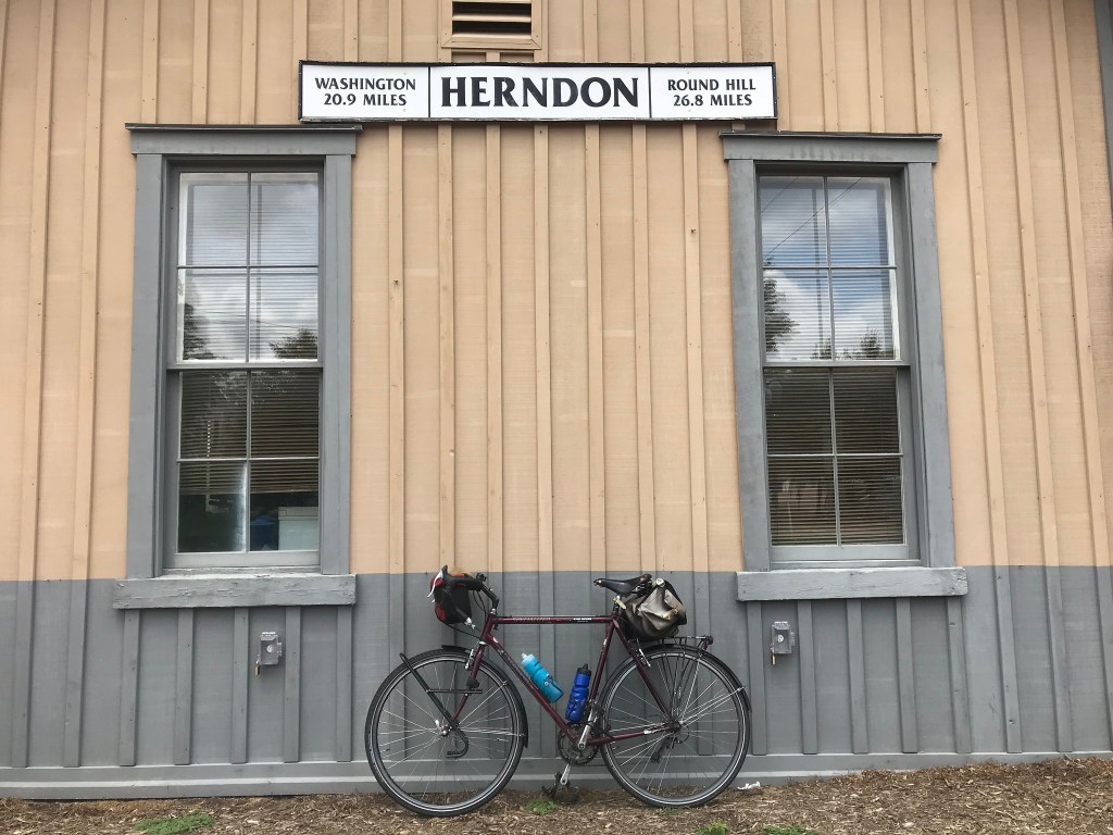
The next nine miles traverses scenic (check out the landscaping, see the pretty Arts and Crafts McMansions) North Arlington. The hills seemed to go up forever until they plunged down to a stop sign, stealing riders of their reward for all that hard work going up. I was glad I had chosen The Mule for this event because it is equipped with a tiny granny gear that I purchased to climb over Monarch Pass in Colorado in 2019.

I stopped at a pit stop to refill a water bottle and say hello to Kristin, WABA’s development and acting managing director. I seem to see her only when I am zonked from riding. In any case it was the first time I’d seen her since 2019 so I didn’t mind the zonked part. That is until she said there would be more climbing in the miles ahead.

And there was.

Thank the gods for granny gears.

At least the neighborhoods were interesting and the traffic was light. At mile 10, I arrived on the Custis Trail again. This led to a somewhat confusing meander through the Ballston area. I briefly lived in this area in the mid to late 1980s. I proposed to my wife at the miniature golf course and took my sister for her first Mexican food meal at a tiny place in a small wood framed shop. Those places are gone, replaced by fancy townhouses and mid rise apartment and office buildings.

Most of the riders I encountered during the event were using GPS cue sheets. I am old school and had a paper cue sheet attached to my handlebars. I couldn’t keep up with the mod crowd because I had to stop and turn the page of my cue sheet booklet from time to time. Also, I am old and slow.

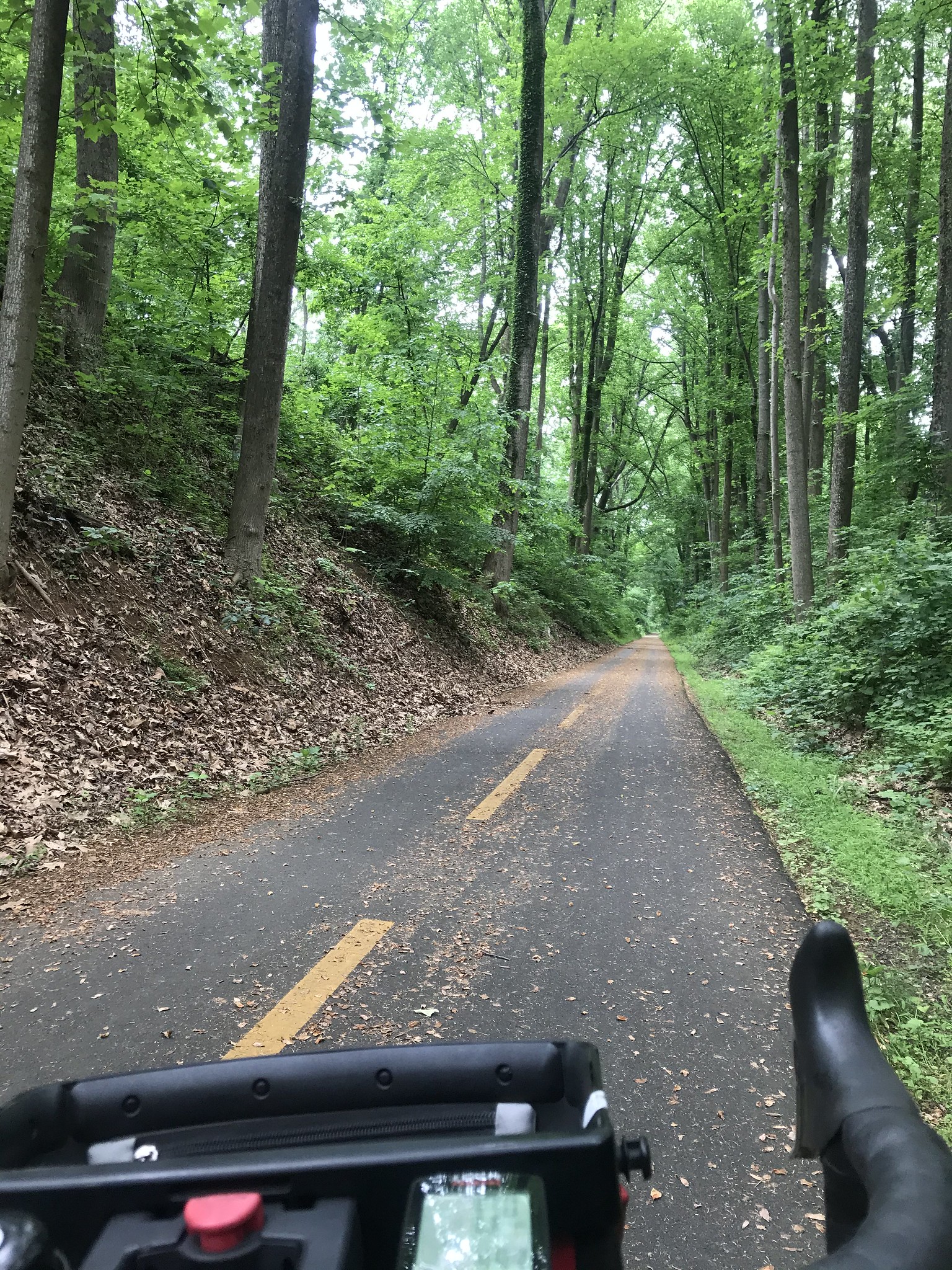
We connected to the Bluemont Trail which I haven’t ridden in 25 years. This led to the Washington and Old Dominion Trail which was packed with families enjoying the lovely weather. In short order I pulled into the pit stop in Bluemont Park where I was greeted by old friend, Ursula, another WABA person, and generally all around great human. Once again this was my first time seeing her since 2019.

I briefly chatted with a man named Adam who kidded me that he thought I should be riding “out in Montana somewhere.” For the life of me, I have no idea how he knew who I was. My broken fusiform gyrus once again was paying me a visit.

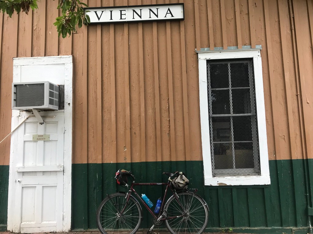
Just before I was to begin riding again, Ed Felkerino, randonneur extraordinaire and co-founder of Friday Coffee Club, appeared at my side as if out of the ether. We chatted briefly, He wasn’t doing the event, just out for a bike stroll, probably headed for Cafe Amouri in Vienna. Yet another person from the before times. Maybe if this keeps up I’ll start to feel less pandemicy sometime soon.

I rolled away on the W&OD to the city of Falls Church where the route wandered past all kinds of smaller but finely designed homes. By this point, my landscaping envy was through the roof. How the heck do these people get such awesome hydrangeas, enormous bushes with blossoms that look like cotton candy. Mine just dry out and die no matter how much I water them.

After a five-minute wait to cross six lanes of US 50, scourge of my ride across Nevada, I found myself in the Lake Barcroft section of Fairfax County. Dang this is nice! I don’t think I had ever been through this area. Rolling hills and curving roads, not to mention the lake, made me not care too much about my now-all-but-dead legs.

Out of Lake Barcroft, the route traversed Bailey’s Crossroads and dropped onto the Holmes Run Trail. The last time I had used this entrance to the trail was in the Hoppy 100 ride. We descended to the trailhead in an absolute deluge. The trial runs along and across Holmes Run (run means creek in Virginia-speak). The downpour had caused the run to flood but we rode through the waters without harm. Today, without a recent downpour, some of the crossings were closed, evidence that this well intentioned trail is a bit of a mess.

The cue sheet said to take a left but it wasn’t clear to me that the left was the one that was directly in front of me or further on. I chose the latter and was wrong. I came out of Holmes Run about a quarter mile south of the route. The Google helped me remedy my error and I was back on track on the streets of Alexandria.

After a couple of easy miles, the streets led back to the Holmes Run Trail where I found the final pit stop, staffed by Anna, WABA’s events coordinator. The only time I ever seem to meet Anna is at pit stops, She’s now officially Pit Stop Anna. Anna informed me that the route has nearly the same elevation gain as the 50 States Ride. It sure felt like it but the 50 States gains about 3,041 feet in 60 miles compared to the 2,654 for this 50-mile ride. On a per mile basis, however, the Sweet Ride gains 53 feet of elevation per mile compared to 50 feet per mile for 50-States.

Anna is soon to be named WABA’s statistics coordinator.

The next several miles were along the trail and completely flat Eisenhower Avenue. I took a left on Mill Road and realized that the next few steps on the cue sheet didn’t work. Hmm. About a mile later I came to realize that Mill Road forms a U, curving back to Eisenhower; I had turned too soon.

No worries. I was now in the Carlyle neighborhood, familiar turf. The route took me up the final hill of the ride, a roughly mile-long incline on King Street headed west. I normally find this climb frustrating because it looks easy but it wears you out with its length. By this point though my legs didn’t much care. I just lowered my torso over the top tube, relaxed my arms and spun away.

The climb was followed by a lovely, curving downhill on Valley Drive through the Park Fairfax neighborhood. This led to the Four Mile Run Trail and blissful level ground. I took Commonwealth Avenue across Del Ray then continued through Old Town back to Jones Point Park.

At the finish, my starting place was now a pit stop for riders who had begun their ride at a second starting point five miles away in Crystal City. The stop was staffed by my friend Monica who seemed elated to learn that I was not passing through but had just finished the route. I was about to ride home when she asked me whether I wanted a vegan, vegetarian, or chicken lunch, I had forgotten that lunch was included in the registration fee.

The food came from Nandos. Lord did it hit the spot. This was the best ride food on a WABA ride in a long time. The grub included a wrap, a bag of chips, a brownie, and a Capri Sun. Sugary drinks taste like champagne after a long slog on a bike.

Other goodies for riders included a bandana with the pattern used on the cue sheet above and a black drawstring bag from Nandos.

After lunch it was time to call it a day. I rode the six miles home on autopilot. I arrived home weary and ready to watch the end of the Nats game on TV, (They won 5-0.)

This was my first Sweet Ride. I missed the first three because of bike tours and the pandemic. Today’s ride makes WABA’s return to more or less normal ride protocols. Aside from masks being worn at pit stops, this seemed like old times.

A final note: I wore my blue 2014 50-states ride shirt today. That year I did a ride with a bunch of 50-States rookies. One of those rookies, my friend Emilia, completed the ride with defective gearing. She didn’t have her lowest gears but managed to ride the distance anyway. (She rode it again with a properly geared bike and kicked my butt.) She proudly held up her shirt at the finish party. I call the shirt my Emilia shirt.

Emilia, who is normally the picture of health, recently had a medical emergency. She posted a couple of pictures on social media of her in a wheel chair. I was pretty upset to see her like this. (It serves me right because I have posted pictures of me in states of medical duress in the past which have resulted in reprimands from friends and family.) After a few days, she contacted me and said she is home from the hospital and on the mend. Get well soon, amiga. The 50-States Ride is in three months!

One Way on the WOD

I’ve really been cooking with gas on my bikes lately. It always takes me a few months after winter departs to get my mechanics working right, but the last week I’ve been riding like a boss. After ten consecutive days of riding over 30 miles a day, I popped a 52 mile ride on my Surly CrossCheck. My route took me up to DC where I rode up Rock Creek Park to Bethesda. After a couple of miles of connecting roads, I hooked up with the Capital Crescent Trail for the return. Beach Drive. the main drag through Rock Creek Park, is closed to through auto traffic in the upper half of the park. This is a positive pandemic dividend. I hope the National Park Service continues this policy because it’s a beautiful ride.

Near the end of yesterday’s ride, the CrossCheck hit 20,000 miles. As is my practice, I am now switching over to other bikes for a while.

Today, The Mule got the call. My wife and daughter drove me out to Purcellville, Virginia where the Washington and Old Dominion (WOD) trail has its western terminus. I bid them farewell and headed for home.

The WOD is about 45 miles long. (A few detours here and there add about a half mile by my odometer). Since it starts at the foothills of the Blue Ridge Mountains the ride loses about 545 feet along the way. The decline isn’t constant, but there are long stretches of gradual downhill that allow for riding at a respectable clip.

A couple of hundred feet from the start of the ride I noticed that my riding position on The Mule is much less aggressive than my position on the CrossCheck. I decided to try an experiment. I adjusted the tilt of the saddle down just a bit. At first it felt strange to have additional weight on my hands. And my butt seemed to have been raised much more than it actually was. After about three miles, I didn’t notice the difference at all and I seemed to have much better power transmission to the pedals.

Dang was I riding fast. I think I had about a 2 mile per hour increase in cruising speed.

To be honest, making a tweak to your riding position before riding 50 miles is not a particularly good idea. But for me. it work out okay.

The more I rode, the more my body liked the new position. Cruising along at 20 miles per hour is not at all normal for me. I blasted through a tunnel of green for ten miles before stopping at Leesburg for a Mule photo op.

As I rode the din from the Brood X, 17-year cicadas was my constant companion. From time to time I heard other summer bugs such as the annual cicadas. The Brood X sound is a low pitched drone coming from the tree tops; the annual bugs make a higher pitched sound that seems to be only a few feet over your head.

The best part of the WOD is the ten miles from Purcellville to Leesburg. After that, development encroaches on the trail corridor. For those of us who remember when much of this area of the corridor was farm land, this change in scenery is a bit depressing.

It is what it is so you just keep rolling along. I past a few turtles in the Ashburn. Later I east of Vienna I saw a deer eating grass on the fringe of the trail. No worries.

Trail traffic was light probably because of severe weather that had raised the humidity noticeably since yesterday.

I booked along through Sterling and Herndon and Reston. Vienna came and went as did Falls Church where some major trail work caused a half mile on-street detour. It brought to mind the fact that I have very little idea what this area looks like beyond eye sight of the trail corridor.

I ran out of WOD in Arlington and stopped for a couple of other photos, one of the trail sign and the other of the Weenie Beenie, an Arlington culinary institution for decades.

With the WOD conquered. I switched to the Four Mile Run Trail which took me three miles further east to the Mount Vernon Trail at National Airport. Turning south on the MVT, I made honest work of the last nine miles. My pace had slowed but by this point my brain had shut down and The Mule and I were on autopilot. Every few miles I had that how-did-I-get-here feeling.

Did I just ride 110 miles in two days? Why am I not crippled? A month ago I would have sworn that my 65-year-old body couldn’t stand a bike tour anymore. Now, it’s telling me “You still got it, kid.”

A Lot Can Happen in 61 Miles

Today was my first ride over 60 miles since the last week of September. It was also my 19th day in a row of riding and 11 days in a row with over 30 miles. My weapon of choice was Big Nellie, my long wheelbase recumbent.

My travels took me about 30 miles northwest to Potomac Village, Maryland. Along the way I passed Old Town Alexandria, a decommissioned power plant, National Airport, the Jefferson and Lincoln Memorials, the Kennedy Center, the Georgetown waterfront, historic Glen Echo Park, and a series of neighborhoods that grew posher by the mile. So many gorgeous houses. So much stellar landscaping. A suburban aspirant’s wet dream.

Along the way on the Capital Crescent Trail I spotted a sure sign of spring in DC. A dozen or more cormorants were perched in leafless trees overhanging the Potomac River. They wait there to pick off bass that are swimming upstream to spawn.

For a couple of miles I rode the rolling hills past the famous golf course of Congressional Country Club. This course has hosted four grand slam events since 1964. I haven’t played golf since the Nixon administration but I know an elite course when I see one. Dang.

At Potomac Village I turned back toward the river on Falls Road. After a ten minute break to devour a peanut buttered bagel, I rode the winding, wooded downhill on MacArthur Boulevard, north out of Great Falls Park. On a recumbent this is pure street luge.

Lunch stop

I re-traced my route back to Georgetown. Along the Capital Crescent Trail I was startled by a beefy looking hawk that swooped down in front of me and cruised about 15 feet above the path until it flapped its wings and climbed up through the trees and back toward the river.

All day I was seeing vultures surfing the winds, turning long graceful arcs as they searched for carrion to feed on. Vultures are so beautiful in flight and so ugly up close. At one point I spotted an enormous vulture doing its acrobatics along the river bank near the power plant. It was being shadowed by a much smaller vulture, a young one learning the tricks of the trade.

One advantage of riding a recumbent is the heads up riding position. You see so much more than when riding a conventional bike. Near Dyke Marsh I searched the trees for the bald eagle nest near Belle View Boulevard. Before I saw the nest, I saw a huge bald eagle perched high in a tree. It was standing guard over the massive nest immediately below it in a crotch in the tree. Pity the squirrel that gets too close to that nest.

My legs were pretty well spent when I arrived at home. 61 miles in the books.

When I went in the house and walked downstairs my left knee gave me a stabbing pain and buckled. Oops.

Maybe I should take a day off.

Nah.

Bridges and Blood

After completing my bicycling goals for the year, I decided to do some volunteering things. I haven’t done much volunteering mostly because my last several volunteering gigs were not a lot of fun. For example, there was the time I volunteered to staff a Bike-to-Work Day pit stop 1.5 miles from my house. It ended up involving 90+ miles of bicycling over three days to fetch and return handouts from an advocacy organization.

My volunteering gig this month was to help scrub the gunk off a wooden bridge on the Mount Vernon Trail. This effort is being spearheaded by the Friends of the Mount Vernon Trail. The National Park Service of the U. S. Department of Interior owns and is supposed to maintain the trail but they have been grossly underfunded for many years. One needs only visit East and West Potomac Parks in DC to see evidence of this. There’s the collapsing sea wall that lines the Tidal Basin and Hains Point for a start. Then there is the Jefferson Memorial jersey barrier farm. A security perimeter was put in after 9/11 but they ran out of money to put in proper, permanent protection (as they did with the Lincoln Memorial and the Washington Monument) so the Jefferson Memorial is surrounded by jersey barriers. America, if you want nice things, you have to pay for them.

End of rant.

The Friends have been working on removing kudzu that was obstructing sightlines on a bridge in Alexandria. Other efforts, more like the one that I volunteered for, involved clearing the gunk from wooden bridges on the trial in Alexandria and Arlington in preparation for the application of grip paint. (That appears to be what it is actually called.) The paint hopefully will keep bicyclists on the trail and out of the emergency room.

My first MVT bridge crash was on what is now called Bridge Number 1. This is the bridge closest to the Mount Vernon terminus of the trail. (There used to be a bridge even closer but it was so dangerous, the Congress ponied up money to re-route the bridge after the wife of a senator crashed on it. That same bridge also claimed Mrs. Rootchopper as a victim.)

Bridge Number 1 took me out in 1989. I suffered a smashed bike, a dislocated left knee cap, and a cut on my left forearm that went to the bone. Gross.

So volunteering for this effort was a no brainer. Plus it was only three miles from home. I think we did about 2 hours of work and one hour of portaging the tools and water in large heavy bladders to the bridge which was 1/2 mile from the nearest parking lot. Thankfully, the younger volunteers carried the water.

I applied oxygen bleach and scrubbed it in. A power washer was used to finish things off. The power washing was a bit of a Rube Goldberg affair. Water was poured into a multi-gallon bladder. Gravity pulled the water through a hose to the power washer. Somebody had to hold the bladder up. Somebody else had to constantly refill the bladder to allow for continuous operation of the power washer. Water is heavy. There was spillage. Long story short, several of us had wet pants by the end of the event.

Sam with bladder, Judd with washer, Josephine with jug for filling bladder

We did about half the bridge before we ran out of battery power. Good enough.

After three days of low mileage cycling, I took today off. Today was also the day our housecleaning service came so my wife and I cleared out. Normally, we go to a diner for breakfast but lately we haven’t been all that interested in biscuits and Covid so we both went over to the Bloodmobile at the hospital down the street and donated blood. My wife has donated gallons over the years but today was my first time. Other than some annoying administrative glitches the donation went smoothly.

I’ll do anything for a t-shirt

We each received a festive t-shirt that gives ugly Christmas sweaters a run for their money.

If you’d like to help with the Mount Vernon Trail efforts, you can make a donation here or sign up to volunteer here.

My next volunteering effort will involve removal of cookies and fudge from our kitchen. Something has to be done.

Happy holidays.